
Photo: Wikipedia
Strategic Assessment of Jefferson County
Meaningful friction. Expect exposure to either population pressure, blast zones, or natural disaster risk. Consider buying a retreat property.
What does the Strategic Assessment tell us?
Our Strategic Assessment grades tactical survivability of an area. Major population centers, military targets, fallout zones, natural disasters, and border exposure all drive risk — lower exposure means a more defensible position in a crisis.
This is heavily inspired by Joel Skousen's Strategic Relocation book. Highly recommended you checkout the book ($)What does this tell us?
Our Strategic Assessment grades tactical survivability of an area. Major population centers, military targets, fallout zones, natural disasters, and border exposure all drive risk — lower exposure means a more defensible position in a crisis.
This is heavily inspired by Joel Skousen's Strategic Relocation book. Highly recommended you checkout the book ($)Strategic Pillars

Key Distances
Strategic Assessment Analysis
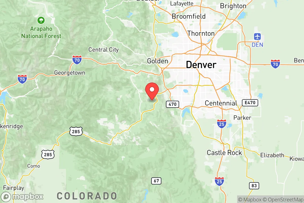
Jefferson County, Colorado, offers a compelling mix of geographic resilience and strategic positioning for relocation-minded individuals and families who prioritize preparedness and self-sufficiency. Located directly west of Denver, the county spans from the urbanized foothills of Golden and Lakewood to the rugged, sparsely populated mountain corridors near Conifer and Evergreen, providing a natural buffer against the densest population centers while maintaining access to critical infrastructure. Its elevation, varied terrain, and distance from major coastal and industrial targets make it a serious contender for those evaluating long-term stability and disaster readiness in the Rocky Mountain region.
Geographic position and natural advantages for long-term stability
Jefferson County’s geography is its primary strategic asset. The county stretches from the eastern plains at roughly 5,200 feet elevation up to the Continental Divide near 14,000-foot peaks, creating a natural defensive gradient. The western half of the county, including towns like Evergreen, Conifer, and Pine, sits in dense pine forests and steep canyons, offering significant concealment and limited road access—a double-edged sword that slows both ingress and egress. The eastern portion, including Lakewood and Golden, is more exposed but benefits from proximity to Denver’s medical and supply networks. The county’s position along the Front Range urban corridor means it is not isolated, but the mountain communities provide a distinct fallback zone. The South Platte River and Clear Creek run through the county, providing surface water sources, while the foothills offer defensible terrain against any ground-level threat from the east. The area’s high altitude also reduces the risk of airborne contamination settling as heavily as in lower-elevation regions, a factor often overlooked in fallout planning.
Risks, exposures, and proximity to fallout-relevant landmarks
No strategic assessment is complete without acknowledging Jefferson County’s exposure to man-made and natural risks. The county sits within 15 miles of the Denver Federal Center in Lakewood, a major administrative hub, and within 20 miles of Buckley Space Force Base in Aurora, both of which could be secondary targets in a conflict scenario. The Rocky Flats National Wildlife Refuge, a former nuclear weapons plant located just north of Golden, remains a site of historical contamination and ongoing monitoring, though it is no longer active. More immediately, the county lies directly downwind of the Denver metro area’s industrial corridors, including oil and gas operations along the Front Range. In a major event, fallout from a strike on Denver’s infrastructure—such as the Denver International Airport or the Suncor Energy refinery in Commerce City—could drift west into Jefferson County’s foothills. Natural risks include wildfire, particularly in the mountain communities west of Highway 285, where the 2021 Marshall Fire (though primarily in Boulder County) demonstrated how quickly a wind-driven fire can threaten suburban-interface zones. Flooding along Clear Creek and Bear Creek is a localized concern, but the county’s elevation generally spares it from the tornado and hurricane threats common to the Plains and Gulf Coast.
Practical resilience for a relocator: food, water, energy, and defensibility
For a relocator focused on self-sufficiency, Jefferson County offers a mixed but workable picture. Water access is the strongest point: the county sits atop the South Platte River basin, and many mountain properties have private wells or access to seasonal streams. However, the arid climate means surface water is not abundant in the western reaches, and drought conditions are common. Rainwater catchment is legal in Colorado but regulated, so planning is required. Food resilience is moderate. The eastern part of the county has some agricultural land, but most food is trucked in via the Denver supply chain. Local farmers’ markets and community gardens exist in Golden and Evergreen, but a serious grower would need to invest in greenhouses or hoop houses to extend the short growing season (roughly 100–130 frost-free days). Energy infrastructure is relatively robust: Xcel Energy serves the area, and many mountain homes already have backup generators or solar arrays due to frequent winter outages. The county’s terrain makes grid-tied solar viable on south-facing slopes, and off-grid living is legal in unincorporated areas with proper permitting. Defensibility varies sharply by location. The mountain communities of Conifer and Evergreen offer natural chokepoints on the few roads leading in (primarily Highway 285 and Evergreen Parkway), but those same roads become bottlenecks for evacuation. The eastern suburbs are wide open and offer little tactical advantage. For a family seeking a balance, a property on a private road in the Pine or Buffalo Creek area, with a well and solar, represents a strong defensive posture.
The overall strategic picture for Jefferson County is one of calculated trade-offs. It provides a rare combination of proximity to a major city’s medical and logistical resources—including the Denver VA Medical Center and multiple Level I trauma centers—while offering a genuine retreat into defensible mountain terrain within a 30-minute drive. The county’s political leanings are mixed, with the eastern urban areas trending liberal and the western mountain precincts more conservative, which can be a social asset for those seeking like-minded neighbors in preparedness-oriented communities. The primary vulnerabilities are the downwind risk from Denver and the wildfire threat in the western forests, both of which can be mitigated through site selection and structural hardening. For a relocator who values strategic depth, water access, and a serious but not alarmist approach to readiness, Jefferson County ranks as one of the stronger Front Range options—provided the move is made with eyes open to the specific exposures of each sub-area.

* Values derived from national, state, county, city and local statistics and may differ in a specific area. Last updated: 2026-07-07T10:41:54.000Z
Narrative content on this page is AI-generated and may contain mistakes. Verify any details that matter before acting on them.
ReloMaps may earn a commission from affiliate links at no extra cost to you.

