Photo: Wikipedia
Strategic Assessment of Arapahoe County
Meaningful friction. Expect exposure to either population pressure, blast zones, or natural disaster risk. Consider buying a retreat property.
What does the Strategic Assessment tell us?
Our Strategic Assessment grades tactical survivability of an area. Major population centers, military targets, fallout zones, natural disasters, and border exposure all drive risk — lower exposure means a more defensible position in a crisis.
This is heavily inspired by Joel Skousen's Strategic Relocation book. Highly recommended you checkout the book ($)What does this tell us?
Our Strategic Assessment grades tactical survivability of an area. Major population centers, military targets, fallout zones, natural disasters, and border exposure all drive risk — lower exposure means a more defensible position in a crisis.
This is heavily inspired by Joel Skousen's Strategic Relocation book. Highly recommended you checkout the book ($)Strategic Pillars

Key Distances
Strategic Assessment Analysis
Arapahoe County offers a mixed strategic picture for relocation-minded individuals and families weighing disaster readiness and self-sufficiency. Its position along Colorado's Front Range places it within commuting distance of Denver while retaining access to open plains and the foothills of the Rocky Mountains, but that proximity to a major metropolitan center also introduces risks that a serious prepper or resilience-focused relocator must weigh carefully. The county's population of roughly 660,000 and its mix of suburban cities, agricultural land, and light industrial zones create both opportunities and vulnerabilities that demand a clear-eyed assessment before making a move.
Geographic position and natural advantages for self-sufficiency
Arapahoe County stretches from the Denver city limits eastward across the High Plains, encompassing a diverse terrain that includes the suburban corridor of Centennial, Aurora, and Littleton in its western half, and increasingly rural land toward the eastern county line near Deer Trail. The county's elevation ranges from roughly 5,000 to 6,000 feet, offering a semi-arid climate with low humidity and over 300 days of sunshine annually — factors that reduce mold, pest, and structural decay issues common in wetter regions. The South Platte River and Cherry Creek run through the county, providing surface water sources, though both are heavily managed and subject to municipal water rights that limit private extraction. The county's position east of the Continental Divide means it is sheltered from the worst Pacific storm systems, and its distance from both the Gulf Coast and the West Coast eliminates hurricane, tsunami, and major earthquake risks. Tornadoes are a genuine threat on the plains, but Arapahoe County sits east of the protective influence of the Front Range foothills, placing it in a zone where severe thunderstorms and occasional EF-2 or EF-3 tornadoes occur, particularly in the eastern unincorporated areas.
Risks, exposures, and proximity to fallout-relevant landmarks
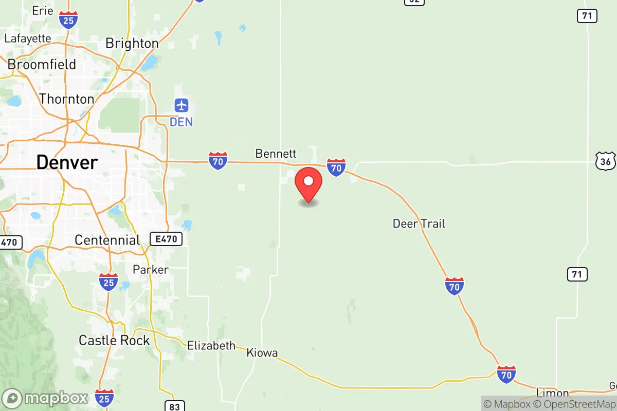
The most significant strategic drawback for Arapahoe County is its location within the Denver-Aurora-Lakewood metropolitan statistical area, which concentrates roughly 3 million people within a 50-mile radius. Buckley Space Force Base in Aurora is a major military installation with space operations and intelligence functions, making it a potential target in a conflict scenario. The county also contains the Denver Federal Center in Lakewood (just west of the county line) and numerous defense contractors along the I-25 corridor. The Denver International Airport, located just north of the county in adjacent Adams County, is a major transportation hub that could become a chokepoint or target. Industrial risks include the Suncor Energy refinery in Commerce City (north of the county) and the numerous chemical storage facilities along the South Platte River corridor. For a relocator concerned about fallout or societal disruption, the county's eastern half — past the E-470 toll road and toward Deer Trail — offers significantly lower population density and greater distance from these concentration points, though at the cost of reduced access to supplies and community support networks.
Practical resilience for a relocator: food, water, energy, and defensibility
Water is the most critical limiting factor for long-term self-sufficiency in Arapahoe County. The region receives only 15-18 inches of precipitation annually, and groundwater in the eastern plains is often saline or requires deep wells exceeding 300 feet. Municipal water comes primarily from the South Platte River and transmountain diversion projects, meaning any disruption to Denver Water's infrastructure would affect most county residents. For a relocator seeking property with a private well, the eastern unincorporated areas near Strasburg and Bennett offer better odds, but well yields are variable and permitting is strict. Food production is feasible with irrigation — the county has a history of dryland wheat farming and cattle grazing — but the short growing season (roughly 130-150 frost-free days) and alkaline soils limit what can be grown without significant amendment. Energy resilience is more promising: the county has excellent solar potential, with an average of 5.5 peak sun hours per day, and net metering policies allow grid-tied systems to offset costs. Natural gas is widely available in the urbanized areas, but propane is the norm for rural properties east of the I-25 corridor. Defensibility varies dramatically by location: the suburban grid of Centennial and Aurora offers no natural defensive advantage and is highly dependent on supply chains, while a well-chosen property in the eastern plains with good sightlines, a reliable well, and a defensible perimeter could be made reasonably secure. The county's law enforcement presence is concentrated in the urbanized west, meaning response times in the eastern areas can exceed 30 minutes.
The overall strategic picture for Arapahoe County is one of trade-offs rather than clear advantages. Its western suburbs offer strong economic opportunity, excellent healthcare infrastructure (including the UCHealth and Centura Health networks), and access to the outdoor recreation and water resources of the Rocky Mountains, but they also carry the risks of metropolitan concentration, water dependency, and proximity to military and industrial targets. The eastern plains offer genuine space, lower population density, and better potential for self-sufficiency, but at the cost of harsher weather, limited water, and isolation from supply chains and community support. For a relocator who can secure a property with a reliable well, install solar with battery backup, and build a network of like-minded neighbors in the eastern part of the county, Arapahoe County can work as a resilience-oriented location. For those tied to the suburban corridor, the county is best viewed as a comfortable place to live that requires active preparation rather than a location that offers inherent strategic advantages.

* Values derived from national, state, county, city and local statistics and may differ in a specific area. Last updated: 2026-06-15T20:41:15.000Z
Narrative content on this page is AI-generated and may contain mistakes. Verify any details that matter before acting on them.
ReloMaps may earn a commission from affiliate links at no extra cost to you.

