
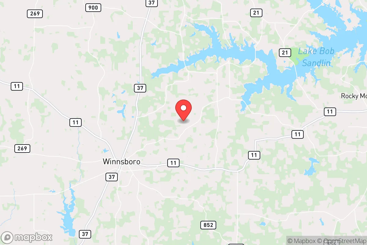
Strategic Assessment of Clearwater, TX
Workable tactical position. Some exposure to population density or targets, but generally defensible in a crisis.
What does the Strategic Assessment tell us?
Our Strategic Assessment grades tactical survivability of an area. Major population centers, military targets, fallout zones, natural disasters, and border exposure all drive risk — lower exposure means a more defensible position in a crisis.
This is heavily inspired by Joel Skousen's Strategic Relocation book. Highly recommended you checkout the book ($)What does this tell us?
Our Strategic Assessment grades tactical survivability of an area. Major population centers, military targets, fallout zones, natural disasters, and border exposure all drive risk — lower exposure means a more defensible position in a crisis.
This is heavily inspired by Joel Skousen's Strategic Relocation book. Highly recommended you checkout the book ($)Strategic Pillars

Key Distances
Regional Safe Places
Below is our recommended "safe zones" in Texas and the surrounding area based on our strategic heuristics. For most people, it's unrealistic to live in a “safe zone” full-time due to work, family or other personal reasons. They tend to be more rural. However, many of these areas are perfect for second homes and retreat properties that double as a vacation home or even a short-term rental.

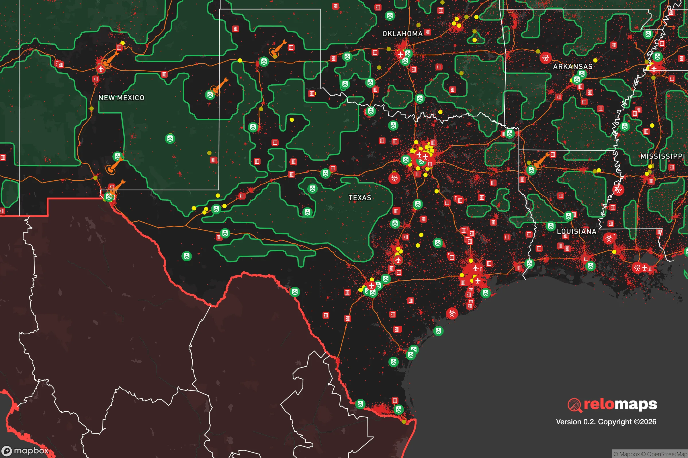


Important Note: For informational purposes only. This does not mean nothing bad ever happens in the green zones. Please use common sense. This is based on public data and modeled with AI. We tried to take a conservative approach but mistakes happen. We update this regularly as new information becomes available.
Solar Generator Recommendations
Backup power matters more here than in safer locations. We've picked three solar generators across budgets and capacity tiers — start with the budget unit if you only need a few essentials, or step up if you want to run a fridge and HVAC for days at a time.

Jackery Portable Power Station Explorer 300
Budget OptionPower on the Go: Weighing only 11 lbs, it's convenient to set up and store with book-sized foldable solar panels

BLUETTI Portable Power Station AC180
Designed for both indoor and outdoor scenarios, AC180 is highly capable as it has a robost capacity and continuous output power.

EF ECOFLOW DELTA Pro Ultra Power Station
Upgraded PickEcoFlow DELTA Pro Ultra is a whole-home energy system designed to grow with your family. Integrated with the Smart Home Panel 2, it scales to meet your evolving energy needs — keeping your home powered, intelligent, and secure through every stage of life.
We earn a commission, at no additional cost to you.
Strategic Assessment Analysis
Clearwater, Texas, offers a strategic relocation option for those prioritizing disaster readiness and self-sufficiency, balancing proximity to essential infrastructure with a lower-risk profile than major urban centers. Located in the Piney Woods region of East Texas, roughly 100 miles north of Houston and 60 miles west of the Louisiana border, the area benefits from a relatively low population density, abundant natural resources, and a climate that supports year-round subsistence activities. For a relocator thinking seriously about resilience, Clearwater presents a defensible position with manageable exposure to both natural and man-made threats, provided one understands its specific vulnerabilities and advantages.
Geographic position and natural advantages for long-term stability
Clearwater sits within a region defined by rolling hills, dense pine and hardwood forests, and a network of rivers and creeks that feed into the Trinity River basin. This topography offers several resilience benefits. The area’s elevation, averaging around 200–300 feet above sea level, places it well above the flood-prone coastal plains of the Gulf, reducing the risk of storm surge or catastrophic flooding from hurricanes. The sandy loam soils drain quickly, making the land suitable for gardening and small-scale agriculture even during wet seasons. The region’s annual rainfall of roughly 45–50 inches supports reliable water tables and surface water sources, including the nearby Neches and Trinity Rivers, which can serve as emergency water supplies with proper treatment. The forest cover provides natural insulation, windbreaks, and a steady supply of firewood for heating or cooking, while also offering concealment and cover for those seeking to avoid unwanted attention. For a relocator, the ability to tap into these resources without heavy reliance on municipal systems is a tangible advantage. The area’s distance from major metropolitan hubs—Houston, Dallas-Fort Worth, and Shreveport are all 1.5 to 2.5 hours away—means it is less likely to be a primary target for large-scale disruptions, yet still within reach of medical and supply centers during stable periods.
Risks, exposures, and proximity to fallout-relevant landmarks
No location is without risk, and Clearwater has specific exposures that a strategic relocator must weigh. The primary natural threat is wildfire, particularly during late summer and early fall when dry conditions and abundant fuel loads from pine needles and underbrush create a high fire danger. The 2011 Texas wildfires, which burned over 30,000 acres in nearby Bastrop County, serve as a reminder that even well-watered forests can burn intensely. Defensible space—clearing brush, maintaining firebreaks, and using metal roofing—is not optional here. Tornadoes are a secondary concern, with East Texas averaging 10–15 tornadoes annually, though most are weak (EF0–EF1). The region’s hilly terrain can disrupt storm tracks, but a sturdy storm shelter or reinforced safe room is a prudent investment.
From a man-made risk perspective, Clearwater’s proximity to critical infrastructure is a double-edged sword. The area lies roughly 80 miles from the Strategic Petroleum Reserve’s Bryan Mound site near Freeport, a potential target in a conflict scenario, and about 120 miles from the Comanche Peak Nuclear Power Plant near Glen Rose. While these distances provide a buffer against immediate blast effects, fallout patterns depend heavily on wind direction and weather. The prevailing winds in East Texas are from the south and southeast, meaning a release from the Gulf Coast or Houston Ship Channel—home to numerous chemical plants and refineries—could drift inland. The Houston Ship Channel is roughly 100 miles south, and a major incident there could deposit particulate matter across the region within 12–24 hours. For a relocator, this means having a fallout shelter plan, including a below-ground space with HEPA filtration and at least two weeks of supplies, is not alarmist but practical. The area’s low population density (roughly 30–40 people per square mile in surrounding counties) reduces the likelihood of civil unrest or resource competition compared to urban centers, but it also means emergency services are thin—response times for fire or medical aid can exceed 30 minutes in rural stretches.
Practical resilience for a relocator: food, water, energy, and defensibility
Clearwater’s practical resilience is strong for those willing to invest in infrastructure. Water is the most abundant resource: the Carrizo-Wilcox Aquifer underlies the region, providing reliable groundwater at depths of 100–300 feet. A solar-powered well pump with a backup hand pump can yield 10–20 gallons per minute, enough for household use and irrigation. Surface water from creeks and rivers is plentiful but requires filtration or boiling due to agricultural runoff and wildlife activity. Rainwater harvesting is also viable, with average annual rainfall supporting a 1,000-square-foot roof collecting roughly 30,000 gallons per year.
Food production is feasible year-round. The growing season spans March through November, with mild winters allowing for cold-hardy crops like kale, carrots, and garlic. The sandy loam soil benefits from composting and raised beds, and local extension services (e.g., Texas A&M AgriLife in nearby Lufkin) offer soil testing and planting guides. Hunting and fishing are legal with licenses and provide protein sources: white-tailed deer, wild hogs (which are abundant and considered a nuisance), and bass or catfish from local waterways. For long-term storage, a root cellar or underground pantry can maintain temperatures in the 50–60°F range, ideal for preserving root vegetables and canned goods.
Energy independence is achievable but requires upfront cost. The region receives an average of 5.0–5.5 peak sun hours per day, making solar panels a viable primary source. A 5–10 kW system with battery storage (e.g., lithium iron phosphate) can cover basic household loads, including a well pump, refrigeration, and lighting. Propane generators are a common backup, with local suppliers in towns like Crockett or Lufkin offering bulk delivery. For defensibility, the area’s forested terrain provides natural cover, but a relocator should consider property layout: a home set back from the road, with a clear field of view to approaches, and a perimeter of native thorny shrubs (e.g., yaupon holly or greenbriar) can deter casual intrusion. Neighbors are sparse, so building a trusted network of like-minded locals is critical—attending county commissioner meetings or volunteer fire department events is a practical first step.
The overall strategic picture for Clearwater, Texas, is one of moderate risk with high potential for self-sufficiency. Its geographic isolation from major targets, abundant natural resources, and manageable climate make it a solid choice for a relocator who is prepared to invest in infrastructure and community relationships. The key vulnerabilities—wildfire, proximity to Gulf Coast industrial targets, and thin emergency services—are not dealbreakers but demand proactive mitigation. For a family or individual willing to drill a well, install solar, clear defensible space, and build a fallout shelter, Clearwater offers a defensible position in a region that has historically been a refuge for those seeking to weather disruptions. The area rewards preparation and penalizes complacency, which is exactly the calculus a serious relocator should expect.

* Values derived from national, state, county, city and local statistics and may differ in a specific area. Last updated: 2026-10-17T15:09:37.000Z
Narrative content on this page is AI-generated and may contain mistakes. Verify any details that matter before acting on them.
ReloMaps may earn a commission from affiliate links at no extra cost to you.

