Photo: Wikipedia
Strategic Assessment of Clearwater, FL
Multiple tactical vulnerabilities. Population density, target proximity, or disaster risk are likely compounding. A retreat property and exit planning is required.
What does the Strategic Assessment tell us?
Our Strategic Assessment grades tactical survivability of an area. Major population centers, military targets, fallout zones, natural disasters, and border exposure all drive risk — lower exposure means a more defensible position in a crisis.
This is heavily inspired by Joel Skousen's Strategic Relocation book. Highly recommended you checkout the book ($)What does this tell us?
Our Strategic Assessment grades tactical survivability of an area. Major population centers, military targets, fallout zones, natural disasters, and border exposure all drive risk — lower exposure means a more defensible position in a crisis.
This is heavily inspired by Joel Skousen's Strategic Relocation book. Highly recommended you checkout the book ($)Strategic Pillars

Key Distances
Regional Safe Places
Below is our recommended "safe zones" in Florida and the surrounding area based on our strategic heuristics. For most people, it's unrealistic to live in a “safe zone” full-time due to work, family or other personal reasons. They tend to be more rural. However, many of these areas are perfect for second homes and retreat properties that double as a vacation home or even a short-term rental.

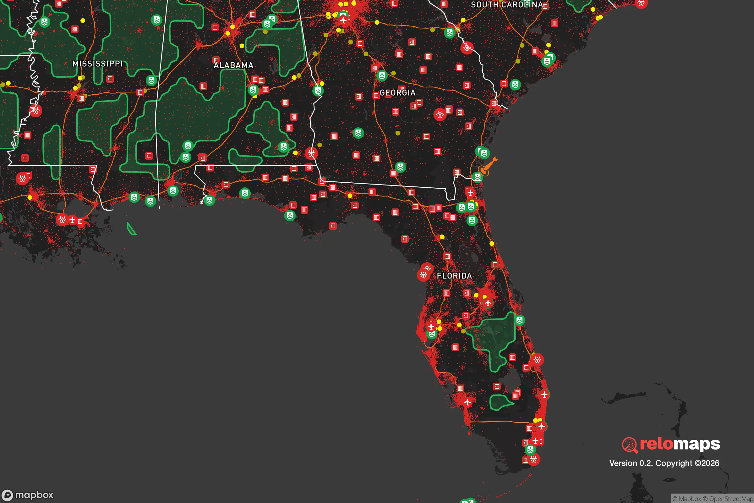
Important Note: For informational purposes only. This does not mean nothing bad ever happens in the green zones. Please use common sense. This is based on public data and modeled with AI. We tried to take a conservative approach but mistakes happen. We update this regularly as new information becomes available.
Solar Generator Recommendations
Backup power matters more here than in safer locations. We've picked three solar generators across budgets and capacity tiers — start with the budget unit if you only need a few essentials, or step up if you want to run a fridge and HVAC for days at a time.

Jackery Portable Power Station Explorer 300
Budget OptionPower on the Go: Weighing only 11 lbs, it's convenient to set up and store with book-sized foldable solar panels

BLUETTI Portable Power Station AC180
Designed for both indoor and outdoor scenarios, AC180 is highly capable as it has a robost capacity and continuous output power.

EF ECOFLOW DELTA Pro Ultra Power Station
Upgraded PickEcoFlow DELTA Pro Ultra is a whole-home energy system designed to grow with your family. Integrated with the Smart Home Panel 2, it scales to meet your evolving energy needs — keeping your home powered, intelligent, and secure through every stage of life.
We earn a commission, at no additional cost to you.
Strategic Assessment Analysis
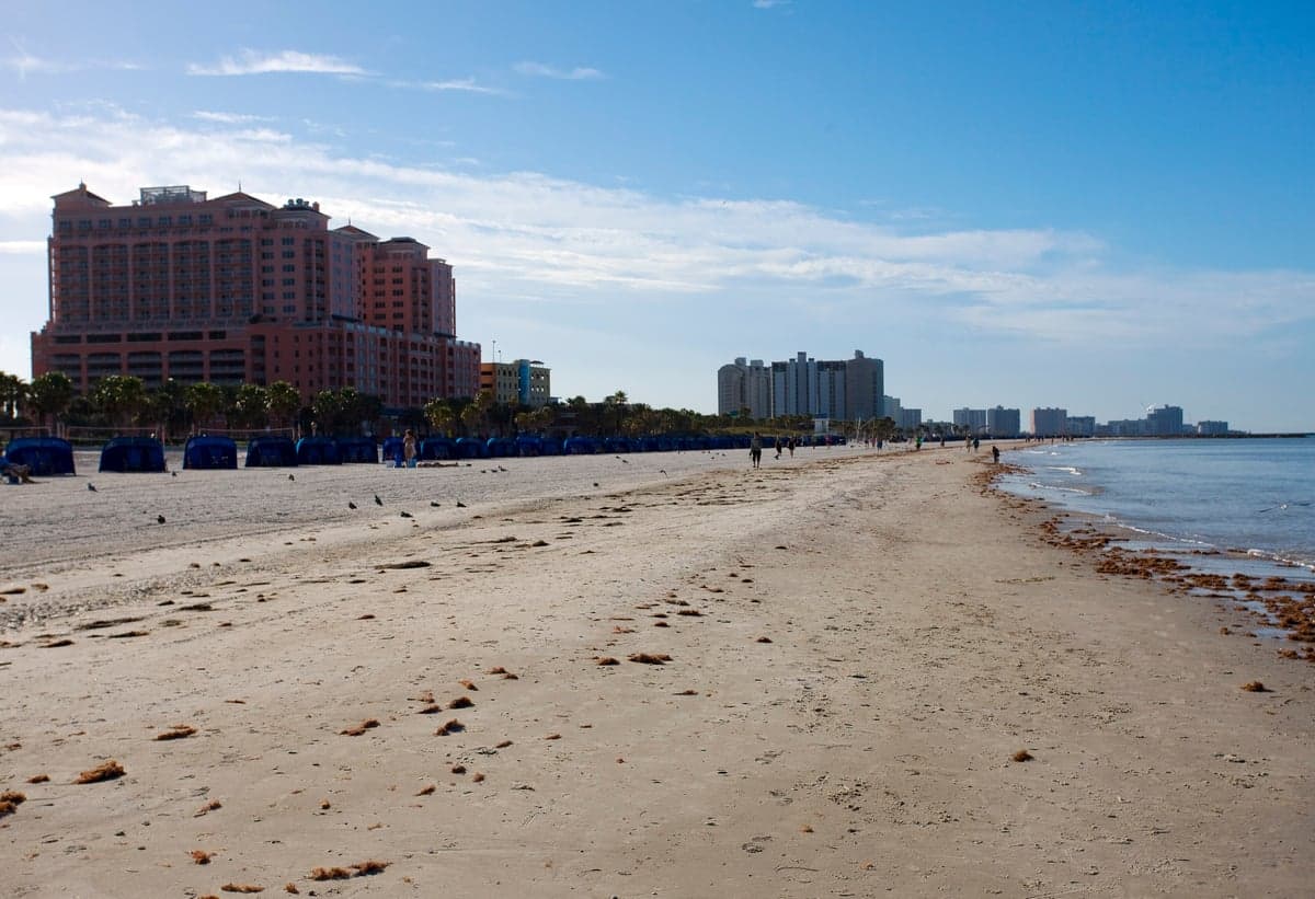
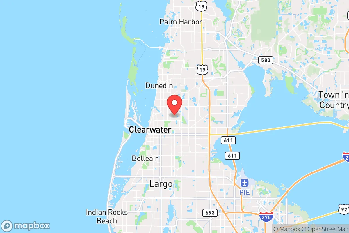
Clearwater, Florida, sits in a precarious strategic position that demands a sober, clear-eyed assessment for anyone serious about long-term preparedness. While its Gulf Coast location offers undeniable natural advantages, its proximity to the Tampa Bay metroplex introduces significant vulnerabilities that a survival-minded relocator cannot ignore. This analysis strips away the tourist brochures and examines Clearwater as a potential base of operations in an increasingly unstable world, weighing its defensive merits against the very real risks of being within the fallout zone of a major urban and military target.
Geographic position and natural advantages for long-term survival
Clearwater's primary strategic asset is its position on a peninsula jutting into the Gulf of Mexico, which inherently limits approach vectors for any potential threat. The barrier islands—Clearwater Beach, Sand Key, and Caladesi Island—create a natural buffer against storm surge and provide a first line of observation. The area's flat, sandy terrain offers few natural chokepoints, but the intracoastal waterway and numerous bayous create a fragmented landscape that can be used for tactical advantage. The subtropical climate allows for year-round food production, with a growing season that stretches from February through November. The region's average annual rainfall of 45 inches means freshwater availability is less of a concern than in the arid West, though the limestone karst geology means groundwater is vulnerable to saltwater intrusion and contamination. The Pinellas County aquifer system is shallow and susceptible to surface pollution, so a relocator should plan on rainwater catchment or deep well drilling as primary water strategies. The area's biodiversity is a genuine asset: the Gulf provides a protein-rich food source (fish, crab, shrimp), while the inland pine flatwoods and scrub habitats offer game like white-tailed deer, wild hogs, and turkey. The proximity to the Withlacoochee State Forest and the Green Swamp—both within a 90-minute drive—provides a fallback zone for foraging and hunting if coastal conditions deteriorate.
Risks, exposures, and proximity to fallout-relevant landmarks
This is where the analysis turns grim. Clearwater's greatest liability is its location within the Tampa Bay metropolitan area, home to over 3 million people. In any scenario involving civil unrest, supply chain collapse, or a coordinated attack, this population density becomes a liability. The city sits just 20 miles from MacDill Air Force Base, home to U.S. Central Command (CENTCOM) and U.S. Special Operations Command (SOCOM). In a conflict scenario, MacDill is a tier-one target for any adversary with missile or cyber capabilities. A kinetic strike on MacDill would produce a blast radius that could easily reach Clearwater, and the electromagnetic pulse (EMP) effects from a high-altitude nuclear detonation would likely fry electronics across the entire peninsula. The Port of Tampa is another high-value target, handling over 50 million tons of cargo annually and serving as a critical logistics hub for the southeastern United States. The I-275 corridor, which runs through Clearwater, would become a choke point for evacuation or movement during any crisis. The area is also home to the Crystal River nuclear power plant, 60 miles north, and the St. Petersburg-Clearwater International Airport, which sits adjacent to residential neighborhoods. In a grid-down scenario, the 1.4 million residents of Pinellas County would be competing for resources on a 280-square-mile peninsula with only three major evacuation routes: US-19, I-275, and SR-60. The bridges connecting the barrier islands to the mainland—the Clearwater Memorial Causeway, the Sand Key Bridge, and the Belleair Causeway—are single points of failure that could be compromised by storm damage, sabotage, or simple traffic congestion.
Practical resilience for a relocator: food, water, energy, and defensibility
For a relocator willing to put in the work, Clearwater offers a mixed bag of resilience opportunities. The year-round growing season is a genuine advantage: a well-planned garden can produce tomatoes, peppers, squash, beans, and leafy greens for 10 months out of the year. The Gulf provides a reliable protein source, but a relocator must factor in the risks of red tide, harmful algal blooms, and the potential for contamination from stormwater runoff. The area's energy infrastructure is fragile: the grid is aging and vulnerable to hurricane damage, and the local utility, Duke Energy Florida, has faced criticism for its response times during outages. Solar is a viable option—the region averages 240 sunny days per year—but any solar installation must be hardened against 140-mph winds. Battery storage is essential, as net metering is unreliable during grid failures. Water is the critical vulnerability: the city's water supply comes from the Tampa Bypass Canal and the Alafia River, both of which are subject to saltwater intrusion and contamination during storm surges. A relocator should budget for a 1,500-gallon rainwater cistern and a Berkey-style gravity filter as a minimum. Defensibility is the weak point: Clearwater's suburban sprawl means most homes are on quarter-acre lots with neighbors within shouting distance. The lack of natural cover and the abundance of glass-fronted homes make it difficult to secure a property against a determined threat. The best defensive strategy is to buy on the northern or eastern edges of the city, closer to the rural areas of Pasco County, where lot sizes increase and population density drops. The city's police force, while professional, would be overwhelmed in a large-scale crisis, so a relocator should plan on self-reliance for security. The local gun culture is strong—Florida is a shall-issue state for concealed carry—and the Pinellas County Sheriff's Office has a reputation for being pro-Second Amendment, but a relocator should still expect to be the first and last line of defense for their property.
The overall strategic picture for Clearwater is one of calculated risk. The natural advantages—climate, food production, water availability—are real and valuable, but they are offset by the area's vulnerability to both natural and man-made disasters. For a relocator who is willing to invest in hardening their property, building community relationships, and maintaining a low profile, Clearwater can work as a base of operations. But it is not a retreat. It is not a bug-out location. It is a suburban outpost on the edge of a major target zone, and anyone moving here must accept that they are living in the shadow of MacDill, the Port of Tampa, and the I-275 corridor. The smart play is to treat Clearwater as a temporary staging area—a place to build skills, stockpile supplies, and establish relationships—while keeping one eye on the exit routes north toward the rural counties of the Florida Panhandle or east toward the interior of the state. If you are looking for a place to ride out the storm, Clearwater is not it. But if you are looking for a place to prepare for the storm, with access to resources and a climate that supports self-sufficiency, it deserves a place on your short list—just not at the top.
* Values derived from national, state, county, city and local statistics and may differ in a specific area. Last updated: 2026-05-01T11:27:35.000Z
Narrative content on this page is AI-generated and may contain mistakes. Verify any details that matter before acting on them.
ReloMaps may earn a commission from affiliate links at no extra cost to you.