
Photo: Wikipedia
Strategic Assessment of Canton, TX
Meaningful friction. Expect exposure to either population pressure, blast zones, or natural disaster risk. Consider buying a retreat property.
What does the Strategic Assessment tell us?
Our Strategic Assessment grades tactical survivability of an area. Major population centers, military targets, fallout zones, natural disasters, and border exposure all drive risk — lower exposure means a more defensible position in a crisis.
This is heavily inspired by Joel Skousen's Strategic Relocation book. Highly recommended you checkout the book ($)What does this tell us?
Our Strategic Assessment grades tactical survivability of an area. Major population centers, military targets, fallout zones, natural disasters, and border exposure all drive risk — lower exposure means a more defensible position in a crisis.
This is heavily inspired by Joel Skousen's Strategic Relocation book. Highly recommended you checkout the book ($)Strategic Pillars

Key Distances
Regional Safe Places
Below is our recommended "safe zones" in Texas and the surrounding area based on our strategic heuristics. For most people, it's unrealistic to live in a “safe zone” full-time due to work, family or other personal reasons. They tend to be more rural. However, many of these areas are perfect for second homes and retreat properties that double as a vacation home or even a short-term rental.

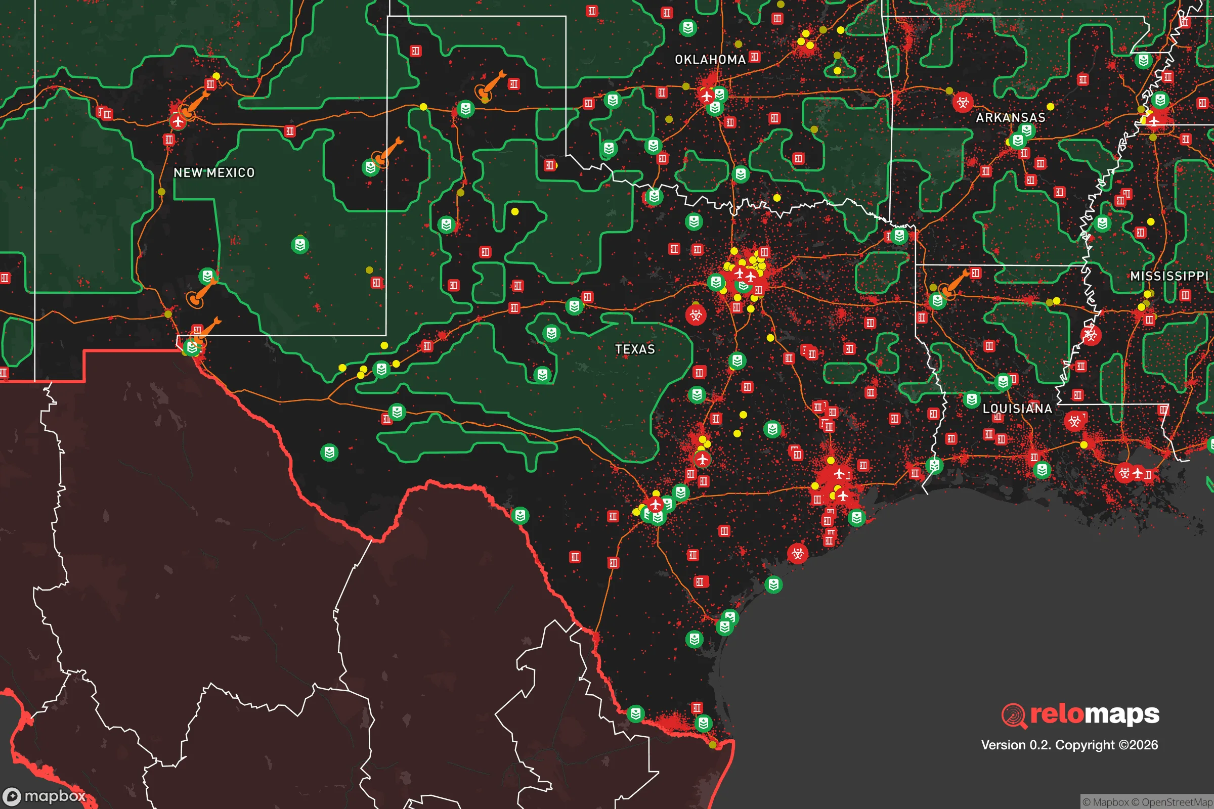


Important Note: For informational purposes only. This does not mean nothing bad ever happens in the green zones. Please use common sense. This is based on public data and modeled with AI. We tried to take a conservative approach but mistakes happen. We update this regularly as new information becomes available.
Solar Generator Recommendations
Backup power matters more here than in safer locations. We've picked three solar generators across budgets and capacity tiers — start with the budget unit if you only need a few essentials, or step up if you want to run a fridge and HVAC for days at a time.

Jackery Portable Power Station Explorer 300
Budget OptionPower on the Go: Weighing only 11 lbs, it's convenient to set up and store with book-sized foldable solar panels

BLUETTI Portable Power Station AC180
Designed for both indoor and outdoor scenarios, AC180 is highly capable as it has a robost capacity and continuous output power.

EF ECOFLOW DELTA Pro Ultra Power Station
Upgraded PickEcoFlow DELTA Pro Ultra is a whole-home energy system designed to grow with your family. Integrated with the Smart Home Panel 2, it scales to meet your evolving energy needs — keeping your home powered, intelligent, and secure through every stage of life.
We earn a commission, at no additional cost to you.
Strategic Assessment Analysis
Canton, Texas, presents a mixed strategic picture for the relocation-minded reader focused on resilience and self-sufficiency. Its primary advantage is a Goldilocks location—far enough from major metropolitan centers to avoid the worst of urban collapse scenarios, yet close enough to access critical supplies and markets during normal times. However, the area’s proximity to several high-value targets and its position within a region prone to natural hazards means that any serious assessment must weigh genuine geographic strengths against tangible, non-alarmist risks.
Geographic position and natural advantages for long-term stability
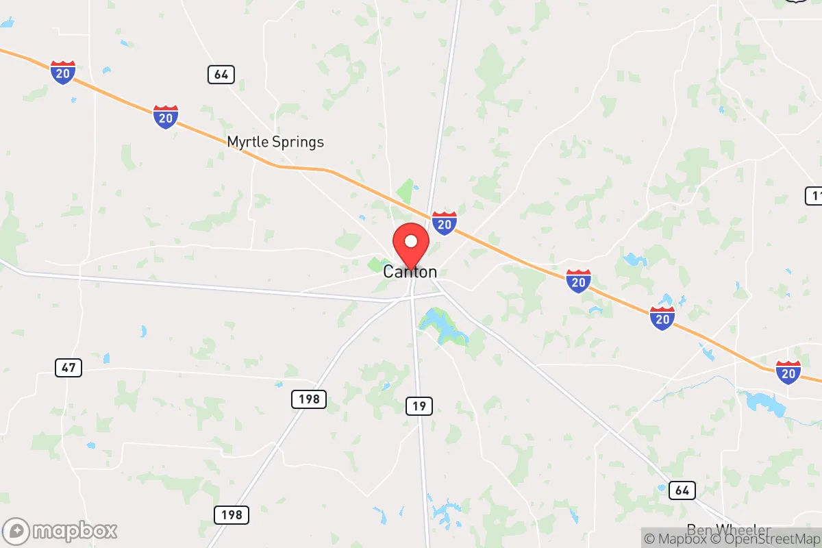
Canton sits in Van Zandt County, roughly 60 miles east of Dallas and 100 miles west of Shreveport, Louisiana. This places it squarely in the Piney Woods region of East Texas, a landscape of rolling hills, dense forests, and abundant surface water. The area’s elevation—around 500 feet above sea level—is modest but sufficient to avoid the catastrophic flooding that plagues coastal and river-bottom communities. The Sabine River and its tributaries, including the Neches, run through or near the county, providing a reliable freshwater source that is less likely to be contaminated by industrial runoff compared to urban watersheds. The local climate is humid subtropical, with hot summers and mild winters, which supports year-round gardening and livestock grazing. For a relocator prioritizing food security, the growing season stretches from March to November, and the region’s sandy loam soils are workable for small-scale agriculture. The area’s low population density—Van Zandt County has about 60,000 residents spread over 860 square miles—means that during a crisis, competition for local resources would be less intense than in suburban Dallas or Fort Worth. Canton’s position along Interstate 20 is a double-edged sword: it provides easy evacuation routes west or east, but also funnels traffic from the Metroplex during emergencies, potentially clogging the highway.
Risks, exposures, and proximity to fallout-relevant landmarks
The most significant risk for Canton is its proximity to the Dallas-Fort Worth metroplex, a major economic and population hub that would be a high-priority target in any large-scale conflict or terrorist event. DFW International Airport, roughly 70 miles west, is a primary node for military and civilian air traffic, and the region hosts several defense contractors, including Lockheed Martin in Fort Worth. In a nuclear exchange scenario, Canton lies outside the immediate blast and thermal zones for a ground burst on Dallas, but it would be within the moderate fallout plume zone depending on wind direction. The prevailing winds in North Texas are from the south and southwest, which means fallout from a strike on Dallas would likely drift northeast, away from Canton. However, a strike on the Comanche Peak Nuclear Power Plant near Glen Rose, about 100 miles southwest, could pose a different threat: a reactor breach would release radioactive material that could drift eastward, potentially affecting Van Zandt County. More immediate and probable risks include severe weather: the area sits in Tornado Alley’s southern extension, with an average of 5-10 tornado warnings per year. Flash flooding from heavy rains is common, particularly along the Sabine River floodplain. Wildfire risk is moderate, as the dense pine forests can dry out during summer droughts. For a relocator, the biggest man-made risk is the potential for civil unrest or supply chain disruptions spilling out of Dallas, which could overwhelm local law enforcement and healthcare resources. The county’s single hospital, UT Health East Texas in Canton, has limited capacity—about 50 beds—and would be quickly overwhelmed in a regional crisis.
Practical resilience for a relocator: food, water, energy, and defensibility
Canton’s practical resilience is a mixed bag. On the positive side, the area has strong agricultural roots. The Van Zandt County Farmers Market operates year-round, and local producers supply beef, poultry, eggs, and vegetables. For a relocator looking to establish a homestead, land is affordable—rural parcels run $5,000–$10,000 per acre, significantly cheaper than comparable land in Colorado or the Pacific Northwest. Water access is excellent: most rural properties have wells, and the average depth to groundwater is 100–200 feet, with good yields. The Sabine River provides a backup surface source, though it requires treatment. Energy resilience is more challenging. The local grid is part of ERCOT, which has a history of winter storm failures (e.g., 2021’s Winter Storm Uri). Solar potential is moderate—the area averages 210 sunny days per year, below the national average of 205, but still viable for a grid-tied or off-grid system paired with battery storage. Natural gas is widely available for heating and cooking, and propane tanks are common for rural homes. Defensibility is a key consideration. Canton itself is a small town of about 3,500 people, with a low crime rate (violent crime is about 60% below the national average). The surrounding countryside is hilly and wooded, offering natural concealment and choke points. However, the area lacks natural barriers like mountains or large rivers that would impede movement. During a crisis, the main threat would be refugees from Dallas, who could travel I-20 in large numbers. A relocator would need to establish a perimeter and have a plan for securing supplies, as local stores (Brookshire’s, Dollar General) would be stripped quickly. The county’s sheriff’s office has about 40 deputies, so law enforcement presence would be thin in a widespread emergency.
Overall, Canton offers a viable but not exceptional strategic position for the disaster-conscious relocator. Its strengths are affordable land, abundant water, and a low-density rural setting that supports self-sufficiency. Its weaknesses are proximity to a major urban target, a fragile power grid, and limited local infrastructure. For a single individual or family willing to invest in off-grid energy, water storage, and a solid security plan, Canton provides a reasonable balance of accessibility and isolation. It is not a fortress, but it is a place where a prepared person can build a resilient life without being cut off from the modern world entirely. The key is to treat it as a base of operations, not a bunker—and to have a plan for when the highway fills with headlights heading east.

* Values derived from national, state, county, city and local statistics and may differ in a specific area. Last updated: 2026-10-05T03:23:34.000Z
Narrative content on this page is AI-generated and may contain mistakes. Verify any details that matter before acting on them.
ReloMaps may earn a commission from affiliate links at no extra cost to you.

