Photo: Wikipedia
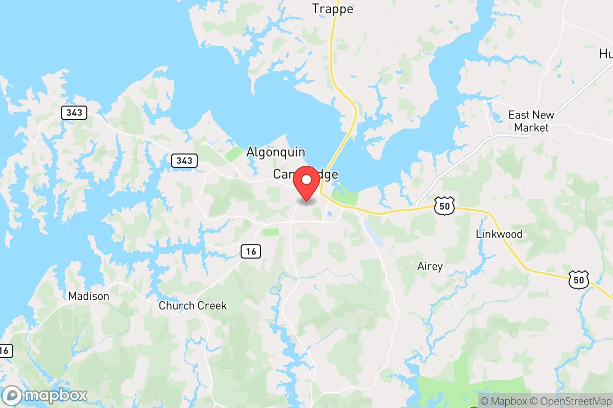
Strategic Assessment of Cambridge, MD
Meaningful friction. Expect exposure to either population pressure, blast zones, or natural disaster risk. Consider buying a retreat property.
What does the Strategic Assessment tell us?
Our Strategic Assessment grades tactical survivability of an area. Major population centers, military targets, fallout zones, natural disasters, and border exposure all drive risk — lower exposure means a more defensible position in a crisis.
This is heavily inspired by Joel Skousen's Strategic Relocation book. Highly recommended you checkout the book ($)What does this tell us?
Our Strategic Assessment grades tactical survivability of an area. Major population centers, military targets, fallout zones, natural disasters, and border exposure all drive risk — lower exposure means a more defensible position in a crisis.
This is heavily inspired by Joel Skousen's Strategic Relocation book. Highly recommended you checkout the book ($)Strategic Pillars

Key Distances
Regional Safe Places
Below is our recommended "safe zones" in Maryland and the surrounding area based on our strategic heuristics. For most people, it's unrealistic to live in a “safe zone” full-time due to work, family or other personal reasons. They tend to be more rural. However, many of these areas are perfect for second homes and retreat properties that double as a vacation home or even a short-term rental.


Important Note: For informational purposes only. This does not mean nothing bad ever happens in the green zones. Please use common sense. This is based on public data and modeled with AI. We tried to take a conservative approach but mistakes happen. We update this regularly as new information becomes available.
Solar Generator Recommendations
Backup power matters more here than in safer locations. We've picked three solar generators across budgets and capacity tiers — start with the budget unit if you only need a few essentials, or step up if you want to run a fridge and HVAC for days at a time.

Jackery Portable Power Station Explorer 300
Budget OptionPower on the Go: Weighing only 11 lbs, it's convenient to set up and store with book-sized foldable solar panels

BLUETTI Portable Power Station AC180
Designed for both indoor and outdoor scenarios, AC180 is highly capable as it has a robost capacity and continuous output power.

EF ECOFLOW DELTA Pro Ultra Power Station
Upgraded PickEcoFlow DELTA Pro Ultra is a whole-home energy system designed to grow with your family. Integrated with the Smart Home Panel 2, it scales to meet your evolving energy needs — keeping your home powered, intelligent, and secure through every stage of life.
We earn a commission, at no additional cost to you.
Strategic Assessment Analysis
Cambridge, Maryland, offers a mixed strategic picture for those prioritizing resilience and self-sufficiency. Its position on the Eastern Shore provides a natural buffer from the immediate fallout of major metropolitan collapse, but its own vulnerabilities—coastal exposure, a single-point-of-failure bridge connection, and proximity to a major military target—demand careful consideration. For a relocator with a prepper mindset, Cambridge is not a fortress, but a calculated trade-off: significant natural advantages in food and water security are offset by real risks that require active mitigation.
Geographic position and natural advantages for long-term survival
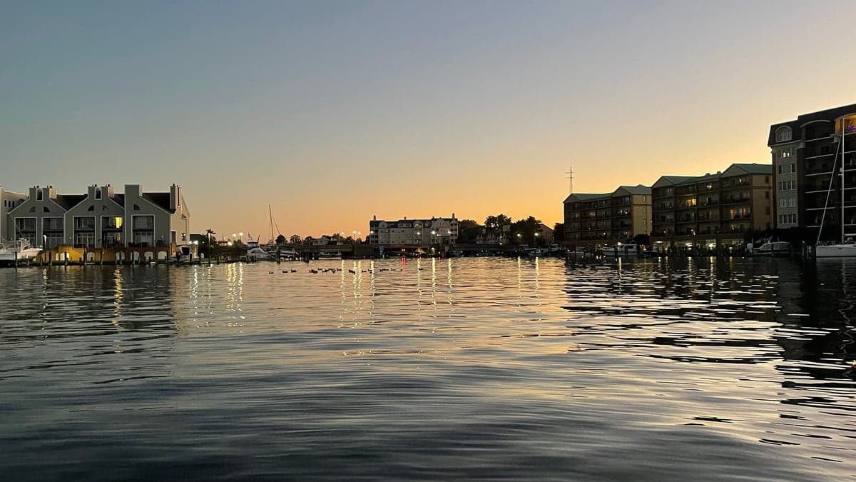
Cambridge sits on the Choptank River, a major tributary of the Chesapeake Bay, placing it within a rich estuarine ecosystem. This is a genuine asset for long-term food security. The surrounding Dorchester County is sparsely populated by Mid-Atlantic standards, with a population density of roughly 80 people per square mile—a fraction of the suburban sprawl found west of the Bay Bridge. The area is laced with tidal creeks, marshes, and farmland, offering multiple avenues for subsistence: fishing, crabbing, hunting waterfowl, and small-scale agriculture. The Blackwater National Wildlife Refuge, just south of town, is a massive undeveloped tract that could serve as a buffer zone and a source of wild game. From a strategic standpoint, the Eastern Shore’s relative isolation from the I-95 corridor means that a cascading collapse in Baltimore or Washington, D.C., would not immediately flood Cambridge with refugees—the Bay Bridge becomes the critical chokepoint. The local climate is temperate, with a growing season long enough for two crop cycles, and the water table is high, making well drilling a viable option for those who secure the right property.
Risks, exposures, and proximity to fallout-relevant landmarks
The most glaring vulnerability is Cambridge’s exposure to the Chesapeake Bay’s storm surge and sea-level rise. The town’s historic district and much of its low-lying residential area are in the floodplain. A Category 2 or higher hurricane making a direct hit could inundate large portions of the town, cutting off escape routes and contaminating freshwater supplies. This is not a theoretical risk—the area has seen repeated flooding events, and the Army Corps of Engineers has identified the region as one of the most vulnerable on the East Coast. Beyond weather, the proximity to the Patuxent River Naval Air Station (roughly 40 miles west) is a double-edged sword. In a major conflict or terrorist event, that base is a high-value target. A conventional or dirty-bomb strike there could send fallout across the Bay, depending on wind direction. Cambridge is also within 90 miles of the Calvert Cliffs Nuclear Power Plant. While the plant is well-regulated, a catastrophic failure—whether from accident or sabotage—would render the entire lower Eastern Shore uninhabitable for a generation. Finally, the single road connection to the mainland, the Bay Bridge (US 50/301), is a critical failure point. If that bridge is compromised—by attack, accident, or civil unrest—Cambridge becomes an island, accessible only by boat or a long detour through Delaware. For a relocator, this isolation is a strength only if you are already on the Eastern Shore when the bridge goes down; if you are not, you are trapped on the wrong side.
Practical resilience for a relocator: food, water, energy, and defensibility
For those willing to invest in preparation, Cambridge offers a workable base. Food security is the strongest card: the local waters provide protein year-round, and the surrounding farmland grows corn, soybeans, and vegetables. The Cambridge Farmers Market and local CSAs are functional now, but in a collapse scenario, bartering with watermen and farmers would be the primary economy. Water is a concern: the municipal supply draws from the Choptank River, which is brackish and vulnerable to saltwater intrusion during droughts. A prepper should plan on a private well with a hand pump, plus rainwater catchment. The water table is shallow, so well drilling is relatively inexpensive compared to the Piedmont region. Energy independence is achievable: the flat, open landscape is ideal for solar panels, and many rural properties already have propane tanks for backup. Wood heat is viable, as the region has abundant forest, but note that most local timber is softwood (pine) which burns fast and creates creosote—hardwood (oak, hickory) is less common and more expensive. Defensibility is mixed: Cambridge itself is a small city of about 12,000, with a historic core that is walkable but not easily fortified. The better option for a relocator is to buy land outside town—north toward Hurlock or south toward Secretary—where properties are spaced out and offer clear sightlines. The local law enforcement presence is thin; the Dorchester County Sheriff’s Office has about 40 deputies for the entire county, meaning response times in rural areas can exceed 20 minutes. In a crisis, you are largely on your own. The local population is a mix of long-time watermen, retirees, and a growing number of remote workers. Politically, Dorchester County leans conservative, but it is not a hardline red area—there is a significant African American community and a Democratic voting bloc in Cambridge itself. For a conservative relocator, this means you will find like-minded neighbors, but you will also need to navigate a community that is not uniformly aligned with your worldview. The key is to keep a low profile and build relationships based on mutual aid, not ideology.
The overall strategic picture for Cambridge is one of calculated risk. It is not a bug-out location for a weekend warrior; it is a place to build a life with serious contingency planning. The natural resources—water, seafood, farmland—are genuine assets that few suburban areas can match. The vulnerabilities—storm surge, single-point-of-failure bridge, proximity to military and nuclear targets—are real but manageable with proper site selection and preparation. For a relocator who is willing to invest in a raised house, a well, solar panels, and a boat, Cambridge offers a defensible position that is close enough to the Chesapeake’s bounty but far enough from the chaos of the I-95 corridor. The key is to not treat it as a retreat, but as a working base where you actively participate in the local economy and community. Those who arrive expecting to simply hunker down will find themselves isolated and vulnerable. Those who integrate—learning to crab, joining a volunteer fire department, trading with neighbors—will find that Cambridge’s greatest strength is not its geography, but the quiet, self-reliant culture of the Eastern Shore itself.
* Values derived from national, state, county, city and local statistics and may differ in a specific area. Last updated: 2026-04-22T02:31:13.000Z
Narrative content on this page is AI-generated and may contain mistakes. Verify any details that matter before acting on them.
ReloMaps may earn a commission from affiliate links at no extra cost to you.