
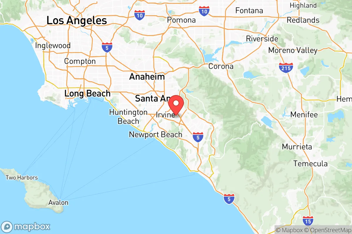
Photo: Wikipedia
Strategic Assessment of Orange County
High tactical risk. This location is likely close to major population centers, strategic targets, or sits in a high-disaster corridor. A retreat property and careful exit planning is required.
What does the Strategic Assessment tell us?
Our Strategic Assessment grades tactical survivability of an area. Major population centers, military targets, fallout zones, natural disasters, and border exposure all drive risk — lower exposure means a more defensible position in a crisis.
This is heavily inspired by Joel Skousen's Strategic Relocation book. Highly recommended you checkout the book ($)What does this tell us?
Our Strategic Assessment grades tactical survivability of an area. Major population centers, military targets, fallout zones, natural disasters, and border exposure all drive risk — lower exposure means a more defensible position in a crisis.
This is heavily inspired by Joel Skousen's Strategic Relocation book. Highly recommended you checkout the book ($)Strategic Pillars

Key Distances
Strategic Assessment Analysis
Orange County, California, presents a complex strategic picture for the relocation-minded individual or family prioritizing resilience and self-sufficiency. While its coastal location and dense population introduce significant vulnerabilities, the county’s internal diversity—from the canyons of the Santa Ana Mountains to the agricultural flatlands of the interior—offers pockets of genuine geographic advantage. For a conservative-leaning reader weighing disaster readiness, the key is understanding that Orange County is not a monolith; the strategic calculus for a homestead in Silverado Canyon is vastly different from one in Huntington Beach or Irvine.
Geographic position and natural advantages for a resilient lifestyle
Orange County’s most underrated resilience asset is its varied topography. The Santa Ana Mountains, running through the eastern edge of the county, provide natural barriers, elevation, and a degree of separation from the coastal population crush. Communities like Trabuco Canyon and Modjeska Canyon sit at higher elevations, offering defensible terrain, cooler temperatures, and access to Cleveland National Forest—a buffer zone that can serve as a resource for water, game, and timber in a prolonged crisis. The county’s Mediterranean climate, with mild winters and dry summers, reduces the risk of freeze-related infrastructure failure and allows for year-round food production in the interior valleys. The Santa Ana River, while flood-prone, is a perennial water source that runs through the county, and its groundwater basins—particularly the Orange County Groundwater Basin—are actively managed and recharged, providing a more reliable water supply than many Southern California regions. For a relocator, the ability to tap into local water districts and potentially drill a private well in unincorporated areas is a tangible advantage over the all-or-nothing municipal systems of Los Angeles or San Diego.
Risks, exposures, and proximity to fallout-relevant landmarks
The county’s strategic liabilities are substantial and must be weighed honestly. Orange County is home to John Wayne Airport (SNA), a major civilian aviation hub, and Camp Pendleton—a sprawling Marine Corps base that straddles the Orange-San Diego county line. While Camp Pendleton is a military asset, its presence makes the region a potential target in a conflict scenario, and its massive fuel and ammunition storage facilities represent a secondary hazard. The Port of Long Beach and Port of Los Angeles, the nation’s busiest container ports, lie just north of the county line; their concentration of hazardous materials, petroleum storage, and shipping traffic creates a fallout-relevant risk corridor along the entire coastal strip. The San Onofre Nuclear Generating Station (SONGS), though decommissioned, still houses spent nuclear fuel on site, located just south of San Clemente. A major seismic event or targeted attack on that facility could render large portions of the southern coast uninhabitable for years. Additionally, the county’s dense population—over 3.1 million people—means that any major disaster will trigger immediate competition for resources. The I-5 and I-405 freeway corridors are choke points that can gridlock within minutes, making evacuation from coastal cities like Newport Beach or Laguna Beach a nightmare scenario. Wildfire risk is acute in the canyons and foothills, and the Santa Ana winds can turn a small brush fire into a regional catastrophe in hours, as seen in the 2020 Silverado Fire.
Practical resilience for a relocator: food, water, energy, and defensibility
For a family or individual serious about self-sufficiency, Orange County offers a mixed but workable environment. Food production is viable in the interior: the Irvine Ranch area still has active agricultural operations, and the county’s numerous farmers’ markets (e.g., in Orange and San Juan Capistrano) indicate a local food culture. However, most residential lots are small, and HOAs in planned communities like Mission Viejo or Aliso Viejo often restrict livestock and large gardens. The better bet is unincorporated canyon or foothill properties where zoning is looser. Water is the critical vulnerability: the county imports roughly half its water from the Colorado River and the State Water Project, both of which are vulnerable to drought, earthquake, and political disruption. A relocator should prioritize properties with access to a private well or a direct connection to the Orange County Water District’s groundwater replenishment system. Energy is a bright spot: the county has significant solar potential, and net metering policies (though changing) still make rooftop solar a sound investment. Battery storage is essential, as the grid is aging and prone to Public Safety Power Shutoffs during fire season. Defensibility varies wildly. Coastal cities are indefensible due to population density and limited egress routes. In contrast, the canyon communities—Silverado Canyon, Williams Canyon—offer narrow, single-road access that can be monitored and controlled, though that same road is a vulnerability if blocked by fire or debris. A relocator should also consider the county’s strong law enforcement presence and conservative-leaning sheriff’s department in unincorporated areas, which can be a stabilizing factor in a breakdown scenario.
The overall strategic picture for Orange County is one of high potential paired with high risk. It is not a place for the unprepared or the passive. The coastal strip is a liability—too many people, too few exits, too close to major infrastructure targets. But the interior canyons and foothills offer a rare combination of defensible terrain, a workable climate, and access to managed water resources that few other Southern California counties can match. For a relocator willing to pay a premium for a property in the right canyon, invest in solar and water storage, and accept the wildfire risk as a manageable trade-off, Orange County can be a viable long-term base. For anyone expecting to ride out a crisis in a coastal condo or a suburban HOA tract, the strategic assessment is far less favorable. The county rewards preparation and punishes complacency—a reality that aligns well with a conservative, self-reliant mindset.

* Values derived from national, state, county, city and local statistics and may differ in a specific area. Last updated: 2026-07-15T04:49:20.000Z
Narrative content on this page is AI-generated and may contain mistakes. Verify any details that matter before acting on them.
ReloMaps may earn a commission from affiliate links at no extra cost to you.

