Photo: Wikipedia
Strategic Assessment of Burlington, WY
Strong survivability profile. Good buffer from population centers, with manageable environmental and tactical risks.
What does the Strategic Assessment tell us?
Our Strategic Assessment grades tactical survivability of an area. Major population centers, military targets, fallout zones, natural disasters, and border exposure all drive risk — lower exposure means a more defensible position in a crisis.
This is heavily inspired by Joel Skousen's Strategic Relocation book. Highly recommended you checkout the book ($)What does this tell us?
Our Strategic Assessment grades tactical survivability of an area. Major population centers, military targets, fallout zones, natural disasters, and border exposure all drive risk — lower exposure means a more defensible position in a crisis.
This is heavily inspired by Joel Skousen's Strategic Relocation book. Highly recommended you checkout the book ($)Strategic Pillars

Key Distances
Regional Safe Places
Below is our recommended "safe zones" in Wyoming and the surrounding area based on our strategic heuristics. For most people, it's unrealistic to live in a “safe zone” full-time due to work, family or other personal reasons. They tend to be more rural. However, many of these areas are perfect for second homes and retreat properties that double as a vacation home or even a short-term rental.
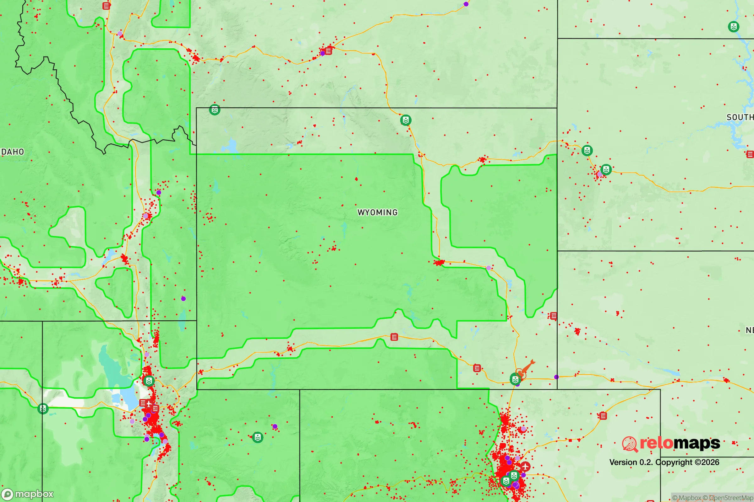
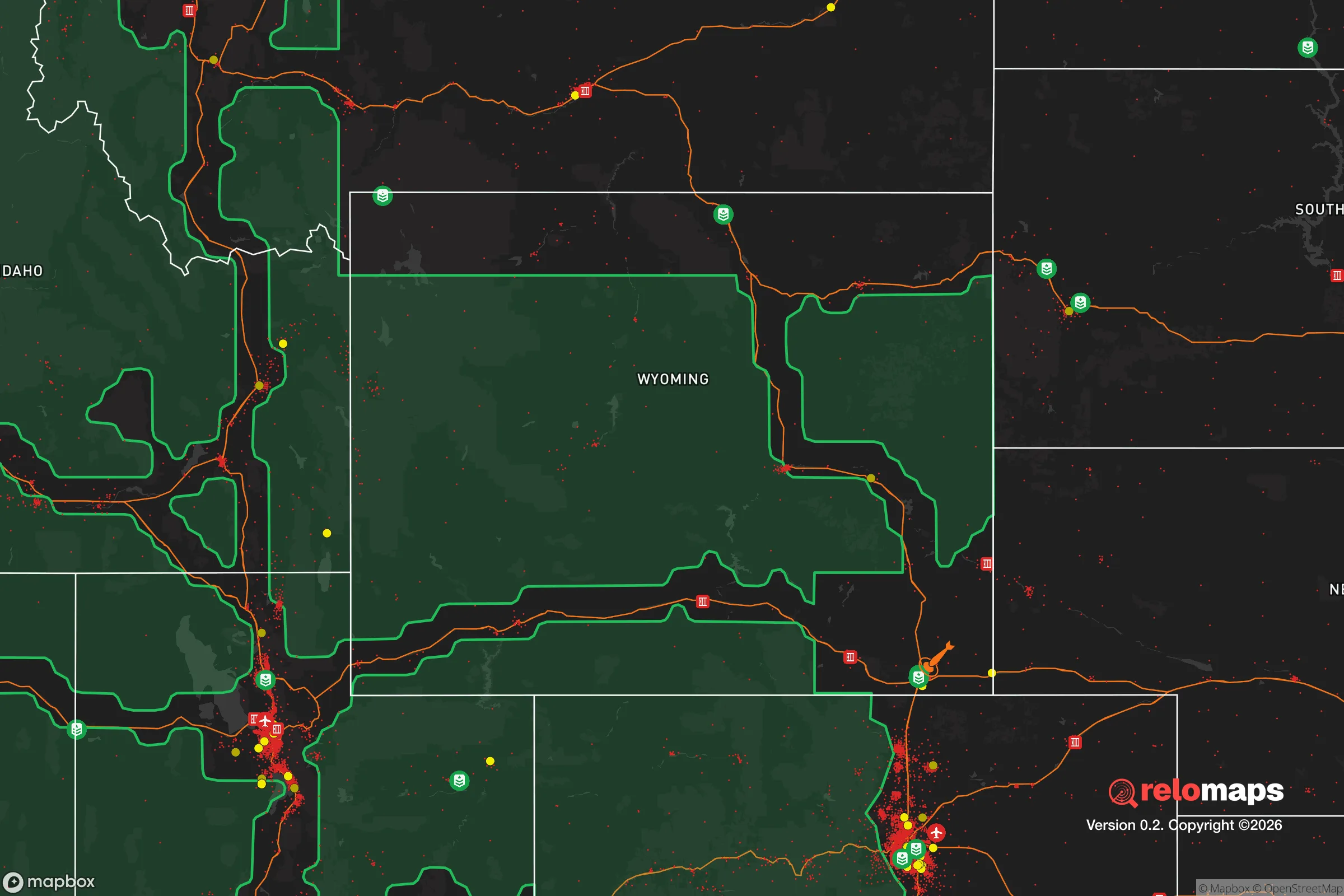


Important Note: For informational purposes only. This does not mean nothing bad ever happens in the green zones. Please use common sense. This is based on public data and modeled with AI. We tried to take a conservative approach but mistakes happen. We update this regularly as new information becomes available.
Solar Generator Recommendations
Backup power matters more here than in safer locations. We've picked three solar generators across budgets and capacity tiers — start with the budget unit if you only need a few essentials, or step up if you want to run a fridge and HVAC for days at a time.

Jackery Portable Power Station Explorer 300
Budget OptionPower on the Go: Weighing only 11 lbs, it's convenient to set up and store with book-sized foldable solar panels

BLUETTI Portable Power Station AC180
Designed for both indoor and outdoor scenarios, AC180 is highly capable as it has a robost capacity and continuous output power.

EF ECOFLOW DELTA Pro Ultra Power Station
Upgraded PickEcoFlow DELTA Pro Ultra is a whole-home energy system designed to grow with your family. Integrated with the Smart Home Panel 2, it scales to meet your evolving energy needs — keeping your home powered, intelligent, and secure through every stage of life.
We earn a commission, at no additional cost to you.
Strategic Assessment Analysis
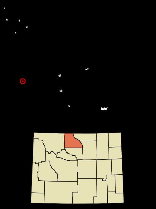
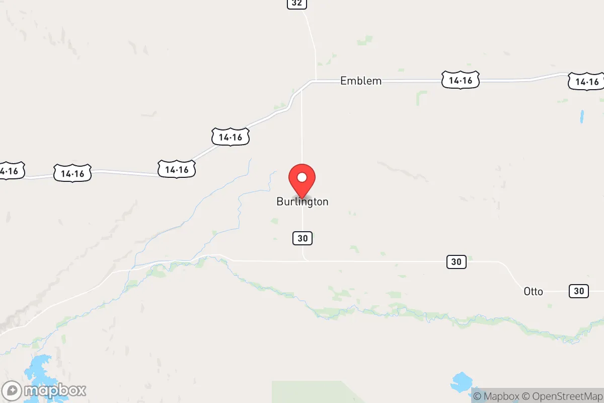
Burlington, Wyoming, occupies a unique strategic position in the Big Horn Basin that offers a blend of genuine geographic advantages and notable risk exposures for those prioritizing disaster readiness and self-sufficiency. Located roughly 15 miles west of Cody and 80 miles east of Yellowstone National Park, this small agricultural community sits at an elevation of approximately 4,400 feet, providing a natural buffer against many of the vulnerabilities that plague larger metropolitan areas. For the relocator thinking seriously about long-term resilience, Burlington presents a mixed picture: strong local resources and low population density offset by proximity to certain man-made risks and the inherent challenges of high-plains living.
Geographic position and natural advantages for long-term stability
Burlington's location in the Big Horn Basin provides several structural advantages that support long-term habitation and self-sufficiency. The town sits near the Shoshone River, which flows year-round from the Absaroka Mountains, offering a reliable surface water source that is less vulnerable to drought than many other Western communities. The surrounding terrain is a mix of irrigated agricultural land and sagebrush steppe, with the Big Horn Mountains rising to the east and the Absaroka Range to the west. This basin geography creates a natural defensive perimeter: the mountains funnel travel through a limited number of passes and highways, making the area inherently more defensible than open plains or sprawling suburbs. The local climate, while cold with winter lows frequently dropping below zero, provides a natural check on population growth and keeps real estate prices relatively accessible. The growing season is short—roughly 100 to 120 days—but the irrigated soils support hay, alfalfa, and small grains, which form the backbone of the local agricultural economy. For a relocator, the key takeaway is that Burlington sits in a region where water, arable land, and defensible terrain coexist, a combination increasingly rare in the American West.
Risk exposures and proximity to fallout-relevant landmarks
The most significant risk factor for Burlington is its proximity to potential man-made threats, particularly those associated with national security infrastructure. The town lies approximately 90 miles southeast of the Yellowstone Caldera, a supervolcano that, while not an imminent threat, represents a low-probability, high-consequence event that would affect the entire region. More immediately relevant to a preparedness-minded relocator is Burlington's position relative to military and strategic assets. The town is roughly 100 miles from the Malmstrom Air Force Base missile fields in Montana, which house Minuteman III intercontinental ballistic missiles. While Burlington itself is not a primary target, the surrounding region could experience secondary effects from a nuclear exchange, including electromagnetic pulse (EMP) disruption and fallout drift patterns that depend on prevailing winds. The prevailing winds in the Big Horn Basin generally flow from west to east, which means that fallout from a strike on the missile fields to the north would likely be carried away from Burlington, but this is a probabilistic assessment, not a guarantee. Additionally, the town's proximity to Cody and the Buffalo Bill Reservoir—a critical water infrastructure asset—could make it a destination for refugees from larger population centers during a crisis. The local road network is limited: US Highway 14A runs through Burlington, but the only major evacuation routes are east through Cody or west over the Big Horn Mountains, both of which can be seasonally impassable due to snow. For the strategic relocator, these factors mean that Burlington offers a moderate risk profile—lower than suburban Denver or Salt Lake City, but higher than more remote locations in central Wyoming or the Dakotas.
Practical resilience for a relocator: food, water, energy, and defensibility
Burlington's practical resilience metrics are mixed but generally favorable for those willing to invest in infrastructure. The local food system is anchored by the surrounding agricultural operations: hay, cattle, and some small-scale vegetable production are common, and the nearby town of Powell hosts a farmers market during the growing season. However, year-round food self-sufficiency requires serious planning, as the short growing season limits fresh produce to roughly June through September. The Shoshone River provides a reliable water source, but access requires either a riparian property or a cooperative arrangement with a landowner. Groundwater is available via wells, though drilling depths in the basin typically range from 100 to 300 feet, and water rights can be complex. For energy, Burlington is served by Rocky Mountain Power, which draws from a mix of coal, natural gas, and hydroelectric sources, including the Buffalo Bill Dam. Off-grid solar is viable given the region's 200-plus sunny days per year, but winter generation is significantly reduced, and battery storage is essential for resilience. The town's small population—roughly 300 residents—means that social cohesion is high, and mutual aid networks are more accessible than in anonymous suburbs. Defensibility is a genuine strength: the basin's geography limits approach routes, and the local culture is heavily oriented toward hunting, firearms ownership, and self-reliance. Park County, which contains Burlington, has one of the highest rates of concealed carry permits in Wyoming, and the sheriff's office maintains a community-oriented approach to law enforcement. For a relocator, the practical calculus is that Burlington provides a solid foundation for resilience but requires active investment in water storage, food production infrastructure, and winterization to achieve genuine self-sufficiency.
The overall strategic picture for Burlington, Wyoming, is one of moderate-to-high resilience with specific, manageable vulnerabilities. The town's isolation, agricultural base, and defensible geography make it a strong candidate for those seeking a balance between access to services and genuine self-reliance. The primary drawbacks are the short growing season, the proximity to national security infrastructure that could become a liability in a major conflict, and the limited evacuation routes during winter months. For the conservative-leaning relocator who values community, firearms culture, and a slower pace of life, Burlington offers a realistic path toward preparedness without the extreme isolation of more remote Wyoming locations. The key is to enter with eyes open: invest in a well, a greenhouse, and a wood-burning stove, and build relationships with neighbors before a crisis arrives. Burlington is not a bunker, but it is a place where a prepared family can build a genuinely resilient life.

* Values derived from national, state, county, city and local statistics and may differ in a specific area. Last updated: 2026-06-21T12:40:24.000Z
Narrative content on this page is AI-generated and may contain mistakes. Verify any details that matter before acting on them.
ReloMaps may earn a commission from affiliate links at no extra cost to you.

