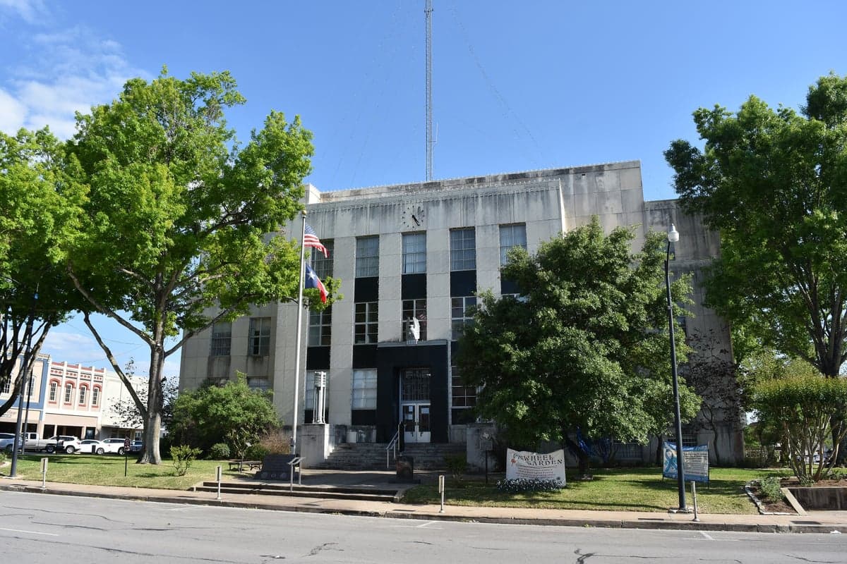
Photo: Wikipedia
Strategic Assessment of Brenham, TX
Meaningful friction. Expect exposure to either population pressure, blast zones, or natural disaster risk. Consider buying a retreat property.
What does the Strategic Assessment tell us?
Our Strategic Assessment grades tactical survivability of an area. Major population centers, military targets, fallout zones, natural disasters, and border exposure all drive risk — lower exposure means a more defensible position in a crisis.
This is heavily inspired by Joel Skousen's Strategic Relocation book. Highly recommended you checkout the book ($)What does this tell us?
Our Strategic Assessment grades tactical survivability of an area. Major population centers, military targets, fallout zones, natural disasters, and border exposure all drive risk — lower exposure means a more defensible position in a crisis.
This is heavily inspired by Joel Skousen's Strategic Relocation book. Highly recommended you checkout the book ($)Strategic Pillars

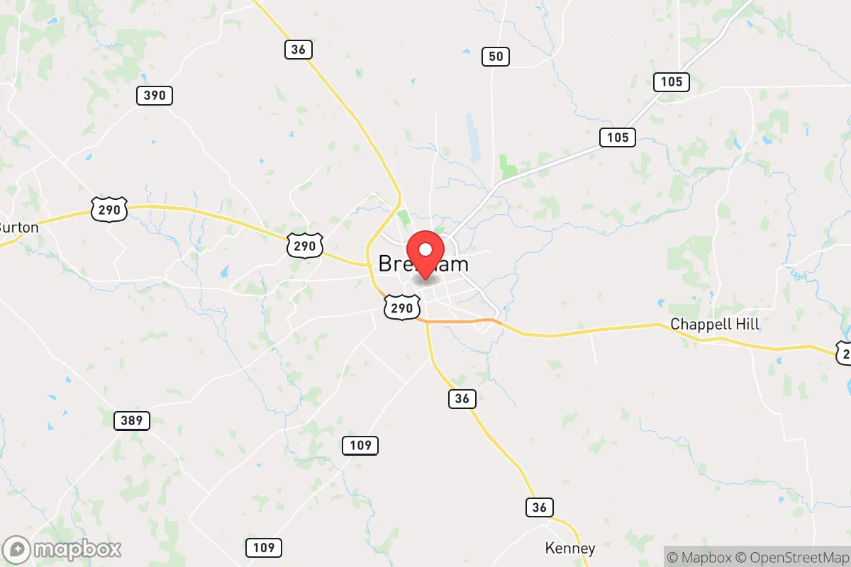
Key Distances
Regional Safe Places
Below is our recommended "safe zones" in Texas and the surrounding area based on our strategic heuristics. For most people, it's unrealistic to live in a “safe zone” full-time due to work, family or other personal reasons. They tend to be more rural. However, many of these areas are perfect for second homes and retreat properties that double as a vacation home or even a short-term rental.

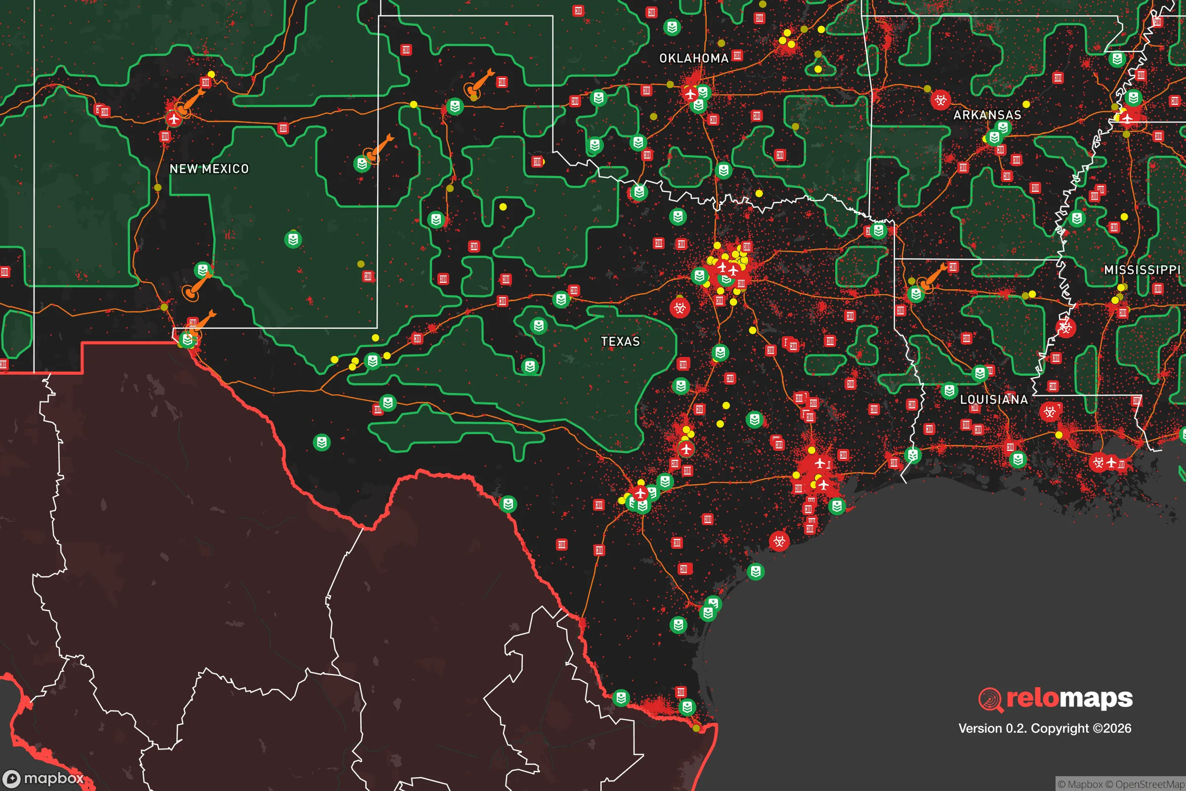


Important Note: For informational purposes only. This does not mean nothing bad ever happens in the green zones. Please use common sense. This is based on public data and modeled with AI. We tried to take a conservative approach but mistakes happen. We update this regularly as new information becomes available.
Solar Generator Recommendations
Backup power matters more here than in safer locations. We've picked three solar generators across budgets and capacity tiers — start with the budget unit if you only need a few essentials, or step up if you want to run a fridge and HVAC for days at a time.

Jackery Portable Power Station Explorer 300
Budget OptionPower on the Go: Weighing only 11 lbs, it's convenient to set up and store with book-sized foldable solar panels

BLUETTI Portable Power Station AC180
Designed for both indoor and outdoor scenarios, AC180 is highly capable as it has a robost capacity and continuous output power.

EF ECOFLOW DELTA Pro Ultra Power Station
Upgraded PickEcoFlow DELTA Pro Ultra is a whole-home energy system designed to grow with your family. Integrated with the Smart Home Panel 2, it scales to meet your evolving energy needs — keeping your home powered, intelligent, and secure through every stage of life.
We earn a commission, at no additional cost to you.
Strategic Assessment Analysis
Brenham, Texas, offers a compelling mix of geographic stability and strategic depth for those prioritizing disaster readiness and long-term self-sufficiency. Located roughly 70 miles northwest of Houston and 90 miles east of Austin, this Washington County seat sits firmly in the Post Oak Savannah region, a transitional zone that avoids the flood-prone coastal plains while retaining rich agricultural soil. For a relocator weighing resilience, Brenham provides a buffer from the immediate fallout zones of major metropolitan targets while still offering access to their resources when conditions are stable.
Geographic position and natural advantages for long-term stability
Brenham’s location is its primary strategic asset. The city sits on the western edge of the Gulf Coastal Plain, an area characterized by gently rolling hills and clay-loam soils that drain well compared to the flat, flood-prone lands closer to the coast. This elevation—roughly 350 feet above sea level—places it well above storm surge risk from the Gulf of Mexico, which is a critical consideration given the region’s vulnerability to hurricanes. The area is also far enough inland that hurricane-force winds are rare, though tropical storm remnants can still dump significant rain. The underlying geology is the Sparta Sand formation, which provides decent natural water filtration and supports shallow groundwater wells, a practical advantage for off-grid water planning.
The climate is humid subtropical, with hot summers and mild winters, allowing for year-round food production. The average growing season stretches from mid-March to early November, roughly 250 days, which is long enough for multiple crop cycles. Annual rainfall averages 40 inches, distributed fairly evenly throughout the year, reducing the risk of prolonged drought that plagues areas further west. The region’s natural vegetation—a mix of post oak, blackjack oak, and native grasses—provides ample biomass for fuel and building materials, though timber stands are not dense enough to create a significant wildfire corridor. The Brazos River runs about 10 miles west of town, and the Navasota River is roughly 15 miles east, offering surface water redundancy if groundwater becomes compromised.
Risk exposure, man-made threats, and proximity to high-value targets
No resilience assessment is complete without acknowledging the risks. Brenham’s primary natural threat is severe weather, specifically tornadoes and hailstorms. Washington County sits on the northern fringe of the Dixie Alley tornado zone, and while the area does not see the frequency of Oklahoma or North Texas, violent spring storms are a real concern. The 1997 tornado that struck nearby Jarrell, Texas, is a sobering reminder that this region can produce catastrophic events. Flooding is a secondary risk, but it is largely confined to the Brazos River floodplain west of town; the city itself is built on higher ground and rarely sees standing water beyond minor street flooding during heavy rain events.
From a man-made risk perspective, Brenham’s distance from major cities is a double-edged sword. Being 70 miles from Houston and 90 miles from Austin places it outside the primary blast and thermal radiation zones of a nuclear detonation in either city, but it is well within the fallout plume range depending on wind direction. The prevailing winds in this region are from the south and southeast, meaning fallout from a Houston event would likely be carried north and northwest, potentially affecting Brenham within hours. The city is also within 50 miles of the Strategic Petroleum Reserve’s Bryan Mound site near Freeport, though that facility is a hardened underground salt dome and not a likely primary target. More relevant is Brenham’s proximity to the Texas Gulf Coast petrochemical corridor, which includes refineries in Texas City, Baytown, and Port Arthur. A major industrial accident or targeted strike on that infrastructure could create a cascading economic and supply chain disruption that would ripple inland to Brenham within days.
The city itself has no major military installations, nuclear power plants, or high-value industrial targets, which is a net positive for a relocator seeking to avoid primary strike zones. However, Highway 290, which runs through Brenham, is a major evacuation route from Houston. In a crisis, the town could see significant through-traffic and temporary population surges, straining local resources. The Brenham Municipal Airport is a general aviation field with a 5,000-foot runway, which could be a strategic asset for resupply or evacuation but also a potential point of unwanted attention.
Practical resilience for daily life: food, water, energy, and defensibility
For a relocator serious about self-sufficiency, Brenham’s practical resilience is strong but requires planning. The area is agricultural heartland—Washington County is one of Texas’s top producers of corn, cotton, and sorghum, and the local cattle industry is robust. The Brenham Farmers Market operates year-round, and the surrounding rural areas have a high density of small farms, ranches, and homesteads. This means local food production is not just possible but already established, and a relocator with land can tap into existing networks for seed stock, livestock, and farming knowledge. The Blue Bell Creameries headquarters in Brenham is a local institution, but more importantly, the dairy infrastructure in the region provides a reliable source of milk and protein.
Water is the critical variable. Brenham’s municipal water comes from the Carrizo-Wilcox Aquifer, a deep, high-quality source that is less susceptible to surface contamination than shallow aquifers. For a relocator on rural property, drilling a well to the Sparta or Carrizo sands is feasible, with typical depths ranging from 200 to 600 feet. Rainwater catchment is also viable given the 40-inch annual rainfall, and the clay soils, while not ideal for septic drain fields, are workable with proper engineering. Surface water from the Brazos or Navasota rivers is available but requires treatment and is subject to upstream contamination from agricultural runoff and potential industrial spills.
Energy resilience is mixed. Brenham is served by the Electric Reliability Council of Texas (ERCOT) grid, which has a documented history of instability during extreme weather events, most notably the 2021 winter storm. A relocator should plan for grid outages lasting several days to two weeks. Solar potential is good—the region averages 260 sunny days per year—and net metering policies are favorable for grid-tied systems. Natural gas is available in town, but rural properties often rely on propane, which requires storage and resupply. Wood heating is a viable backup given the local timber, but the oak and mesquite require seasoning and proper stove infrastructure.
Defensibility is a function of layout and community. Brenham is a small city of roughly 17,000 people, with a county population of about 35,000. The surrounding terrain is open farmland with scattered woodlots, offering good visibility but limited natural cover. The town itself is compact, with a traditional grid street pattern that is easy to navigate but also easy to monitor. The local law enforcement presence is adequate for normal times, but the Washington County Sheriff’s Office has limited personnel for a large-scale crisis. A relocator’s best defense is likely to be a rural property with good sightlines, a reliable water source, and a network of like-minded neighbors. The local culture is heavily influenced by German and Czech heritage, with a strong tradition of community self-reliance and mutual aid, which is a soft but real resilience asset.
The overall strategic picture for Brenham is one of moderate-to-strong resilience with clear, manageable risks. It is not a remote bunker location, but it is far enough from major targets to avoid the worst of a man-made disaster while remaining close enough to agricultural and industrial resources to support a self-sufficient lifestyle. The climate is forgiving, the water is accessible, and the community is grounded. For a relocator who wants to be prepared without living in isolation, Brenham offers a realistic balance of safety, sustainability, and access.

* Values derived from national, state, county, city and local statistics and may differ in a specific area. Last updated: 2026-10-23T21:31:54.000Z
Narrative content on this page is AI-generated and may contain mistakes. Verify any details that matter before acting on them.
ReloMaps may earn a commission from affiliate links at no extra cost to you.

