 Popular
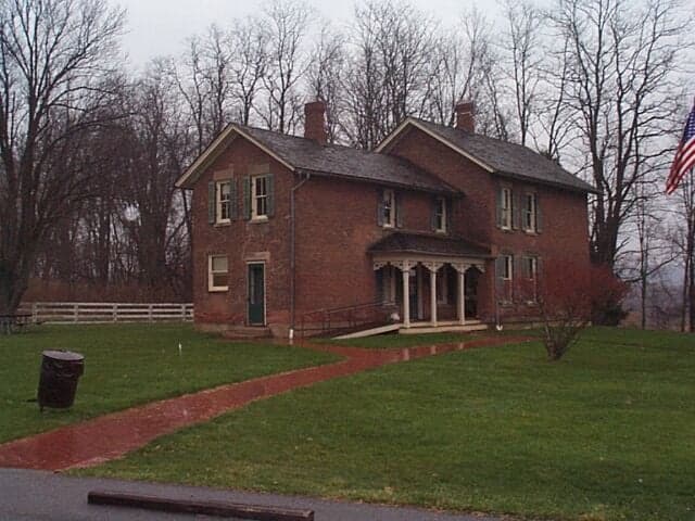
Photo: Wikipedia
Strategic Assessment of Brecksville, OH
Meaningful friction. Expect exposure to either population pressure, blast zones, or natural disaster risk. Consider buying a retreat property.
What does the Strategic Assessment tell us?
Our Strategic Assessment grades tactical survivability of an area. Major population centers, military targets, fallout zones, natural disasters, and border exposure all drive risk — lower exposure means a more defensible position in a crisis.
This is heavily inspired by Joel Skousen's Strategic Relocation book. Highly recommended you checkout the book ($)What does this tell us?
Our Strategic Assessment grades tactical survivability of an area. Major population centers, military targets, fallout zones, natural disasters, and border exposure all drive risk — lower exposure means a more defensible position in a crisis.
This is heavily inspired by Joel Skousen's Strategic Relocation book. Highly recommended you checkout the book ($)Strategic Pillars

Key Distances
Regional Safe Places
Below is our recommended "safe zones" in Ohio and the surrounding area based on our strategic heuristics. For most people, it's unrealistic to live in a “safe zone” full-time due to work, family or other personal reasons. They tend to be more rural. However, many of these areas are perfect for second homes and retreat properties that double as a vacation home or even a short-term rental.

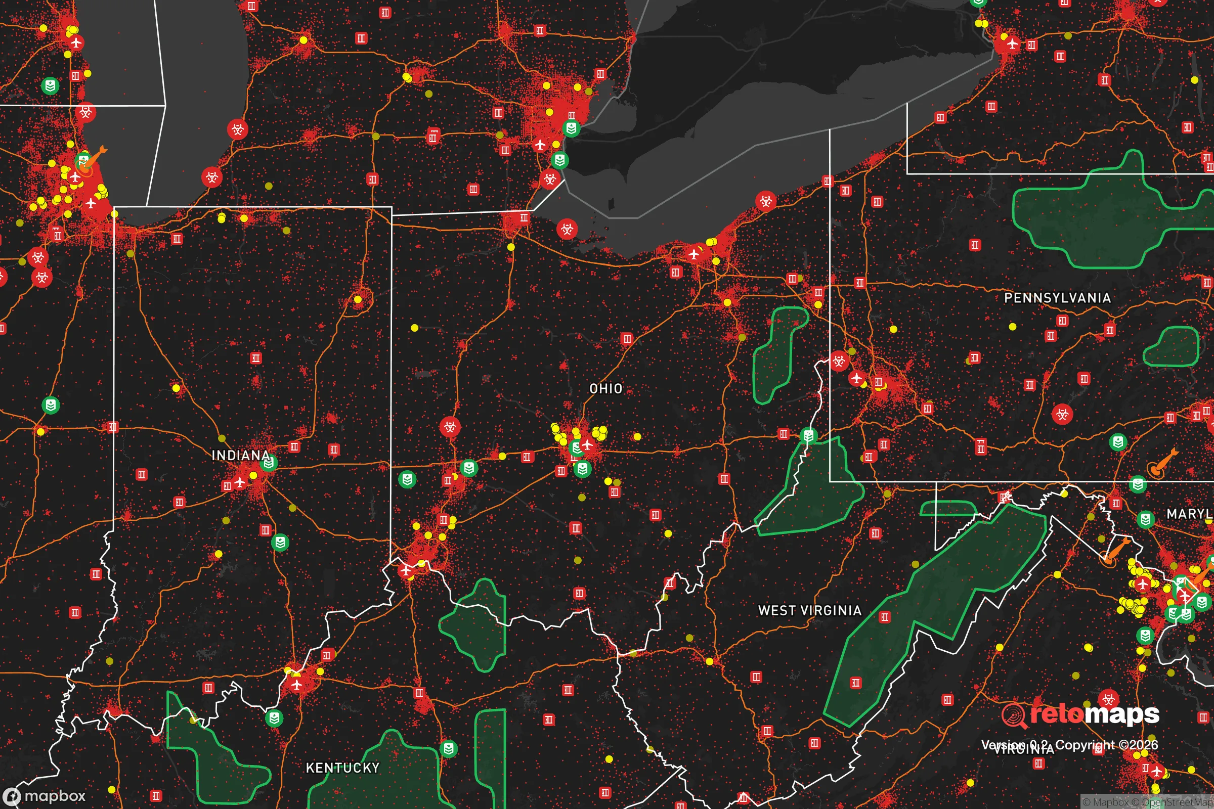


Important Note: For informational purposes only. This does not mean nothing bad ever happens in the green zones. Please use common sense. This is based on public data and modeled with AI. We tried to take a conservative approach but mistakes happen. We update this regularly as new information becomes available.
Solar Generator Recommendations
Backup power matters more here than in safer locations. We've picked three solar generators across budgets and capacity tiers — start with the budget unit if you only need a few essentials, or step up if you want to run a fridge and HVAC for days at a time.

Jackery Portable Power Station Explorer 300
Budget OptionPower on the Go: Weighing only 11 lbs, it's convenient to set up and store with book-sized foldable solar panels

BLUETTI Portable Power Station AC180
Designed for both indoor and outdoor scenarios, AC180 is highly capable as it has a robost capacity and continuous output power.

EF ECOFLOW DELTA Pro Ultra Power Station
Upgraded PickEcoFlow DELTA Pro Ultra is a whole-home energy system designed to grow with your family. Integrated with the Smart Home Panel 2, it scales to meet your evolving energy needs — keeping your home powered, intelligent, and secure through every stage of life.
We earn a commission, at no additional cost to you.
Strategic Assessment Analysis
Brecksville, Ohio, offers a strategic balance of proximity to Cleveland’s economic engine and the protective buffer of the Cuyahoga Valley National Park, making it a location worth serious consideration for those prioritizing resilience and self-sufficiency. The city’s position on the edge of the Appalachian foothills provides natural terrain advantages, while its distance from the urban core—roughly 15 miles south of downtown Cleveland—reduces exposure to the immediate fallout of a major metropolitan disruption. For a relocator thinking about disaster readiness, Brecksville’s combination of suburban infrastructure, green space, and relative isolation from high-density targets presents a credible, if not perfect, foundation for long-term preparedness.
Geographic position and natural advantages for long-term stability
Brecksville sits within the glaciated Allegheny Plateau, a region characterized by rolling hills, deep valleys, and mixed hardwood forests. This topography offers natural defensibility: the Cuyahoga River cuts through the eastern edge of the city, creating a physical barrier that slows movement and provides a natural water source. The Cuyahoga Valley National Park, which covers over 33,000 acres, borders Brecksville to the east and south, creating a large, undeveloped buffer zone that limits suburban sprawl and preserves wildlife corridors. This greenbelt is a genuine asset for anyone thinking about food security or retreat options, as it supports deer, turkey, and edible plant species. The city itself sits at an elevation of roughly 900 feet, with some ridges reaching over 1,000 feet, offering vantage points and reducing flood risk from the river below. Brecksville’s location also places it outside the primary snowbelt effect that hits communities east of Cleveland, meaning winter storms are less severe here than in Chardon or Painesville, which can receive over 100 inches of lake-effect snow annually. For a relocator, this means fewer road closures and less strain on heating fuel reserves during a prolonged winter event.
Risk exposure, man-made threats, and proximity to fallout-relevant landmarks
No location in Northeast Ohio is immune to the risks posed by the region’s industrial and military infrastructure, and Brecksville is no exception. The most significant man-made threat is the Perry Nuclear Power Plant, located roughly 30 miles northeast along Lake Erie. While 30 miles provides a substantial buffer, a major incident at Perry—especially a containment breach or spent fuel fire—could still affect Brecksville depending on wind patterns, with prevailing winds from the west and southwest offering some protection. More concerning is the concentration of chemical and refining infrastructure along the Cuyahoga River and Lake Erie shoreline, including the BP-Husky Toledo Refinery and multiple chemical storage facilities in the Cleveland-Akron corridor. A large-scale industrial accident or terrorist event targeting these facilities could produce toxic plumes that reach Brecksville within hours. On the military side, the Cleveland Air National Guard Base at Hopkins International Airport is roughly 12 miles north, and the Ravenna Army Ammunition Plant—a 21,000-acre facility used for munitions storage and demilitarization—lies about 25 miles east. While Brecksville is not a primary target for a nuclear strike (that distinction belongs to downtown Cleveland, the Port of Cleveland, and the NASA Glenn Research Center), it sits within the moderate fallout zone for a ground burst on downtown Cleveland, roughly 15 miles out. Fallout arrival time would be 30–60 minutes, which is enough time to shelter but not to evacuate. For a relocator, the key takeaway is that Brecksville is far enough from the highest-risk targets to avoid immediate destruction, but close enough that a major event would require a well-prepared sheltering plan.
Practical resilience for a relocator: food, water, energy, and defensibility
Brecksville’s practical resilience is a mixed bag, weighted heavily by its suburban character and access to natural resources. The city is served by the Cleveland Water Department, which draws from Lake Erie—a massive, reliable freshwater source. However, the treatment and distribution system is vulnerable to power loss, cyberattack, or contamination. A relocator should plan for at least two weeks of stored water or a private well, though well installation is feasible only on larger lots outside the denser subdivisions. The electrical grid is typical for the region: overhead lines, prone to ice storm and wind damage, with restoration times that can stretch to a week after a major event. Solar panels are a viable option here, as Brecksville averages 160 sunny days per year—below the national average but sufficient for a grid-tied system with battery backup. Natural gas is widely available for heating and cooking, which is a resilience advantage over all-electric homes, but the pipeline network is a single point of failure. For food security, Brecksville benefits from the Cuyahoga Valley National Park’s foraging potential and the presence of several community gardens and farmers’ markets, including the Brecksville Farmers Market (seasonal). The city’s zoning allows for backyard chickens and small-scale vegetable gardens, though livestock is restricted on lots under one acre. For long-term food storage, the area’s moderate humidity and basement availability make root cellaring practical. Defensibility is moderate: Brecksville is a bedroom community with a grid-like street pattern in its core, but the surrounding parkland and river create natural chokepoints. The main roads—Route 21, Route 82, and I-77—are evacuation corridors that would likely become congested or blocked during a crisis. A relocator should identify secondary routes through the park or along the river valley. The local police department is well-funded and professional, but in a widespread disaster, response times would lengthen significantly. The community’s social cohesion is a genuine asset: Brecksville has a strong sense of local identity, active neighborhood watch programs, and a history of mutual aid during severe weather events.
Overall, Brecksville presents a credible option for the disaster-conscious relocator who wants suburban convenience without being trapped in a high-risk urban core. Its natural buffers, access to fresh water, and moderate distance from major targets make it a defensible choice, provided you invest in your own water storage, backup power, and a realistic sheltering plan. The city is not a remote survivalist retreat—it’s a well-positioned suburb that offers a fighting chance in most scenarios short of a direct nuclear strike. For a family or individual willing to put in the preparation work, Brecksville strikes a reasonable balance between everyday livability and long-term resilience.

* Values derived from national, state, county, city and local statistics and may differ in a specific area. Last updated: 2026-10-10T16:26:39.000Z
Narrative content on this page is AI-generated and may contain mistakes. Verify any details that matter before acting on them.
ReloMaps may earn a commission from affiliate links at no extra cost to you.

