
Photo: Wikipedia
Strategic Assessment of Boxford, MA
Meaningful friction. Expect exposure to either population pressure, blast zones, or natural disaster risk. Consider buying a retreat property.
What does the Strategic Assessment tell us?
Our Strategic Assessment grades tactical survivability of an area. Major population centers, military targets, fallout zones, natural disasters, and border exposure all drive risk — lower exposure means a more defensible position in a crisis.
This is heavily inspired by Joel Skousen's Strategic Relocation book. Highly recommended you checkout the book ($)What does this tell us?
Our Strategic Assessment grades tactical survivability of an area. Major population centers, military targets, fallout zones, natural disasters, and border exposure all drive risk — lower exposure means a more defensible position in a crisis.
This is heavily inspired by Joel Skousen's Strategic Relocation book. Highly recommended you checkout the book ($)Strategic Pillars

Key Distances
Regional Safe Places
Below is our recommended "safe zones" in Massachusetts and the surrounding area based on our strategic heuristics. For most people, it's unrealistic to live in a “safe zone” full-time due to work, family or other personal reasons. They tend to be more rural. However, many of these areas are perfect for second homes and retreat properties that double as a vacation home or even a short-term rental.




Important Note: For informational purposes only. This does not mean nothing bad ever happens in the green zones. Please use common sense. This is based on public data and modeled with AI. We tried to take a conservative approach but mistakes happen. We update this regularly as new information becomes available.
Solar Generator Recommendations
Backup power matters more here than in safer locations. We've picked three solar generators across budgets and capacity tiers — start with the budget unit if you only need a few essentials, or step up if you want to run a fridge and HVAC for days at a time.

Jackery Portable Power Station Explorer 300
Budget OptionPower on the Go: Weighing only 11 lbs, it's convenient to set up and store with book-sized foldable solar panels

BLUETTI Portable Power Station AC180
Designed for both indoor and outdoor scenarios, AC180 is highly capable as it has a robost capacity and continuous output power.

EF ECOFLOW DELTA Pro Ultra Power Station
Upgraded PickEcoFlow DELTA Pro Ultra is a whole-home energy system designed to grow with your family. Integrated with the Smart Home Panel 2, it scales to meet your evolving energy needs — keeping your home powered, intelligent, and secure through every stage of life.
We earn a commission, at no additional cost to you.
Strategic Assessment Analysis
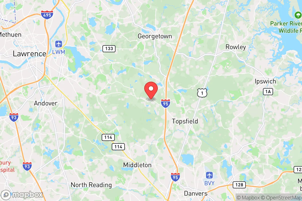
Boxford, Massachusetts offers a compelling balance of rural seclusion and strategic access, making it one of the more resilient suburbs within Greater Boston for those prioritizing disaster readiness and self-sufficiency. Located about 25 miles north of Boston and 12 miles from the New Hampshire border, this town of roughly 8,000 residents sits on the edge of the I-95 corridor while maintaining a low-density, heavily forested character. Its position outside the immediate blast and fallout zones of major urban centers like Boston, combined with its proximity to fresh water and agricultural land, gives it a structural advantage over denser, more exposed communities inside Route 128.
Geographic position and natural defensive advantages
Boxford’s topography and layout provide several built-in resilience factors. The town straddles the watershed of the Parker River, which feeds into the Ipswich River and ultimately the Atlantic, but its interior consists of rolling hills, wetlands, and extensive woodlands. This terrain makes it less prone to the flooding that plagues coastal towns like Newburyport or Salisbury, while the dense tree cover offers natural concealment and a degree of wind protection during severe storms. The town is not located on any major fault line, and its elevation—generally 100 to 200 feet above sea level—puts it well above storm surge risk. Critically, Boxford is surrounded by conservation land: the 1,000-acre Boxford State Forest, the 600-acre Crooked Pond Conservation Area, and numerous town-owned parcels create a natural buffer zone that limits suburban sprawl and provides potential foraging and timber resources in a prolonged emergency. The area’s low population density—roughly 300 people per square mile versus Boston’s 14,000—means that in a crisis, competition for local resources would be far less intense than in nearby towns like Andover or Topsfield. Boxford’s geography also places it within a two-hour drive of the White Mountains of New Hampshire, offering a realistic secondary retreat option if the immediate region becomes compromised.
Risks, exposures, and proximity to fallout-relevant landmarks
No analysis is complete without acknowledging the liabilities. Boxford sits within the extended shadow of some of the highest-value targets on the East Coast. Boston’s Logan International Airport, the Seaport District’s financial infrastructure, and Hanscom Air Force Base in Bedford—a key node in U.S. command and control—are all within a 25- to 35-mile radius. In a nuclear or major conventional attack on Boston, Boxford would be outside the initial thermal and blast radius of a ground burst, but it lies in a zone that could experience light fallout depending on wind patterns. Prevailing westerlies would carry fallout from a Boston strike east toward the Atlantic, but a shift to north or northwest winds—common in winter—would push contamination over the North Shore, including Boxford. The Pilgrim Nuclear Power Station in Plymouth, 50 miles south, is an older plant that remains a concern, though its shutdown in 2019 reduced that specific risk. On the man-made hazard side, the town’s proximity to the I-95 corridor means chemical spills or hazmat incidents from tanker trucks are a plausible, if low-probability, event. Natural risks are modest: occasional nor’easters and blizzards cause power outages that can last 3–5 days, but the town’s tree-lined roads and overhead utilities mean storm recovery is slower than in denser communities with underground lines. Dam failures on the Ipswich River or local millponds could cause localized flooding, but these are small-scale events. The overall picture is one of moderate risk: Boxford avoids the worst of coastal and urban threats but remains exposed to secondary effects from regional disruptions.
Practical resilience for a relocator: food, water, energy, and defensibility
For someone serious about self-sufficiency, Boxford’s practical infrastructure is a mixed but promising picture. Water access is excellent: the town sits atop a shallow aquifer, and many homes have private wells or access to the Town of Boxford’s public water system, which draws from Great Pond and Quarry Pond. In a grid-down scenario, well owners with hand pumps or generators can maintain water supply independent of municipal systems. The Parker River and several kettle ponds—such as Stiles Pond and Hood Pond—offer emergency surface water, though treatment would require filtration or boiling. Food resilience is supported by the town’s agricultural history. Several active farms remain, including the historic Boxford Village Farm and multiple community-supported agriculture (CSA) programs that operate through the growing season, typically May through October. Backyard gardening is feasible on most 2- to 5-acre lots, though soil quality varies and deer pressure is heavy. For energy, Boxford has limited solar penetration—only about 5% of homes have rooftop solar as of 2025—but the town is not in an HOA-heavy environment that restricts installation. Wood heat is a realistic option: most rural properties have fireplaces or wood stoves, and the state forests provide abundant firewood, though cutting permits are required. For long-term energy, a propane generator is the standard backup among local preppers. Defensibility is one of Boxford’s standout features. The town’s many dead-end roads, winding country lanes, and wooded lots make it difficult to traverse quickly by vehicle. A determined group could effectively block or monitor the three main access roads—Route 97, Route 133, and Middleton Road—with minimal effort. The local police force is small (roughly 8–10 officers), so OODA-loop planning favors the informed resident. There is no obvious concentration of valuables, infrastructure, or population that would attract organized looting, but isolated homes could be targeted. The nearest hospitals are Anna Jaques in Newburyport and Beverly Hospital, both 25 minutes away, so medical self-sufficiency is important—a serious consideration for families with chronic conditions.
Overall, Boxford rates as a strong strategic holding for the disciplined relocator who values privacy, natural buffers, and access to New England’s interior. It is not a fortress—no suburb is—but its low profile, reliable water sources, and limited chokepoints offer meaningful advantages over more connected and exposed communities. The key trade-off is that Boxford’s resilience depends on preparation, not institutional support. The town government has no formal disaster stockpile or community bunker system, and mutual aid agreements with nearby towns are standard but not guaranteed. For the family willing to invest in well maintenance, solar panels, wood heat, and long-term food storage, Boxford provides a defensible base within striking distance of Boston’s economic opportunities while remaining far enough from the city’s risks to matter when things go wrong. The natural beauty and quiet streets are a bonus—but the real value is strategic.

* Values derived from national, state, county, city and local statistics and may differ in a specific area. Last updated: 2026-09-13T22:15:13.000Z
Narrative content on this page is AI-generated and may contain mistakes. Verify any details that matter before acting on them.
ReloMaps may earn a commission from affiliate links at no extra cost to you.

