Photo: Wikipedia
Strategic Assessment of Berkeley Springs, WV
Meaningful friction. Expect exposure to either population pressure, blast zones, or natural disaster risk. Consider buying a retreat property.
What does the Strategic Assessment tell us?
Our Strategic Assessment grades tactical survivability of an area. Major population centers, military targets, fallout zones, natural disasters, and border exposure all drive risk — lower exposure means a more defensible position in a crisis.
This is heavily inspired by Joel Skousen's Strategic Relocation book. Highly recommended you checkout the book ($)What does this tell us?
Our Strategic Assessment grades tactical survivability of an area. Major population centers, military targets, fallout zones, natural disasters, and border exposure all drive risk — lower exposure means a more defensible position in a crisis.
This is heavily inspired by Joel Skousen's Strategic Relocation book. Highly recommended you checkout the book ($)Strategic Pillars

Key Distances
Regional Safe Places
Below is our recommended "safe zones" in West Virginia and the surrounding area based on our strategic heuristics. For most people, it's unrealistic to live in a “safe zone” full-time due to work, family or other personal reasons. They tend to be more rural. However, many of these areas are perfect for second homes and retreat properties that double as a vacation home or even a short-term rental.
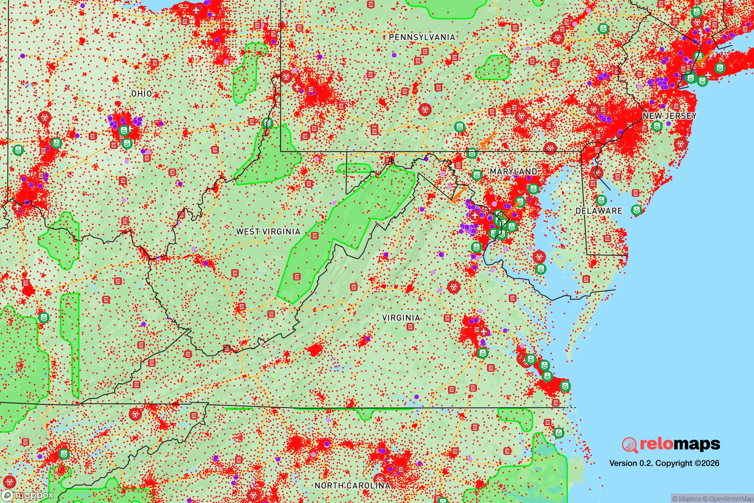
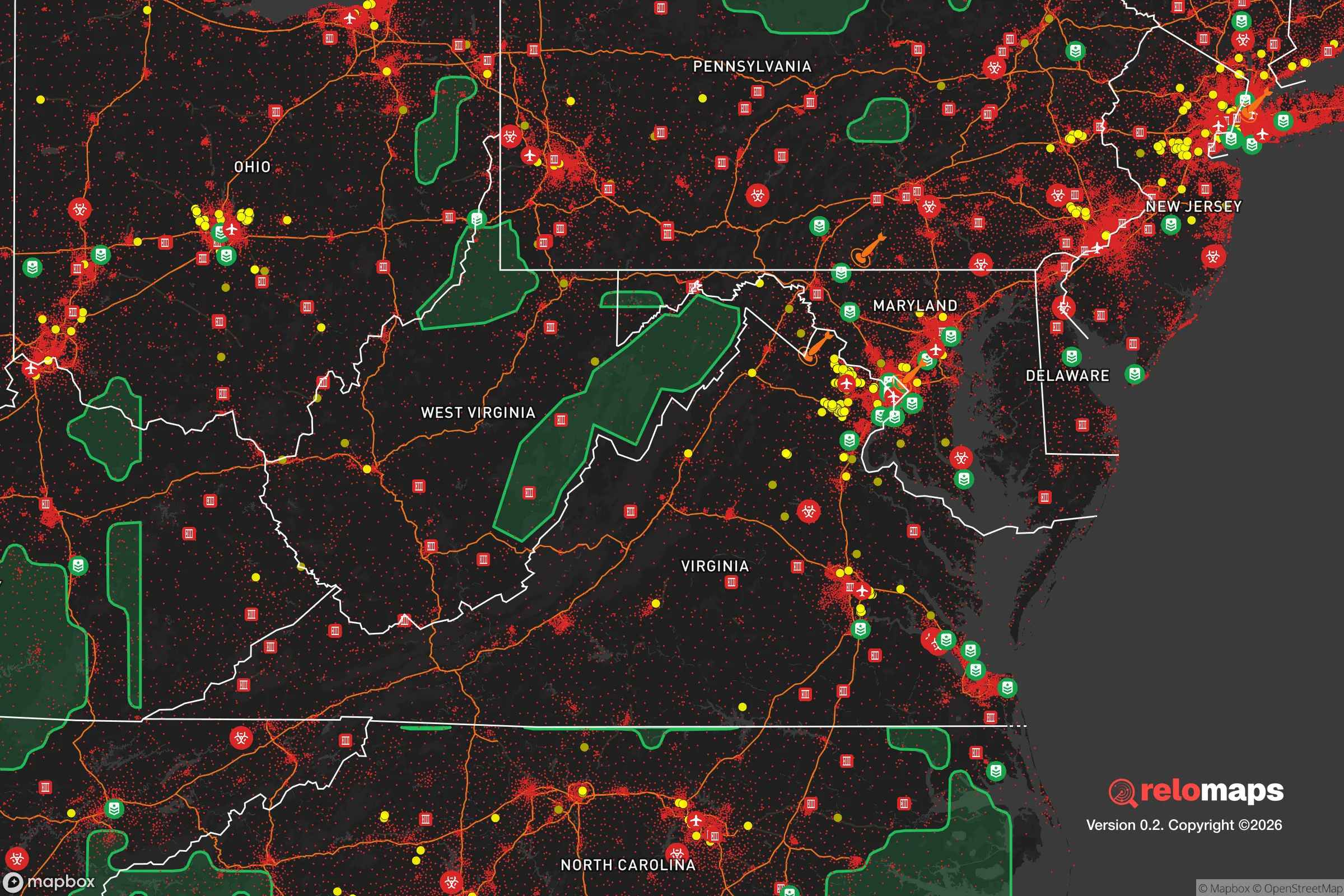


Important Note: For informational purposes only. This does not mean nothing bad ever happens in the green zones. Please use common sense. This is based on public data and modeled with AI. We tried to take a conservative approach but mistakes happen. We update this regularly as new information becomes available.
Solar Generator Recommendations
Backup power matters more here than in safer locations. We've picked three solar generators across budgets and capacity tiers — start with the budget unit if you only need a few essentials, or step up if you want to run a fridge and HVAC for days at a time.
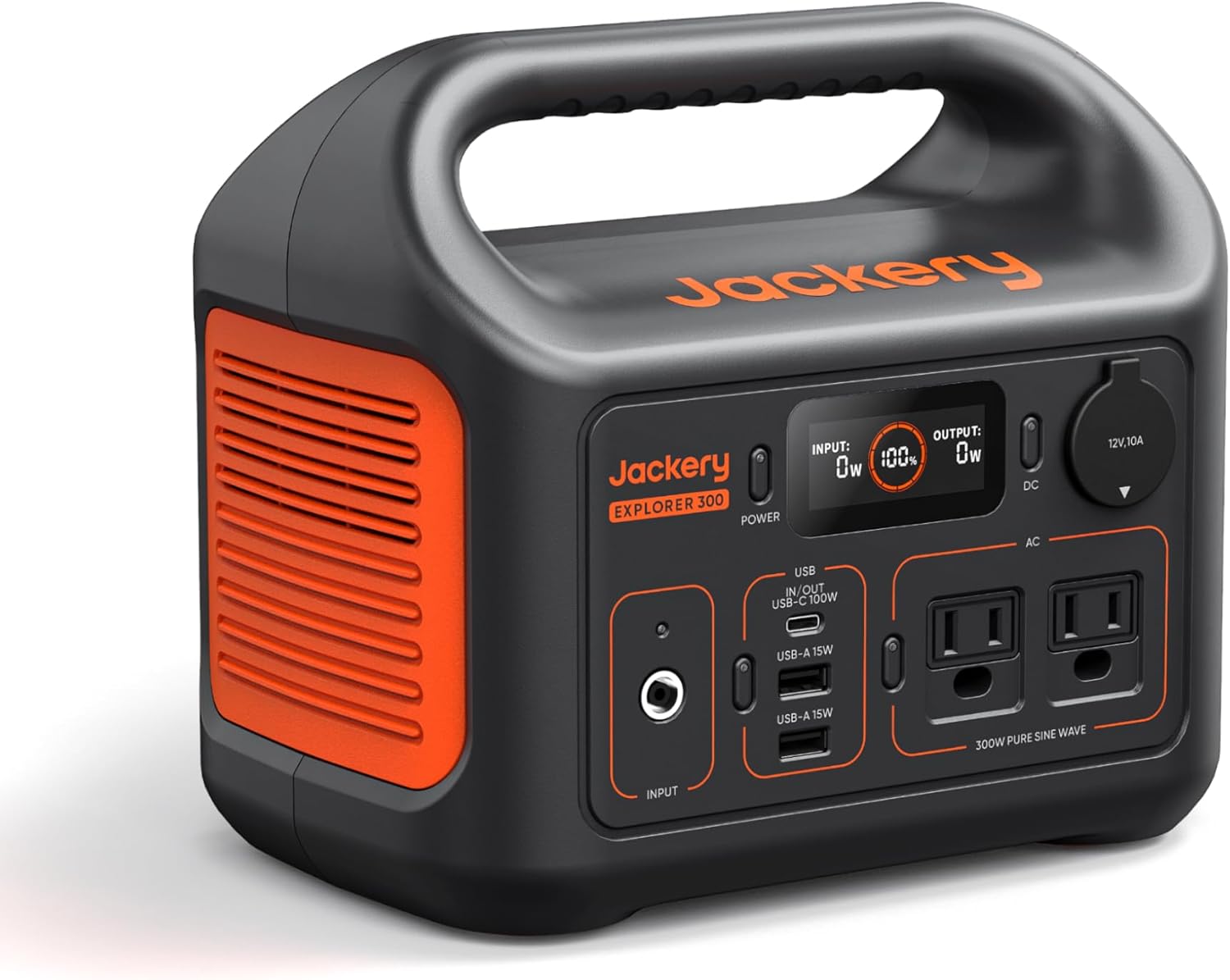
Jackery Portable Power Station Explorer 300
Budget OptionPower on the Go: Weighing only 11 lbs, it's convenient to set up and store with book-sized foldable solar panels

BLUETTI Portable Power Station AC180
Designed for both indoor and outdoor scenarios, AC180 is highly capable as it has a robost capacity and continuous output power.

EF ECOFLOW DELTA Pro Ultra Power Station
Upgraded PickEcoFlow DELTA Pro Ultra is a whole-home energy system designed to grow with your family. Integrated with the Smart Home Panel 2, it scales to meet your evolving energy needs — keeping your home powered, intelligent, and secure through every stage of life.
We earn a commission, at no additional cost to you.
Strategic Assessment Analysis
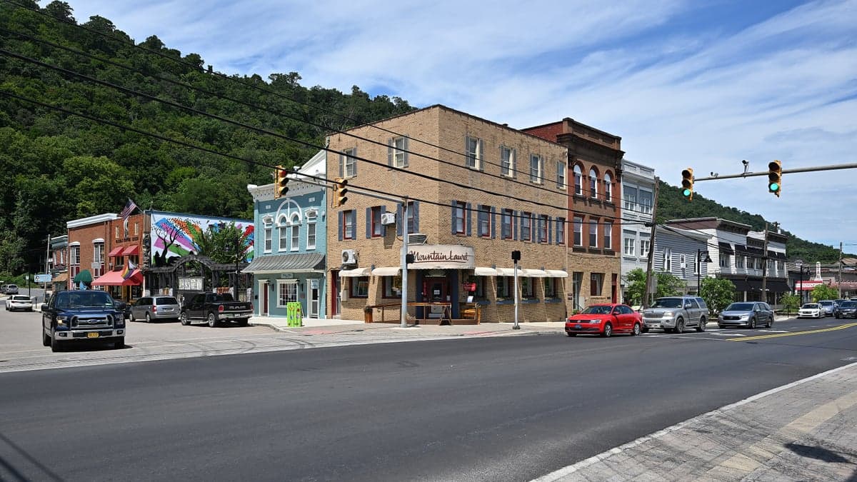
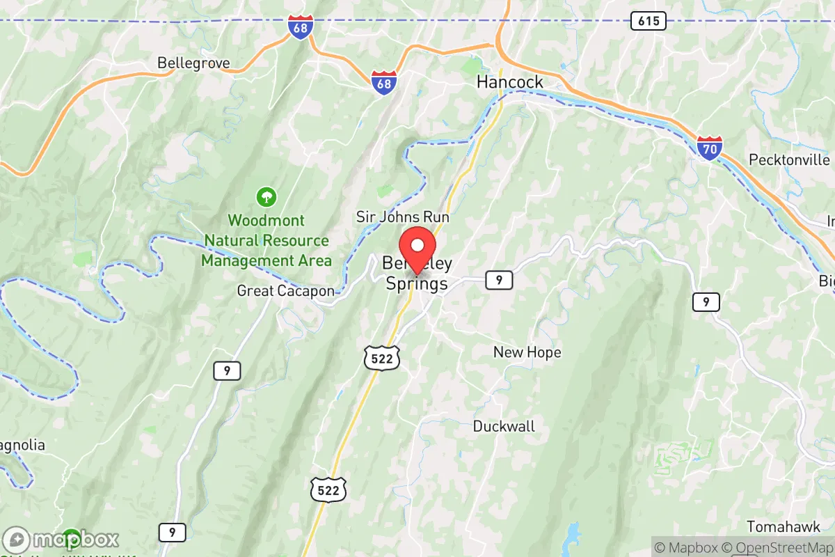
Berkeley Springs, West Virginia, occupies a strategic position that balances genuine resilience advantages with real-world exposure risks, making it a location worth serious consideration for relocators prioritizing disaster readiness and self-sufficiency. Nestled in the eastern panhandle of West Virginia, roughly 90 miles from Washington, D.C., and 30 miles from the Maryland border, the town sits in Morgan County, a rural area of about 18,000 residents. Its location offers a mix of geographic buffers and proximity to potential man-made hazards that require careful evaluation. For a single individual or family thinking about long-term preparedness, Berkeley Springs presents a credible option, but not without clear trade-offs that demand honest assessment.
Geographic position and natural advantages for self-sufficiency
Berkeley Springs benefits from several natural features that support a self-sufficient lifestyle. The town is situated in the Appalachian Ridge and Valley region, with the Cacapon Mountain and Sleepy Creek Mountain providing physical barriers that create natural isolation from major urban corridors. The area's elevation ranges from roughly 600 to 1,200 feet, reducing flood risk compared to low-lying river towns, though the Cacapon River and its tributaries do present localized flood potential during heavy rain events. The surrounding hardwood forests offer abundant timber for heating, construction, and foraging, while the region's moderate climate—with average January lows around 22°F and July highs near 85°F—supports a growing season of roughly 150 to 170 days. This is long enough for staple crops like corn, beans, squash, and potatoes, though not for warm-weather crops without careful timing. The area's karst topography, with limestone bedrock and numerous springs, provides reliable groundwater access, but it also means well water quality can vary and requires testing for hardness and potential contamination. The town's namesake warm springs (74°F year-round) are a unique asset, though they are a public attraction rather than a private resource. For a relocator, the key advantage is the combination of defensible terrain, moderate climate, and natural resources that support basic subsistence without extreme environmental challenges.
Risks, exposures, and proximity to fallout-relevant landmarks
The most significant risk for Berkeley Springs relocators is its proximity to high-value man-made targets. The town lies roughly 90 miles from Washington, D.C., a primary target for any large-scale conflict, and about 70 miles from the Fort Detrick biodefense research facility in Frederick, Maryland. The Baltimore-Washington metropolitan area, with its population of over 6 million, is within a 90-minute drive, meaning any major event in that corridor would generate significant refugee flow westward along Interstate 70 and U.S. Route 522. Berkeley Springs sits directly on Route 522, a primary north-south artery connecting the D.C. suburbs to Pennsylvania, making it a likely transit corridor during an evacuation. The area also has two nuclear power plants within a 100-mile radius: the Calvert Cliffs plant in Maryland (about 100 miles east) and the Peach Bottom plant in Pennsylvania (about 80 miles northeast). While these are not immediate threats, a major incident could affect wind patterns and fallout distribution. Natural disaster risks are moderate: the area experiences occasional flash flooding from thunderstorms, with the Cacapon River reaching flood stage roughly once every two to three years. Tornado risk is low compared to the Midwest, but not zero—Morgan County has seen F1 and F2 tornadoes historically. Winter storms can drop 20 to 30 inches of snow annually, occasionally causing multi-day power outages. Earthquake risk is minimal, with the region's last significant event being the 2011 Mineral, Virginia quake (magnitude 5.8), which caused minor damage locally. For a relocator, the primary exposure is man-made, not natural, and the town's position as a potential evacuation route is a serious consideration.
Practical resilience for a relocator: food, water, energy, and defensibility
Berkeley Springs offers a mixed picture for practical self-sufficiency. Water access is the strongest asset: the area's abundant springs and groundwater mean most properties can support a drilled well, with typical depths of 100 to 300 feet and yields of 5 to 20 gallons per minute. The Cacapon River provides a surface water backup, though treatment would be necessary. The town's municipal water system draws from the Cacapon and is treated, but a relocator should plan for a private well or rainwater catchment system for true independence. Food production is viable but not effortless. The growing season is adequate for cool-weather crops, and the surrounding forests support deer, turkey, and small game hunting. However, soil quality varies significantly—much of the area has thin, rocky soil over limestone, requiring raised beds or significant amendment for vegetable gardening. Local agriculture is limited, with Morgan County having only about 200 farms, mostly small livestock operations. The Berkeley Springs Farmers Market operates seasonally, but year-round food self-sufficiency would require serious planning, including greenhouse or cold-frame construction. Energy resilience is a weak point. The area is served by Potomac Edison, with power lines running along major roads and through wooded areas. Outages are common during storms, sometimes lasting 24 to 48 hours. Solar potential is moderate—the region receives about 4.5 peak sun hours per day, enough for a well-sized off-grid system, but tree cover on many properties limits rooftop solar. Wood heating is the most practical backup, with firewood available for $150 to $250 per cord delivered. Defensibility is moderate. The town itself is a small community of about 1,000 people, with a low crime rate (violent crime roughly 1.5 per 1,000 residents, property crime about 10 per 1,000). The surrounding rural area offers natural chokepoints along narrow valley roads, but the proximity to Route 522 means any determined group could access the area. The local law enforcement presence is limited—the Morgan County Sheriff's Office has about 20 deputies for the entire county. For a relocator, the practical takeaway is that Berkeley Springs provides a solid foundation for water and heating but requires significant investment in food production and energy backup to achieve true self-sufficiency.
The overall strategic picture for Berkeley Springs is one of qualified viability. The town offers genuine natural advantages—reliable water, defensible terrain, a moderate climate, and abundant forest resources—that make it a credible choice for a relocator focused on resilience. However, the proximity to the D.C. metro area and major transportation corridors introduces a level of risk that cannot be ignored. For a single individual or family willing to invest in well drilling, solar or wood heating, and serious food production infrastructure, Berkeley Springs can work as a long-term base. The key is to recognize that the area's resilience is not automatic; it requires active preparation and a clear-eyed understanding of the trade-offs. For those seeking complete isolation from man-made risks, deeper rural areas of West Virginia—farther west in the Allegheny Mountains or south of the Potomac—would offer greater buffer. But for someone who wants a balance of accessibility to services (the town has a grocery store, hardware store, and medical clinic) and a reasonable foundation for self-sufficiency, Berkeley Springs is a solid, if not perfect, option. The decision ultimately comes down to whether the convenience of proximity to the East Coast corridor outweighs the risks that same proximity brings.

* Values derived from national, state, county, city and local statistics and may differ in a specific area. Last updated: 2026-11-06T03:03:01.000Z
Narrative content on this page is AI-generated and may contain mistakes. Verify any details that matter before acting on them.
ReloMaps may earn a commission from affiliate links at no extra cost to you.

