
Strategic Assessment of St Francis County
Workable tactical position. Some exposure to population density or targets, but generally defensible in a crisis.
What does the Strategic Assessment tell us?
Our Strategic Assessment grades tactical survivability of an area. Major population centers, military targets, fallout zones, natural disasters, and border exposure all drive risk — lower exposure means a more defensible position in a crisis.
This is heavily inspired by Joel Skousen's Strategic Relocation book. Highly recommended you checkout the book ($)What does this tell us?
Our Strategic Assessment grades tactical survivability of an area. Major population centers, military targets, fallout zones, natural disasters, and border exposure all drive risk — lower exposure means a more defensible position in a crisis.
This is heavily inspired by Joel Skousen's Strategic Relocation book. Highly recommended you checkout the book ($)Strategic Pillars

Key Distances
Strategic Assessment Analysis
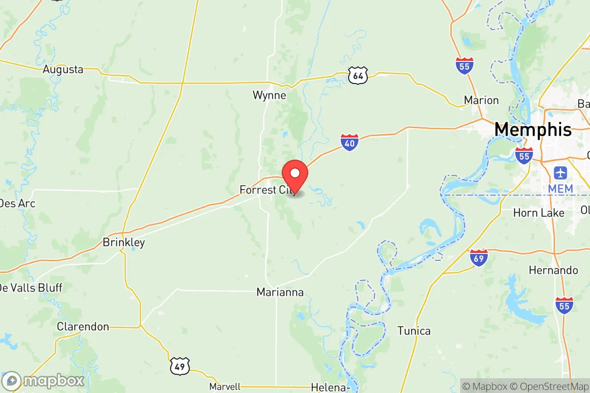
St Francis County, Arkansas, offers a strategic relocation option for those prioritizing resilience and self-sufficiency, anchored by its position in the Mississippi River Delta and its distance from major metropolitan fallout zones. The county seat, Forrest City, sits roughly 50 miles west of Memphis, Tennessee, placing it outside the immediate blast and fallout radius of a major urban center while still providing access to regional infrastructure. This balance of isolation and connectivity makes the area a viable base for a prepared household, though its flat, agricultural terrain and proximity to the New Madrid Seismic Zone introduce specific considerations that any relocator must weigh carefully.
Geographic position and natural advantages for a resilient homestead
St Francis County's primary strategic asset is its location within the Arkansas Delta, a region characterized by fertile alluvial soil and abundant surface water. The county is bordered by the St. Francis River to the east and the L'Anguille River to the west, with numerous bayous and drainage ditches crisscrossing the landscape. This water abundance supports local agriculture—primarily row crops like soybeans, rice, and cotton—and offers decentralized water sources for a prepared household. The terrain is predominantly flat, with elevations rarely exceeding 200 feet, which simplifies well drilling and septic system installation but offers no natural defensible high ground. Forrest City, the largest town, sits on Crowley's Ridge, a narrow geological formation rising 100–150 feet above the surrounding delta, providing slightly better drainage and a modest vantage point. For a relocator, the county's rural character means lower population density—roughly 24,000 residents across 643 square miles—reducing competition for resources in a crisis scenario. The nearest major military installation is Little Rock Air Force Base, about 100 miles west, which is far enough to avoid direct targeting but close enough to potentially draw secondary effects in a conflict.
Risks, exposures, and proximity to fallout-relevant landmarks
The most significant risk for St Francis County is its location within the New Madrid Seismic Zone, which produced magnitude 7+ earthquakes in 1811–1812 and could do so again. The county sits on deep alluvial sediments that amplify seismic waves, making it vulnerable to liquefaction and ground failure during a major quake. This is a concrete concern for infrastructure resilience—bridges, levees, and pipelines crossing the region could fail, isolating the area for weeks. Additionally, the county lies within 100 miles of the Mississippi River's industrial corridor, including refineries and chemical plants near Memphis and Helena-West Helena. A major incident at these facilities could produce toxic plumes or secondary hazards, though prevailing winds typically carry such material eastward. The county's flat, open terrain offers no natural shielding from fallout, meaning a nuclear event at a distant target—such as the Memphis intermodal hub or the Arkansas Nuclear One plant near Russellville (150 miles west)—could deposit radioactive material across the delta. Forrest City's position on Crowley's Ridge provides some advantage for groundwater protection, as the ridge's clay cap reduces vertical contamination of aquifers compared to the surrounding floodplain. For a relocator, the key takeaway is that St Francis County is not a fallout-free zone, but its distance from primary targets and low population density reduce the probability of direct exposure.
Practical resilience for a relocator: food, water, energy, and defensibility
St Francis County offers strong potential for food and water self-sufficiency, but energy and defensibility require deliberate planning. The agricultural base means local access to seeds, livestock feed, and farming equipment, with the St. Francis River and numerous bayous providing surface water for irrigation and household use. Groundwater is available through wells, though depth varies—typical wells in the delta range from 80 to 200 feet, with the Sparta Sand aquifer offering reliable yields. For energy, the county is served by Entergy Arkansas and Woodruff Electric Cooperative, but grid reliability in rural areas is moderate, with occasional outages during storms. Solar panel installation is feasible given the region's 215 sunny days per year, though tree cover along Crowley's Ridge may require site-specific assessment. Defensibility is the weakest point: the flat, open terrain offers no natural chokepoints or elevated positions, and the county's road network—dominated by U.S. Highway 70 and Interstate 40—provides easy access for outsiders. A prepared household would need to rely on perimeter security, community networks, and the inherent isolation of rural living rather than terrain advantages. The county's small towns—including Hughes, Madison, and Caldwell—offer tight-knit communities where mutual aid is culturally embedded, but newcomers should invest in building relationships before a crisis. Forrest City's regional medical center provides basic healthcare, but trauma care requires evacuation to Memphis or Jonesboro, a vulnerability in a grid-down scenario.
Overall, St Francis County presents a mixed strategic picture for a relocator focused on resilience. Its strengths lie in abundant water, fertile soil, low population density, and distance from primary targets, making it a viable base for a self-sufficient household. The weaknesses are real: seismic risk, flat terrain with no natural defensibility, and exposure to fallout from distant industrial and military targets. For a family or individual willing to invest in well drilling, solar backup, and community integration, the county offers a workable foundation for long-term preparedness. The key is to treat it as a deliberate choice rather than a refuge—one that requires active mitigation of the region's specific hazards rather than passive reliance on isolation alone.

* Values derived from national, state, county, city and local statistics and may differ in a specific area. Last updated: 2026-07-24T14:55:44.000Z
Narrative content on this page is AI-generated and may contain mistakes. Verify any details that matter before acting on them.
ReloMaps may earn a commission from affiliate links at no extra cost to you.

