
Photo: Wikipedia
Strategic Assessment of Craighead County
Workable tactical position. Some exposure to population density or targets, but generally defensible in a crisis.
What does the Strategic Assessment tell us?
Our Strategic Assessment grades tactical survivability of an area. Major population centers, military targets, fallout zones, natural disasters, and border exposure all drive risk — lower exposure means a more defensible position in a crisis.
This is heavily inspired by Joel Skousen's Strategic Relocation book. Highly recommended you checkout the book ($)What does this tell us?
Our Strategic Assessment grades tactical survivability of an area. Major population centers, military targets, fallout zones, natural disasters, and border exposure all drive risk — lower exposure means a more defensible position in a crisis.
This is heavily inspired by Joel Skousen's Strategic Relocation book. Highly recommended you checkout the book ($)Strategic Pillars

Key Distances
Strategic Assessment Analysis
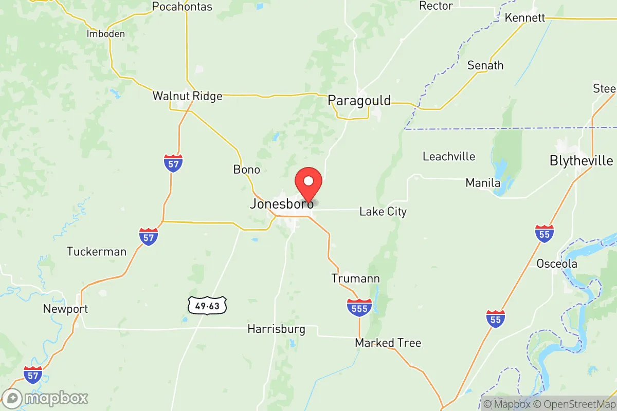
Craighead County, anchored by the city of Jonesboro, offers a compelling strategic profile for relocators prioritizing disaster readiness and self-sufficiency, combining a resilient local economy with a location that is far enough from major metropolitan targets to reduce fallout exposure, yet close enough to essential supply chains. The county’s position in northeastern Arkansas places it roughly 70 miles from Memphis, Tennessee—a major logistics hub and potential target—but outside the immediate blast and fallout zones of that city, while also being over 200 miles from the St. Louis and Nashville metro areas. This geographic buffer, paired with a robust agricultural base and a growing population of over 100,000, makes Craighead County a practical choice for those seeking a balance between rural security and access to modern infrastructure.
Geographic position and natural advantages for self-sufficiency
Craighead County sits in the Mississippi Alluvial Plain, a region of exceptional agricultural productivity. The area’s flat, fertile soil supports extensive row crops—primarily rice, soybeans, and corn—which means local food production is a tangible asset, not just a theoretical one. The county is bisected by the Crowley’s Ridge, a unique geological formation rising 100–200 feet above the surrounding delta, offering slightly elevated terrain that can provide natural drainage and a modest defensive advantage in an otherwise flat landscape. The ridge runs through Jonesboro and into neighboring Greene County, with the town of Bono sitting near its northern edge. Water resources are abundant: the St. Francis River forms the county’s eastern border, and the Cache River runs through the western portion, supplemented by numerous bayous and agricultural reservoirs. The Lake City area, just north of Jonesboro, has several smaller lakes that could serve as secondary water sources. This combination of fertile land, accessible surface water, and a moderate climate (with an average of 215 sunny days per year) supports year-round gardening and small-scale livestock operations, making the county inherently more self-sufficient than many urban or arid regions.
Risks, exposures, and proximity to fallout-relevant landmarks
While Craighead County avoids the highest-risk zones, it is not without exposures. The primary man-made risk comes from its proximity to Memphis (70 miles southeast), which hosts a major FedEx hub, a large inland port on the Mississippi River, and a significant rail and highway interchange—all potential secondary targets in a conflict scenario. Fallout patterns from a strike on Memphis would depend on wind direction, but prevailing westerlies mean Craighead County could be downwind in certain conditions, particularly if the strike occurs during a spring or summer frontal passage. The county also lies within 150 miles of the Malden Air Force Station in Missouri (a former missile warning radar site) and the Arkansas Nuclear One power plant near Russellville (about 180 miles west), though neither poses a direct fallout risk under normal circumstances. Natural hazards are more immediate: the region sits in Tornado Alley’s southern extension, with Jonesboro experiencing a devastating EF-3 tornado in March 2020 that killed 0 and injured dozens. Flooding is a recurring issue along the St. Francis and Cache rivers, particularly in low-lying areas around Bay and Monette. The New Madrid Seismic Zone, located about 50 miles east of the county line, poses a low-probability but high-consequence earthquake risk—a major quake could disrupt transportation and utilities for weeks. On balance, the county’s risks are manageable for a prepared relocator, but they require attention to building standards, emergency supplies, and evacuation routes.
Practical resilience for a relocator: food, water, energy, and defensibility
Craighead County’s practical resilience is strong, particularly in food and water security. The agricultural economy means that local farmers’ markets, co-ops, and direct-from-farm sales are common—Jonesboro’s farmers market operates from May through October, and the Craighead County Extension Office offers workshops on home food preservation and gardening. For water, the primary municipal supply comes from the Alluvial Aquifer, which is generally reliable but can experience drawdown during droughts; private wells are common in rural areas and typically produce good-quality water at depths of 50–150 feet. Energy infrastructure is moderately resilient: Jonesboro is served by Craighead Electric Cooperative and Entergy Arkansas, with a mix of natural gas, coal, and hydroelectric power. The county has no major refineries or chemical plants, reducing the risk of industrial accidents, but it does host a Nucor Steel mill in nearby Mississippi County (about 20 miles west), which is a potential target but not a fallout source. For defensibility, the county’s flat terrain and dispersed population make it harder to secure than a mountainous region, but the Crowley’s Ridge offers natural chokepoints and elevated observation points. The Jonesboro Municipal Airport provides a potential evacuation hub, and the county’s network of state highways (US 63, US 49, and AR 18) offers multiple egress routes, though they could become congested during a mass evacuation. The local law enforcement presence is robust, with the Craighead County Sheriff’s Office and Jonesboro Police Department maintaining good coverage, but rural areas may have longer response times. For a relocator, investing in a well, solar panels, and a secure outbuilding on a few acres near the ridge would significantly enhance self-sufficiency.
The overall strategic picture for Craighead County is one of moderate-to-high resilience for a relocator who values preparedness. Its agricultural base, abundant water, and distance from primary targets make it a solid choice for those seeking a balance between rural security and access to modern amenities. The county’s main vulnerabilities—tornadoes, flooding, and proximity to Memphis—are manageable with proper planning, such as building a storm shelter, securing flood insurance, and maintaining a 72-hour evacuation kit. For the conservative-leaning reader who prioritizes self-reliance, community ties, and a slower pace of life, Craighead County offers a practical foundation without the isolation of more remote areas. The key is to locate on higher ground near the Crowley’s Ridge, establish local supply chains, and build relationships with the farming community—this is not a bug-out location but a place to build a sustainable, resilient life.

* Values derived from national, state, county, city and local statistics and may differ in a specific area. Last updated: 2026-06-16T04:00:27.000Z
Narrative content on this page is AI-generated and may contain mistakes. Verify any details that matter before acting on them.
ReloMaps may earn a commission from affiliate links at no extra cost to you.

