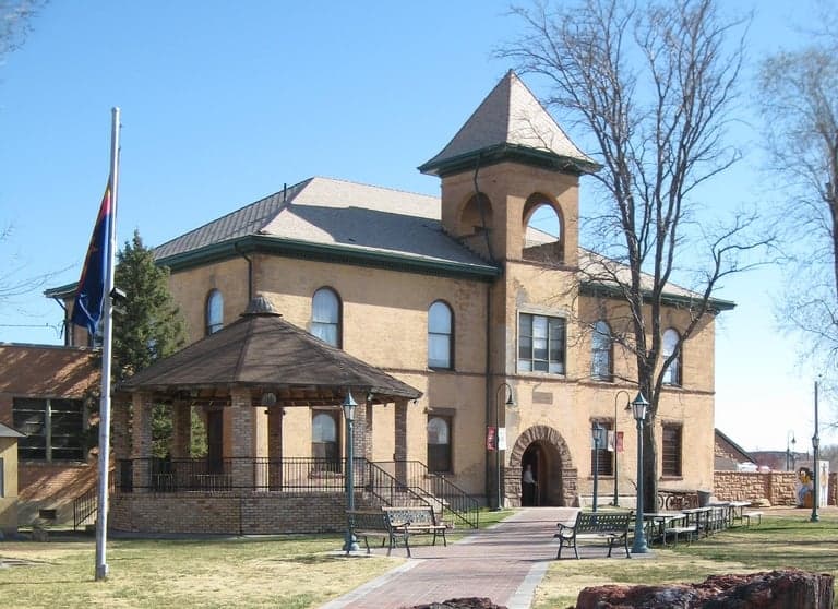
Photo: Wikipedia
Strategic Assessment of Navajo County
Strong survivability profile. Good buffer from population centers, with manageable environmental and tactical risks.
What does the Strategic Assessment tell us?
Our Strategic Assessment grades tactical survivability of an area. Major population centers, military targets, fallout zones, natural disasters, and border exposure all drive risk — lower exposure means a more defensible position in a crisis.
This is heavily inspired by Joel Skousen's Strategic Relocation book. Highly recommended you checkout the book ($)What does this tell us?
Our Strategic Assessment grades tactical survivability of an area. Major population centers, military targets, fallout zones, natural disasters, and border exposure all drive risk — lower exposure means a more defensible position in a crisis.
This is heavily inspired by Joel Skousen's Strategic Relocation book. Highly recommended you checkout the book ($)Strategic Pillars

Key Distances
Strategic Assessment Analysis
Navajo County, Arizona, offers a compelling strategic position for relocators prioritizing resilience and self-sufficiency, balancing remote access with proximity to critical infrastructure. Its location in the high desert of northeastern Arizona provides natural buffers against many coastal and urban risks, while its sparse population and rugged terrain create inherent defensibility. For a conservative-leaning audience focused on disaster readiness, the county presents a mix of genuine advantages and specific exposures that require careful consideration.
Geographic position and natural advantages for long-term security
Navajo County spans over 9,900 square miles of the Colorado Plateau, making it larger than several U.S. states. Its geography is defined by high-elevation plateaus, deep canyons, and the Painted Desert, with elevations ranging from 4,500 to over 7,000 feet. This elevation provides a cooler, drier climate than Arizona's low deserts, reducing risks from extreme heat and wildfire compared to areas like Flagstaff or Prescott. The county's primary population centers—Show Low, Pinetop-Lakeside, Snowflake, and Holbrook—sit along the Mogollon Rim, a natural escarpment that offers strategic vantage points and limited access routes. The region's distance from major metropolitan areas is a key advantage: Phoenix is roughly 180 miles southwest, Albuquerque about 200 miles east, and Las Vegas over 300 miles northwest. This isolation reduces exposure to urban cascading failures, such as grid collapse or civil unrest, while still allowing for resupply via U.S. Route 60 and Interstate 40. The county also contains significant water resources, including the Little Colorado River and numerous springs, though surface water is limited compared to wetter regions. The Apache-Sitgreaves National Forests cover much of the eastern portion, providing timber, wildlife, and potential off-grid homesteading opportunities.
Risks, exposures, and proximity to fallout-relevant landmarks
While Navajo County avoids many coastal and seismic threats, it is not without strategic vulnerabilities. The county lies within the Intermountain West seismic zone, with minor fault lines near Holbrook and Snowflake, though major earthquakes are rare. Wildfire risk is moderate to high, particularly in forested areas around Pinetop-Lakeside and Show Low, where the 2002 Rodeo-Chediski Fire burned over 460,000 acres—a reminder of the region's fire ecology. More critically for a resilience-focused analysis, Navajo County sits within 150 miles of several high-value targets. The Navajo Generating Station near Page (just north of the county line) was a major coal-fired plant, now decommissioned, but the Four Corners Power Plant near Farmington, New Mexico, remains operational and is a potential industrial target. The county also lies within 200 miles of Kirtland Air Force Base in Albuquerque and Davis-Monthan Air Force Base in Tucson, both of which could be primary or secondary targets in a conflict scenario. Fallout patterns from a strike on these bases would depend on prevailing winds, which in this region are typically from the southwest, potentially carrying particulate matter toward the county. Additionally, the Petrified Forest National Park and the Navajo Nation border the county to the north and east, introducing jurisdictional complexity in a crisis. The county's proximity to Interstate 40, a major transcontinental route, means it could become a chokepoint for evacuation or supply movements, but also a target for disruption. Overall, the risk profile is moderate—lower than coastal or urban areas, but not negligible for those planning for worst-case scenarios.
Practical resilience for a relocator: food, water, energy, and defensibility
For a family or individual serious about self-sufficiency, Navajo County offers a mixed but workable environment. Water is the most critical constraint. The region averages 10-15 inches of precipitation annually, with most falling as winter snow or summer monsoon rains. Groundwater is available but deep, requiring wells of 200-500 feet in many areas. Surface water from the Little Colorado River is seasonal and often silty, requiring filtration. Rainwater harvesting is feasible but requires large cisterns due to low rainfall frequency. Food production is limited by a short growing season (120-150 days) and alkaline soils, but cold-hardy crops like potatoes, beans, and squash can thrive with irrigation. The county has a small but active agricultural sector, with hay and livestock operations near Snowflake and Taylor. Local food sources are limited, so relocators should plan for seed stockpiles and greenhouse construction. Energy is a relative strength: the region has excellent solar insolation (over 300 sunny days per year), and many properties are off-grid capable. Wind energy is also viable in higher elevations. The county's electric grid is served by Arizona Public Service and Navopache Electric Cooperative, but rural areas are prone to outages during winter storms. Defensibility is high due to low population density (roughly 7 people per square mile) and the natural barriers of the Mogollon Rim and forested terrain. Properties in the White Mountains near Show Low and Pinetop-Lakeside offer good line-of-sight and limited access points. However, the county's vast size means that emergency services response times can exceed 30 minutes in remote areas, making medical self-sufficiency and community networks essential. The presence of Summit Healthcare Regional Medical Center in Show Low provides a trauma center, but it is a single facility for a large region.
The overall strategic picture for Navajo County is one of balanced opportunity and honest limitation. It offers genuine geographic isolation, a stable climate, and a culture of self-reliance that aligns with conservative values of personal preparedness. The risks from natural disasters are manageable, and the exposure to man-made threats is lower than in most of the Southwest. However, the water scarcity and agricultural constraints mean that long-term self-sufficiency requires significant upfront investment in infrastructure—wells, storage, and protected growing systems. For a relocator who values space, security, and a slower pace of life, and who is willing to work within the region's arid realities, Navajo County represents one of the more defensible and resilient options in the continental United States. It is not a prepper's paradise, but it is a serious, grounded choice for those who understand that resilience is built, not found.

* Values derived from national, state, county, city and local statistics and may differ in a specific area. Last updated: 2026-08-27T20:32:06.000Z
Narrative content on this page is AI-generated and may contain mistakes. Verify any details that matter before acting on them.
ReloMaps may earn a commission from affiliate links at no extra cost to you.

