
Photo: Wikipedia
Strategic Assessment of Alexandria, VA
Multiple tactical vulnerabilities. Population density, target proximity, or disaster risk are likely compounding. A retreat property and exit planning is required.
What does the Strategic Assessment tell us?
Our Strategic Assessment grades tactical survivability of an area. Major population centers, military targets, fallout zones, natural disasters, and border exposure all drive risk — lower exposure means a more defensible position in a crisis.
This is heavily inspired by Joel Skousen's Strategic Relocation book. Highly recommended you checkout the book ($)What does this tell us?
Our Strategic Assessment grades tactical survivability of an area. Major population centers, military targets, fallout zones, natural disasters, and border exposure all drive risk — lower exposure means a more defensible position in a crisis.
This is heavily inspired by Joel Skousen's Strategic Relocation book. Highly recommended you checkout the book ($)Strategic Pillars

Key Distances
Regional Safe Places
Below is our recommended "safe zones" in Virginia and the surrounding area based on our strategic heuristics. For most people, it's unrealistic to live in a “safe zone” full-time due to work, family or other personal reasons. They tend to be more rural. However, many of these areas are perfect for second homes and retreat properties that double as a vacation home or even a short-term rental.


Important Note: For informational purposes only. This does not mean nothing bad ever happens in the green zones. Please use common sense. This is based on public data and modeled with AI. We tried to take a conservative approach but mistakes happen. We update this regularly as new information becomes available.
Solar Generator Recommendations
Backup power matters more here than in safer locations. We've picked three solar generators across budgets and capacity tiers — start with the budget unit if you only need a few essentials, or step up if you want to run a fridge and HVAC for days at a time.

Jackery Portable Power Station Explorer 300
Budget OptionPower on the Go: Weighing only 11 lbs, it's convenient to set up and store with book-sized foldable solar panels

BLUETTI Portable Power Station AC180
Designed for both indoor and outdoor scenarios, AC180 is highly capable as it has a robost capacity and continuous output power.

EF ECOFLOW DELTA Pro Ultra Power Station
Upgraded PickEcoFlow DELTA Pro Ultra is a whole-home energy system designed to grow with your family. Integrated with the Smart Home Panel 2, it scales to meet your evolving energy needs — keeping your home powered, intelligent, and secure through every stage of life.
We earn a commission, at no additional cost to you.
Strategic Assessment Analysis
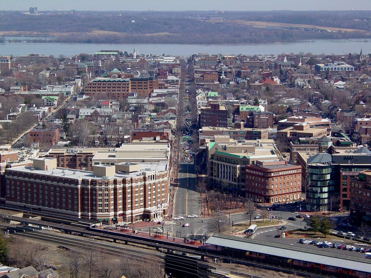
Alexandria, Virginia, presents a complex strategic picture for the conservative prepper. Its immediate proximity to the nation’s political and military nerve centers offers a unique set of advantages in terms of early warning and potential resource access, but those same factors make it a high-priority target in any major conflict or period of severe civil unrest. The city’s resilience is not inherent; it is entirely contingent on the stability of the federal apparatus it surrounds, making it a location for those who want to be *near* the levers of power, but not necessarily *in* the blast radius of a worst-case scenario. For a single individual or family with a survivalist mindset, Alexandria demands a plan that prioritizes rapid egress and a deep understanding of the area’s choke points, rather than a long-term, self-sufficient homesteading strategy.
Geographic position and natural advantages for a strategic relocation
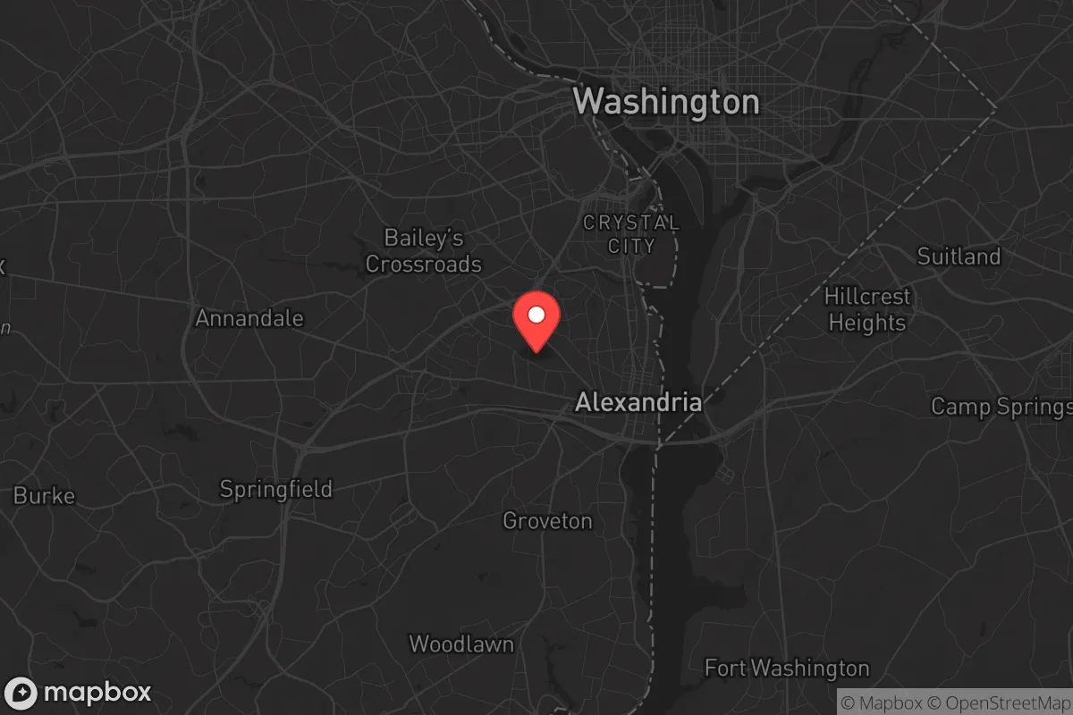
Alexandria sits on the western bank of the Potomac River, directly south of Washington, D.C., and is part of the densely populated Northern Virginia corridor. Its primary natural advantage is its position within the Piedmont region, which provides slightly more varied topography than the flat coastal plain to the east. The Potomac River is a major water source, but it is also a heavily trafficked and monitored waterway, making it a poor choice for discreet water access or purification in a crisis. The city’s location at the fall line—where the Piedmont meets the Coastal Plain—means there are some modest hills and wooded areas to the west, particularly towards Fairfax County and the Bull Run Mountains, which offer the only realistic terrain for short-term evasion or retreat. However, the immediate area is heavily urbanized and suburbanized, with limited natural cover. The Chesapeake Bay to the east and the Potomac to the north create a natural funnel for any evacuation route, forcing traffic onto a handful of major bridges and highways—a critical vulnerability. For a prepper, the key geographic takeaway is that Alexandria is a strategic *gateway* to the interior, not a defensible redoubt itself. The natural advantages are all about egress: the ability to move west into the Shenandoah Valley or southwest toward the Blue Ridge Mountains, which are the true fallback positions for this region.
Risks, exposures, and proximity to fallout-relevant landmarks
This is where the analysis turns sobering. Alexandria is within a 10-mile radius of the Pentagon, Reagan National Airport, the U.S. Capitol, the White House, and the CIA headquarters in Langley. In any scenario involving a nuclear exchange, a large-scale terrorist attack, or a decapitation strike, this entire corridor is a primary target zone. The fallout patterns from a ground burst on the National Mall would likely blanket Alexandria and much of Northern Virginia, depending on wind direction. Even a conventional attack on the Pentagon or Reagan Airport—using a large truck bomb or a downed aircraft—would create a massive security cordon, gridlock, and potential secondary hazards from fuel fires and infrastructure damage. The city’s proximity to the Potomac River also means it is vulnerable to a deliberate contamination event upstream, which could compromise the municipal water supply for weeks. Furthermore, Alexandria is a major transit hub for the D.C. Metro system and I-95, meaning that during any civil unrest or evacuation, the city would become a chokepoint for hundreds of thousands of people fleeing the capital. The risk of being trapped in a vehicle on the 14th Street Bridge or the Woodrow Wilson Bridge during a crisis is very real. For a conservative prepper, the calculus is clear: living in Alexandria means accepting a high probability of being in a secondary or tertiary impact zone, with limited time to execute a pre-planned evacuation before the roads become impassable.
Practical resilience for a relocator: food, water, energy, and defensibility
For a single individual or family, the practical resilience of Alexandria is low without significant preparation. The city is almost entirely dependent on the regional power grid, which is managed by Dominion Energy and is vulnerable to both cyberattacks and physical sabotage. Natural gas and electricity are the primary energy sources; a prolonged blackout would render most homes uninhabitable within 48 hours, especially in winter. Municipal water comes from the Potomac via the D.C. Water system, a single-point-of-failure that is a known security concern. Food resilience is virtually nonexistent—Alexandria has no significant agricultural land, and its grocery stores rely on just-in-time delivery from regional distribution centers. A relocator would need to stockpile at least 90 days of food and water, and have a plan for water purification (e.g., a Berkey filter or similar) if relying on the Potomac or local streams. Defensibility is the weakest point. Alexandria’s dense, interconnected neighborhoods—like Old Town, Del Ray, and the West End—offer no natural defensive perimeter. Houses are close together, with many shared walls in townhouses and apartments. A single armed group could control an entire block. The best defensive strategy is not to fight, but to have a pre-positioned cache and a vehicle ready to go west. A realistic prepper in Alexandria would maintain a "go-bag" in the car at all times, have a primary evacuation route (likely west on I-66 or Route 50 toward the mountains) and a secondary route (south on Route 1 or the Fairfax County Parkway), and keep a low profile. OPSEC (operational security) is critical—drawing attention to your supplies in a dense urban environment is an invitation to trouble.
In the overall strategic picture, Alexandria is best understood as a high-risk, high-information outpost. It is not a place to ride out a long-term collapse or a major war. Its value lies in its proximity to the political and intelligence apparatus, which can provide early warning of major events—if you have the right connections or monitoring equipment. For a single person with a career in defense, intelligence, or federal contracting, it can be a useful base of operations during stable times, provided you have a clear, rehearsed exit plan for when things go sideways. For a family, the risks likely outweigh the benefits, unless the primary breadwinner’s job is non-negotiable and the family maintains a secondary property in a lower-risk area like the Shenandoah Valley or southwestern Virginia. The bottom line: Alexandria is a place to *be from* in a crisis, not a place to *be* in one. If you choose to relocate here, do so with your eyes wide open, a full tank of gas, and a map of the back roads to the mountains already memorized.
* Values derived from national, state, county, city and local statistics and may differ in a specific area. Last updated: 2026-05-02T01:19:06.000Z
Narrative content on this page is AI-generated and may contain mistakes. Verify any details that matter before acting on them.
ReloMaps may earn a commission from affiliate links at no extra cost to you.