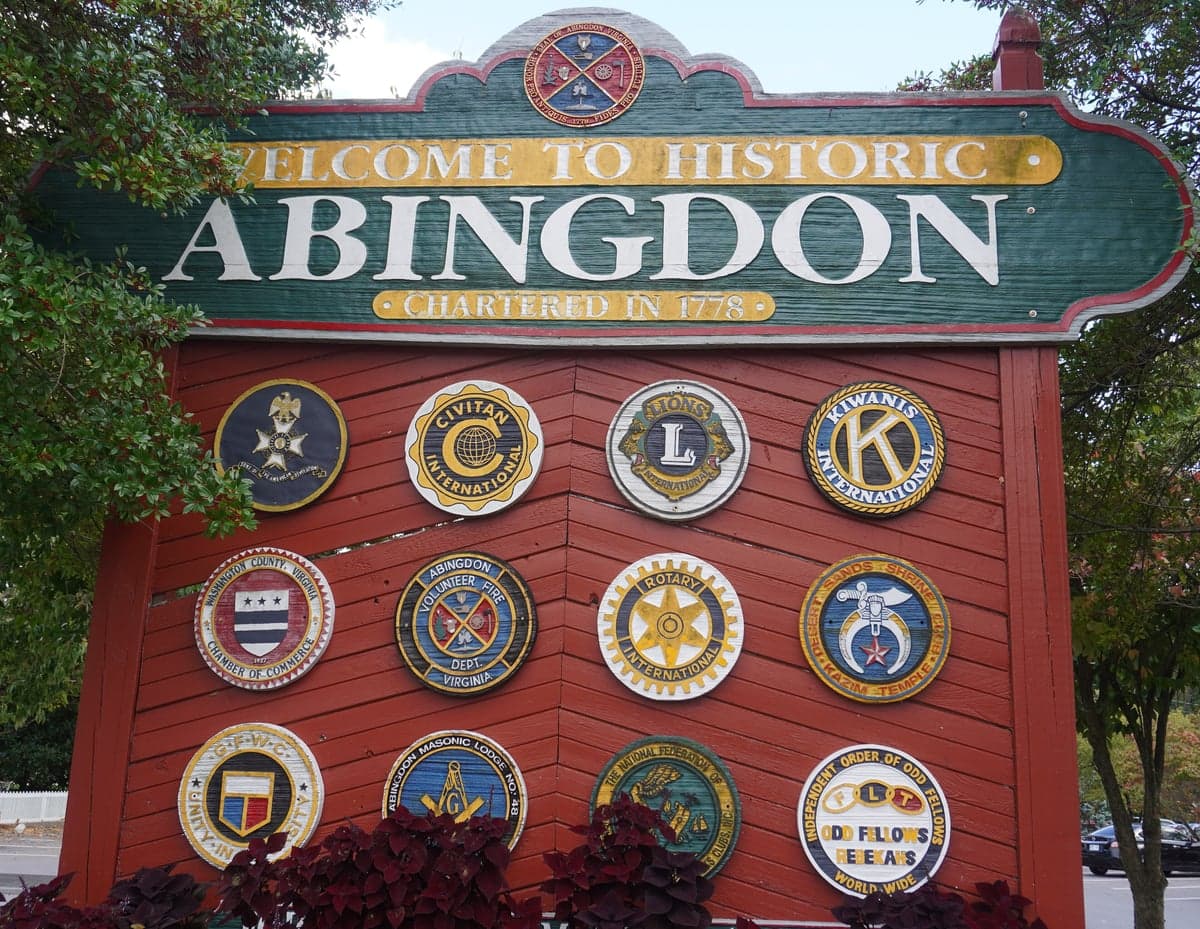
Photo: Wikipedia
Strategic Assessment of Abingdon, VA
Workable tactical position. Some exposure to population density or targets, but generally defensible in a crisis.
What does the Strategic Assessment tell us?
Our Strategic Assessment grades tactical survivability of an area. Major population centers, military targets, fallout zones, natural disasters, and border exposure all drive risk — lower exposure means a more defensible position in a crisis.
This is heavily inspired by Joel Skousen's Strategic Relocation book. Highly recommended you checkout the book ($)What does this tell us?
Our Strategic Assessment grades tactical survivability of an area. Major population centers, military targets, fallout zones, natural disasters, and border exposure all drive risk — lower exposure means a more defensible position in a crisis.
This is heavily inspired by Joel Skousen's Strategic Relocation book. Highly recommended you checkout the book ($)Strategic Pillars

Key Distances
Regional Safe Places
Below is our recommended "safe zones" in Virginia and the surrounding area based on our strategic heuristics. For most people, it's unrealistic to live in a “safe zone” full-time due to work, family or other personal reasons. They tend to be more rural. However, many of these areas are perfect for second homes and retreat properties that double as a vacation home or even a short-term rental.
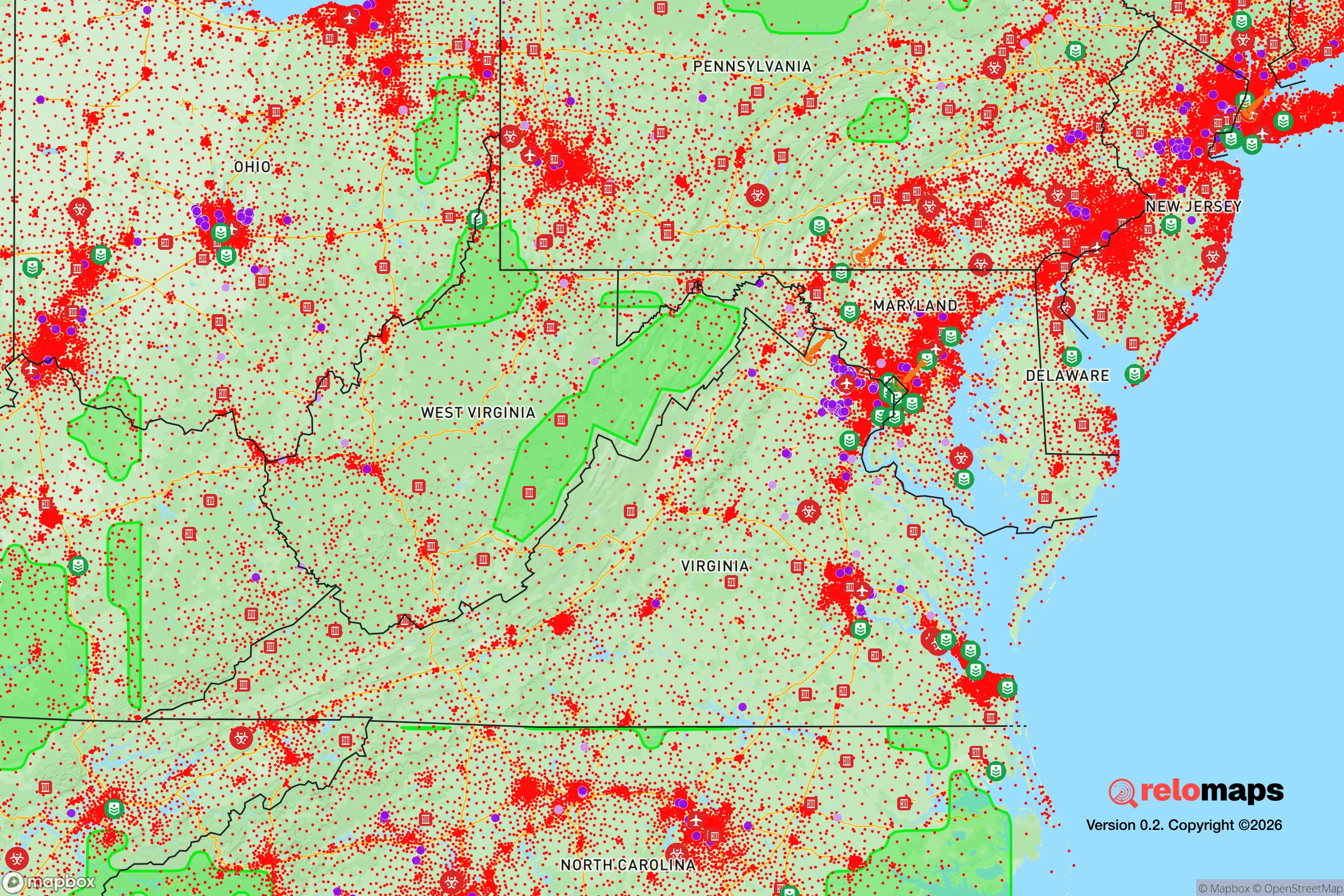
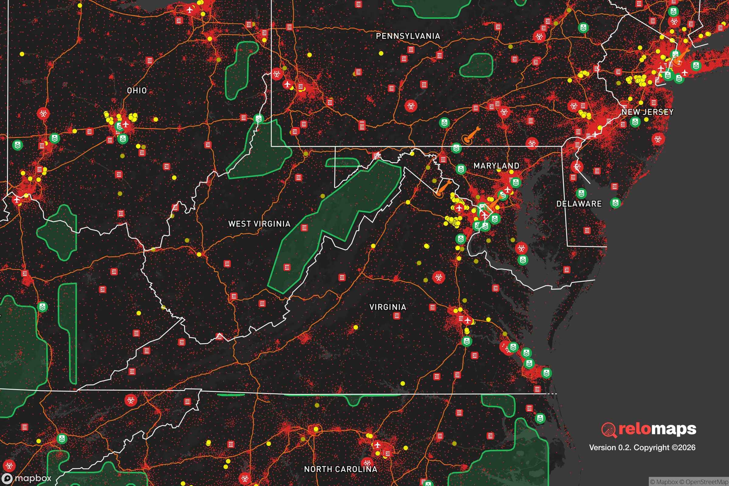


Important Note: For informational purposes only. This does not mean nothing bad ever happens in the green zones. Please use common sense. This is based on public data and modeled with AI. We tried to take a conservative approach but mistakes happen. We update this regularly as new information becomes available.
Solar Generator Recommendations
Backup power matters more here than in safer locations. We've picked three solar generators across budgets and capacity tiers — start with the budget unit if you only need a few essentials, or step up if you want to run a fridge and HVAC for days at a time.

Jackery Portable Power Station Explorer 300
Budget OptionPower on the Go: Weighing only 11 lbs, it's convenient to set up and store with book-sized foldable solar panels

BLUETTI Portable Power Station AC180
Designed for both indoor and outdoor scenarios, AC180 is highly capable as it has a robost capacity and continuous output power.

EF ECOFLOW DELTA Pro Ultra Power Station
Upgraded PickEcoFlow DELTA Pro Ultra is a whole-home energy system designed to grow with your family. Integrated with the Smart Home Panel 2, it scales to meet your evolving energy needs — keeping your home powered, intelligent, and secure through every stage of life.
We earn a commission, at no additional cost to you.
Strategic Assessment Analysis
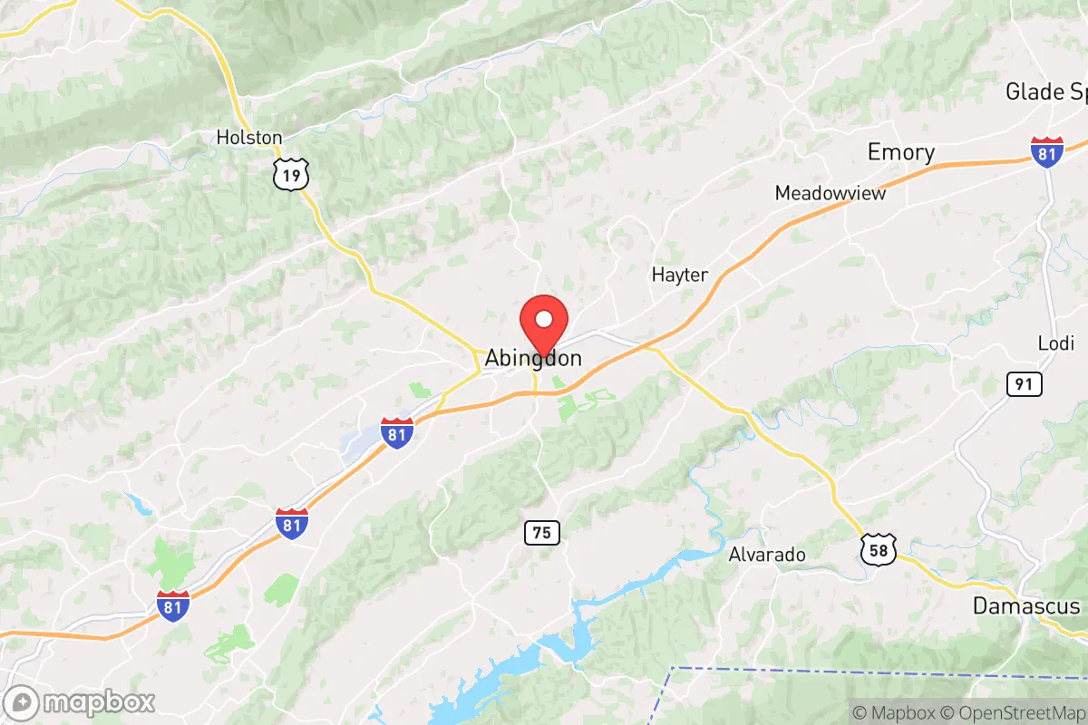
Abingdon, Virginia, offers a compelling strategic position for those prioritizing resilience and self-sufficiency, combining the sheltering geography of the Appalachian highlands with practical access to essential infrastructure. Its location in the southwestern tip of the state, roughly 130 miles from the Roanoke and Tri-Cities metro areas, provides meaningful separation from major population centers while still being within a reasonable drive for supply runs or medical care. The town sits at an elevation of approximately 2,000 feet, which contributes to a moderate climate and reduces exposure to several common natural disaster risks, making it a serious consideration for a relocator weighing long-term preparedness.
Geographic position and natural advantages for long-term security
Abingdon's position in the Valley of Virginia, flanked by the Blue Ridge and Appalachian ranges, creates a natural buffer zone that offers several strategic benefits. The surrounding mountains and rolling hills provide natural defensibility, limiting easy access from major corridors and creating chokepoints that would slow any large-scale movement. The area is situated well inland, roughly 350 miles from the Atlantic coast, which eliminates storm surge and hurricane wind threats that plague coastal communities. The elevation also means the region is not prone to the flooding that affects lower-lying areas of the Tennessee Valley, though localized flash flooding in creek beds remains a minor concern. The climate is four-season but moderate, with average winter lows in the mid-20s and summer highs in the low 80s, reducing the strain on heating and cooling systems compared to more extreme environments. The South Holston Lake and the South Fork Holston River provide reliable surface water sources, and the region's annual rainfall of about 45 inches supports robust agriculture without the drought risks seen in the western United States. The area's karst geology, with its limestone bedrock and cave systems, also offers potential for natural shelter and water filtration, though well water quality varies and requires testing.
Risks, exposures, and proximity to fallout-relevant landmarks
While Abingdon's remote position reduces many risks, it is not without strategic vulnerabilities. The most significant concern is its proximity to the Oak Ridge National Laboratory in Tennessee, roughly 120 miles to the southwest, and the nuclear facilities at the Watts Bar and Sequoyah plants along the Tennessee River, about 100 miles away. In a worst-case scenario involving a major incident at these facilities, Abingdon's prevailing westerly winds could carry fallout toward the area, though the distance and mountain barriers provide substantial dilution. The town is also about 130 miles from the Bristol-Johnson City-Kingsport metro area, which includes the Eastman Chemical Company complex in Kingsport, a large industrial site that could be a secondary target in a conflict scenario. On the natural disaster front, the region experiences occasional minor earthquakes due to the East Tennessee Seismic Zone, but these are typically below magnitude 4.0 and cause negligible damage. The area's mountainous terrain also creates a risk of landslides on steep slopes after heavy rain, particularly along the Interstate 81 corridor and in the more rugged sections of the Blue Ridge. Wildfire risk is moderate, with the potential for fast-moving fires in dry autumn conditions, but the region's high humidity and frequent rainfall keep the overall threat lower than in the western United States. The primary man-made risk is the Interstate 81 corridor itself, which runs just east of Abingdon and carries heavy truck traffic, including hazardous materials, creating a localized chemical spill or accident risk that could affect air quality or water sources temporarily.
Practical resilience for a relocator: food, water, energy, and defensibility
For a relocator focused on self-sufficiency, Abingdon offers a strong foundation in several key areas. The region's agricultural capacity is significant, with Washington County and surrounding areas supporting cattle farming, hay production, and vegetable growing. The growing season runs from late April to early October, allowing for a productive garden, and the local soil quality in the valley bottoms is good for row crops. The Abingdon Farmers Market operates year-round, and there are multiple local farms that offer raw milk, pasture-raised meats, and eggs, providing direct access to unprocessed food sources outside the industrial supply chain. Water availability is generally reliable, with the town drawing from the South Fork Holston River and maintaining a reservoir system, but a relocator should plan for a backup well or rainwater catchment system, as municipal water could be disrupted in a prolonged emergency. The area's groundwater is generally good, but well depths vary from 100 to 400 feet, and drilling costs are moderate. Energy resilience is a mixed picture: the region is served by Appalachian Power, which has a relatively reliable grid, but winter ice storms can cause multi-day outages, particularly in more rural areas. Solar potential is decent, with about 200 sunny days per year, though the valley's cloud cover and mountain shading reduce output compared to the Southwest. Wood heating is a practical and common supplement, with abundant hardwood forests providing fuel, and many homes already have wood stoves or fireplaces. Defensibility is one of Abingdon's strongest attributes: the town's layout along the narrow valley floor, with the mountains rising on either side, creates natural chokepoints on the main roads, and the surrounding rural areas offer numerous retreat properties with limited access points. The local population is generally self-reliant and community-oriented, with a strong tradition of hunting, fishing, and gardening that would be an asset in a prolonged disruption. The Washington County Sheriff's Office and Virginia State Police maintain a visible presence, and the area's low crime rate means that law enforcement resources are not stretched thin under normal conditions.
Overall, Abingdon presents a balanced strategic picture for a relocator prioritizing resilience and self-sufficiency. Its geographic isolation, moderate climate, and agricultural capacity provide a strong baseline for long-term security, while the risks from nearby industrial and nuclear sites are manageable with proper planning and situational awareness. The town's infrastructure is adequate for daily life and would function reasonably well in a moderate disruption, though a relocator should invest in backup power, water storage, and food production systems to achieve true independence. For someone looking to balance access to modern amenities with a defensible, resource-rich location, Abingdon is a serious contender that deserves a close look.

* Values derived from national, state, county, city and local statistics and may differ in a specific area. Last updated: 2026-10-24T15:31:27.000Z
Narrative content on this page is AI-generated and may contain mistakes. Verify any details that matter before acting on them.
ReloMaps may earn a commission from affiliate links at no extra cost to you.

