Strategic Assessment of Williamsburg, WV
Workable tactical position. Some exposure to population density or targets, but generally defensible in a crisis.
What does the Strategic Assessment tell us?
Our Strategic Assessment grades tactical survivability of an area. Major population centers, military targets, fallout zones, natural disasters, and border exposure all drive risk — lower exposure means a more defensible position in a crisis.
This is heavily inspired by Joel Skousen's Strategic Relocation book. Highly recommended you checkout the book ($)What does this tell us?
Our Strategic Assessment grades tactical survivability of an area. Major population centers, military targets, fallout zones, natural disasters, and border exposure all drive risk — lower exposure means a more defensible position in a crisis.
This is heavily inspired by Joel Skousen's Strategic Relocation book. Highly recommended you checkout the book ($)Strategic Pillars

Key Distances
Regional Safe Places
Below is our recommended "safe zones" in West Virginia and the surrounding area based on our strategic heuristics. For most people, it's unrealistic to live in a “safe zone” full-time due to work, family or other personal reasons. They tend to be more rural. However, many of these areas are perfect for second homes and retreat properties that double as a vacation home or even a short-term rental.


Important Note: For informational purposes only. This does not mean nothing bad ever happens in the green zones. Please use common sense. This is based on public data and modeled with AI. We tried to take a conservative approach but mistakes happen. We update this regularly as new information becomes available.
Solar Generator Recommendations
Backup power matters more here than in safer locations. We've picked three solar generators across budgets and capacity tiers — start with the budget unit if you only need a few essentials, or step up if you want to run a fridge and HVAC for days at a time.

Jackery Portable Power Station Explorer 300
Budget OptionPower on the Go: Weighing only 11 lbs, it's convenient to set up and store with book-sized foldable solar panels

BLUETTI Portable Power Station AC180
Designed for both indoor and outdoor scenarios, AC180 is highly capable as it has a robost capacity and continuous output power.

EF ECOFLOW DELTA Pro Ultra Power Station
Upgraded PickEcoFlow DELTA Pro Ultra is a whole-home energy system designed to grow with your family. Integrated with the Smart Home Panel 2, it scales to meet your evolving energy needs — keeping your home powered, intelligent, and secure through every stage of life.
We earn a commission, at no additional cost to you.
Strategic Assessment Analysis
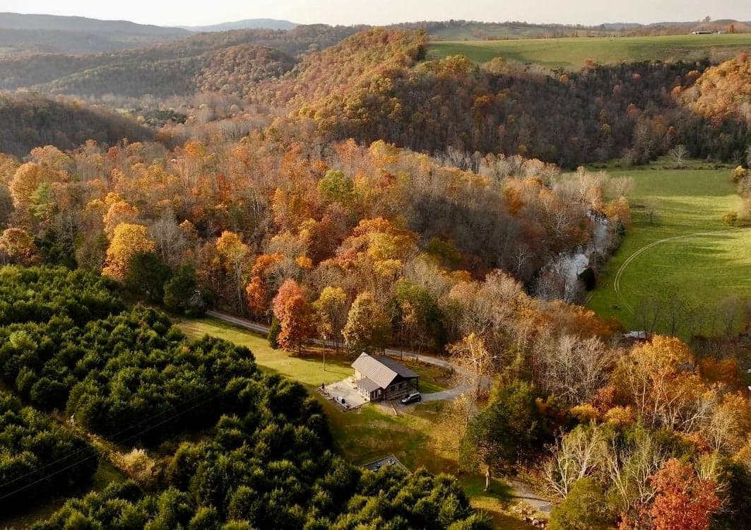
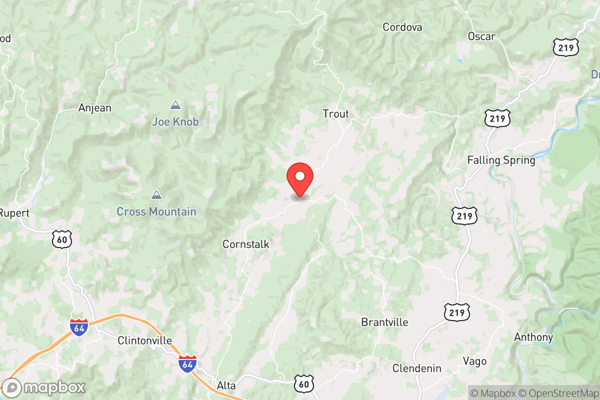
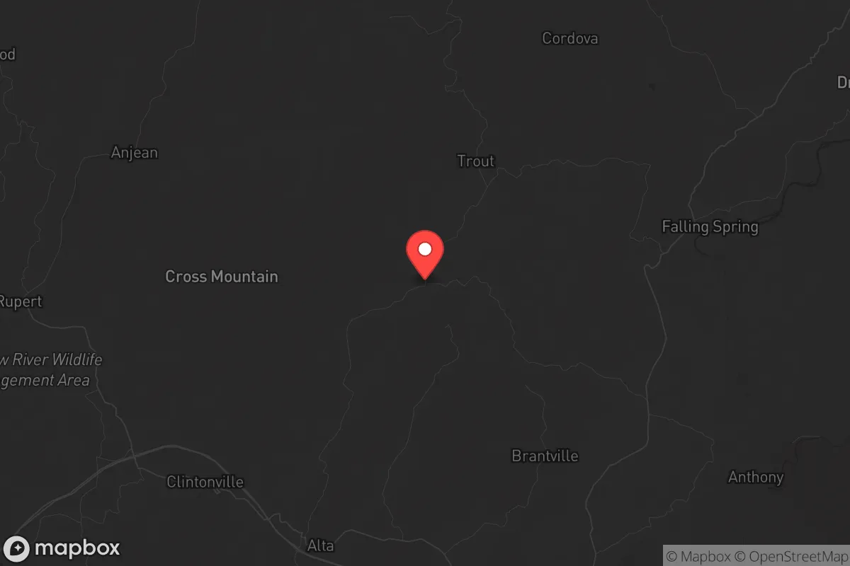
Williamsburg, West Virginia sits in a pocket of the Appalachian Mountains that offers genuine strategic depth for those thinking seriously about long-term resilience. This isn't a place that makes headlines, and that's exactly the point. The town's location in Greenbrier County places it roughly 100 miles from the state capital in Charleston and about 150 miles from Roanoke, Virginia — far enough from major population centers to avoid the worst of any cascading collapse, yet close enough to access supplies or medical care if the grid holds. The surrounding terrain, dominated by the Allegheny Mountains, provides natural chokepoints and defensible positions that flatland relocators rarely consider until it's too late.
Geographic position and natural advantages for long-term security
Williamsburg's primary strategic asset is its position within the Appalachian ridge-and-valley system. The town sits along the Greenbrier River, a tributary of the New River, which means year-round surface water is available without relying on municipal infrastructure. The surrounding mountains rise 2,000 to 3,000 feet above the valley floor, creating natural barriers that slow movement and provide observation points. For someone thinking about retreat or relocation, this topography offers something increasingly rare in the lower 48: genuine defensible space. The area's elevation — roughly 2,200 feet at the town center — also means cooler summers and a longer growing season than higher Appalachian peaks, though winters do bring snow that can isolate the area for days at a time. The Monongahela National Forest lies just to the north and east, offering hundreds of thousands of acres of public land for hunting, foraging, and timber. That's not theoretical; the forest is actively managed and accessible. For a relocator, the key takeaway is that Williamsburg sits in a zone where self-sufficiency is physically possible — the soil is thin but workable, the rainfall is reliable at 40-50 inches annually, and the surrounding ecosystem is productive enough to support a family with effort.
Risks, exposures, and proximity to fallout-relevant landmarks
No strategic assessment is honest without addressing the downsides, and Williamsburg has real ones. The most immediate concern is the Greenbrier River's floodplain. The town itself sits mostly above the 100-year flood line, but low-lying areas along the river have flooded repeatedly — most notably in 1985 and 2016. Anyone buying property here needs to check FEMA flood maps carefully and avoid anything below 2,100 feet elevation. The second risk is proximity to the Greenbrier Resort's bunker, the famous Congressional fallout shelter built during the Cold War. While the bunker is decommissioned and now a tourist attraction, its existence signals that this area was considered a target during a nuclear exchange. The reality is that no location east of the Mississippi is truly safe from fallout in a major conflict, but Williamsburg's distance from known strategic targets — no major military bases, no ICBM silos, no major ports within 100 miles — reduces the risk of a direct strike. The Lewisburg Airport (about 20 miles east) is a general aviation field, not a military installation. The closest significant infrastructure is the Greenbrier Valley Airport, which handles regional flights and could become a FEMA staging point during a disaster — a double-edged sword that could bring both aid and unwanted attention. For the prepper mindset, the bigger concern is proximity to Interstate 64, which runs about 15 miles south of town. In a mass evacuation scenario, that highway could become a funnel for desperate populations moving west from Virginia's Tidewater region or north from the Carolinas. Williamsburg is far enough off the main routes to avoid the initial crush, but not so remote that it's invisible.
Practical resilience for a relocator: food, water, energy, and defensibility
For someone actually moving here with a prepper mindset, the practicalities matter more than the theory. Water is the strongest asset. The Greenbrier River is perennial and clean enough for filtration, and the water table in the valley is high enough that hand-dug wells are viable in many areas. The county health department permits private wells, and spring-fed properties are common. Food production is viable but not easy. The growing season runs roughly May through September, with frost possible into late April and returning by early October. That's enough for a serious garden — tomatoes, beans, squash, potatoes, and leafy greens all do well — but not for row-crop agriculture. The area's history of subsistence farming means local knowledge is still available through older residents and the county extension office. Hunting is excellent: white-tailed deer are abundant, turkey populations are healthy, and the Monongahela National Forest allows hunting with a valid license. Energy independence is achievable. The area gets decent sun — about 4.5 peak sun hours per day on average — and solar panels are becoming more common among off-grid properties. Wood heating is the standard for rural homes; firewood is plentiful and cheap if you have a chainsaw and a truck. The county has no natural gas infrastructure outside of Lewisburg, so propane tanks are the backup for most households. Defensibility is where Williamsburg really shines. The narrow valley roads create natural ambush points, and the mountains provide observation posts that can see movement from miles away. A small group could effectively control access to a property with minimal effort. The local population is sparse — Greenbrier County has about 34,000 people spread over 1,025 square miles — meaning you're not dealing with neighbors packed in tight. The downside is that law enforcement response times are measured in tens of minutes, not single digits. The Greenbrier County Sheriff's Office covers the entire county, and Williamsburg doesn't have its own police force. In a crisis, you're on your own until help arrives, which is exactly the scenario most preppers are planning for.
The overall strategic picture for Williamsburg is one of moderate isolation with high natural resilience. It's not a bug-out location for a weekend warrior; it's a place where you can build a life that doesn't depend on the fragile systems of the coastal cities. The trade-offs are real — limited employment, harsh winters, and the constant need for physical labor to maintain self-sufficiency — but for someone who sees the writing on the wall and wants to be somewhere that still has a chance when things go sideways, this corner of West Virginia deserves serious consideration. The mountains don't care about your politics, but they do reward preparation. Williamsburg offers the raw materials for that preparation; what you do with them is up to you.
* Values derived from national, state, county, city and local statistics and may differ in a specific area. Last updated: 2026-04-23T05:58:53.000Z
Narrative content on this page is AI-generated and may contain mistakes. Verify any details that matter before acting on them.
ReloMaps may earn a commission from affiliate links at no extra cost to you.