Photo: Wikipedia
Strategic Assessment of Visalia, CA
Meaningful friction. Expect exposure to either population pressure, blast zones, or natural disaster risk. Consider buying a retreat property.
What does the Strategic Assessment tell us?
Our Strategic Assessment grades tactical survivability of an area. Major population centers, military targets, fallout zones, natural disasters, and border exposure all drive risk — lower exposure means a more defensible position in a crisis.
This is heavily inspired by Joel Skousen's Strategic Relocation book. Highly recommended you checkout the book ($)What does this tell us?
Our Strategic Assessment grades tactical survivability of an area. Major population centers, military targets, fallout zones, natural disasters, and border exposure all drive risk — lower exposure means a more defensible position in a crisis.
This is heavily inspired by Joel Skousen's Strategic Relocation book. Highly recommended you checkout the book ($)Strategic Pillars

Key Distances
Regional Safe Places
Below is our recommended "safe zones" in California and the surrounding area based on our strategic heuristics. For most people, it's unrealistic to live in a “safe zone” full-time due to work, family or other personal reasons. They tend to be more rural. However, many of these areas are perfect for second homes and retreat properties that double as a vacation home or even a short-term rental.




Important Note: For informational purposes only. This does not mean nothing bad ever happens in the green zones. Please use common sense. This is based on public data and modeled with AI. We tried to take a conservative approach but mistakes happen. We update this regularly as new information becomes available.
Solar Generator Recommendations
Backup power matters more here than in safer locations. We've picked three solar generators across budgets and capacity tiers — start with the budget unit if you only need a few essentials, or step up if you want to run a fridge and HVAC for days at a time.

Jackery Portable Power Station Explorer 300
Budget OptionPower on the Go: Weighing only 11 lbs, it's convenient to set up and store with book-sized foldable solar panels

BLUETTI Portable Power Station AC180
Designed for both indoor and outdoor scenarios, AC180 is highly capable as it has a robost capacity and continuous output power.

EF ECOFLOW DELTA Pro Ultra Power Station
Upgraded PickEcoFlow DELTA Pro Ultra is a whole-home energy system designed to grow with your family. Integrated with the Smart Home Panel 2, it scales to meet your evolving energy needs — keeping your home powered, intelligent, and secure through every stage of life.
We earn a commission, at no additional cost to you.
Strategic Assessment Analysis
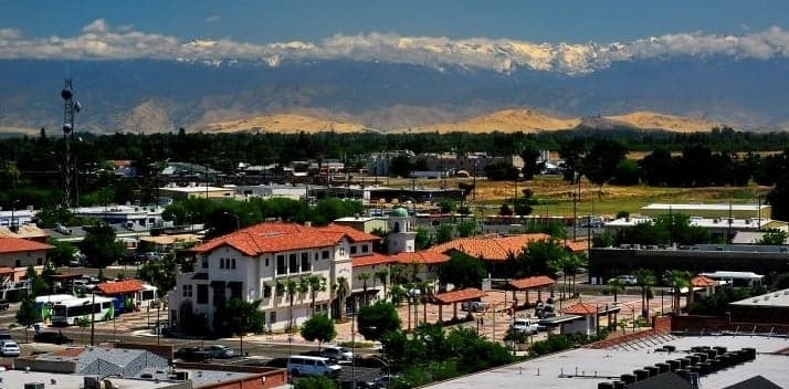
Visalia, California, offers a surprisingly strong strategic position for the relocation-minded reader who prioritizes resilience and self-sufficiency, but it requires a clear-eyed understanding of its trade-offs. Situated in the heart of the San Joaquin Valley, the city benefits from a deep agricultural economy, a moderate climate, and a location that is far enough from major coastal population centers to avoid their immediate collapse scenarios, yet close enough to access their resources in a stable period. For a conservative-leaning individual or family seeking a defensible, productive base of operations, Visalia presents a compelling case—provided you account for its specific vulnerabilities.
Geographic position and natural advantages for long-term stability
Visalia’s primary strategic asset is its location within the Tulare Lake Basin, one of the most productive agricultural regions in the world. The city sits on the eastern edge of the valley floor, at the base of the Sierra Nevada foothills, giving it access to both flat, arable land and the mountain watershed. The Kaweah River and its associated groundwater basin provide a relatively reliable water supply compared to other parts of California, though the region has faced severe drought cycles. The climate is Mediterranean with hot, dry summers and cool, wet winters—ideal for year-round food production if you have irrigation. The surrounding farmland is not just a scenic backdrop; it is a functional buffer zone that limits urban sprawl and provides a local food supply chain that would remain operational in many disruption scenarios. The city’s elevation at roughly 330 feet means it is not threatened by sea-level rise, and its inland position places it well outside the tsunami and storm-surge zones of the coast.
Risks, exposures, and proximity to fallout-relevant landmarks
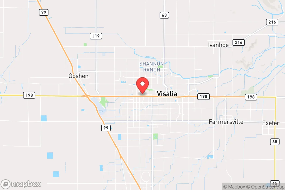
The most significant risk for Visalia is its location within a seismically active region. The San Andreas Fault is roughly 100 miles to the west, and the Garlock Fault to the south can produce large quakes. While Visalia itself is not directly on a major fault line, a major rupture could disrupt the California Aqueduct and the Friant-Kern Canal, which are critical for valley water delivery. The city is also vulnerable to extreme heat events and wildfire smoke from Sierra Nevada fires, which can degrade air quality for weeks. Flooding is a historical concern—the Tulare Lake region was once a vast inland lake, and heavy snowmelt years (like 2023) can cause localized flooding in low-lying areas. From a man-made risk perspective, Visalia’s proximity to Naval Air Station Lemoore (about 30 miles south) and Fresno Yosemite International Airport (about 45 miles north) places it within a potential secondary target zone in a major conflict, though neither is a primary strategic nuclear target. The Diablo Canyon Power Plant on the coast is over 150 miles away, well outside the immediate fallout zone. The greater risk is that a major event on the coast—whether earthquake, tsunami, or attack—would trigger a mass exodus inland, and Visalia sits directly in the path of Highway 99 and Highway 198, two major evacuation routes. A sudden population surge could overwhelm local resources and infrastructure.
Practical resilience for a relocator: food, water, energy, and defensibility
For the self-sufficient relocator, Visalia’s practical resilience is a mixed bag. Food security is the strongest card: the surrounding valley produces a staggering variety of crops—citrus, almonds, grapes, tomatoes, dairy, and livestock. Local farmers’ markets and CSAs are abundant, and the city has a strong 4-H and FFA culture that supports small-scale agriculture. A family with a half-acre lot can realistically grow a significant portion of its own food. Water security is more complex. The city’s municipal water comes from a mix of surface water (Kaweah River) and groundwater. The Tulare County groundwater basin has been overdrafted for decades, leading to subsidence and well failures in some rural areas. A relocator should plan on drilling a private well (depths of 200-500 feet are common) and installing a rainwater catchment system. Energy resilience is decent: the valley has abundant solar potential, and net metering policies (though evolving) still make rooftop solar a viable investment. Natural gas is widely available, and firewood from the Sierra foothills is plentiful. The grid is relatively stable but can fail during heat waves or PSPS (Public Safety Power Shutoff) events from PG&E. A backup generator with a propane or natural gas hookup is a wise investment. Defensibility is moderate. Visalia is a medium-sized city (population ~140,000) with a low crime rate compared to Fresno or Bakersfield, but it is not a fortress. The Tulare County Sheriff’s Office and Visalia Police Department are professional and well-funded, but response times in rural outskirts can be 20-30 minutes. The best strategy is to live on the eastern edge of town or in the unincorporated foothill communities (like Three Rivers or Lemon Cove) where you have more land, better water access, and natural chokepoints. The city’s layout is mostly grid-based, which is not ideal for defense, but the surrounding agricultural land provides good visibility and limited approach routes.
The overall strategic picture for Visalia is that of a high-potential, moderate-risk relocation destination for the preparedness-minded individual. It offers genuine advantages in food production, water access (with effort), and a conservative, self-reliant culture that aligns with the values of the target audience. Its primary weaknesses are seismic risk, flood history, and its position as a potential inland refuge for coastal evacuees. A relocator who secures a property with a private well, solar panels, and a defensible layout on the eastern side of the valley will be well-positioned to ride out most disruptions. The key is to avoid the urban core and the low-lying floodplains, and to build a network with the local farming and ranching community. Visalia is not a bug-out location—it is a live-in, work-in, grow-in location that requires active management of its risks. For the family or individual willing to do that work, it is one of the more viable options in California for long-term resilience.

* Values derived from national, state, county, city and local statistics and may differ in a specific area. Last updated: 2026-09-28T16:15:20.000Z
Narrative content on this page is AI-generated and may contain mistakes. Verify any details that matter before acting on them.
ReloMaps may earn a commission from affiliate links at no extra cost to you.

