Photo: Wikipedia
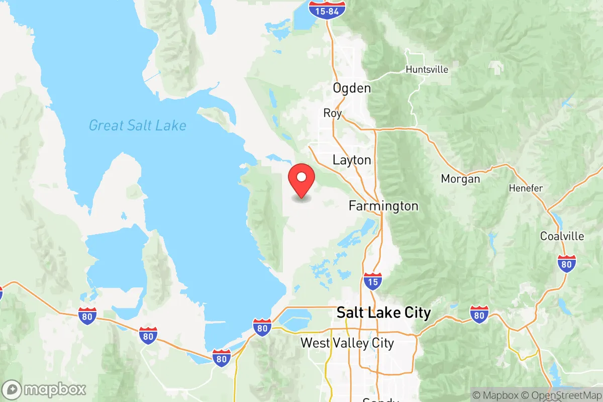
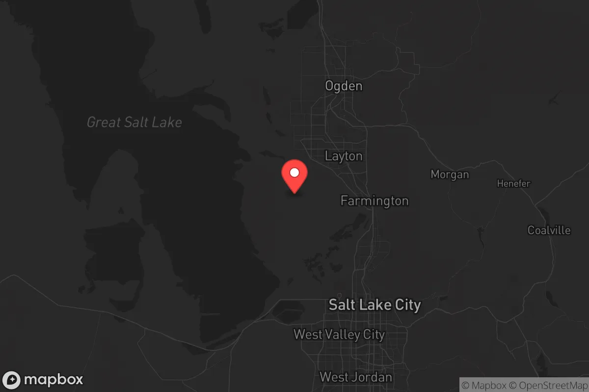
Strategic Assessment of Davis County
Workable tactical position. Some exposure to population density or targets, but generally defensible in a crisis.
What does the Strategic Assessment tell us?
Our Strategic Assessment grades tactical survivability of an area. Major population centers, military targets, fallout zones, natural disasters, and border exposure all drive risk — lower exposure means a more defensible position in a crisis.
This is heavily inspired by Joel Skousen's Strategic Relocation book. Highly recommended you checkout the book ($)What does this tell us?
Our Strategic Assessment grades tactical survivability of an area. Major population centers, military targets, fallout zones, natural disasters, and border exposure all drive risk — lower exposure means a more defensible position in a crisis.
This is heavily inspired by Joel Skousen's Strategic Relocation book. Highly recommended you checkout the book ($)Strategic Pillars

Key Distances
Strategic Assessment Analysis
If you're mapping out a relocation strategy with an eye on long-term stability and self-reliance, Davis County, Utah, sits in a complicated spot. It offers genuine geographic buffers—mountain canyons, a Great Salt Lake shoreline, and a mix of suburban and semi-rural pockets—but it's also wedged between a major metropolitan area and a high-value military installation. For a conservative-leaning prepper or survivalist, the county's resilience depends heavily on which zip code you pick and how you plan to mitigate the risks baked into the Wasatch Front. The key is understanding that Davis County can work as a staging ground or a primary retreat, but only if you account for the targets and choke points that come with the territory.
Geographic position and natural advantages for off-grid living
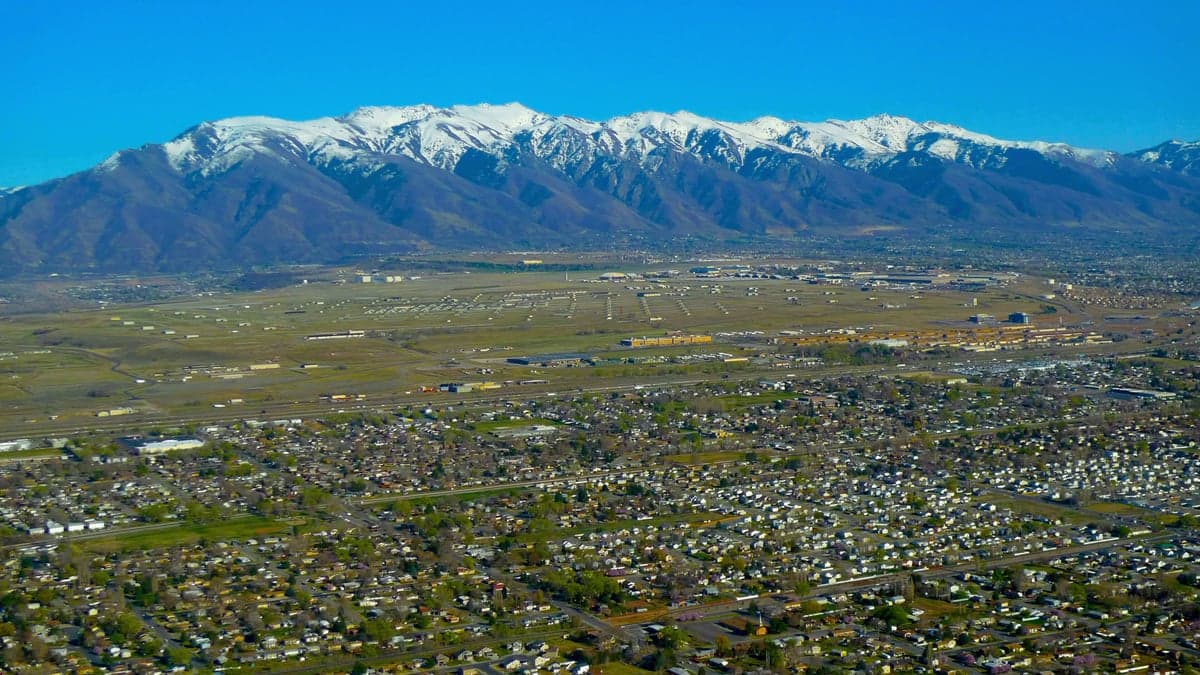
Davis County runs roughly 30 miles north-south along the eastern shore of the Great Salt Lake, with the Wasatch Mountains rising sharply to the east. That mountain wall provides natural defensibility—canyons like Farmington Canyon, Weber Canyon (on the northern border), and Bountiful's Mueller Park Canyon offer escape routes into high-elevation terrain with water, timber, and game. The county's western half, including towns like Syracuse and West Point, flattens out into lake-effect plains with some agricultural land still in production. These areas are farther from the mountain foothills and the fault line, which matters for earthquake risk. The Great Salt Lake itself is a non-potable water source, but its wetlands and marshes provide a buffer against urban sprawl from Salt Lake City to the south. For a relocator, the natural advantages are real: reliable mountain snowpack feeds streams like Holmes Creek and Ricks Creek, and the higher elevations offer summer grazing and winter shelter. The county's position also puts it a solid 20–30 miles north of downtown Salt Lake City, which is close enough to access resources in a stable period but far enough to avoid the worst of a city-wide collapse scenario—provided you're not living in the southern cities like Woods Cross or North Salt Lake, which are essentially suburbs of the capital.
Fallout risks from Hill Air Force Base, refineries, and the Wasatch Fault
Here's where the prepper calculus gets uncomfortable. Hill Air Force Base, located in the central part of the county near Clearfield and Layton, is a primary nuclear target. It houses the Ogden Air Logistics Complex and is a key hub for the F-35 program. In a major conflict, a ground burst or airburst over Hill would render a large swath of Davis County uninhabitable for years. Even a conventional strike on the base's munitions storage could produce catastrophic secondary explosions. Additionally, the oil refineries in North Salt Lake and Woods Cross—Chevron, HollyFrontier, and others—are within 10 miles of the county's southern border. A direct hit or a cascading failure at those facilities would release toxic plumes that could drift north over Bountiful and Farmington. Then there's the Wasatch Fault, which runs directly under the eastern bench communities like Bountiful, Kaysville, and Fruit Heights. A magnitude 7.0 or larger earthquake would level unreinforced masonry homes, rupture gas lines, and trigger landslides in the canyons. The county's proximity to Salt Lake City (population ~200,000 within 15 miles) also means that in a grid-down or civil unrest scenario, you'd face a massive outflow of desperate people heading north along I-15 and US-89. Those two highways are the only major north-south routes through the county, making them obvious choke points for both evacuation and refugee flow.
Water, food, energy, and defensibility for a relocating family
On the practical side, Davis County has mixed marks. Water is the strongest asset: mountain streams and the Weber River (which forms the northern border) provide surface water, and many homes in the foothills have private wells. The county's culinary water system draws from mountain reservoirs like Farmington Bay and Causey Reservoir, but those are vulnerable to earthquake damage and power outages. For off-grid living, a property with a year-round stream or a deep well is worth a premium. Food production is limited—the agricultural land in Syracuse and West Point is shrinking, and the growing season is short (about 150 frost-free days). You can raise small livestock and garden, but you won't be self-sufficient without significant acreage. Energy is a concern: the grid is tied to Rocky Mountain Power's coal and natural gas plants, and solar potential is good (over 200 sunny days per year), but net metering rules have tightened. Battery storage is essential if you want to ride out a multi-day outage. Defensibility varies by location. The mountain canyons offer natural chokepoints and line-of-sight advantages, but they also funnel traffic and are prone to wildfire. The flat western towns are more open and harder to secure. A smart play is to buy on the eastern bench in a community like Fruit Heights or South Weber, where you have canyon access and a view corridor, but you're still within a 15-minute drive of supplies in Layton or Farmington. Avoid the areas within a 5-mile radius of Hill AFB and the refinery corridor—those are the highest-risk zones for both fallout and civil disruption.
Overall, Davis County is a mixed bag for the strategic relocator. It gives you genuine natural buffers and water security, but it's sitting on a fault line and within spitting distance of a primary nuclear target and a major refinery complex. If you're willing to invest in a well, solar, and a solid bug-out plan into the Uinta-Wasatch-Cache National Forest, the county can work as a base of operations. But don't kid yourself: the proximity to Salt Lake City and Hill AFB means that in a worst-case scenario, you're not in a remote redoubt—you're in a suburban buffer zone that could become a refugee corridor overnight. For a conservative audience looking at the bigger picture, Davis County is worth a hard look, but only if you pick your exact location with a map, a Geiger counter, and a clear-eyed assessment of the risks.
* Values derived from national, state, county, city and local statistics and may differ in a specific area. Last updated: 2026-05-14T17:08:18.000Z
Narrative content on this page is AI-generated and may contain mistakes. Verify any details that matter before acting on them.
ReloMaps may earn a commission from affiliate links at no extra cost to you.