
Photo: Wikipedia
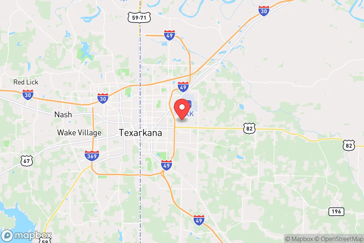
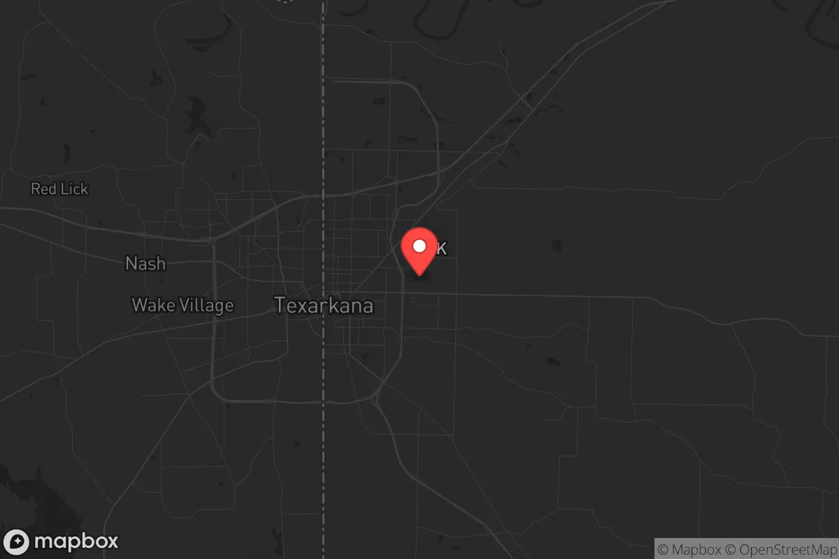
Strategic Assessment of Texarkana, AR
Workable tactical position. Some exposure to population density or targets, but generally defensible in a crisis.
What does the Strategic Assessment tell us?
Our Strategic Assessment grades tactical survivability of an area. Major population centers, military targets, fallout zones, natural disasters, and border exposure all drive risk — lower exposure means a more defensible position in a crisis.
This is heavily inspired by Joel Skousen's Strategic Relocation book. Highly recommended you checkout the book ($)What does this tell us?
Our Strategic Assessment grades tactical survivability of an area. Major population centers, military targets, fallout zones, natural disasters, and border exposure all drive risk — lower exposure means a more defensible position in a crisis.
This is heavily inspired by Joel Skousen's Strategic Relocation book. Highly recommended you checkout the book ($)Strategic Pillars

Key Distances
Regional Safe Places
Below is our recommended "safe zones" in Arkansas and the surrounding area based on our strategic heuristics. For most people, it's unrealistic to live in a “safe zone” full-time due to work, family or other personal reasons. They tend to be more rural. However, many of these areas are perfect for second homes and retreat properties that double as a vacation home or even a short-term rental.


Important Note: For informational purposes only. This does not mean nothing bad ever happens in the green zones. Please use common sense. This is based on public data and modeled with AI. We tried to take a conservative approach but mistakes happen. We update this regularly as new information becomes available.
Solar Generator Recommendations
Backup power matters more here than in safer locations. We've picked three solar generators across budgets and capacity tiers — start with the budget unit if you only need a few essentials, or step up if you want to run a fridge and HVAC for days at a time.

Jackery Portable Power Station Explorer 300
Budget OptionPower on the Go: Weighing only 11 lbs, it's convenient to set up and store with book-sized foldable solar panels

BLUETTI Portable Power Station AC180
Designed for both indoor and outdoor scenarios, AC180 is highly capable as it has a robost capacity and continuous output power.

EF ECOFLOW DELTA Pro Ultra Power Station
Upgraded PickEcoFlow DELTA Pro Ultra is a whole-home energy system designed to grow with your family. Integrated with the Smart Home Panel 2, it scales to meet your evolving energy needs — keeping your home powered, intelligent, and secure through every stage of life.
We earn a commission, at no additional cost to you.
Strategic Assessment Analysis
Texarkana, Arkansas, sits in a unique strategic pocket that most relocation analyses overlook, and that is precisely its strength. This twin-city straddling the Arkansas-Texas line offers a blend of geographic isolation from major coastal threats while maintaining critical infrastructure access—a rare combination for those prioritizing long-term resilience. For a relocator concerned with civic unrest, mass casualty events, or systemic collapse, Texarkana provides a defensible position that is neither too remote to be self-sufficient nor too connected to be a primary target.
Geographic position and natural advantages for long-term security
Texarkana’s location is its first and most significant asset. Situated roughly 150 miles from Dallas, 180 miles from Little Rock, and 240 miles from Oklahoma City, it sits outside the immediate blast radius and fallout zones of any major metropolitan area. The region is not near any known nuclear power plants, major military installations, or high-value infrastructure that would make it a primary target in a conflict scenario. The surrounding landscape is a mix of piney woods, rolling hills, and agricultural land, offering natural cover and multiple egress routes. The Red River forms the southern boundary of the area, providing a natural barrier and a reliable water source. The terrain is not mountainous, but it is sufficiently varied to offer defensible positions and concealment. The climate is temperate, with four distinct seasons, reducing the risk of extreme weather events that plague coastal or plains regions. The area’s low population density—Miller County has roughly 43,000 residents—means less competition for resources in a crisis, and the rural character of the surrounding counties provides buffer zones against any urban unrest that might spill over from Texarkana proper.
Risks, exposures, and proximity to fallout-relevant landmarks
No location is without vulnerabilities, and Texarkana has several that a serious prepper must weigh. The most immediate concern is the city’s position as a transportation hub: Interstate 30 and U.S. Highway 67/82 converge here, and the Union Pacific rail line runs through the center of town. In a mass evacuation scenario, these corridors could become chokepoints or vectors for displaced populations. The Texarkana Regional Airport is small but could become a focal point for government or military activity. The nearby Red River Army Depot, about 20 miles west in Hooks, Texas, is a major ammunition storage and maintenance facility. While not a nuclear target, it could attract secondary attention or become a source of hazardous materials in a crisis. The city itself has a combined population of roughly 65,000 across the state line, which is manageable but not negligible. The presence of a federal building, a VA hospital, and a county jail means that in a collapse scenario, these institutions could become targets for looting or civil unrest. The area is also in Tornado Alley, with a moderate risk of severe storms, though this is a manageable threat compared to coastal hurricane zones. The primary risk is not a direct strike but the potential for refugee flow from Dallas or Shreveport, both of which are within a day’s drive and would likely see significant civil disorder in a national emergency.
Practical resilience for a relocator: food, water, energy, and defensibility
For a single individual or family looking to establish a resilient homestead, Texarkana offers a solid foundation. The water situation is favorable: the Red River provides a surface water source, and the area sits atop the Carrizo-Wilcox Aquifer, one of the largest groundwater reserves in the South. Well drilling is common and affordable in the rural outskirts, with typical depths of 200-400 feet yielding reliable water. The growing season is long—roughly 230 days—allowing for substantial food production. The soil is sandy loam in many areas, suitable for gardens and small-scale farming. Local farmers’ markets and feed stores are plentiful, and the presence of the University of Arkansas Hope-Texarkana campus offers agricultural extension resources. For energy, the region is served by Southwestern Electric Power Company (SWEPCO), but grid reliability is average; rural areas experience occasional outages during storms. Solar potential is good, with an average of 215 sunny days per year, and off-grid setups are feasible on larger parcels. Propane is widely available for backup heating and cooking. Defensibility is moderate: the flat to gently rolling terrain means you cannot rely on natural fortifications, but the dense pine forests provide cover and privacy. Rural properties with long driveways, perimeter fencing, and good sightlines are common. The local gun culture is strong—Arkansas is a constitutional carry state, and Miller County has a sheriff’s office that is generally supportive of Second Amendment rights. The crime rate in Texarkana proper is higher than the national average, particularly for property crime, but the rural outskirts are significantly safer. The key is to avoid being within city limits and to establish a buffer of at least 10-15 miles from the urban core.
The overall strategic picture for Texarkana is one of calculated compromise. It is not a bug-out location for those seeking total isolation in the mountains, nor is it a fortified compound in the desert. What it offers is a middle ground: a place where a prepared individual or family can establish a sustainable lifestyle with access to critical resources—water, arable land, building materials, and a supportive community—while remaining far enough from major population centers to avoid the worst of any collapse. The proximity to Texas provides a political and economic safety net, as the state’s independent energy grid and strong local governance offer a degree of stability that more progressive regions lack. The presence of the Red River Army Depot and the nearby military presence at Fort Polk (about 90 miles south) could be a double-edged sword, but in a prolonged crisis, it may also mean a faster restoration of order. For the conservative-minded relocator who wants to be prepared without living like a hermit, Texarkana represents a viable, underappreciated option. The key is to act before the masses discover it—because once the urban exodus begins, this quiet corner of the Ark-La-Tex will not stay quiet for long.
* Values derived from national, state, county, city and local statistics and may differ in a specific area. Last updated: 2026-04-23T03:18:26.000Z
Narrative content on this page is AI-generated and may contain mistakes. Verify any details that matter before acting on them.
ReloMaps may earn a commission from affiliate links at no extra cost to you.