
Photo: Wikipedia
Strategic Assessment of St Paul, MN
Multiple tactical vulnerabilities. Population density, target proximity, or disaster risk are likely compounding. A retreat property and exit planning is required.
What does the Strategic Assessment tell us?
Our Strategic Assessment grades tactical survivability of an area. Major population centers, military targets, fallout zones, natural disasters, and border exposure all drive risk — lower exposure means a more defensible position in a crisis.
This is heavily inspired by Joel Skousen's Strategic Relocation book. Highly recommended you checkout the book ($)What does this tell us?
Our Strategic Assessment grades tactical survivability of an area. Major population centers, military targets, fallout zones, natural disasters, and border exposure all drive risk — lower exposure means a more defensible position in a crisis.
This is heavily inspired by Joel Skousen's Strategic Relocation book. Highly recommended you checkout the book ($)Strategic Pillars

Key Distances
Regional Safe Places
Below is our recommended "safe zones" in Minnesota and the surrounding area based on our strategic heuristics. For most people, it's unrealistic to live in a “safe zone” full-time due to work, family or other personal reasons. They tend to be more rural. However, many of these areas are perfect for second homes and retreat properties that double as a vacation home or even a short-term rental.


Important Note: For informational purposes only. This does not mean nothing bad ever happens in the green zones. Please use common sense. This is based on public data and modeled with AI. We tried to take a conservative approach but mistakes happen. We update this regularly as new information becomes available.
Solar Generator Recommendations
Backup power matters more here than in safer locations. We've picked three solar generators across budgets and capacity tiers — start with the budget unit if you only need a few essentials, or step up if you want to run a fridge and HVAC for days at a time.

Jackery Portable Power Station Explorer 300
Budget OptionPower on the Go: Weighing only 11 lbs, it's convenient to set up and store with book-sized foldable solar panels

BLUETTI Portable Power Station AC180
Designed for both indoor and outdoor scenarios, AC180 is highly capable as it has a robost capacity and continuous output power.

EF ECOFLOW DELTA Pro Ultra Power Station
Upgraded PickEcoFlow DELTA Pro Ultra is a whole-home energy system designed to grow with your family. Integrated with the Smart Home Panel 2, it scales to meet your evolving energy needs — keeping your home powered, intelligent, and secure through every stage of life.
We earn a commission, at no additional cost to you.
Strategic Assessment Analysis
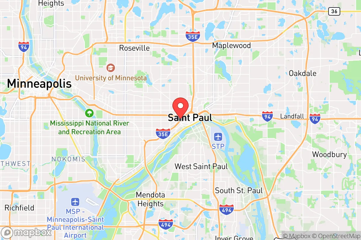
St. Paul, Minnesota, occupies a unique strategic position that offers both genuine resilience advantages and significant vulnerabilities for those prioritizing preparedness. As the state capital and the smaller half of the Twin Cities metro, it benefits from state-level governance infrastructure while being less dense and less of a primary target than Minneapolis. However, its location on the Mississippi River, proximity to major transportation corridors, and status as a political and administrative hub create a complex risk profile that demands careful consideration for anyone evaluating it as a relocation destination from a survivalist perspective.
Geographic position and natural advantages for long-term stability
St. Paul sits at the confluence of the Mississippi, Minnesota, and St. Croix rivers, providing abundant freshwater access—a critical asset in any prolonged disruption scenario. The city itself is built on a series of bluffs and terraces, offering natural elevation advantages over floodplains and potential defensive positions in the event of civil unrest. The surrounding region includes extensive hardwood forests, agricultural land in the Minnesota River Valley, and the Driftless Area to the southeast, which offers rugged terrain and isolated pockets for retreat if needed. The city's position as the state capital means it houses the Minnesota National Guard headquarters, the State Emergency Operations Center, and key government continuity facilities. For a relocator, this means that during a crisis, St. Paul is likely to receive priority for state-level resources, law enforcement support, and emergency management coordination. The presence of the State Capitol complex, the Minnesota Department of Public Safety, and the Ramsey County Emergency Management office provides a layer of institutional resilience that smaller towns lack. However, this same concentration of government assets also makes the city a potential target for coordinated attacks or civil unrest aimed at disrupting governance.
Risks, exposures, and proximity to fallout-relevant landmarks
The most significant strategic drawback of St. Paul is its location within the Twin Cities metropolitan area, home to over 3 million people. In a major disaster—whether natural, economic, or societal—the city would face the same cascading failures that plague all large urban centers: supply chain collapse, mass migration of displaced populations, overwhelmed medical systems, and potential civil unrest. St. Paul is directly adjacent to Minneapolis, which has been a flashpoint for riots, arson, and looting in recent years, most notably in 2020 following the George Floyd incident. The proximity to the Minneapolis–Saint Paul International Airport (MSP) and the convergence of Interstates 94, 35E, and 494 make the area a transportation hub that could become a chokepoint or a target. Additionally, the Mississippi River locks and dams, while useful for barge transport, also represent critical infrastructure that could be disrupted. The city is within 150 miles of the Prairie Island Indian Community's nuclear power plant, and while a meltdown is unlikely, the evacuation corridors would be heavily congested. For a prepper, the sheer density of population and infrastructure means that St. Paul is not a bug-out location—it is a location that requires a robust plan for either hunkering down with substantial supplies or having a pre-established retreat further north or west.
Practical resilience for a relocator: food, water, energy, and defensibility
On the practical side, St. Paul offers some genuine advantages for a prepared individual or family. The city's water supply comes from the Mississippi River, treated by the St. Paul Regional Water Services, which has backup generators and redundant treatment capacity. For those with a well on a private property within city limits (rare but possible in some neighborhoods like the Dayton's Bluff area), groundwater is generally reliable. Food security is a mixed bag: the city has a strong network of community gardens, farmers' markets, and the Minnesota State Fairgrounds, which could serve as a distribution hub. However, grocery store shelves empty quickly in a crisis, and the city's reliance on just-in-time delivery means that a three-day supply of food is the norm for most households. Energy resilience is a concern: Xcel Energy provides electricity, and while the grid is generally reliable, winter storms (like the 2021 Texas freeze, though Minnesota's grid is better prepared) can cause outages. Natural gas for heating is common, but a prolonged power outage in winter is a life-threatening scenario. Defensibility varies by neighborhood. The historic Summit Avenue area and the Crocus Hill neighborhood offer older, solidly built homes with basements and some distance from main thoroughfares. The East Side and North End are denser and closer to industrial areas, which could become chaotic. For a relocator, the key is to choose a home with a basement, a wood-burning fireplace or stove, and the ability to store at least a month's worth of supplies. The city's zoning allows for backyard chickens and some small-scale livestock in certain areas, and the proximity to rural Ramsey County and Washington County means that a short drive can put you in farmland. But defensibility is low compared to a rural homestead; St. Paul is a city of neighborhoods, and in a breakdown, you would be relying on community cohesion and your own preparations rather than physical barriers.
The overall strategic picture for St. Paul is one of calculated risk. It is not a survivalist's paradise—it is a major urban center with all the vulnerabilities that entails. But for someone who needs to remain near employment, family, or medical infrastructure while maintaining a preparedness mindset, it offers a better balance than Minneapolis. The state capital status provides institutional resilience, the river access ensures water, and the surrounding region offers retreat options. The downsides are real: population density, historical civil unrest, and the concentration of critical infrastructure that could become a target. A conservative-leaning relocator should view St. Paul as a location to be approached with eyes wide open—a place where you can build a life and prepare, but only if you have a solid plan for both staying and leaving. The winters are harsh, the politics are blue, and the risks are urban. But for those who value the resources of a capital city and are willing to invest in serious preparations, St. Paul can be a viable base of operations in an uncertain future.
* Values derived from national, state, county, city and local statistics and may differ in a specific area. Last updated: 2026-04-24T18:35:50.000Z
Narrative content on this page is AI-generated and may contain mistakes. Verify any details that matter before acting on them.
ReloMaps may earn a commission from affiliate links at no extra cost to you.