
Photo: Wikipedia
Strategic Assessment of Spanish Fork, UT
Workable tactical position. Some exposure to population density or targets, but generally defensible in a crisis.
What does the Strategic Assessment tell us?
Our Strategic Assessment grades tactical survivability of an area. Major population centers, military targets, fallout zones, natural disasters, and border exposure all drive risk — lower exposure means a more defensible position in a crisis.
This is heavily inspired by Joel Skousen's Strategic Relocation book. Highly recommended you checkout the book ($)What does this tell us?
Our Strategic Assessment grades tactical survivability of an area. Major population centers, military targets, fallout zones, natural disasters, and border exposure all drive risk — lower exposure means a more defensible position in a crisis.
This is heavily inspired by Joel Skousen's Strategic Relocation book. Highly recommended you checkout the book ($)Strategic Pillars

Key Distances
Regional Safe Places
Below is our recommended "safe zones" in Utah and the surrounding area based on our strategic heuristics. For most people, it's unrealistic to live in a “safe zone” full-time due to work, family or other personal reasons. They tend to be more rural. However, many of these areas are perfect for second homes and retreat properties that double as a vacation home or even a short-term rental.


Important Note: For informational purposes only. This does not mean nothing bad ever happens in the green zones. Please use common sense. This is based on public data and modeled with AI. We tried to take a conservative approach but mistakes happen. We update this regularly as new information becomes available.
Solar Generator Recommendations
Backup power matters more here than in safer locations. We've picked three solar generators across budgets and capacity tiers — start with the budget unit if you only need a few essentials, or step up if you want to run a fridge and HVAC for days at a time.

Jackery Portable Power Station Explorer 300
Budget OptionPower on the Go: Weighing only 11 lbs, it's convenient to set up and store with book-sized foldable solar panels

BLUETTI Portable Power Station AC180
Designed for both indoor and outdoor scenarios, AC180 is highly capable as it has a robost capacity and continuous output power.

EF ECOFLOW DELTA Pro Ultra Power Station
Upgraded PickEcoFlow DELTA Pro Ultra is a whole-home energy system designed to grow with your family. Integrated with the Smart Home Panel 2, it scales to meet your evolving energy needs — keeping your home powered, intelligent, and secure through every stage of life.
We earn a commission, at no additional cost to you.
Strategic Assessment Analysis
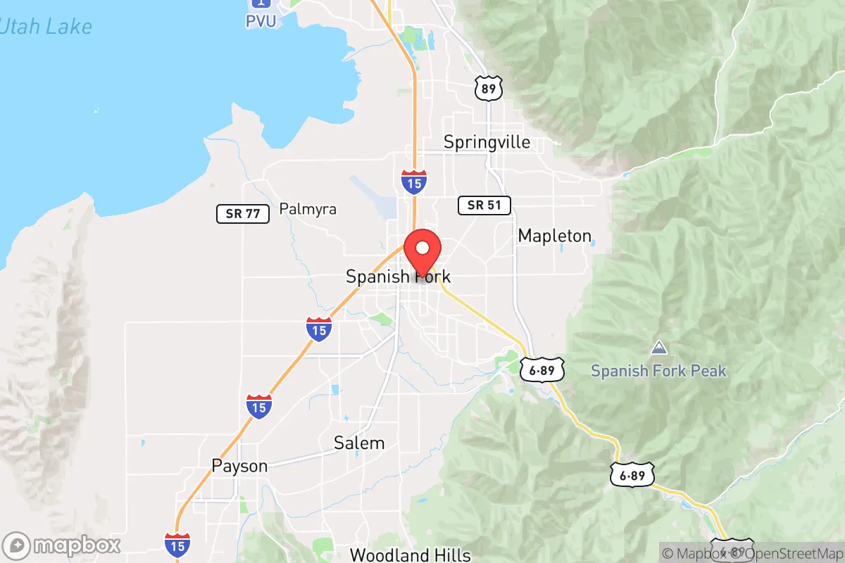
Spanish Fork, Utah, sits in a geographic sweet spot that balances access to resources with a degree of separation from the most obvious collapse vectors, making it a credible relocation option for those prioritizing long-term resilience. Nestled at the base of the Wasatch Range in Utah County, the city benefits from a strong local economy, a growing population, and a cultural ethos that still values self-reliance and community preparedness. For a conservative-leaning individual or family looking to hedge against civic unrest, supply chain disruptions, or natural disasters, Spanish Fork offers a mix of defensible terrain, agricultural capacity, and a social fabric that hasn't yet fully frayed—though it’s not without its own strategic vulnerabilities.
Geographic position and natural advantages for long-term security
Spanish Fork’s location at the mouth of Spanish Fork Canyon gives it a natural chokepoint that can be leveraged for security. The canyon provides a single primary route into the high Uinta Mountains, meaning that in a grid-down scenario, movement into the backcountry can be monitored or controlled. The city sits at roughly 4,600 feet elevation, which mitigates some flood risks while still offering arable land—a rare combination in the Intermountain West. The nearby Utah Lake, just 10 miles west, provides a freshwater reservoir, though its water quality is a concern for long-term consumption without treatment. The surrounding mountains offer timber, game, and potential retreat zones, with the Uinta-Wasatch-Cache National Forest less than 30 minutes east. This proximity to public lands gives a relocator options for hunting, foraging, and off-grid living if the suburbs become untenable. The area’s four-season climate, with cold winters that suppress pest-borne diseases and hot summers that support agriculture, is another natural advantage. Spanish Fork also sits in the shadow of Mount Nebo, which provides a visual landmark for navigation and a potential high-ground observation point.
Risks, exposures, and proximity to fallout-relevant landmarks
No strategic assessment is honest without acknowledging the liabilities. Spanish Fork’s primary risk is its proximity to the Wasatch Front—the densely populated corridor stretching from Provo to Salt Lake City, home to over 2.5 million people. In a major civic unrest event or mass casualty scenario, this population could become a liability, with refugees potentially flowing south and east along I-15 and US-6. Spanish Fork is roughly 45 miles south of Salt Lake City and 10 miles south of Provo, putting it within a day’s walk for desperate populations. The city is also within 50 miles of Hill Air Force Base, a strategic target in any conflict involving the U.S. military. While Spanish Fork itself has no major military or industrial targets, the nearby Utah Valley is home to several tech and defense contractors, including the NSA’s Utah Data Center in Bluffdale, about 30 miles north. In a cyber or EMP attack, this proximity could mean secondary effects like power grid instability or targeted infrastructure failures. Earthquake risk is moderate—the Wasatch Fault runs through the region, and a major quake (7.0+) could disrupt roads, water lines, and natural gas pipelines, isolating the city from supply routes. Wildfire risk is real in the canyon areas, particularly during dry summers, and could cut off the primary escape route east. Finally, the city’s rapid growth—population nearly doubled from 2000 to 2020—means that many newer subdivisions are built on former farmland, with limited defensible space and reliance on municipal water systems that could fail in a prolonged emergency.
Practical resilience for a relocator: food, water, energy, and defensibility
For the prepper-minded relocator, Spanish Fork offers several concrete advantages. The city sits in the heart of Utah County’s agricultural zone, with working farms and orchards still operating within city limits. This means local food production is not just theoretical—you can buy directly from growers, and the soil is viable for home gardens. The Spanish Fork River, which runs through town, provides a year-round water source, though it requires filtration due to agricultural runoff and upstream development. The city’s water rights are tied to the Utah Lake and Jordan River systems, but individual well drilling is possible in some areas, particularly on the east side near the canyon. For energy, the region is served by Rocky Mountain Power, which has a relatively modern grid, but solar potential is excellent—Spanish Fork averages over 220 sunny days per year, and net metering policies are favorable for residential solar installations. Natural gas is widely available, which is a plus for backup heating. Defensibility is mixed: the older neighborhoods near Main Street have a traditional grid layout with alleyways and multiple egress points, while newer subdivisions are cul-de-sac-heavy, which can be both a security asset (fewer entry points) and a liability (single road in/out). The city’s police department is well-funded and has a good reputation, but in a SHTF scenario, you’re relying on neighbors, not first responders. The dominant LDS (Mormon) culture means that many households already have food storage and emergency supplies—a social asset that can be tapped through community networks, but also a potential liability if you’re not part of that community. For a single individual or family willing to integrate, this pre-existing preparedness culture is a force multiplier. For those who prefer to stay independent, the local preparedness community is active, with regular classes and meetups at places like the Spanish Fork Sportsmen’s Club.
The overall strategic picture for Spanish Fork is cautiously optimistic for the disciplined relocator. It’s not a remote bug-out location—it’s a working town with real exposure to the Wasatch Front’s vulnerabilities. But for someone who wants to maintain a normal life while building resilience, it offers a rare combination: a functioning local economy, agricultural land, water access, and a cultural baseline that still values preparedness. The key is to buy property on the east side, closer to the canyon, where you have better access to public lands and a natural retreat route. Avoid the floodplain near the river and the new subdivisions on the west side that are too close to I-15. Build relationships with local farmers and the LDS ward if you can—they’re your first line of defense in a crisis. Spanish Fork won’t save you from a direct nuclear strike on Hill AFB or a refugee wave from Salt Lake, but it gives you a fighting chance to ride out the smaller disruptions that are far more likely to occur. In a world where most cities are becoming less resilient, Spanish Fork is holding steady—and that’s worth a serious look.
* Values derived from national, state, county, city and local statistics and may differ in a specific area. Last updated: 2026-04-21T07:25:44.000Z
Narrative content on this page is AI-generated and may contain mistakes. Verify any details that matter before acting on them.
ReloMaps may earn a commission from affiliate links at no extra cost to you.