
Photo: Wikipedia
Strategic Assessment of Beadle County
Strong survivability profile. Good buffer from population centers, with manageable environmental and tactical risks.
What does the Strategic Assessment tell us?
Our Strategic Assessment grades tactical survivability of an area. Major population centers, military targets, fallout zones, natural disasters, and border exposure all drive risk — lower exposure means a more defensible position in a crisis.
This is heavily inspired by Joel Skousen's Strategic Relocation book. Highly recommended you checkout the book ($)What does this tell us?
Our Strategic Assessment grades tactical survivability of an area. Major population centers, military targets, fallout zones, natural disasters, and border exposure all drive risk — lower exposure means a more defensible position in a crisis.
This is heavily inspired by Joel Skousen's Strategic Relocation book. Highly recommended you checkout the book ($)Strategic Pillars

Key Distances
Strategic Assessment Analysis
Beadle County, anchored by the city of Huron, offers a compelling strategic position for those prioritizing resilience and self-sufficiency in the Upper Great Plains. Its location along Interstate 90 and U.S. Highway 14 provides solid logistical connectivity without the vulnerabilities of a major metropolitan hub, while the county's agricultural base and low population density create a foundation for long-term stability. For a relocator weighing disaster readiness, Beadle County presents a balanced profile of geographic advantages and manageable risks, particularly when compared to more exposed regions near the coasts or major industrial corridors.
Geographic position and natural advantages for long-term stability
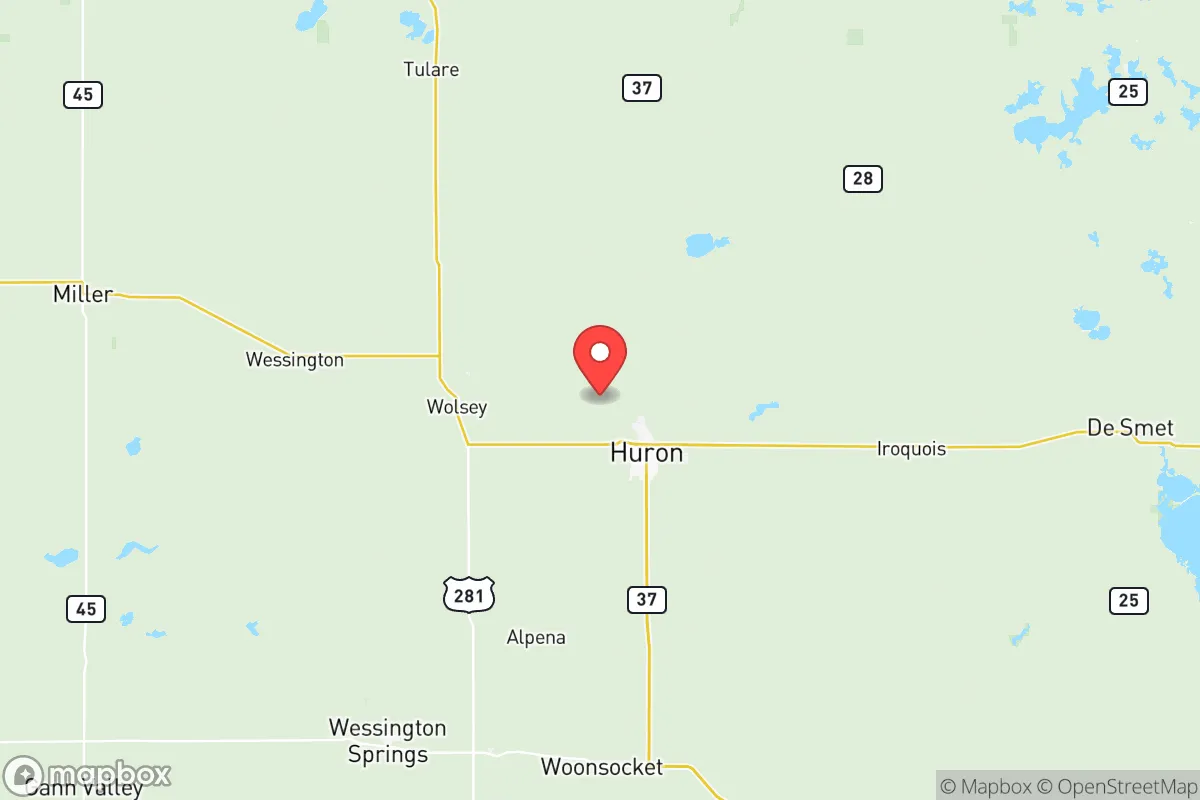
Beadle County sits in the heart of South Dakota's James River Valley, a region defined by flat to gently rolling plains that support intensive agriculture. The county's roughly 1,260 square miles contain a population of just over 19,000, with nearly 14,000 residents in Huron itself. This low density is a primary resilience asset: it reduces competition for resources during disruptions and limits the spread of cascading failures common in dense urban areas. The James River, which flows north-south through the county, provides a reliable surface water source, though its flow is modest compared to the Missouri River system 100 miles to the west. The county's position roughly 120 miles from Sioux Falls and 150 miles from Fargo places it outside the immediate fallout zones of those larger cities, while still allowing access to their medical and supply networks under normal conditions. The local climate—cold, dry winters and warm summers—reduces the risk of hurricane, earthquake, or wildfire, with the primary natural hazards being blizzards, drought, and occasional tornadoes. The flat terrain simplifies transportation and construction, but offers minimal natural cover or defensible terrain, a factor to weigh for those prioritizing security.
Risks, exposures, and proximity to fallout-relevant landmarks
Beadle County's primary risk profile centers on its agricultural economy and limited industrial diversification, rather than proximity to high-value strategic targets. The county contains no major military bases, refineries, or ports. The nearest significant military installation is Ellsworth Air Force Base near Rapid City, roughly 250 miles west, which houses B-1B bombers—a potential target in a conflict scenario, but far enough to avoid direct fallout effects. The closest nuclear power plant is the Fort Calhoun Station in Nebraska, over 200 miles southeast, well outside the typical severe accident plume zone. More relevant to a relocator's calculus is the county's position relative to the nation's critical infrastructure. The major rail lines and Interstate 90 corridor that pass through Huron could become chokepoints or targets in a widespread disruption, but the county itself is not a primary node. The James River's floodplain presents localized risks: the 2011 Missouri River floods caused significant agricultural damage in the region, though Huron itself remained largely dry. Tornado risk is real but statistically moderate—South Dakota averages 30 tornadoes annually, with Beadle County seeing one every few years. The greater concern for long-term resilience is economic: the county's reliance on agriculture (corn, soybeans, cattle) and the Dakotaland Manufacturing plant in Huron means vulnerability to commodity price swings and supply chain disruptions. For a relocator, the absence of high-value targets is a net positive, but the lack of economic diversification means local recovery capacity after a major event would depend heavily on state and federal support.
Practical resilience for a relocator: food, water, energy, and defensibility
Beadle County's practical resilience strengths are rooted in its agricultural abundance and low population pressure. The county is part of one of the most productive agricultural regions in the world, with local food production far exceeding local consumption. Huron's Farmers Market and the county's network of grain elevators and livestock operations mean fresh food access is realistic even during supply chain interruptions. Water availability is adequate but not unlimited: the James River provides a surface source, but most rural residents rely on groundwater from the Dakota Aquifer, which has good quality but requires proper well depth and maintenance. The city of Huron's water treatment plant draws from the James River and serves the urban core; rural properties typically need private wells. Energy infrastructure is stable: the county is served by Northwestern Energy and several rural electric cooperatives, with power primarily from coal and natural gas plants in the region. Solar potential is moderate—South Dakota averages 4.5 peak sun hours per day—and wind resources are excellent, with the county hosting several commercial wind farms. For a relocator seeking energy independence, a small wind turbine paired with solar panels and battery storage is a viable option. Defensibility is the county's weakest resilience attribute. The flat, open terrain offers little natural cover or chokepoints for security. Rural properties are spaced far apart, which reduces the risk of opportunistic crime but also means neighbors are distant for mutual aid. Huron's police department and the Beadle County Sheriff's Office provide law enforcement, but response times in remote areas can exceed 20 minutes. For those prioritizing security, a property with a good line of sight to approach routes and a reinforced structure is advisable. The county's strong sense of community and low crime rate (violent crime in Huron is roughly half the national average) partially offset the terrain disadvantage, as social cohesion is a proven resilience multiplier in disasters.
The overall strategic picture for Beadle County is one of moderate resilience with clear trade-offs. Its geographic isolation from major targets and industrial corridors is a genuine advantage for those concerned about man-made disasters, while its agricultural base provides a food security buffer that few urban-adjacent counties can match. The trade-offs are real: limited economic diversification, flat terrain that complicates security, and exposure to prairie weather extremes. For a single individual or family willing to invest in well water, backup power, and a defensible property layout, Beadle County offers a stable, low-stress environment that can weather most disruptions without the chaos of a major city. It is not a bug-out location for a doomsday scenario, but a solid, livable base for those who want to be prepared without living in constant alert. The county's trajectory—slow population decline, steady agricultural output, and modest economic growth—suggests it will remain a quiet, resilient corner of the Plains for the foreseeable future. For the right relocator, that is precisely the point.

* Values derived from national, state, county, city and local statistics and may differ in a specific area. Last updated: 2026-07-30T12:12:42.000Z
Narrative content on this page is AI-generated and may contain mistakes. Verify any details that matter before acting on them.
ReloMaps may earn a commission from affiliate links at no extra cost to you.

