 Popular
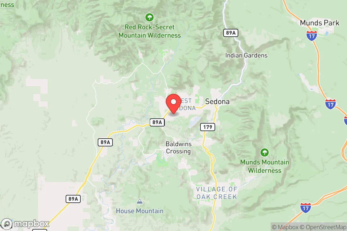
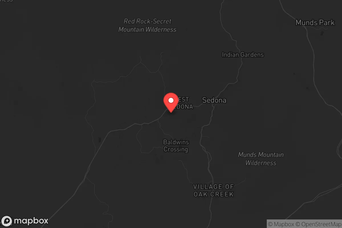
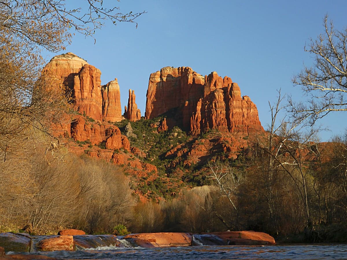
Photo: Wikipedia
Strategic Assessment of Sedona, AZ
Meaningful friction. Expect exposure to either population pressure, blast zones, or natural disaster risk. Consider buying a retreat property.
What does the Strategic Assessment tell us?
Our Strategic Assessment grades tactical survivability of an area. Major population centers, military targets, fallout zones, natural disasters, and border exposure all drive risk — lower exposure means a more defensible position in a crisis.
This is heavily inspired by Joel Skousen's Strategic Relocation book. Highly recommended you checkout the book ($)What does this tell us?
Our Strategic Assessment grades tactical survivability of an area. Major population centers, military targets, fallout zones, natural disasters, and border exposure all drive risk — lower exposure means a more defensible position in a crisis.
This is heavily inspired by Joel Skousen's Strategic Relocation book. Highly recommended you checkout the book ($)Strategic Pillars

Key Distances
Regional Safe Places
Below is our recommended "safe zones" in Arizona and the surrounding area based on our strategic heuristics. For most people, it's unrealistic to live in a “safe zone” full-time due to work, family or other personal reasons. They tend to be more rural. However, many of these areas are perfect for second homes and retreat properties that double as a vacation home or even a short-term rental.
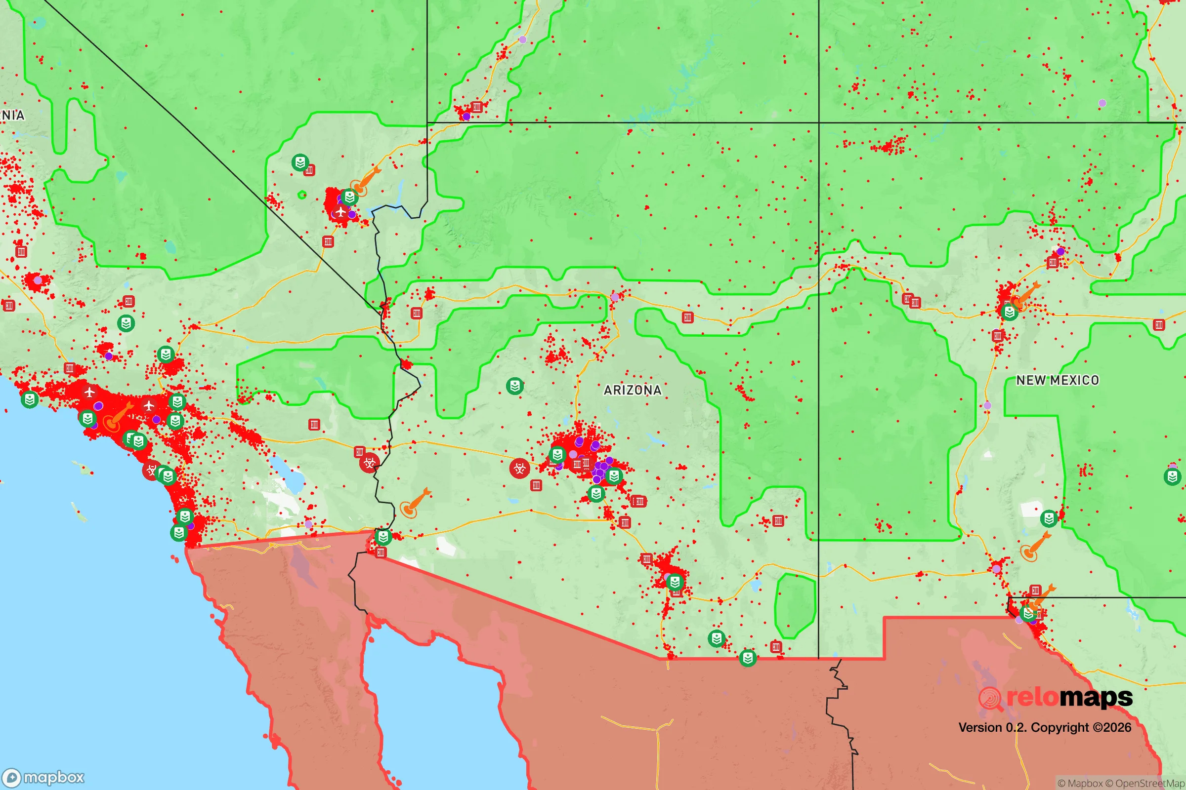
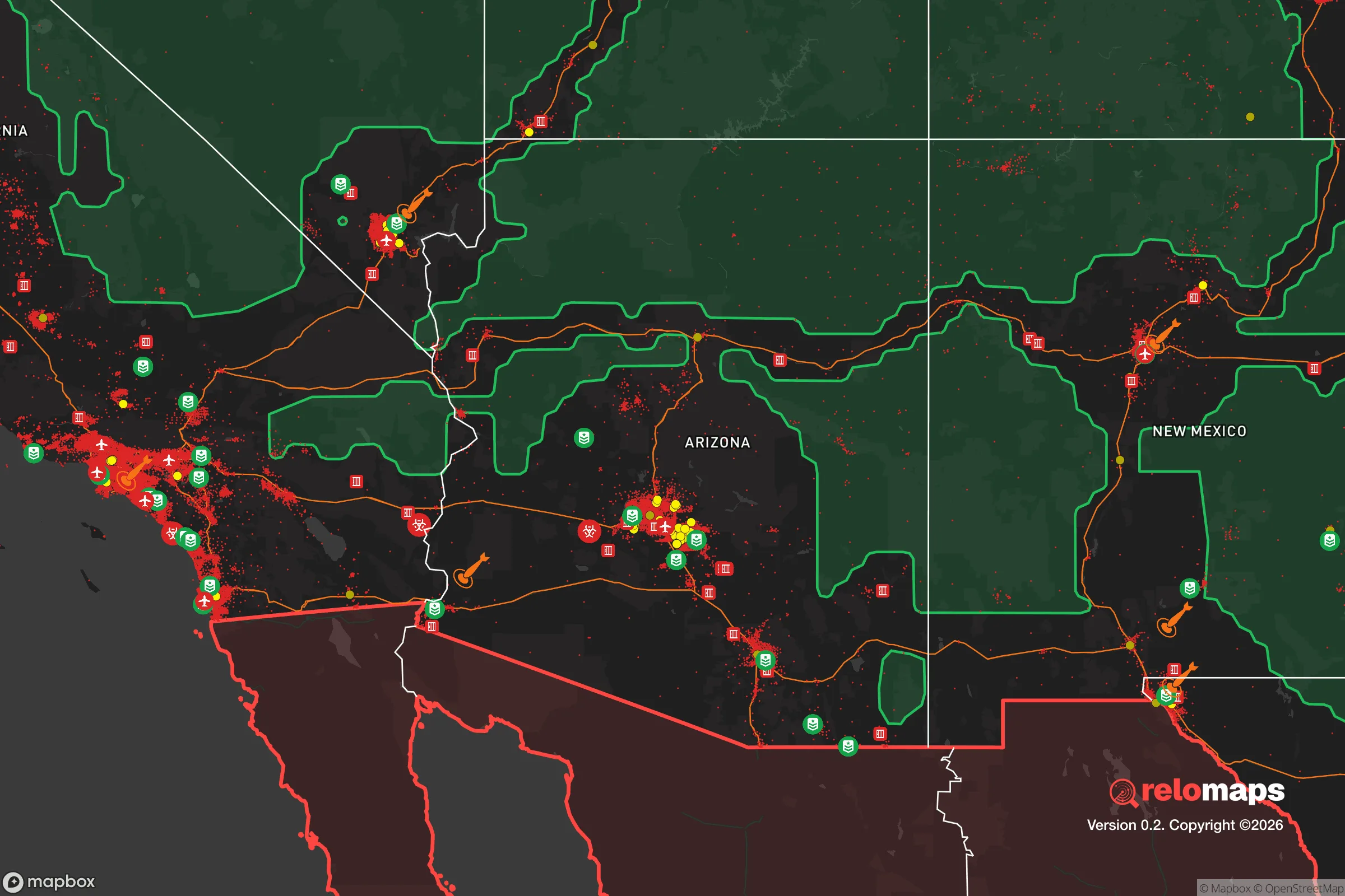
Important Note: For informational purposes only. This does not mean nothing bad ever happens in the green zones. Please use common sense. This is based on public data and modeled with AI. We tried to take a conservative approach but mistakes happen. We update this regularly as new information becomes available.
Solar Generator Recommendations
Backup power matters more here than in safer locations. We've picked three solar generators across budgets and capacity tiers — start with the budget unit if you only need a few essentials, or step up if you want to run a fridge and HVAC for days at a time.

Jackery Portable Power Station Explorer 300
Budget OptionPower on the Go: Weighing only 11 lbs, it's convenient to set up and store with book-sized foldable solar panels

BLUETTI Portable Power Station AC180
Designed for both indoor and outdoor scenarios, AC180 is highly capable as it has a robost capacity and continuous output power.

EF ECOFLOW DELTA Pro Ultra Power Station
Upgraded PickEcoFlow DELTA Pro Ultra is a whole-home energy system designed to grow with your family. Integrated with the Smart Home Panel 2, it scales to meet your evolving energy needs — keeping your home powered, intelligent, and secure through every stage of life.
We earn a commission, at no additional cost to you.
Strategic Assessment Analysis
Sedona, Arizona, offers a compelling but nuanced strategic relocation option for those prioritizing resilience, offering a unique blend of natural fortress-like geography and significant proximity risks that demand careful consideration. Its location in the Verde Valley, surrounded by the Coconino and Prescott National Forests, provides a degree of natural isolation from the sprawling urban corridors of Phoenix and Flagstaff, yet it remains within a two-hour drive of both, creating a critical tension between accessibility and security. For the conservative-minded prepper, Sedona’s red-rock landscape is both a defensive asset and a potential liability, requiring a clear-eyed assessment of its strengths and weaknesses in a world of increasing uncertainty.
Geographic position and natural defensive advantages
Sedona’s primary strategic value lies in its topography. The city sits at roughly 4,500 feet elevation, nestled in a canyon system that funnels access through a limited number of roads—primarily State Route 89A and Interstate 17 to the south. This natural chokepoint creates a defensible position: any large-scale movement of people or vehicles into the area can be monitored and, if necessary, controlled. The surrounding Mogollon Rim and high desert plateaus offer excellent vantage points and natural barriers against overland approach. For a relocator, this means that in a scenario of widespread civil unrest or grid-down events, Sedona’s geography inherently slows and complicates the movement of potential threats. The area’s elevation also provides a moderate climate, avoiding the extreme summer heat of Phoenix (which can exceed 115°F) and the deep winter snows of Flagstaff, making it more survivable without modern HVAC. Water is a more complex story—the Verde River and Oak Creek run through the valley, providing surface water sources, but these are finite and shared with downstream communities. The region’s natural beauty also serves as a psychological buffer, offering a sense of remoteness that can be critical for maintaining morale during prolonged disruptions.
Risks, exposures, and proximity to fallout-relevant landmarks
The most significant strategic drawback is Sedona’s proximity to high-value, high-risk targets. Phoenix, a major metropolitan area of over 4.5 million people, lies just 120 miles south—a two-hour drive under normal conditions, but a potential funnel of displaced populations during a crisis. Flagstaff, 30 miles north, is home to Northern Arizona University and serves as a regional transportation hub along I-40, a major east-west interstate that could become a corridor for mass movement. Sedona itself is a world-renowned tourist destination, drawing over 3 million visitors annually, which means that in a sudden emergency, the local population could swell unpredictably with transient outsiders, straining already limited resources. The area also sits within 200 miles of Luke Air Force Base (west of Phoenix) and Davis-Monthan Air Force Base (Tucson), both potential targets in a conflict scenario. While Sedona is not directly downwind of any major nuclear facilities, the prevailing winds from the southwest could carry fallout from a strike on Phoenix or Tucson. The region is also seismically active—the Verde Valley sits near the Mogollon Rim fault line—and while major earthquakes are rare, the area is prone to flash flooding and wildfires, which can cut off access routes for days at a time. For the prepper, these exposures mean that Sedona is not a remote bunker but a semi-exposed outpost that requires active planning for evacuation or shelter-in-place contingencies.
Practical resilience for a relocator: food, water, energy, and defensibility
For a relocator serious about self-sufficiency, Sedona presents a mixed picture. Water is the single most critical factor: the Verde River and Oak Creek provide year-round surface flow, but the city’s municipal water supply is heavily dependent on groundwater and the Verde River system, which is already over-allocated. A well on private property is a must for any long-term resilience plan, but drilling depths can exceed 500 feet in some areas, and permits are regulated by the Arizona Department of Water Resources. Rainwater harvesting is legal and encouraged, but annual precipitation averages only 18 inches, making it a supplementary source at best. Food production is limited by the rocky, alkaline soil and short growing season (roughly April to October), though raised beds and greenhouses can extend it. The local farmers’ market and a handful of small-scale growers exist, but the area is not a breadbasket—most food is trucked in from Phoenix or California. Energy resilience is more promising: Sedona averages over 260 sunny days per year, making solar power highly viable, and net metering policies with Arizona Public Service (APS) allow for grid-tied systems. Off-grid solar with battery storage is practical for a well-insulated home, but the area’s frequent summer monsoon storms can knock out power for hours to days. Defensibility is a double-edged sword: the limited road access works both ways, making it easy to block entry but also easy to become trapped if those roads are compromised. A property with a good view of the main approaches (e.g., on a mesa or ridge) is ideal, but such properties are expensive and often subject to strict building codes due to the scenic area designation. For a single individual or family, the key is to secure a location with its own water source, solar capability, and a defensible perimeter—preferably outside the city limits, where zoning is less restrictive and neighbors are farther apart.
The overall strategic picture for Sedona is one of calculated trade-offs. It offers a stunning natural fortress with defensible terrain, moderate climate, and solar energy potential, but it sits uncomfortably close to major population centers and critical infrastructure targets. For the conservative prepper who values self-reliance and is willing to invest in a well, solar system, and food storage, Sedona can be a viable base of operations—provided they are prepared for the reality that it is not a true remote retreat. The tourist economy means that in a crisis, the area could become a magnet for unprepared refugees, and the limited road network could turn into a bottleneck. If you are looking for a place that balances natural beauty with a reasonable chance of riding out a regional disruption, Sedona deserves a spot on your shortlist—but only if you secure a property with independent water and energy, and maintain a low profile. For those seeking absolute isolation and minimal exposure to fallout risks, the more remote areas of northern Arizona (e.g., the White Mountains or the Arizona Strip) may be better suited. Sedona is a strategic compromise: a beautiful, defensible outpost that requires constant vigilance and serious preparation to realize its potential as a resilience hub.
* Values derived from national, state, county, city and local statistics and may differ in a specific area. Last updated: 2026-05-14T18:03:46.000Z
Narrative content on this page is AI-generated and may contain mistakes. Verify any details that matter before acting on them.
ReloMaps may earn a commission from affiliate links at no extra cost to you.