Photo: Wikipedia
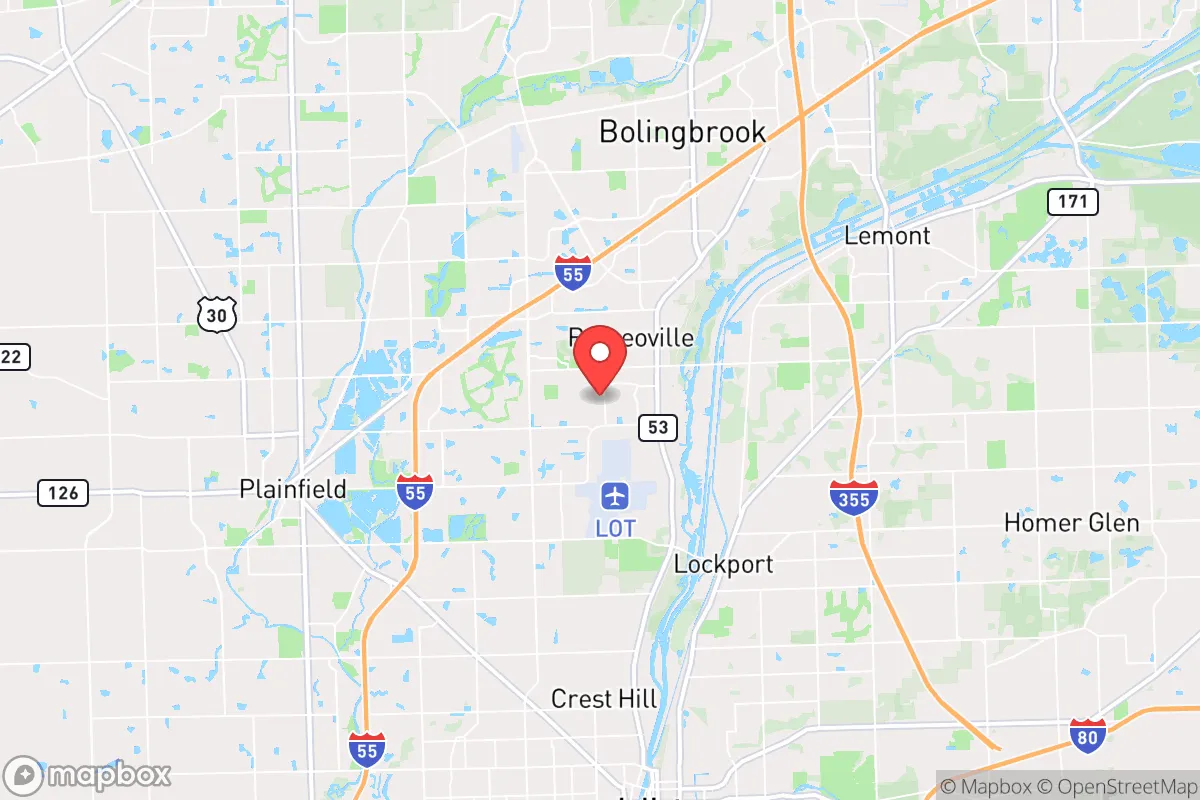
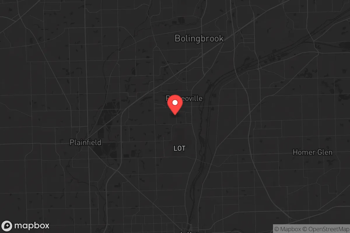
Strategic Assessment of Romeoville, IL
Multiple tactical vulnerabilities. Population density, target proximity, or disaster risk are likely compounding. A retreat property and exit planning is required.
What does the Strategic Assessment tell us?
Our Strategic Assessment grades tactical survivability of an area. Major population centers, military targets, fallout zones, natural disasters, and border exposure all drive risk — lower exposure means a more defensible position in a crisis.
This is heavily inspired by Joel Skousen's Strategic Relocation book. Highly recommended you checkout the book ($)What does this tell us?
Our Strategic Assessment grades tactical survivability of an area. Major population centers, military targets, fallout zones, natural disasters, and border exposure all drive risk — lower exposure means a more defensible position in a crisis.
This is heavily inspired by Joel Skousen's Strategic Relocation book. Highly recommended you checkout the book ($)Strategic Pillars

Key Distances
Regional Safe Places
Below is our recommended "safe zones" in Illinois and the surrounding area based on our strategic heuristics. For most people, it's unrealistic to live in a “safe zone” full-time due to work, family or other personal reasons. They tend to be more rural. However, many of these areas are perfect for second homes and retreat properties that double as a vacation home or even a short-term rental.
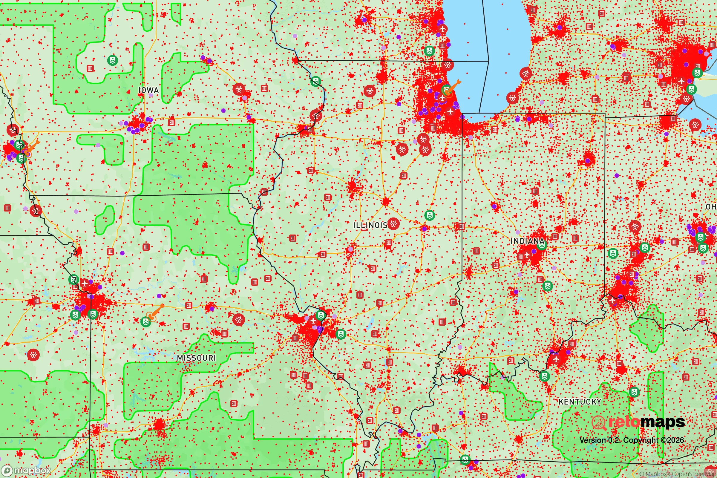
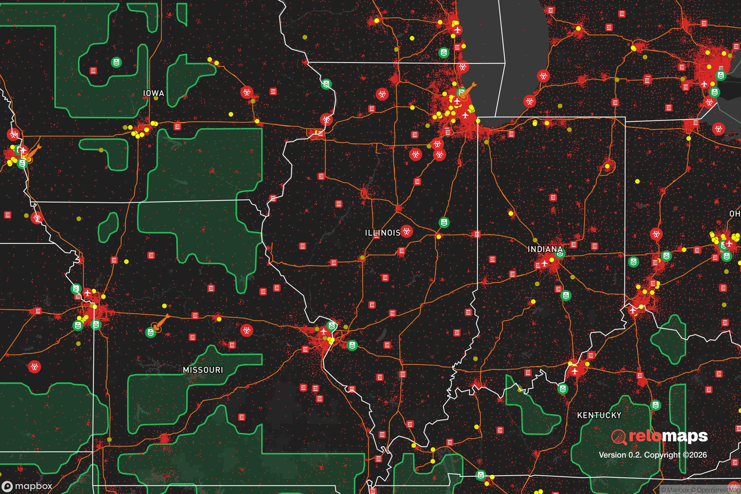
Important Note: For informational purposes only. This does not mean nothing bad ever happens in the green zones. Please use common sense. This is based on public data and modeled with AI. We tried to take a conservative approach but mistakes happen. We update this regularly as new information becomes available.
Solar Generator Recommendations
Backup power matters more here than in safer locations. We've picked three solar generators across budgets and capacity tiers — start with the budget unit if you only need a few essentials, or step up if you want to run a fridge and HVAC for days at a time.

Jackery Portable Power Station Explorer 300
Budget OptionPower on the Go: Weighing only 11 lbs, it's convenient to set up and store with book-sized foldable solar panels

BLUETTI Portable Power Station AC180
Designed for both indoor and outdoor scenarios, AC180 is highly capable as it has a robost capacity and continuous output power.

EF ECOFLOW DELTA Pro Ultra Power Station
Upgraded PickEcoFlow DELTA Pro Ultra is a whole-home energy system designed to grow with your family. Integrated with the Smart Home Panel 2, it scales to meet your evolving energy needs — keeping your home powered, intelligent, and secure through every stage of life.
We earn a commission, at no additional cost to you.
Strategic Assessment Analysis
Romeoville, Illinois, sits in a precarious strategic position that demands careful consideration for anyone prioritizing long-term resilience and self-sufficiency. Located roughly 30 miles southwest of Chicago, this Will County village of approximately 40,000 residents offers a mix of suburban infrastructure and industrial logistics that could be either an asset or a liability depending on the nature of a crisis. For the conservative-minded prepper or survivalist, Romeoville presents a location that is neither deep rural sanctuary nor dense urban kill zone, but rather a transitional zone with specific trade-offs in security, resource access, and exposure to fallout risks.
Geographic position and natural advantages for long-term survival
Romeoville's location along the Des Plaines River and its proximity to the I-55 and I-80 corridors provide both transportation advantages and natural resource access. The Des Plaines River Valley offers some natural terrain variation in an otherwise flat region, with wooded areas along the river that could serve as cover or emergency foraging zones. The village sits within the broader Chicago metropolitan area but maintains a distinct suburban character, with roughly 15% of its land area classified as parks or open space. The nearby Isle a la Cache Museum and Preserve offers 80 acres of floodplain forest and wetlands that could provide emergency water filtration and wildlife habitat. However, the region's flat topography and dense suburban development pattern mean that natural defensible positions are limited. The area's average elevation of just 590 feet above sea level offers no high-ground advantage, and the river valley's floodplain status means low-lying areas near the Des Plaines are vulnerable to flooding during heavy rain events—a concern for anyone storing supplies in basements or low-lying structures.
Risks, exposures, and proximity to fallout-relevant landmarks
The most significant strategic liability for Romeoville is its proximity to multiple high-value targets that could become fallout zones during a major conflict or terrorist event. The village lies within 15 miles of the Argonne National Laboratory in Lemont, a major nuclear research facility that would be a primary target in any strategic strike scenario. Additionally, the Joliet Army Ammunition Plant, located just 10 miles south, represents another high-risk industrial target. The I-55 and I-80 interchange, a major logistics hub, would likely become a chokepoint during any evacuation or civil unrest scenario, potentially trapping residents trying to flee south or west. Romeoville also sits within the primary fallout plume zone for any ground burst targeting downtown Chicago, with prevailing westerly winds potentially carrying radioactive debris directly over the village. The nearby ExxonMobil Joliet Refinery, one of the largest in the Midwest, presents a secondary risk of industrial accident or targeted attack that could release toxic chemicals across the area. For the prepper, these overlapping risk vectors mean that any long-term survival plan must account for the possibility of rapid, unplanned evacuation or extended shelter-in-place with heavy filtration.
Practical resilience for a relocator: food, water, energy, and defensibility
Romeoville's suburban infrastructure offers some practical advantages for the prepared individual, but also significant vulnerabilities. The village's water supply comes from the Joliet Waterworks system, drawing from the Kankakee River and Lake Michigan via deep tunnels—a centralized system that would be vulnerable to contamination or disruption. However, the Des Plaines River provides a surface water source for emergency filtration, though it carries industrial runoff from upstream communities. The area's average annual rainfall of 37 inches supports rainwater catchment systems, and the relatively flat terrain makes solar panel installation straightforward for off-grid energy. Food resilience is mixed: while the surrounding Will County farmland produces corn and soybeans, local grocery stores would empty within 48 hours of any crisis, and the village's dense suburban layout means most residents lack space for significant food production. Community gardens exist but are small-scale. Defensibility is a major concern—Romeoville's grid-like street pattern and lack of natural barriers make it difficult to secure a perimeter. The village's police force of roughly 60 officers would be overwhelmed in any widespread civil unrest scenario, and the proximity to Chicago means that urban refugees would likely flow through the area during any evacuation. For the relocator, the practical recommendation is to treat Romeoville as a transitional location rather than a final retreat—a place to stage supplies and maintain a low profile while developing a more defensible rural property further west or south.
The overall strategic picture for Romeoville is one of calculated risk with limited upside for the serious prepper. Its location offers access to regional infrastructure and some natural resources, but the concentration of high-value targets within a 20-mile radius creates unacceptable exposure for anyone prioritizing long-term survival over convenience. The village's suburban character provides a degree of anonymity and community support that could be valuable during slow-moving crises, but the lack of defensible terrain, centralized water dependency, and proximity to potential fallout zones make it a poor choice for a permanent retreat. For the conservative-minded relocator, Romeoville might serve as a temporary base for building skills and networks before moving to a more secure location in southern Illinois or the Missouri Ozarks, but it should not be viewed as a final destination for those serious about weathering the coming storms. The prudent approach is to treat this area as a waypoint—not a home.
* Values derived from national, state, county, city and local statistics and may differ in a specific area. Last updated: 2026-04-30T02:37:14.000Z
Narrative content on this page is AI-generated and may contain mistakes. Verify any details that matter before acting on them.
ReloMaps may earn a commission from affiliate links at no extra cost to you.