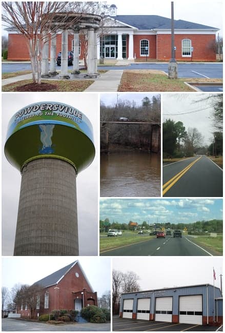
Photo: Wikipedia
Strategic Assessment of Powdersville, SC
Workable tactical position. Some exposure to population density or targets, but generally defensible in a crisis.
What does the Strategic Assessment tell us?
Our Strategic Assessment grades tactical survivability of an area. Major population centers, military targets, fallout zones, natural disasters, and border exposure all drive risk — lower exposure means a more defensible position in a crisis.
This is heavily inspired by Joel Skousen's Strategic Relocation book. Highly recommended you checkout the book ($)What does this tell us?
Our Strategic Assessment grades tactical survivability of an area. Major population centers, military targets, fallout zones, natural disasters, and border exposure all drive risk — lower exposure means a more defensible position in a crisis.
This is heavily inspired by Joel Skousen's Strategic Relocation book. Highly recommended you checkout the book ($)Strategic Pillars

Key Distances
Regional Safe Places
Below is our recommended "safe zones" in South Carolina and the surrounding area based on our strategic heuristics. For most people, it's unrealistic to live in a “safe zone” full-time due to work, family or other personal reasons. They tend to be more rural. However, many of these areas are perfect for second homes and retreat properties that double as a vacation home or even a short-term rental.
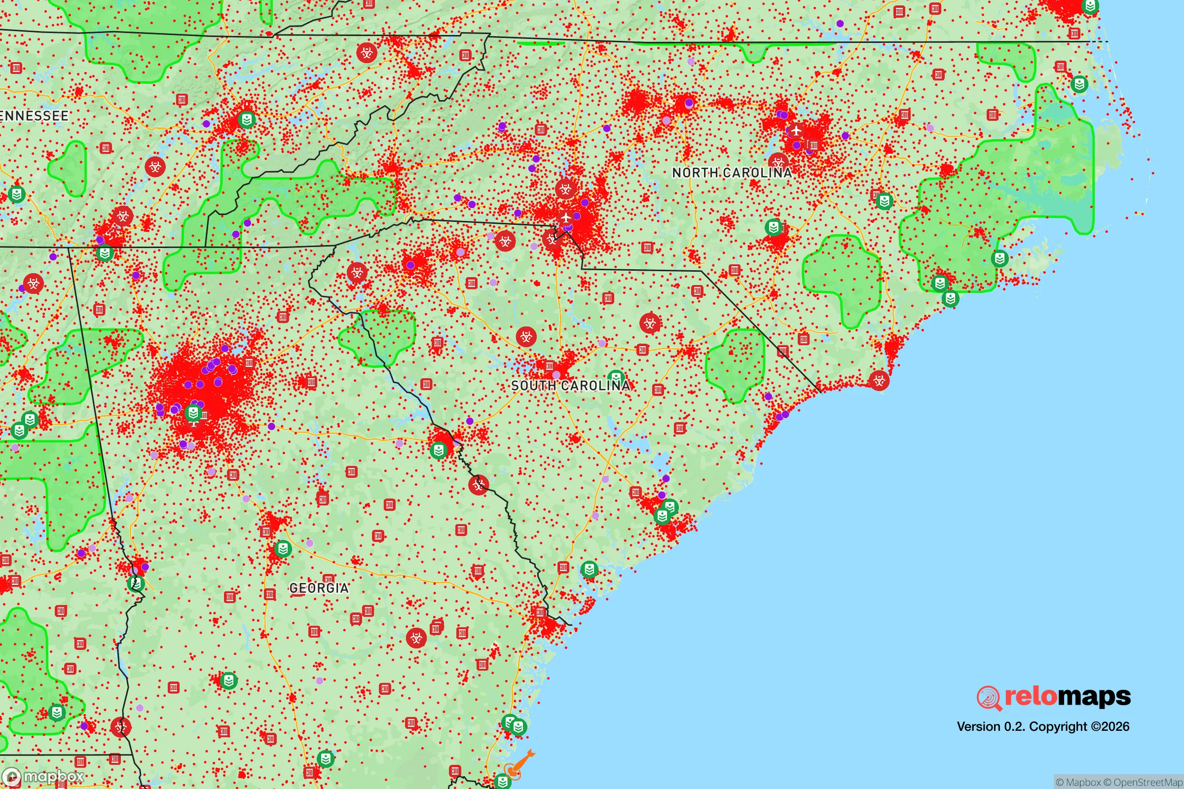
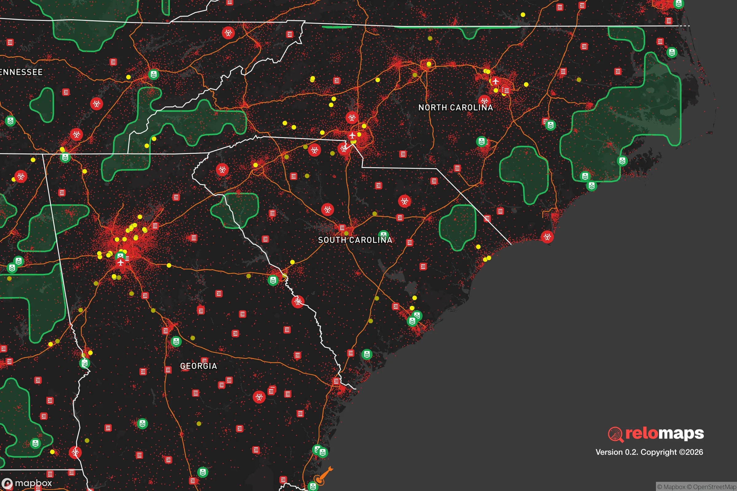


Important Note: For informational purposes only. This does not mean nothing bad ever happens in the green zones. Please use common sense. This is based on public data and modeled with AI. We tried to take a conservative approach but mistakes happen. We update this regularly as new information becomes available.
Solar Generator Recommendations
Backup power matters more here than in safer locations. We've picked three solar generators across budgets and capacity tiers — start with the budget unit if you only need a few essentials, or step up if you want to run a fridge and HVAC for days at a time.

Jackery Portable Power Station Explorer 300
Budget OptionPower on the Go: Weighing only 11 lbs, it's convenient to set up and store with book-sized foldable solar panels

BLUETTI Portable Power Station AC180
Designed for both indoor and outdoor scenarios, AC180 is highly capable as it has a robost capacity and continuous output power.

EF ECOFLOW DELTA Pro Ultra Power Station
Upgraded PickEcoFlow DELTA Pro Ultra is a whole-home energy system designed to grow with your family. Integrated with the Smart Home Panel 2, it scales to meet your evolving energy needs — keeping your home powered, intelligent, and secure through every stage of life.
We earn a commission, at no additional cost to you.
Strategic Assessment Analysis
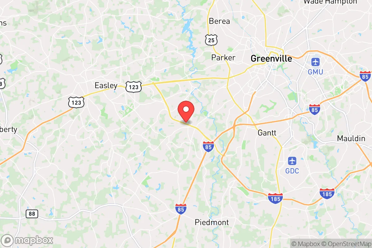
Powdersville, South Carolina, occupies a strategic middle ground that appeals to relocation-minded individuals and families who value both access and buffer. Situated in Anderson County along the I-85 corridor, this unincorporated community sits roughly 15 miles from Greenville and 30 miles from the Spartanburg-Anderson metropolitan complex, yet retains a distinctly rural, low-density character. For a reader weighing disaster readiness and self-sufficiency, Powdersville offers a blend of proximity to regional resources and a physical separation from the densest population centers—a combination that can be leveraged for resilience, provided one understands the specific trade-offs involved.
Geographic position and natural advantages for self-sufficiency
Powdersville’s location in the Piedmont region of upstate South Carolina gives it several inherent advantages. The area sits on rolling, well-drained terrain at an elevation of roughly 800–900 feet, which reduces flood risk compared to coastal or river-bottom communities. The nearby Saluda River and Lake Hartwell—about 10 miles to the west—provide reliable surface water sources, while the region’s moderate rainfall (averaging 50 inches annually) supports private wells and rainwater catchment systems. The climate is temperate, with mild winters and long growing seasons (roughly 220 frost-free days), making year-round food production feasible for those with land. Soils in the area are primarily sandy loam and clay loam, which, while not ideal for intensive row cropping without amendment, support orchards, vineyards, and pasture for small livestock. The surrounding topography offers natural defensibility: the area is not a major transportation choke point, and its network of secondary roads and rural lanes provides multiple egress routes away from the I-85 corridor if that artery becomes compromised. For a relocator prioritizing self-sufficiency, Powdersville’s combination of water access, arable land, and moderate climate is a solid foundation.
Risks, exposures, and proximity to fallout-relevant landmarks
No strategic assessment is complete without acknowledging the liabilities. Powdersville’s primary risk exposure comes from its position within the broader Greenville-Spartanburg-Anderson metropolitan region, a population center of roughly 1.5 million people. In a major disruption—whether natural disaster, grid failure, or civil unrest—the I-85 corridor could become a liability rather than an asset. The area is within 30 miles of the Savannah River Site (SRS), a nuclear reservation that handles tritium and plutonium processing. While SRS has a strong safety record, its presence means that a major incident there could affect downwind areas, including Powdersville, depending on weather patterns. Additionally, the nearby Greenville-Spartanburg International Airport (GSP) and the rail lines running parallel to I-85 are potential targets or chokepoints in a conflict scenario. Natural disaster risks are moderate: the region lies inland enough to avoid direct hurricane storm surge, but tropical systems can bring heavy rain and flooding, as seen with Hurricane Helene in 2024, which caused localized power outages and tree damage. Tornado risk is present but not extreme—Anderson County averages 1–2 tornadoes per year, typically EF-0 or EF-1. Earthquake risk is low, as the area is far from active fault lines. The net assessment: Powdersville is not a high-risk location, but its proximity to regional infrastructure and a nuclear facility means a relocator should have a plan for evacuation or sheltering-in-place, particularly if wind patterns shift during an SRS incident.
Practical resilience for a relocator: food, water, energy, and defensibility
For a family or individual serious about self-sufficiency, Powdersville offers a workable baseline that requires active investment to reach full resilience. Water is the strongest asset: the area’s groundwater is generally good quality, and many rural properties already have private wells. The Saluda River and Lake Hartwell provide backup surface water, though treatment would be necessary for drinking. Rainwater harvesting is practical given the annual precipitation. Food production is viable but not effortless. The growing season supports warm-season crops (tomatoes, peppers, squash) and cool-season staples (kale, carrots, potatoes). Local soil benefits from composting and raised beds. The area has a strong agricultural heritage—Anderson County is home to numerous small farms, livestock operations, and farmers’ markets—meaning seeds, livestock feed, and farming knowledge are locally available. For those without land, community garden plots exist but are limited; a relocator should plan to secure at least 1–2 acres for meaningful food production. Energy resilience is a mixed picture. Duke Energy provides grid power, and outages are common during thunderstorms and winter ice storms, typically lasting 2–6 hours but occasionally extending to 24–48 hours after major events. Solar potential is good—the region averages 4.5 peak sun hours per day—and net metering is available through Duke Energy, though interconnection can be slow. Propane and wood are common backup fuels for heating and cooking. Defensibility is moderate. Powdersville’s rural character means properties are often spaced apart, with natural sightlines and limited through-traffic. However, the area is not gated or patrolled; security depends on neighbor networks and personal measures. The local sheriff’s office (Anderson County) has a visible presence but response times in rural areas can be 15–30 minutes. For a relocator, the practical takeaway is that Powdersville provides the raw ingredients for resilience—water, land, climate—but turning them into a self-sufficient homestead requires planning, capital, and community integration.
The overall strategic picture for Powdersville is one of moderate, achievable resilience with clear trade-offs. It is not a remote bunker location, nor is it a high-risk urban center. For a relocator who wants to be within an hour of medical centers, supply chains, and employment hubs while maintaining a rural lifestyle with self-sufficiency potential, Powdersville ranks favorably. The key vulnerabilities—proximity to I-85, the Savannah River Site, and regional population density—are manageable with awareness and preparation. A family that secures a well, installs solar with battery backup, establishes a garden and small livestock operation, and builds relationships with neighbors will find Powdersville a defensible, productive base. For those unwilling to make those investments, the area offers little inherent protection beyond its low crime rate and rural spacing. In short: Powdersville is a solid choice for the prepared relocator, but it rewards effort and punishes complacency.

* Values derived from national, state, county, city and local statistics and may differ in a specific area. Last updated: 2026-08-11T13:03:14.000Z
Narrative content on this page is AI-generated and may contain mistakes. Verify any details that matter before acting on them.
ReloMaps may earn a commission from affiliate links at no extra cost to you.

