Photo: Wikipedia
Strategic Assessment of Poolesville, MD
Multiple tactical vulnerabilities. Population density, target proximity, or disaster risk are likely compounding. A retreat property and exit planning is required.
What does the Strategic Assessment tell us?
Our Strategic Assessment grades tactical survivability of an area. Major population centers, military targets, fallout zones, natural disasters, and border exposure all drive risk — lower exposure means a more defensible position in a crisis.
This is heavily inspired by Joel Skousen's Strategic Relocation book. Highly recommended you checkout the book ($)What does this tell us?
Our Strategic Assessment grades tactical survivability of an area. Major population centers, military targets, fallout zones, natural disasters, and border exposure all drive risk — lower exposure means a more defensible position in a crisis.
This is heavily inspired by Joel Skousen's Strategic Relocation book. Highly recommended you checkout the book ($)Strategic Pillars

Key Distances
Regional Safe Places
Below is our recommended "safe zones" in Maryland and the surrounding area based on our strategic heuristics. For most people, it's unrealistic to live in a “safe zone” full-time due to work, family or other personal reasons. They tend to be more rural. However, many of these areas are perfect for second homes and retreat properties that double as a vacation home or even a short-term rental.


Important Note: For informational purposes only. This does not mean nothing bad ever happens in the green zones. Please use common sense. This is based on public data and modeled with AI. We tried to take a conservative approach but mistakes happen. We update this regularly as new information becomes available.
Solar Generator Recommendations
Backup power matters more here than in safer locations. We've picked three solar generators across budgets and capacity tiers — start with the budget unit if you only need a few essentials, or step up if you want to run a fridge and HVAC for days at a time.

Jackery Portable Power Station Explorer 300
Budget OptionPower on the Go: Weighing only 11 lbs, it's convenient to set up and store with book-sized foldable solar panels

BLUETTI Portable Power Station AC180
Designed for both indoor and outdoor scenarios, AC180 is highly capable as it has a robost capacity and continuous output power.

EF ECOFLOW DELTA Pro Ultra Power Station
Upgraded PickEcoFlow DELTA Pro Ultra is a whole-home energy system designed to grow with your family. Integrated with the Smart Home Panel 2, it scales to meet your evolving energy needs — keeping your home powered, intelligent, and secure through every stage of life.
We earn a commission, at no additional cost to you.
Strategic Assessment Analysis
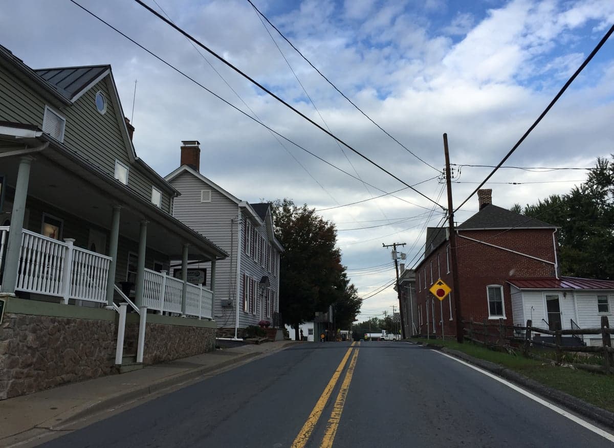
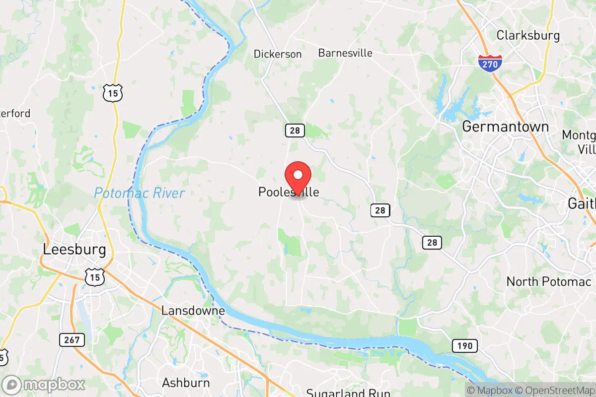
Poolesville, Maryland, sits in a unique strategic pocket that most relocation analyses overlook. Located in far western Montgomery County, this town of roughly 5,700 residents offers a rare combination: proximity to the nation’s capital for work or influence, yet enough physical and cultural distance to function as a genuine retreat when things go sideways. Its position along the Potomac River, surrounded by agricultural reserves and conservation land, creates a buffer zone that few suburbs within 50 miles of D.C. can claim. For someone thinking in terms of long-term resilience—civic unrest, supply chain disruptions, or larger-scale societal fractures—Poolesville presents a defensible, low-profile base with real advantages, provided you understand its limitations.
Geographic position and natural advantages for long-term security
Poolesville’s geography is its strongest card. The town sits on a plateau above the Potomac River, roughly 35 miles northwest of Washington, D.C., but the drive feels like 100 miles. The surrounding area is dominated by the Agricultural Reserve, a 93,000-acre swath of permanently preserved farmland and forest that limits dense development and creates a natural buffer against urban sprawl. To the west, the Potomac River and the C&O Canal National Historical Park form a hard boundary—difficult to cross without a bridge, which means any approach from Virginia is funneled through a handful of choke points. To the north and east, rolling hills and rural roads with limited through-traffic make the area inherently harder to navigate for anyone unfamiliar with the terrain. This is not a place that gets accidentally overrun. The local water supply is groundwater-based, with many homes on private wells, and the Potomac provides a massive, renewable water source for those with the means to access it. The agricultural land means local food production is not just theoretical—there are working farms, CSAs, and livestock operations within a 10-minute drive. For a prepper or survivalist, this is the kind of geography that buys time and options.
Risks, exposures, and proximity to fallout-relevant landmarks
No location is a fortress, and Poolesville has real vulnerabilities that must be weighed. The most obvious is its proximity to Washington, D.C., and the National Capital Region—a primary target for any state-level adversary or domestic disruption scenario. While Poolesville is far enough to avoid the immediate blast zone of a nuclear detonation in D.C., it sits within the downwind fallout pattern for prevailing winds from the south and southwest. A major event at the capital could deposit radioactive material across Montgomery County within hours. Additionally, the town is roughly 20 miles from Fort Detrick in Frederick, a U.S. Army biodefense lab that has historically handled select agents like Ebola and anthrax. Any accident or security breach there could affect the region. The Poolesville Volunteer Fire Department is the primary emergency response, but it’s a volunteer force with limited capacity for mass-casualty events. The nearest trauma center is Shady Grove Adventist Hospital in Rockville, 25 minutes away under ideal conditions—but in a crisis, that road (MD-28 and I-270) becomes a parking lot. The town’s single main artery, MD-107, is a two-lane road that can be easily blocked by a single accident or checkpoint. For a relocator, the risk calculus is this: Poolesville is far enough to avoid the initial chaos of a D.C. event, but not far enough to be immune from secondary effects like fallout, refugees, or supply chain collapse.
Practical resilience for a relocator: food, water, energy, and defensibility
For someone serious about self-sufficiency, Poolesville offers a foundation that can be built upon. Water is the first concern, and here the town scores well. Many properties in the area have private wells, and the local water table is reliable. For those on municipal water, the system draws from deep aquifers, not surface reservoirs that could be contaminated or targeted. Food is a genuine asset: the Agricultural Reserve means you can buy land with soil that actually grows things, and there are established farmers’ markets, butchery services, and even a local grain mill (the Poolesville Mill) for long-term storage. Energy is a weak point. The grid is above-ground and vulnerable to storms, ice, or sabotage. Solar is viable—the area gets decent sun—but any serious prepper should plan for battery backup or generator capacity. Natural gas is available in town but not in outlying areas. Defensibility is mixed. The town itself is compact and walkable, with a historic core that could be secured with minimal effort. But the surrounding rural roads offer many approach vectors for a determined group. The local population is a mix of longtime farming families, D.C. commuters, and a small but active community of like-minded individuals—there are prepper and homesteading groups in the area, though they keep a low profile. The biggest practical advantage is the low population density: about 200 people per square mile in the surrounding area, compared to over 2,000 in the rest of Montgomery County. That means fewer mouths to feed, fewer eyes on your operations, and more room to maneuver.
The overall strategic picture for Poolesville is one of calculated trade-offs. It is not a remote mountain redoubt—you are still within the gravitational pull of the federal government and its associated risks. But for someone who needs to maintain access to the D.C. area for work, family, or influence, while also wanting a defensible, resource-rich base that can function independently when the system falters, Poolesville is one of the better options within a two-hour drive of the capital. The key is to treat it as a layered position: a primary residence that can be hardened, with a secondary bug-out location further west (West Virginia or western Maryland) for worst-case scenarios. The town’s quiet, conservative-leaning culture—rooted in farming and self-reliance—aligns well with a prepper mindset, and the local government is generally hands-off compared to the rest of Montgomery County. If you are looking for a place that balances proximity to power with genuine resilience, Poolesville deserves a serious look. Just don’t expect it to stay quiet forever—no place within fallout range of D.C. can promise that.
* Values derived from national, state, county, city and local statistics and may differ in a specific area. Last updated: 2026-04-22T01:23:42.000Z
Narrative content on this page is AI-generated and may contain mistakes. Verify any details that matter before acting on them.
ReloMaps may earn a commission from affiliate links at no extra cost to you.