
Photo: Wikipedia
Strategic Assessment of Erie County
Meaningful friction. Expect exposure to either population pressure, blast zones, or natural disaster risk. Consider buying a retreat property.
What does the Strategic Assessment tell us?
Our Strategic Assessment grades tactical survivability of an area. Major population centers, military targets, fallout zones, natural disasters, and border exposure all drive risk — lower exposure means a more defensible position in a crisis.
This is heavily inspired by Joel Skousen's Strategic Relocation book. Highly recommended you checkout the book ($)What does this tell us?
Our Strategic Assessment grades tactical survivability of an area. Major population centers, military targets, fallout zones, natural disasters, and border exposure all drive risk — lower exposure means a more defensible position in a crisis.
This is heavily inspired by Joel Skousen's Strategic Relocation book. Highly recommended you checkout the book ($)Strategic Pillars

Key Distances
Strategic Assessment Analysis
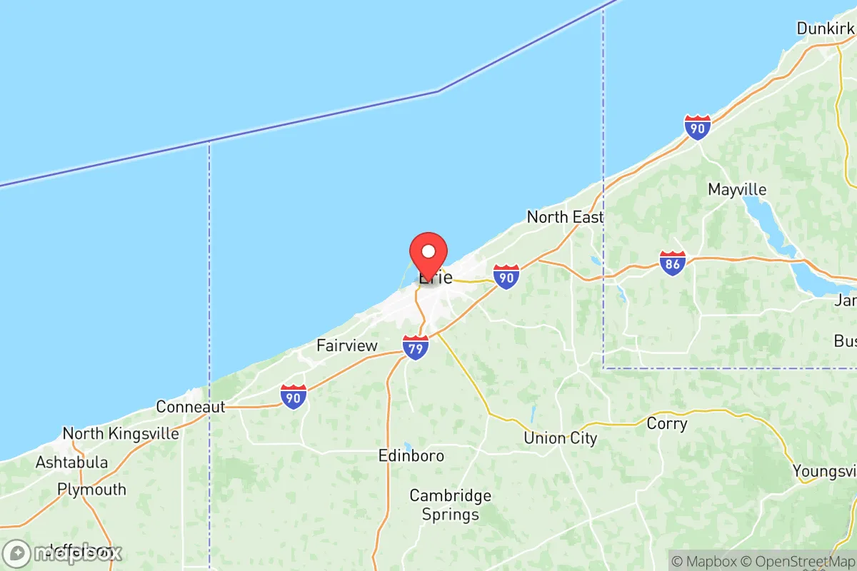
Erie County, Pennsylvania, occupies a unique strategic position on the southern shore of Lake Erie, offering a blend of natural defenses and logistical vulnerabilities that make it a serious consideration for relocation-minded individuals and families prioritizing resilience and self-sufficiency. The county’s economy and infrastructure have demonstrated notable durability, pivoting from heavy manufacturing toward a more diversified base in healthcare, logistics, and advanced materials, while its location places it far from the most probable high-value national targets. For a reader weighing disaster readiness, Erie County presents a mixed but generally favorable profile: strong water access, moderate population density, and a buffer from major metropolitan fallout zones, offset by exposure to lake-effect weather and proximity to certain industrial and energy infrastructure.
Geographic position and natural advantages for long-term stability
Erie County’s most significant strategic asset is its position on Lake Erie, one of the Great Lakes, which provides an essentially inexhaustible freshwater supply — a critical factor for any long-term resilience plan. The county seat, Erie, sits roughly 100 miles from Buffalo, New York, and 120 miles from Cleveland, Ohio, placing it outside the immediate blast and fallout zones of those major population centers while remaining close enough for supply runs or medical evacuation in normal times. The surrounding terrain is predominantly rolling hills and farmland, with Presque Isle State Park offering a natural peninsula that shelters Erie’s harbor and provides a recreational buffer. The county’s agricultural belt, particularly around Edinboro and Waterford, supports local food production, and the region’s moderate climate — with four distinct seasons and adequate rainfall — allows for reliable crop yields and livestock grazing. The absence of major fault lines, active volcanoes, or hurricane corridors further reduces natural disaster risk, though winter storms and occasional ice storms are a recurring challenge that requires proper preparation.
Risks, exposures, and proximity to fallout-relevant landmarks
While Erie County avoids the highest-risk national targets, it is not without exposure. The most notable man-made risk is the Beaver Valley Nuclear Power Station, located roughly 70 miles southwest in Shippingport, Pennsylvania, within the broader region’s emergency planning zone. A major incident there could affect Erie County depending on wind patterns, though prevailing westerlies typically carry fallout eastward, away from the county. Closer to home, the Erie Refinery (formerly PBF Energy) on the city’s east side processes roughly 155,000 barrels of crude oil per day, presenting a localized hazard for chemical release or fire in the event of an earthquake, sabotage, or accident. The county also hosts significant rail traffic along the Norfolk Southern and CSX lines that hug the lake shore, carrying hazardous materials through the city of Erie and smaller towns like North East and Girard. On the military side, the Erie Army Depot (a former ammunition storage facility) is now largely decommissioned, but the region sits within the broader logistics network supporting the Buffalo Niagara Military Reservation and the Niagara Falls Air Reserve Station roughly 90 miles northeast. These are not primary nuclear targets, but they could become secondary objectives in a prolonged conflict. The county’s greatest natural risk remains lake-effect snow, which can dump several feet in a single storm, isolating rural areas and straining power grids — a scenario that demands robust backup heating and food storage from any serious relocator.
Practical resilience for a relocator: food, water, energy, and defensibility
For a family or individual building a self-sufficient homestead, Erie County offers several concrete advantages. Water access is exceptional: Lake Erie provides a virtually unlimited supply, and the county’s groundwater is generally abundant and of good quality, with many rural properties drawing from private wells. Municipal water in Erie city and surrounding townships is treated and reliable, but a well with a hand pump or a lake-side property with a filtration system offers true independence. Local food production is viable: the county’s agricultural sector includes dairy, corn, soybeans, and a growing number of small-scale vegetable farms and orchards, particularly in the Lake Erie Wine Country region stretching from North East to the New York border. Farmers’ markets operate in Erie, Edinboro, and Fairview during the growing season, and the region’s hunting and fishing opportunities — deer, turkey, small game, and Lake Erie’s walleye and perch — supplement a protein supply. Energy resilience is mixed: the grid is served by Penelec (FirstEnergy), which has faced reliability issues during severe winter storms, but natural gas is widely available in populated areas, and propane delivery is common in rural zones. Solar potential is moderate — the region averages 160 sunny days per year, less than the Southwest but sufficient for a well-sized off-grid system with battery storage. Wood heating is a practical option given the county’s forest cover, particularly in the southeastern townships near Union City and Corwin. Defensibility is moderate: the county’s terrain lacks natural chokepoints like mountain passes, but the rural areas offer good line-of-sight and limited road access, making it easier to monitor approaches. The population density of roughly 270 people per square mile (with Erie city at about 4,000 per square mile and rural townships under 100) means that a well-chosen property on a dead-end road or near state game lands provides substantial privacy and security. The local law enforcement presence is adequate but thin in remote areas, so a community-oriented approach — knowing neighbors, forming a watch group, and sharing resources — is advisable.
Overall, Erie County presents a credible option for the resilience-minded relocator who values freshwater security, moderate isolation from primary targets, and a workable climate for self-sufficient living. The trade-offs are real: lake-effect snow demands serious winter preparedness, the refinery and rail corridor introduce localized risk, and the county’s economic recovery from industrial decline means that some infrastructure (roads, broadband, emergency services) is unevenly maintained. But for a family willing to invest in a well, a wood stove, a solar array, and a deep pantry, Erie County offers a defensible, resource-rich base of operations within a day’s drive of major medical and supply centers — without being close enough to suffer their worst-case outcomes. The strategic picture is one of cautious optimism: the area is not a bunker, but it is a viable long-term home for those who plan ahead.

* Values derived from national, state, county, city and local statistics and may differ in a specific area. Last updated: 2026-07-10T21:28:26.000Z
Narrative content on this page is AI-generated and may contain mistakes. Verify any details that matter before acting on them.
ReloMaps may earn a commission from affiliate links at no extra cost to you.

