Photo: Wikipedia
Strategic Assessment of Rogers County
Workable tactical position. Some exposure to population density or targets, but generally defensible in a crisis.
What does the Strategic Assessment tell us?
Our Strategic Assessment grades tactical survivability of an area. Major population centers, military targets, fallout zones, natural disasters, and border exposure all drive risk — lower exposure means a more defensible position in a crisis.
This is heavily inspired by Joel Skousen's Strategic Relocation book. Highly recommended you checkout the book ($)What does this tell us?
Our Strategic Assessment grades tactical survivability of an area. Major population centers, military targets, fallout zones, natural disasters, and border exposure all drive risk — lower exposure means a more defensible position in a crisis.
This is heavily inspired by Joel Skousen's Strategic Relocation book. Highly recommended you checkout the book ($)Strategic Pillars

Key Distances
Strategic Assessment Analysis
Rogers County, Oklahoma, offers a compelling mix of geographic insulation and practical self-sufficiency for those prioritizing resilience and disaster preparedness. Located in the northeastern corner of the state, the county provides a strategic buffer from the densest population centers while maintaining access to critical infrastructure and supply chains. For a relocator thinking seriously about long-term stability, the area around Claremore and Owasso presents a balanced profile of natural advantages, manageable risks, and workable defensibility.
Geographic position and natural advantages for long-term stability
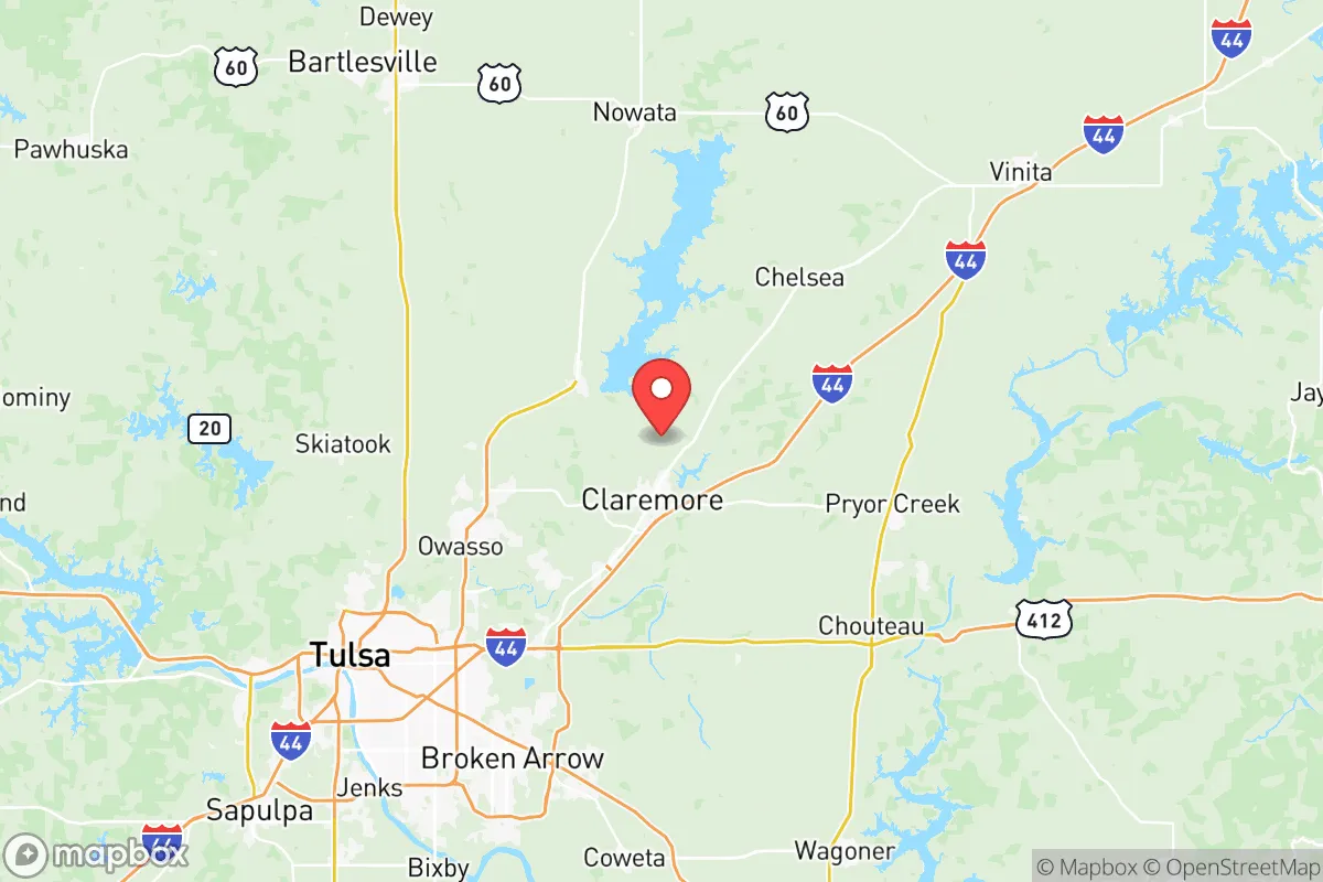
Rogers County sits in the Green Country region of Oklahoma, a landscape defined by the rolling hills of the Ozark Plateau and the Verdigris River watershed. This topography offers a natural advantage over the flat, exposed plains to the west: the hills provide visual screening, natural drainage, and microclimate moderation. The county's position roughly 20 miles northeast of Tulsa places it outside the immediate blast or fallout zone of a major urban target, while still close enough to access medical, logistical, and economic resources in a non-crisis period. The city of Claremore, the county seat, anchors the central part of the county with a population around 20,000, while Owasso, on the southern edge, has grown rapidly but remains suburban rather than dense urban. Farther north, the smaller towns of Chelsea and Oologah offer even lower population density and greater separation from the Tulsa metro. The county's eastern boundary touches the Verdigris River and Oologah Lake, a U.S. Army Corps of Engineers reservoir that provides a significant freshwater reserve. The lake, covering over 29,000 acres, is a key asset for water security, recreation, and potential irrigation. The region's moderate climate—with four distinct seasons, average annual rainfall around 40 inches, and a growing season of roughly 200 days—supports small-scale agriculture and gardening, a meaningful factor for anyone planning food self-sufficiency.
Risks, exposures, and proximity to fallout-relevant landmarks
Rogers County is not without its vulnerabilities, and a clear-eyed assessment requires acknowledging them. The most significant man-made risk is the county's proximity to Tulsa, which hosts a major oil and gas industry hub, including refineries and storage facilities along the Arkansas River corridor. While Rogers County itself is not home to large-scale refining, the Tulsa refineries—including the HollyFrontier facility in nearby West Tulsa—represent potential targets or accident sites that could produce hazardous material releases. The prevailing winds in the region are from the south and southwest, meaning that a plume from Tulsa would generally move northeast, directly toward Rogers County. This is a critical consideration for fallout planning: in the event of a major industrial accident or deliberate attack on Tulsa's energy infrastructure, Claremore and Owasso lie in a downwind risk zone. Additionally, the county is within roughly 100 miles of Vance Air Force Base in Enid, Oklahoma, and Tinker Air Force Base near Oklahoma City, both of which are strategic military assets that could become targets in a broader conflict. On the natural disaster side, Rogers County sits in an area of elevated tornado risk, part of the traditional "Dixie Alley" extension. The May 2010 tornado outbreak that struck the region, including a devastating EF-3 that hit Claremore, is a reminder that severe weather is a recurring hazard. Flooding along the Verdigris River and its tributaries is also a concern, particularly in low-lying areas near Oologah and the river bottoms. Earthquake risk is lower than in central Oklahoma, but the region has experienced minor induced seismicity linked to wastewater injection wells. For a relocator, these risks are manageable with proper site selection—avoiding floodplains, building or retrofitting for storm shelters, and maintaining a robust emergency plan—but they cannot be ignored.
Practical resilience for a relocator: food, water, energy, and defensibility
For someone serious about self-sufficiency, Rogers County offers a workable foundation. Water security is the strongest asset: Oologah Lake, along with the Verdigris and Caney Rivers, provides abundant surface water. Private wells are common in rural parts of the county, with groundwater quality generally good, though testing for agricultural runoff and industrial contaminants is advisable near the Tulsa county line. The county's agricultural base is modest but real—cattle ranching, hay production, and some row crops dominate—meaning that local food production is possible, especially for those willing to garden or raise small livestock. The Claremore Farmers Market and local producers in Owasso offer some access to regional food sources, though the county is not a major agricultural exporter. Energy resilience is mixed: the grid is served by Public Service Company of Oklahoma (PSO), a subsidiary of American Electric Power, and outages during storms are not uncommon. However, the rural character of much of the county means that solar panel installation is generally unrestricted, and many properties have space for backup generators or small wind turbines. Natural gas is widely available in the region, and propane delivery is standard for off-grid homes. Defensibility is a more nuanced factor. The terrain—wooded hills, winding roads, and scattered farmsteads—offers natural cover and chokepoints that could be leveraged in a prolonged disruption. The county's population density is low outside the Owasso-Claremore corridor, with many properties set back from main roads and screened by trees. However, the area is not remote: Interstate 44 and Highway 66 run through the county, providing rapid access for both supply movement and potential unwanted traffic. A relocator should prioritize a property with good visibility of approach routes, multiple egress options, and a defensible perimeter—features more easily found in the northern and eastern parts of the county, away from the Tulsa sprawl.
The overall strategic picture for Rogers County is one of moderate resilience with clear trade-offs. Its geographic position offers a buffer from the highest-risk urban targets while retaining access to critical infrastructure, and its natural water resources and agricultural potential provide a solid base for self-sufficiency. The primary vulnerabilities—downwind proximity to Tulsa's industrial corridor, tornado risk, and the county's position along major transit routes—are real but manageable with deliberate planning and site selection. For a relocator who values a balance of isolation and access, and who is willing to invest in storm hardening, water storage, and energy independence, Rogers County represents a defensible, livable option in the central United States. It is not a fortress, but it is a place where a prepared individual or family can build a stable, resilient life.

* Values derived from national, state, county, city and local statistics and may differ in a specific area. Last updated: 2026-06-24T21:40:42.000Z
Narrative content on this page is AI-generated and may contain mistakes. Verify any details that matter before acting on them.
ReloMaps may earn a commission from affiliate links at no extra cost to you.

