
Photo: Wikipedia
Strategic Assessment of Fairfield County
Meaningful friction. Expect exposure to either population pressure, blast zones, or natural disaster risk. Consider buying a retreat property.
What does the Strategic Assessment tell us?
Our Strategic Assessment grades tactical survivability of an area. Major population centers, military targets, fallout zones, natural disasters, and border exposure all drive risk — lower exposure means a more defensible position in a crisis.
This is heavily inspired by Joel Skousen's Strategic Relocation book. Highly recommended you checkout the book ($)What does this tell us?
Our Strategic Assessment grades tactical survivability of an area. Major population centers, military targets, fallout zones, natural disasters, and border exposure all drive risk — lower exposure means a more defensible position in a crisis.
This is heavily inspired by Joel Skousen's Strategic Relocation book. Highly recommended you checkout the book ($)Strategic Pillars

Key Distances
Strategic Assessment Analysis
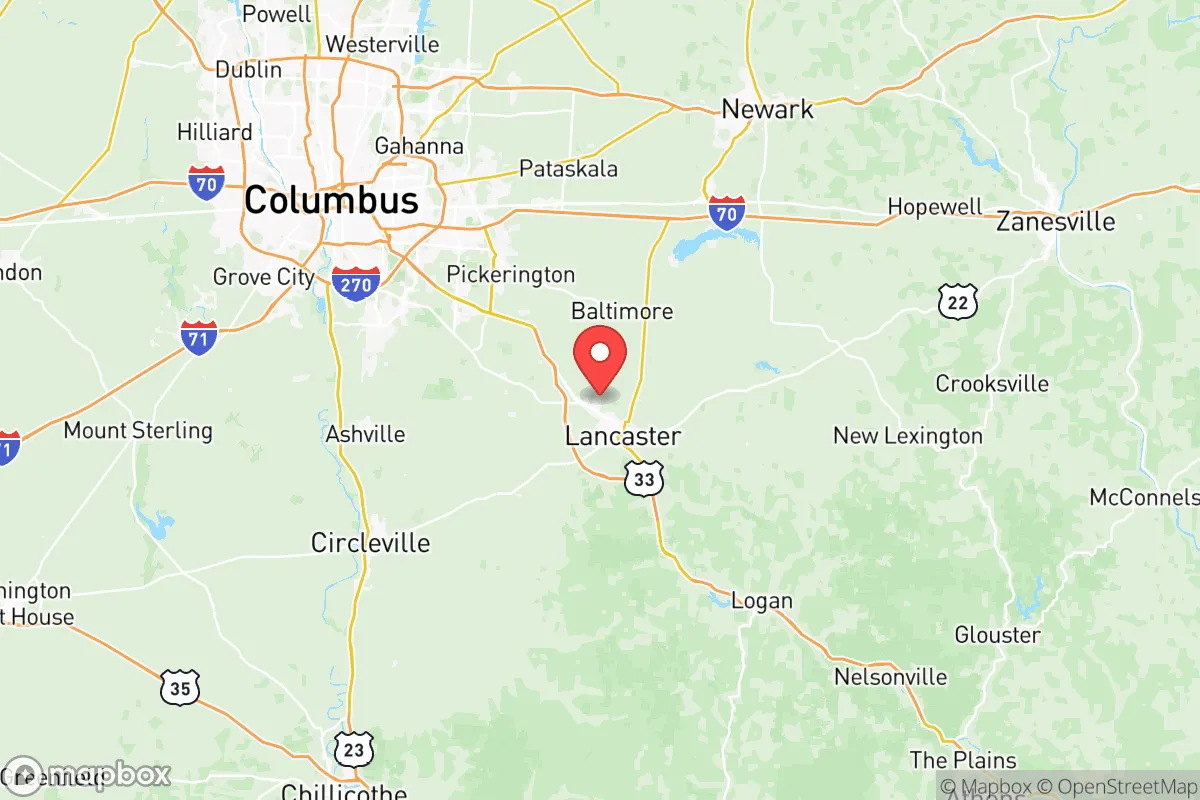
Fairfield County, Ohio, occupies a strategic position in the southeastern quadrant of the state, roughly 30 miles southeast of Columbus, offering a blend of rural access and proximity to a major metropolitan economy. Its resilience profile is shaped by this location: close enough to a state capital and its associated infrastructure for supply chains and employment, yet far enough from the densest urban core to avoid the worst of a metropolitan collapse scenario. The county’s population of roughly 160,000 is spread across a mix of small cities—Lancaster (the county seat, ~40,000), Pickerington (~24,000), and Canal Winchester (~10,000)—and unincorporated townships, giving it a decentralized footprint that aids in self-sufficiency planning.
Geographic position and natural advantages for long-term stability
Fairfield County sits at the edge of the Appalachian foothills, with the Hocking River cutting through its southern half. This topography provides natural drainage and some defensible terrain—hills and valleys that break up sightlines and create microclimates—without the extreme isolation of deeper Appalachia. The county is not in a floodplain for major rivers like the Ohio or Scioto, though localized flooding along the Hocking and its tributaries (e.g., Rush Creek) is a known risk in low-lying areas near Lancaster and Sugar Grove. The region’s groundwater is generally reliable, with the underlying sandstone and shale aquifers providing decent well yields for rural properties, though water quality varies by depth and location. The climate is temperate, with four distinct seasons, and the growing season (roughly 160 frost-free days) supports small-scale agriculture—corn, soybeans, hay, and livestock—which is a practical advantage for a relocator aiming for partial food self-sufficiency.
Risks, exposures, and proximity to fallout-relevant landmarks
The primary man-made risk for Fairfield County is its proximity to Columbus and the broader I-71 corridor. A major event at the Pickerington-area industrial parks or the Lancaster-based Anchor Hocking glass plant (a legacy manufacturing site) could produce localized chemical or industrial hazards, but these are small-scale compared to the refinery and chemical complexes near Toledo or the Ohio River. More significantly, the county lies within the fallout shadow of potential targets in Columbus—specifically the Rickenbacker Air National Guard Base (southeast of Columbus, ~15 miles from Pickerington) and the Columbus Defense Supply Center. A ground burst at either site could deposit fallout across eastern Fairfield County depending on wind direction. The county also has two small airports (Fairfield County Airport near Lancaster and a private field near Canal Winchester) that could become secondary targets in a conflict scenario. Natural risks are moderate: tornadoes are a seasonal threat (the county is in the Ohio Valley severe weather zone), and the region has minor seismic risk from the Anna, Ohio, seismic zone to the west, but no active fault lines run through the county.
Practical resilience for a relocator: food, water, energy, and defensibility
For a relocator serious about self-sufficiency, Fairfield County offers a mixed picture. Food resilience is above average: the county has a strong agricultural base, with numerous small farms, farmers’ markets (Lancaster, Pickerington, and Canal Winchester all host weekly markets), and a growing network of CSAs. The Hocking Hills region to the south provides foraging and hunting opportunities (deer, turkey, small game) on public land, though pressure from recreational users is high. Water resilience is good for rural properties with drilled wells (typical depth 100–300 feet, yields 5–20 GPM), but suburban subdivisions in Pickerington and Canal Winchester rely on municipal water from the Columbus system, which is vulnerable to disruption. Energy resilience is average: the county is served by AEP Ohio and South Central Power, with no major local generation beyond a few small solar installations and backup generators at critical facilities. Off-grid solar is viable given the region’s ~4.5 peak sun hours per day, but winter cloud cover reduces output significantly. Defensibility is moderate: the decentralized settlement pattern and hilly terrain in the southern half of the county offer natural chokepoints and observation points, but the northern half (Pickerington, Violet Township) is suburban sprawl with easy road access from Columbus. The county has a well-regarded sheriff’s office and a network of volunteer fire departments, but response times in rural areas can exceed 20 minutes.
Overall, Fairfield County presents a viable option for a relocator who wants a balance of rural self-sufficiency potential and access to urban infrastructure, without the extreme isolation of deeper Appalachia or the high exposure of a metro-adjacent suburb. Its strengths—decent groundwater, agricultural base, and defensible terrain in the south—are offset by its proximity to Columbus-area targets and the vulnerability of its suburban water and power grids. For a family or individual willing to invest in a well, solar, and food storage, and to locate in the southern or eastern townships (e.g., Bremen, Rushville, or Stoutsville), the county offers a solid foundation for long-term resilience. The key is to avoid the northern sprawl and to plan for the seasonal realities of Ohio’s climate—mud, snow, and cloud cover—which will test any off-grid setup.

* Values derived from national, state, county, city and local statistics and may differ in a specific area. Last updated: 2026-08-08T16:54:13.000Z
Narrative content on this page is AI-generated and may contain mistakes. Verify any details that matter before acting on them.
ReloMaps may earn a commission from affiliate links at no extra cost to you.

