Photo: Wikipedia
Strategic Assessment of Humboldt County
Strong survivability profile. Good buffer from population centers, with manageable environmental and tactical risks.
What does the Strategic Assessment tell us?
Our Strategic Assessment grades tactical survivability of an area. Major population centers, military targets, fallout zones, natural disasters, and border exposure all drive risk — lower exposure means a more defensible position in a crisis.
This is heavily inspired by Joel Skousen's Strategic Relocation book. Highly recommended you checkout the book ($)What does this tell us?
Our Strategic Assessment grades tactical survivability of an area. Major population centers, military targets, fallout zones, natural disasters, and border exposure all drive risk — lower exposure means a more defensible position in a crisis.
This is heavily inspired by Joel Skousen's Strategic Relocation book. Highly recommended you checkout the book ($)Strategic Pillars

Key Distances
Strategic Assessment Analysis
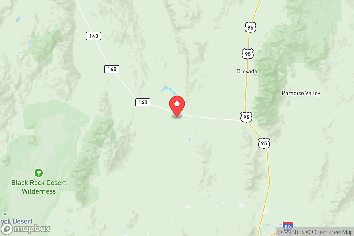
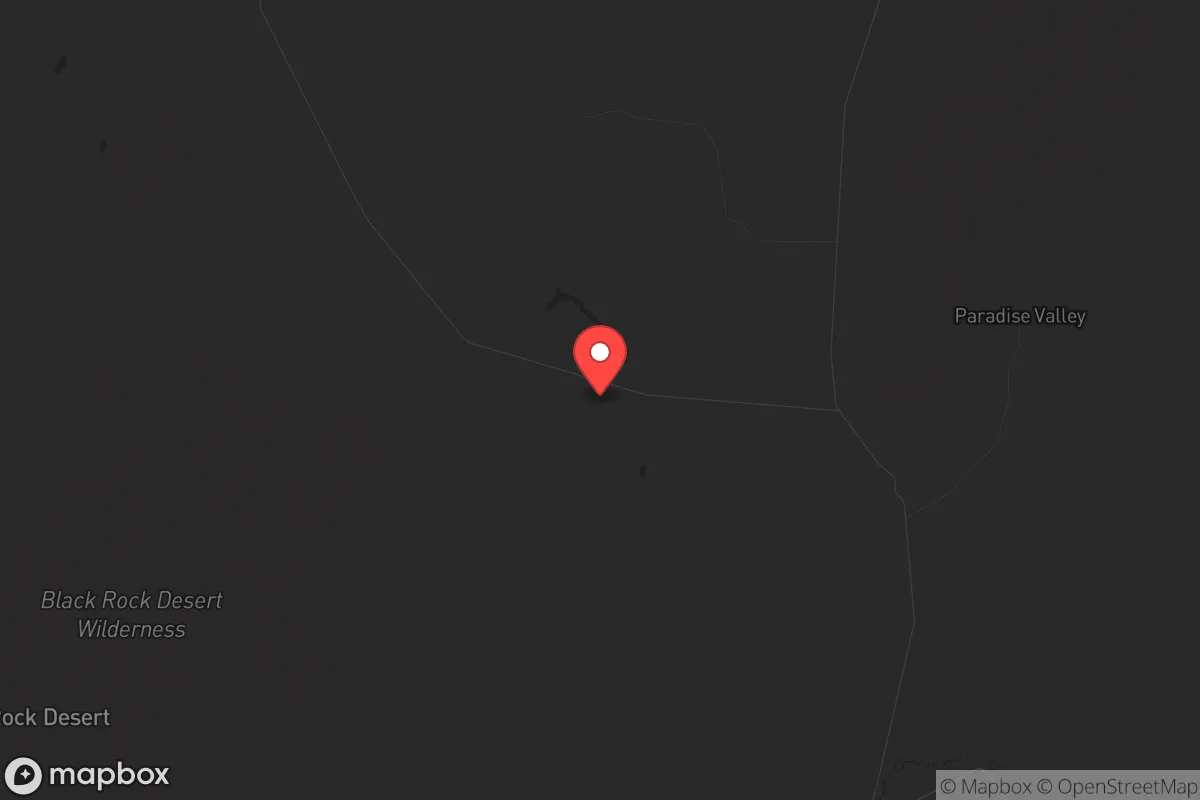
Humboldt County, Nevada, offers a strategic relocation option for those prioritizing resilience and distance from major population centers, sitting over 160 miles from Reno and roughly 300 miles from Salt Lake City. This isolation, combined with a high desert environment and low population density of roughly 17,000 residents across 9,600 square miles, creates a natural buffer against cascading failures from urban unrest or infrastructure collapse. The county’s position along Interstate 80 provides a critical east-west corridor for supply movement, while its location near the Oregon and Idaho borders offers multiple egress routes if regional conditions deteriorate.
Geographic position and natural advantages for long-term sustainability
Humboldt County’s geography is defined by the Humboldt River basin, which provides a rare perennial water source in the Great Basin—a critical asset for independent water security. The county seat, Winnemucca, sits at the junction of I-80 and US-95, giving residents access to both transcontinental logistics and north-south routes toward the Snake River Plain. The surrounding terrain includes the Santa Rosa Range and the Sonoma Range, offering defensible high ground with natural chokepoints for monitoring approach routes. The area’s arid climate reduces risks from flooding and mold-related infrastructure decay, while the low humidity preserves stored supplies and equipment. The Black Rock Desert to the west provides a vast, uninhabited buffer zone that complicates any large-scale movement toward the county, and the Humboldt-Toiyabe National Forest to the east offers timber and game resources for those with backcountry skills. The county’s elevation—averaging 4,300 feet—means cooler summers than lower desert regions, reducing heat stress on both people and solar infrastructure.
Risks, exposures, and proximity to fallout-relevant landmarks
The primary risk for Humboldt County relocators is its proximity to the Naval Air Station Fallon (roughly 90 miles west), a major military aviation training center that could become a target in a conflict scenario. The I-80 corridor itself is a double-edged sword: while useful for logistics, it also funnels traffic from the San Francisco Bay Area and Reno, potentially bringing displaced populations during a crisis. The county lies within 200 miles of the Waste Isolation Pilot Plant (WIPP) in New Mexico and the Nevada National Security Site (formerly the Nevada Test Site) near Mercury, though prevailing winds generally carry fallout eastward away from Humboldt. The Thacker Pass lithium mine project, located about 30 miles north of Winnemucca, introduces industrial activity and potential supply chain vulnerabilities, though it also provides local economic resilience. The county’s distance from major ports (over 500 miles from Oakland) and refineries (over 400 miles from Salt Lake City refineries) means fuel supply disruptions would hit later here than in coastal areas, but residents should plan for extended fuel storage. The Union Pacific rail line running through Winnemucca carries hazardous materials, including crude oil from the Bakken fields, creating a localized derailment risk that demands situational awareness.
Practical resilience for a relocator: food, water, energy, and defensibility
Water access is Humboldt County’s strongest resilience asset. The Humboldt River flows through the county year-round, and groundwater in the basin is generally accessible at depths of 50-200 feet for those with drilling capability. The county’s agricultural sector, centered on alfalfa and cattle operations around Paradise Valley and McDermitt, provides a local food production base that could be expanded with small-scale farming. The growing season is short (roughly 100-120 frost-free days), but cold-hardy crops like potatoes, carrots, and kale thrive, and the region’s sagebrush steppe supports free-range livestock. Energy resilience is achievable through solar, with the area averaging over 300 sunny days per year, though winter snow accumulation at higher elevations requires panel tilting or ground-mount systems. The county’s low population density—roughly 1.8 people per square mile—means that defensible positions are abundant, particularly in the Santa Rosa Range where remote homesteads sit on private inholdings within national forest land. The Winnemucca Police Department and Humboldt County Sheriff’s Office maintain a visible presence, but response times in rural areas can exceed 30 minutes, making personal security planning essential. The county’s gun culture is strong, with multiple shooting ranges and a permissive regulatory environment that aligns with conservative preparedness priorities.
The overall strategic picture for Humboldt County is one of trade-offs: you gain exceptional isolation, water security, and defensible terrain, but you accept limited medical infrastructure (the nearest Level 1 trauma center is in Reno, 160 miles away) and a thin economic base dependent on mining and agriculture. For a relocator with a prepper mindset, the county offers a realistic long-term survival environment where a well-prepared individual or family can achieve genuine self-sufficiency without the constant threat of urban spillover. The key is to arrive with skills, supplies, and a plan for community integration—the existing population is small but tight-knit, and newcomers who demonstrate competence and self-reliance will find allies. Humboldt County won’t shelter you from every risk, but it gives you the space and resources to manage them on your own terms, which is the core of strategic relocation.
* Values derived from national, state, county, city and local statistics and may differ in a specific area. Last updated: 2026-05-12T10:01:33.000Z
Narrative content on this page is AI-generated and may contain mistakes. Verify any details that matter before acting on them.
ReloMaps may earn a commission from affiliate links at no extra cost to you.