Photo: Wikipedia
Strategic Assessment of Douglas County
Workable tactical position. Some exposure to population density or targets, but generally defensible in a crisis.
What does the Strategic Assessment tell us?
Our Strategic Assessment grades tactical survivability of an area. Major population centers, military targets, fallout zones, natural disasters, and border exposure all drive risk — lower exposure means a more defensible position in a crisis.
This is heavily inspired by Joel Skousen's Strategic Relocation book. Highly recommended you checkout the book ($)What does this tell us?
Our Strategic Assessment grades tactical survivability of an area. Major population centers, military targets, fallout zones, natural disasters, and border exposure all drive risk — lower exposure means a more defensible position in a crisis.
This is heavily inspired by Joel Skousen's Strategic Relocation book. Highly recommended you checkout the book ($)Strategic Pillars

Key Distances
Strategic Assessment Analysis
Douglas County, Nevada, offers a strategic relocation option for those prioritizing resilience, geographic isolation, and a conservative-aligned lifestyle in an era of increasing uncertainty. Positioned along the eastern slope of the Sierra Nevada, the county provides a natural buffer from the coastal chaos of California and the urban sprawl of Reno, while maintaining access to critical infrastructure and resources. For single individuals and parents seeking a defensible, self-sufficient base, Douglas County’s combination of low population density, water availability, and distance from major fallout targets makes it a standout choice in the Great Basin corridor.
Geographic position and natural advantages for long-term security
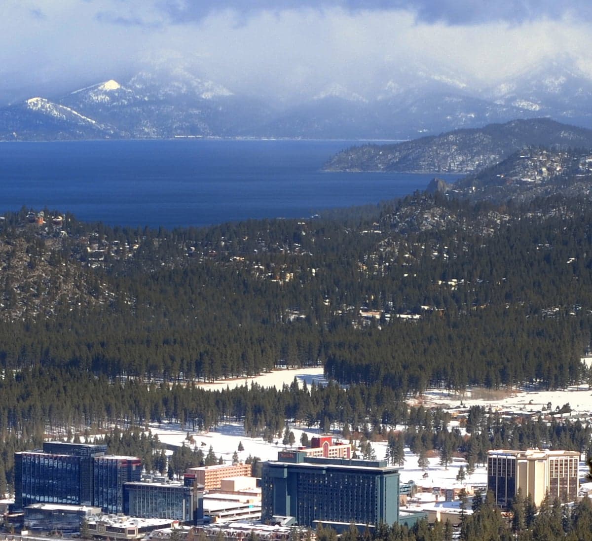
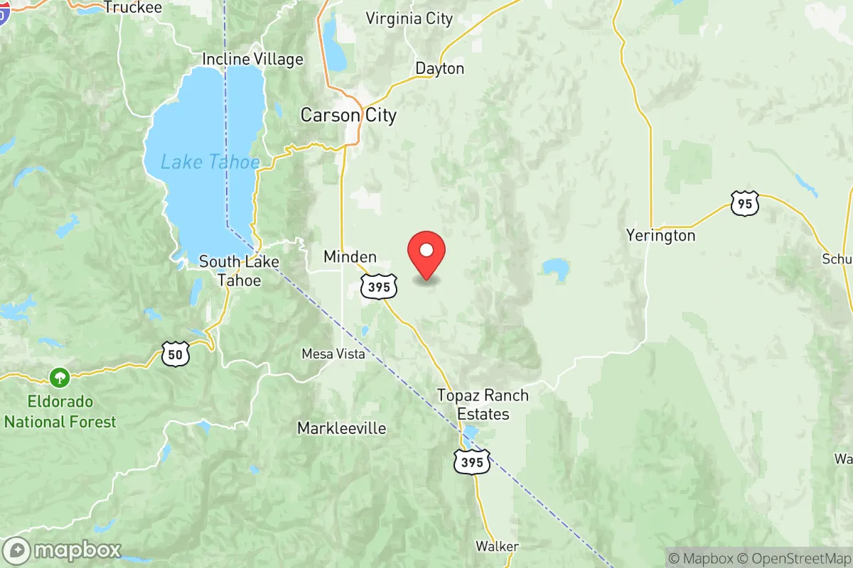
Douglas County sits in a unique geographic pocket that offers both isolation and connectivity. The county seat, Minden, and its twin town Gardnerville lie in the Carson Valley, a fertile basin fed by the Carson River and surrounded by the Pine Nut Mountains to the east and the Sierra Nevada to the west. This valley provides a natural defensive perimeter—any approach from the west must cross high mountain passes (like Kingsbury Grade or Monitor Pass), while the east is shielded by rugged, sparsely populated terrain. The county’s elevation (around 4,700 feet in the valley) means a four-season climate with reliable snowpack, which feeds the Carson River and its tributaries—a critical water source that many western counties lack. For a prepper, this water security is non-negotiable. The area is also far from major military targets like Naval Air Station Fallon (about 60 miles northeast) or the Nevada National Security Site (formerly the Nevada Test Site, roughly 100 miles northwest), reducing the risk of direct fallout from a nuclear exchange. The nearest major population center, Reno-Sparks, is 45 miles north—close enough for supply runs but far enough to avoid the chaos of a city collapse.
Risks, exposures, and proximity to fallout-relevant landmarks
No location is without risk, and Douglas County has its own set of exposures that a strategic relocator must weigh. The most immediate threat is wildfire, particularly in the forested western slopes near Lake Tahoe and the Sierra front. The 2021 Caldor Fire came within 10 miles of the county line, and the Tamarack Fire in 2021 burned near the eastern edge. These events can disrupt power, block evacuation routes (especially Highway 395, the county’s main north-south artery), and degrade air quality for weeks. Flooding is a secondary concern along the Carson River during heavy snowmelt years, though the valley’s floodplain is well-mapped and avoidable. From a fallout perspective, the county’s distance from high-value targets is a net positive, but it’s not zero-risk. The Walker Lake area to the east has a small naval training range, and the Hawthorne Army Depot (a massive ammunition storage facility) is about 70 miles southeast—a potential secondary target. More concerning is the Interstate 80 corridor through Reno, which carries hazardous materials and could be a choke point during a crisis. The county’s reliance on a single major highway (US 395) for north-south movement is a vulnerability; a bridge failure or road blockage could isolate the valley. For parents, the local schools (Douglas County School District) are well-regarded but small, and the nearest Level 1 trauma center is in Reno—a 45-minute drive under good conditions.
Practical resilience for a relocator: food, water, energy, and defensibility
Douglas County scores high on practical resilience metrics that matter for a prepper household. Water is the standout advantage: the Carson River flows year-round, and the valley’s groundwater is plentiful and shallow. Many rural properties have existing wells, and the county’s water rights system is relatively straightforward compared to California’s. For food, the Carson Valley is agricultural—hay, alfalfa, and some livestock operations dominate, but small-scale market gardens and orchards are viable. The Minden-Gardnerville farmers market runs through summer, and local ranchers sell beef and lamb directly. For long-term food security, the growing season is short (May to September) but productive with cold-hardy crops. Energy is a mixed bag: NV Energy provides grid power, but outages during winter storms are common. Solar is viable (the valley gets over 300 sunny days per year), and many off-grid properties already use solar-plus-battery setups. Propane is widely available for heating and cooking. Defensibility is where the county truly shines. The Carson Valley is a natural bowl with limited entry points: Highway 395 from the north, Highway 88 from the west (via Carson Pass), and a few two-lane roads from the east. A small group could monitor or block these approaches. The local population is heavily armed and self-reliant—Nevada has constitutional carry, and the Douglas County Sheriff’s Office is known for a pro-Second Amendment stance. For a single individual or family, a rural property in the Topaz Lake area or the Dresslerville community offers seclusion without total isolation. The county’s emergency services are competent but stretched thin; a serious medical event would require evacuation to Reno, so stockpiling medical supplies and training in basic trauma care is wise.
The overall strategic picture for Douglas County is one of calculated trade-offs. It offers a rare combination of water security, geographic defensibility, and distance from major fallout targets—qualities that are increasingly scarce in the American West. The conservative culture is genuine, not performative: local governance is small-government, taxes are low (no state income tax, low property taxes), and the community is tight-knit. The downsides—wildfire risk, single-road vulnerability, and limited medical infrastructure—are manageable with proper planning. For a relocator who values preparedness over convenience, Douglas County is a strong candidate. It’s not a bunker; it’s a base of operations. And in a world where the grid could flicker and the cities could burn, having a base with water, space, and a clear line of sight to the horizon is worth more than any stock portfolio.
* Values derived from national, state, county, city and local statistics and may differ in a specific area. Last updated: 2026-05-16T23:18:43.000Z
Narrative content on this page is AI-generated and may contain mistakes. Verify any details that matter before acting on them.
ReloMaps may earn a commission from affiliate links at no extra cost to you.