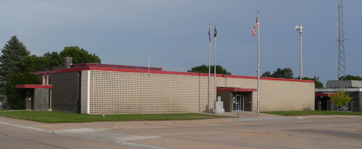
Photo: Wikipedia
Strategic Assessment of Keith County
Deep buffer from population centers and strategic targets. Low natural disaster risk and minimal exposure to border or coastal threats.
What does the Strategic Assessment tell us?
Our Strategic Assessment grades tactical survivability of an area. Major population centers, military targets, fallout zones, natural disasters, and border exposure all drive risk — lower exposure means a more defensible position in a crisis.
This is heavily inspired by Joel Skousen's Strategic Relocation book. Highly recommended you checkout the book ($)What does this tell us?
Our Strategic Assessment grades tactical survivability of an area. Major population centers, military targets, fallout zones, natural disasters, and border exposure all drive risk — lower exposure means a more defensible position in a crisis.
This is heavily inspired by Joel Skousen's Strategic Relocation book. Highly recommended you checkout the book ($)Strategic Pillars

Key Distances
Strategic Assessment Analysis
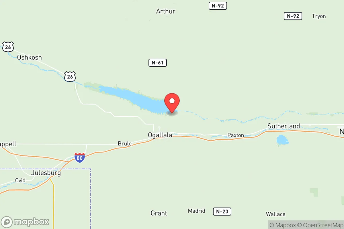
Keith County, Nebraska, offers a compelling strategic profile for relocators prioritizing resilience and self-sufficiency, anchored by the Platte River Valley and the Ogallala Aquifer. Its position in the western part of the state, roughly 200 miles from Denver and 300 from Omaha, places it well outside the immediate fallout zones of major metropolitan targets while still providing access to regional supply chains. The county seat of Ogallala serves as the population and commercial hub, with smaller communities like Brule, Paxton, and Roscoe offering additional low-density living options. This combination of water security, low population density, and distance from primary strategic targets makes Keith County a noteworthy consideration for those assessing long-term preparedness.
Geographic position and natural advantages for long-term security
Keith County sits astride the Platte River, a major tributary of the Missouri, and directly over the Ogallala Aquifer, one of the largest freshwater aquifers in the world. This dual water access is a rare and significant advantage for a semi-arid region, providing both surface and groundwater resources that are less vulnerable to drought than many other parts of the Great Plains. The county's elevation, averaging around 3,200 feet, places it above the flood-prone bottomlands of the lower Platte while still benefiting from the river's alluvial soils. Lake McConaughy, a massive reservoir just north of Ogallala, stores over 1.7 million acre-feet of water and serves as a critical buffer against prolonged dry spells. For a relocator, this means a local water supply that is both abundant and geographically protected, unlike areas dependent on distant reservoirs or declining aquifers like the High Plains Aquifer further south. The terrain is rolling shortgrass prairie with scattered cottonwood breaks along the river, offering natural cover and defensible positions without the fire risk of dense forest. The county's position along Interstate 80 and the Union Pacific mainline provides logistical connectivity, but the low traffic volume and wide-open spaces mean that a disruption to those corridors would not immediately isolate the area.
Risks, exposures, and proximity to fallout-relevant landmarks
Keith County's primary risk exposure is not from direct targeting but from its position relative to higher-value infrastructure in the broader region. The nearest major military installation is F.E. Warren Air Force Base near Cheyenne, Wyoming, roughly 120 miles west, which is a primary target for intercontinental ballistic missile silos and command facilities. The county itself contains no nuclear power plants, major refineries, or large-scale military depots, which reduces its attractiveness as a direct strike location. However, the Union Pacific rail line and Interstate 80 corridor that pass through Ogallala and Brule are critical east-west logistics arteries; a disruption at the North Platte rail yard (about 50 miles east) or the Denver metro area could create secondary effects like supply chain interruptions or population displacement. The nearest major population center is North Platte (population ~24,000), which is not a primary strategic target but could experience secondary fallout from a strike on the rail yard or the nearby Sutherland Reservoir, which supplies cooling water to the Gerald Gentleman Station coal plant. For a relocator, the key takeaway is that Keith County is far enough from high-value targets to avoid direct blast and thermal effects, but close enough to experience fallout drift from a Cheyenne or Denver strike depending on prevailing westerly winds. The county's low population density (roughly 8,000 residents across 1,062 square miles) means that even in a widespread evacuation scenario, local resources would not be immediately overwhelmed by urban refugees, unlike counties closer to Denver or Omaha.
Practical resilience for a relocator: food, water, energy, and defensibility
For a relocator focused on self-sufficiency, Keith County offers a strong baseline across all four pillars. Water is the standout advantage: the Ogallala Aquifer provides reliable groundwater at depths of 100-200 feet, and surface water from Lake McConaughy and the Platte River is accessible with proper rights. Most rural properties have existing wells, and the county's irrigation infrastructure means that even in a grid-down scenario, hand pumps or solar-powered pumps can access water. Food production is viable but requires adaptation: the growing season averages only 130-140 frost-free days, and the semi-arid climate (18 inches of annual precipitation) necessitates irrigation for row crops. However, the region is a major producer of corn, alfalfa, and cattle, and local ranchers often sell direct to consumers. The Ogallala Livestock Auction and smaller operations in Brule and Paxton provide access to livestock for those looking to build herd resilience. Energy is a mixed picture: the county is served by the Gerald Gentleman Station (coal) and the Sutherland Reservoir hydroelectric plant, both about 50 miles east, but the grid is vulnerable to disruption. Solar potential is excellent, with over 220 sunny days per year, and wind resources are strong, particularly on the ridges north of the river. Many rural properties already have backup generators or propane systems, and the county's low population density means that a distributed solar-plus-battery setup would be difficult to detect or disrupt. Defensibility is high due to the open terrain and low population density: the county's few paved roads (primarily I-80, US-30, and US-61) create natural chokepoints, and the river valley provides both cover and a water source for perimeter defense. The nearest law enforcement is the Keith County Sheriff's Office in Ogallala, with backup from the Nebraska State Patrol, but response times in rural areas can exceed 30 minutes. For a relocator, the practical recommendation is to secure a property with existing well water, south-facing solar exposure, and at least 20 acres for food production and buffer space.
The overall strategic picture for Keith County is one of moderate-to-high resilience with specific, manageable vulnerabilities. Its greatest strengths are water security, low population density, and distance from primary strategic targets, which together create a buffer against both natural and man-made disasters. The primary weaknesses are the semi-arid climate's impact on food production, the reliance on a single interstate and rail line for supply chains, and the potential for fallout drift from a Cheyenne or Denver strike. For a relocator willing to invest in irrigation, solar energy, and food storage, the county offers a defensible position with access to abundant natural resources. It is not a remote wilderness—it has a functioning county government, a hospital in Ogallala, and regular bus service along I-80—but it is far enough from major population centers to avoid the worst of urban collapse scenarios. The key trade-off is between the security of water and space versus the vulnerability of a semi-arid climate and a single transportation corridor. For those who prioritize water and distance over climate and convenience, Keith County represents a solid, data-backed choice in the Great Plains resilience landscape.

* Values derived from national, state, county, city and local statistics and may differ in a specific area. Last updated: 2026-07-17T17:20:55.000Z
Narrative content on this page is AI-generated and may contain mistakes. Verify any details that matter before acting on them.
ReloMaps may earn a commission from affiliate links at no extra cost to you.

