
Photo: Wikipedia
Strategic Assessment of Pondera County
Strong survivability profile. Good buffer from population centers, with manageable environmental and tactical risks.
What does the Strategic Assessment tell us?
Our Strategic Assessment grades tactical survivability of an area. Major population centers, military targets, fallout zones, natural disasters, and border exposure all drive risk — lower exposure means a more defensible position in a crisis.
This is heavily inspired by Joel Skousen's Strategic Relocation book. Highly recommended you checkout the book ($)What does this tell us?
Our Strategic Assessment grades tactical survivability of an area. Major population centers, military targets, fallout zones, natural disasters, and border exposure all drive risk — lower exposure means a more defensible position in a crisis.
This is heavily inspired by Joel Skousen's Strategic Relocation book. Highly recommended you checkout the book ($)Strategic Pillars

Key Distances
Strategic Assessment Analysis
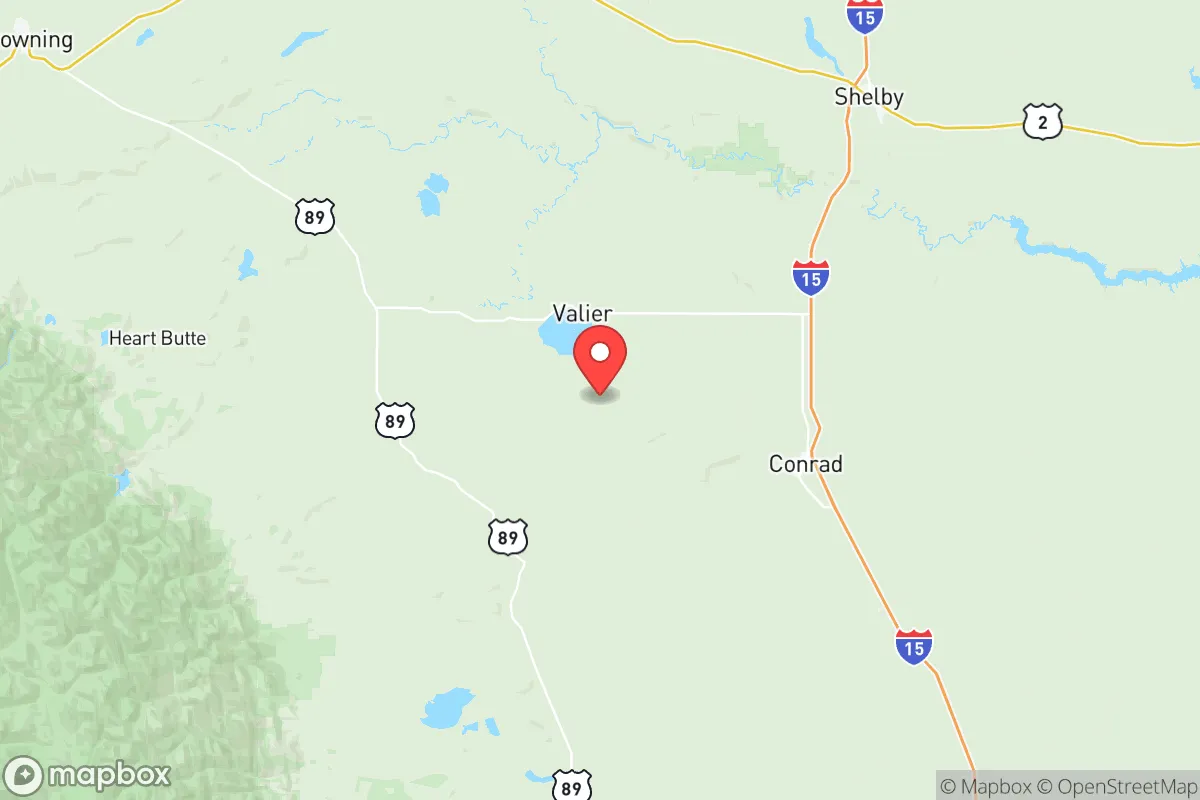
Pondera County, Montana, offers a compelling strategic position for those prioritizing resilience and self-sufficiency, combining geographic isolation with access to critical infrastructure. Located in north-central Montana along the Rocky Mountain Front, the county is anchored by the town of Conrad (pop. ~2,500) and includes smaller communities like Valier and Dupuyer. Its location places it roughly 80 miles from the Canadian border, 100 miles from Great Falls, and over 200 miles from any major metropolitan area, providing a buffer from urban vulnerabilities while maintaining connectivity via U.S. Highway 91 and Montana Highway 44. The county's position along the eastern slope of the Rockies offers natural advantages in water access, defensible terrain, and reduced exposure to many common disaster scenarios.
Geographic position and natural advantages for long-term security
Pondera County sits at the intersection of the Rocky Mountain Front and the Great Plains, a transition zone that provides both defensive depth and resource access. The county's western edge abuts the Lewis and Clark National Forest, offering timber, wildlife, and natural barriers against large-scale movement. The area is drained by the Teton River and its tributaries, including Birch Creek and Dupuyer Creek, which flow from the mountains into the Marias River system. This watershed provides reliable surface water in a region where water rights are a critical asset. The county's elevation ranges from roughly 3,500 to over 7,000 feet in the western mountains, creating natural chokepoints and observation points. Winters are harsh, with average January lows near 10°F and significant snowfall, which acts as a natural deterrent to unprepared travelers and provides a seasonal water reservoir. The low population density—roughly 6,000 residents across 1,625 square miles—means minimal competition for local resources compared to more populated regions of Montana like the Gallatin Valley or Missoula.
Risk exposure and proximity to fallout-relevant landmarks
Pondera County's primary risk exposure comes from its proximity to Malmstrom Air Force Base, located roughly 70 miles southeast near Great Falls. Malmstrom is a key component of the U.S. nuclear triad, housing Minuteman III ICBM silos spread across central Montana. While Pondera County itself does not host missile silos—those are concentrated in neighboring counties like Cascade, Chouteau, and Fergus—the presence of this strategic asset makes the broader region a potential target in a major conflict. The county is also within 150 miles of the Williston Basin oil fields in eastern Montana and North Dakota, which include refineries and processing facilities near Sidney and Culbertson. Natural disaster risks are comparatively low: the area experiences occasional severe winter storms, drought, and wildfire risk in the western forested zones, but is not prone to earthquakes, hurricanes, or flooding of the scale seen in other regions. Tornado risk exists but is lower than in the Great Plains proper, with an average of 1-2 tornadoes per decade in the county. The primary man-made risk is the potential for a cascading failure in the electrical grid during extreme winter events, as seen in the 2021 Texas blackouts, though Montana's grid is more decentralized and less vulnerable to single-point failures.
Practical resilience for relocators: food, water, energy, and defensibility
For a relocator focused on self-sufficiency, Pondera County offers strong fundamentals. Water access is the county's standout advantage: the Teton River and its tributaries provide reliable surface water, and groundwater is generally accessible at depths of 50-200 feet in the valley floors. Agricultural irrigation is well-established, with the Pondera County Canal and Reservoir Company managing a network of canals fed by the Teton River and Birch Creek. This infrastructure supports dryland and irrigated farming of wheat, barley, and hay, as well as cattle ranching. Local food production is robust: the county has over 500 farms and ranches, and the Conrad Farmers Market operates seasonally. For energy, the county is served by Northwestern Energy and the rural electric cooperative Pondera Electric Cooperative, which provides power to most of the county. The area has significant wind energy potential, with the Pondera Wind Farm (a 60 MW facility near Conrad) demonstrating commercial viability. Residential solar is feasible, with roughly 200 sunny days per year, though winter generation is limited. Defensibility is aided by the county's low population density and the natural barrier of the Rocky Mountain Front to the west. The terrain offers numerous defensible positions along river valleys and mountain passes, though the open plains to the east present challenges for perimeter security. The nearest major medical facility is the Pondera Medical Center in Conrad, a critical access hospital with 25 beds, with Level II trauma care available in Great Falls (100 miles away). Law enforcement is provided by the Pondera County Sheriff's Office, with a small staff covering a large area, meaning residents should expect significant self-reliance in emergencies.
Overall, Pondera County presents a balanced strategic picture for the resilience-minded relocator. Its strengths lie in water abundance, low population density, agricultural capacity, and geographic isolation from major urban centers and their associated vulnerabilities. The primary trade-offs are the harsh winter climate, which demands significant preparation and infrastructure investment, and the regional proximity to Malmstrom AFB, which introduces a low-probability but high-consequence risk. For those willing to invest in winter-ready housing, backup power, and water storage, the county offers one of the more defensible and resource-secure positions in the lower 48 states, particularly when compared to more exposed regions like the Front Range of Colorado or the Pacific Northwest. The combination of mountain-front defensibility, irrigated agriculture, and existing energy infrastructure makes Pondera County a serious option for those prioritizing long-term resilience over convenience or climate mildness.

* Values derived from national, state, county, city and local statistics and may differ in a specific area. Last updated: 2026-08-08T11:39:45.000Z
Narrative content on this page is AI-generated and may contain mistakes. Verify any details that matter before acting on them.
ReloMaps may earn a commission from affiliate links at no extra cost to you.

