
Photo: Wikipedia
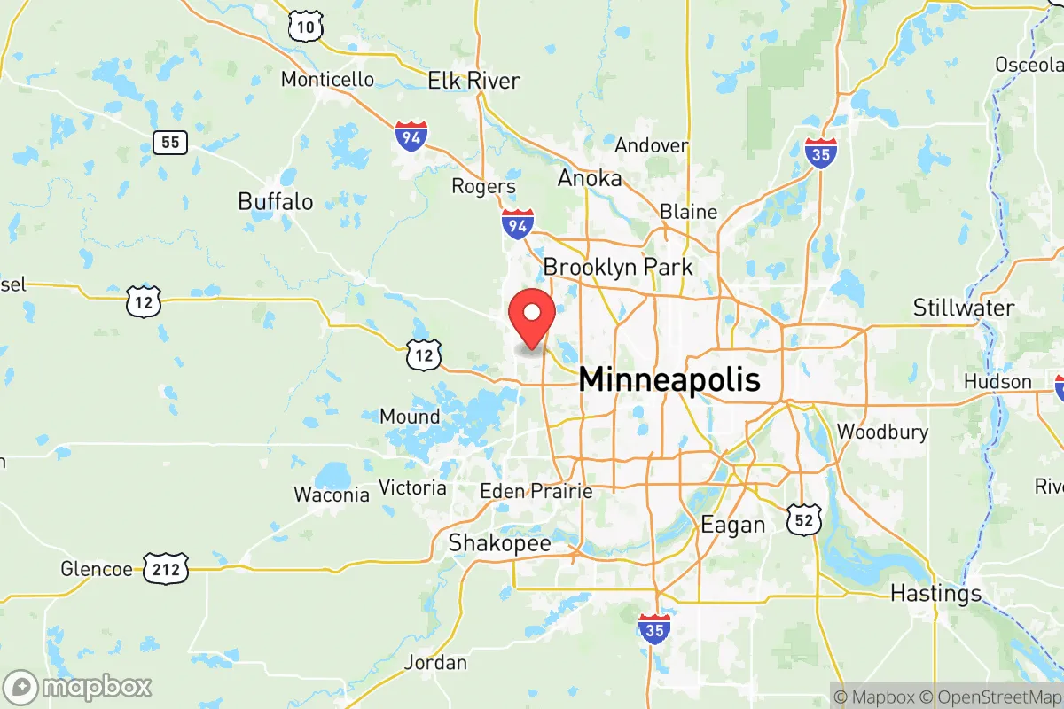
Strategic Assessment of Hennepin County
Multiple tactical vulnerabilities. Population density, target proximity, or disaster risk are likely compounding. A retreat property and exit planning is required.
What does the Strategic Assessment tell us?
Our Strategic Assessment grades tactical survivability of an area. Major population centers, military targets, fallout zones, natural disasters, and border exposure all drive risk — lower exposure means a more defensible position in a crisis.
This is heavily inspired by Joel Skousen's Strategic Relocation book. Highly recommended you checkout the book ($)What does this tell us?
Our Strategic Assessment grades tactical survivability of an area. Major population centers, military targets, fallout zones, natural disasters, and border exposure all drive risk — lower exposure means a more defensible position in a crisis.
This is heavily inspired by Joel Skousen's Strategic Relocation book. Highly recommended you checkout the book ($)Strategic Pillars

Key Distances
Strategic Assessment Analysis
Hennepin County presents a complex strategic picture for the relocation-minded reader prioritizing resilience and self-sufficiency. While the county is anchored by the major urban center of Minneapolis, its geographic position within the Upper Midwest offers a unique blend of natural advantages and significant exposure to man-made risks that demand careful consideration. The area’s core resilience stems from its abundant freshwater resources and relatively low risk of natural disasters like hurricanes, earthquakes, and wildfires, but this is counterbalanced by its status as a dense population and economic hub, which creates a high-consequence target profile for a variety of systemic disruptions.
Geographic position and natural advantages for long-term stability
Hennepin County’s primary strategic asset is its location within the Great Lakes region, which provides a buffer against many of the climate-driven catastrophes plaguing other parts of the country. The county sits at the confluence of the Mississippi, Minnesota, and St. Croix rivers, and its western edge touches the vast expanse of Lake Minnetonka, a 14,000-acre lake that serves as a massive, decentralized freshwater reservoir. This water abundance is a critical long-term advantage for any serious self-sufficiency plan. The surrounding topography is relatively flat but features a mix of hardwood forests, wetlands, and agricultural land, offering a degree of natural cover and resource availability that is absent from the open plains further west. The climate, while harsh with long, cold winters, also acts as a natural deterrent to many biological and insect-borne threats. The county’s position roughly 350 miles from the Canadian border provides a potential northern retreat corridor, and its distance from major coastal ports and the Gulf of Mexico’s refinery corridor reduces its exposure to direct hurricane or tsunami impacts. The presence of the Minneapolis-St. Paul International Airport (MSP) in the city of Fort Snelling is a double-edged sword: it provides a critical logistical node for emergency supply chains but also marks the area as a high-value target.
Risk exposure: proximity to fallout-relevant landmarks and systemic vulnerabilities
The most significant strategic weakness of Hennepin County is its density and economic concentration. As the most populous county in Minnesota, home to over 1.2 million people, it is a primary target for any adversary seeking to disrupt the regional or national economy. The county contains several high-consequence landmarks. The Pine Bend Refinery in nearby Rosemount (Dakota County) is the largest refinery in the region and a critical fuel source for the Upper Midwest; its proximity to the southern edge of Hennepin County creates a substantial secondary risk zone for chemical release or targeted disruption. The Fort Snelling National Cemetery and the historic fort itself are located at the confluence of the Mississippi and Minnesota rivers, a strategic chokepoint for river traffic and a symbolic target. The county is also home to the University of Minnesota Twin Cities campus in Minneapolis, a major research institution with potential dual-use research vulnerabilities. The Hennepin County Government Center in downtown Minneapolis is a central administrative hub. For a relocator, the primary man-made risk is not a direct strike but the cascading effects of a disruption to these nodes: mass evacuation gridlock on I-94 and I-494, supply chain collapse for food and medicine, and the potential for civil unrest in a densely populated urban core. The county’s reliance on a centralized power grid and natural gas infrastructure also presents a vulnerability, as a prolonged winter power outage could be catastrophic for unprepared residents.
Practical resilience for a relocator: food, water, energy, and defensibility
For a family or individual looking to establish a self-sufficient homestead within Hennepin County, the practical reality is mixed. The county’s abundant surface water—from Lake Minnetonka to the Mississippi River—is a major plus, but access to it for private use is heavily regulated and often restricted to municipal systems. Well water is an option in the more rural western and northern townships, such as Maple Plain or Independence, but the water table depth and quality vary. Food resilience is more challenging. While the county has a strong local food movement and farmers' markets, the agricultural land within the county is increasingly fragmented by suburban development. The most productive soils are found in the western and southern parts of the county, near Chanhassen and Shakopee (Scott County), but these areas are also experiencing rapid growth. For a relocator, the best strategy is to look at the exurban fringe—towns like Rogers or Corcoran—where larger lots and a more rural character still allow for significant food production. Energy resilience is a weak point. The county is heavily dependent on the regional grid, and while solar adoption is growing, the long, overcast winters limit its effectiveness. Wood heating is common in rural areas, but air quality regulations and the cost of firewood are considerations. Defensibility is the hardest factor. The county’s terrain is generally open and lacks natural chokepoints, making perimeter security difficult. The best defensible positions are on the bluffs overlooking the Mississippi River or on the larger, wooded properties in the western lake country, where natural barriers and distance from major roads provide a modest buffer. The key takeaway is that true self-sufficiency within Hennepin County requires a deliberate choice of location on the far periphery, away from the urban core and its associated risks.
The overall strategic picture for Hennepin County is one of high potential reward paired with high systemic risk. Its natural advantages—abundant water, a moderate climate for food production, and a low risk of natural disasters—are genuine and valuable for a long-term resilience plan. However, the county’s role as the economic and population center of the Upper Midwest makes it a primary target for any large-scale disruption, whether from a cyberattack on the grid, a pandemic, or a geopolitical conflict. For the relocator who is serious about preparedness, the county is not a destination for urban survivalism but rather a region to be approached with a clear-eyed strategy: live on the rural fringe, secure your own water and energy sources, and maintain a low profile. The towns of Maple Plain and Independence offer the best balance of proximity to resources and distance from the highest-risk zones. Ultimately, Hennepin County is a place where a well-prepared individual can thrive, but it is not a place for the unprepared to seek refuge. The margin for error is thin, and the consequences of being caught in the urban core during a crisis are severe.

* Values derived from national, state, county, city and local statistics and may differ in a specific area. Last updated: 2026-07-02T18:03:42.000Z
Narrative content on this page is AI-generated and may contain mistakes. Verify any details that matter before acting on them.
ReloMaps may earn a commission from affiliate links at no extra cost to you.

