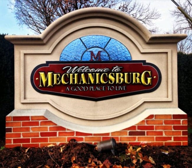
Photo: Wikipedia
Strategic Assessment of Mechanicsburg, PA
Multiple tactical vulnerabilities. Population density, target proximity, or disaster risk are likely compounding. A retreat property and exit planning is required.
What does the Strategic Assessment tell us?
Our Strategic Assessment grades tactical survivability of an area. Major population centers, military targets, fallout zones, natural disasters, and border exposure all drive risk — lower exposure means a more defensible position in a crisis.
This is heavily inspired by Joel Skousen's Strategic Relocation book. Highly recommended you checkout the book ($)What does this tell us?
Our Strategic Assessment grades tactical survivability of an area. Major population centers, military targets, fallout zones, natural disasters, and border exposure all drive risk — lower exposure means a more defensible position in a crisis.
This is heavily inspired by Joel Skousen's Strategic Relocation book. Highly recommended you checkout the book ($)Strategic Pillars

Key Distances
Regional Safe Places
Below is our recommended "safe zones" in Pennsylvania and the surrounding area based on our strategic heuristics. For most people, it's unrealistic to live in a “safe zone” full-time due to work, family or other personal reasons. They tend to be more rural. However, many of these areas are perfect for second homes and retreat properties that double as a vacation home or even a short-term rental.
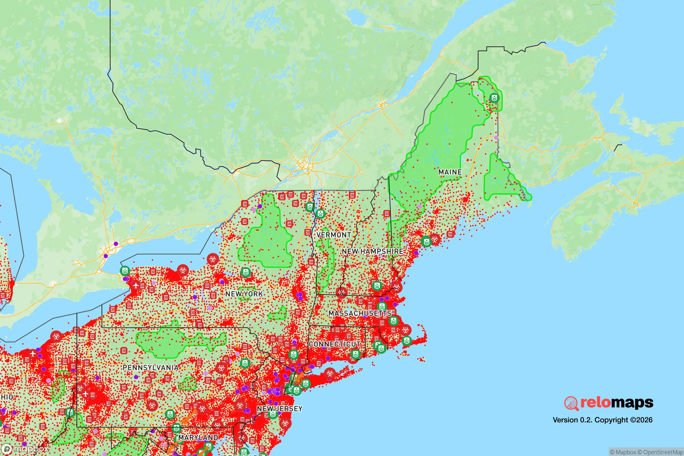
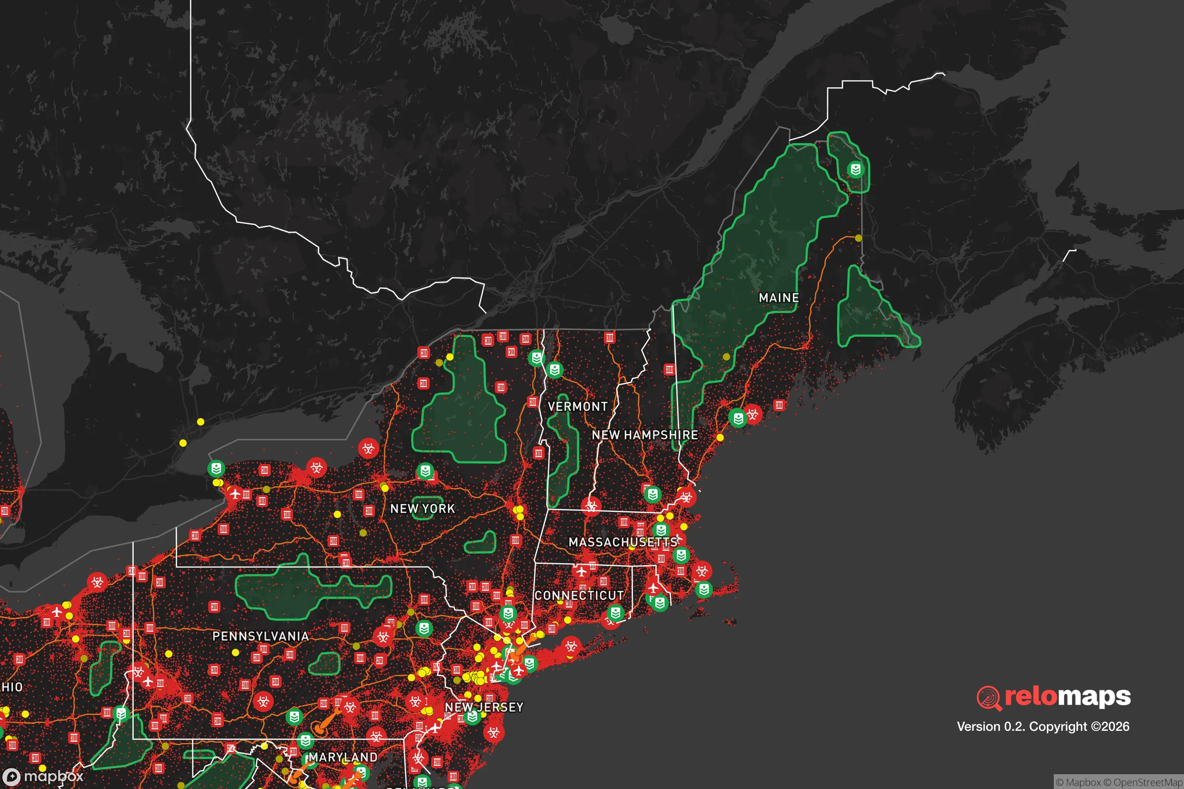


Important Note: For informational purposes only. This does not mean nothing bad ever happens in the green zones. Please use common sense. This is based on public data and modeled with AI. We tried to take a conservative approach but mistakes happen. We update this regularly as new information becomes available.
Solar Generator Recommendations
Backup power matters more here than in safer locations. We've picked three solar generators across budgets and capacity tiers — start with the budget unit if you only need a few essentials, or step up if you want to run a fridge and HVAC for days at a time.

Jackery Portable Power Station Explorer 300
Budget OptionPower on the Go: Weighing only 11 lbs, it's convenient to set up and store with book-sized foldable solar panels

BLUETTI Portable Power Station AC180
Designed for both indoor and outdoor scenarios, AC180 is highly capable as it has a robost capacity and continuous output power.

EF ECOFLOW DELTA Pro Ultra Power Station
Upgraded PickEcoFlow DELTA Pro Ultra is a whole-home energy system designed to grow with your family. Integrated with the Smart Home Panel 2, it scales to meet your evolving energy needs — keeping your home powered, intelligent, and secure through every stage of life.
We earn a commission, at no additional cost to you.
Strategic Assessment Analysis
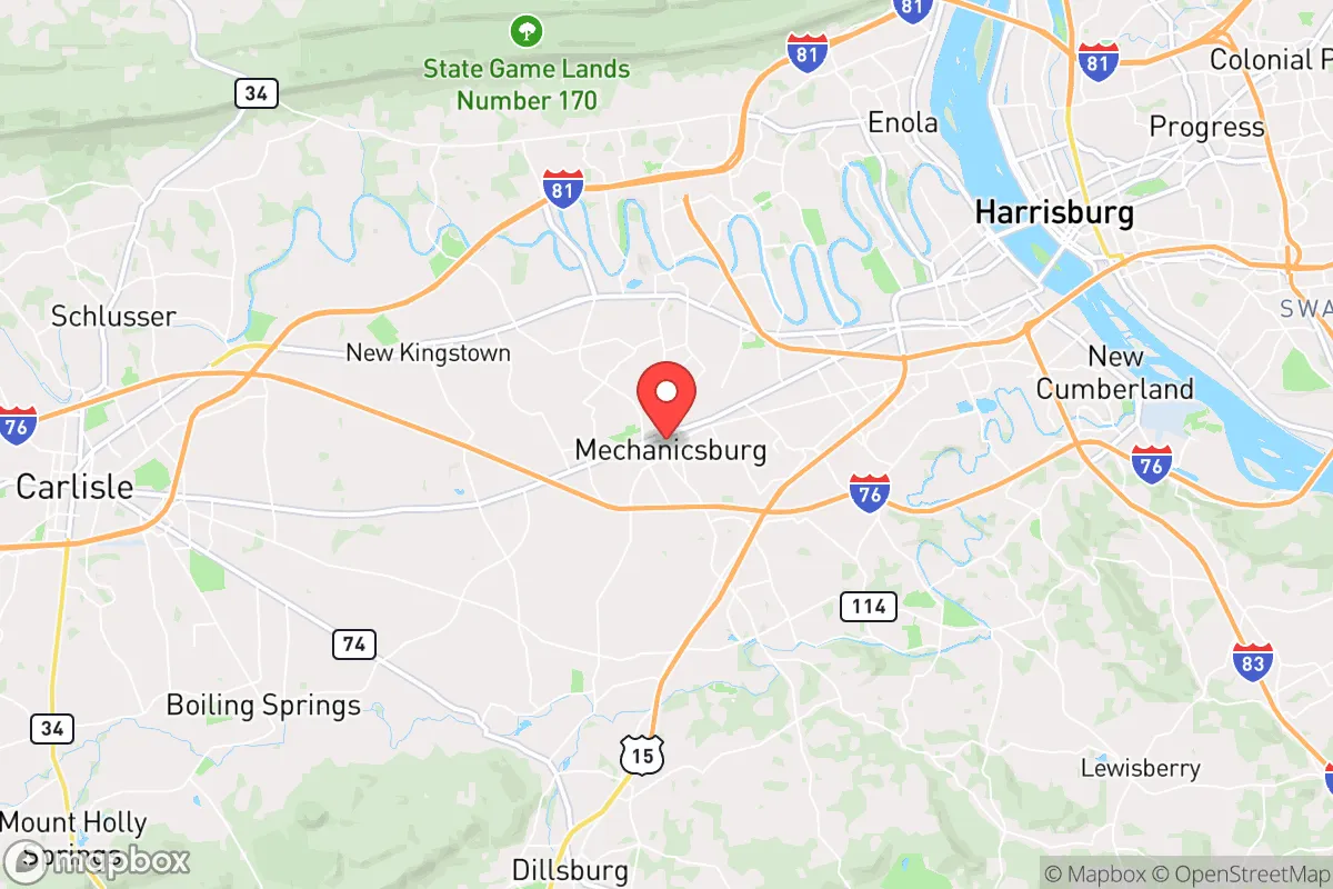
Mechanicsburg, Pennsylvania, offers a compelling mix of strategic depth and practical resilience for those prioritizing disaster readiness and self-sufficiency, though its proximity to major population and industrial centers introduces specific vulnerabilities that demand careful consideration. Located in Cumberland County, roughly 10 miles west of Harrisburg and 90 miles west of Philadelphia, the borough sits at a geographic pivot point between the Appalachian ridge-and-valley system and the fertile Cumberland Valley. This position provides a moderate buffer from coastal threats while maintaining access to critical infrastructure, but it also places residents within the shadow of several high-value man-made risk zones. For a relocator thinking seriously about long-term preparedness, Mechanicsburg represents a calculated trade-off: solid natural advantages in terms of water and agricultural access, tempered by its location near a state capital, major transportation corridors, and facilities that could become secondary targets in a broader crisis.
Geographic position and natural advantages for long-term stability
Mechanicsburg's most significant resilience asset is its location within the Cumberland Valley, a broad, fertile lowland flanked by South Mountain to the east and the Blue Ridge to the west. This valley acts as a natural funnel for prevailing westerly winds, which helps disperse airborne contaminants faster than in enclosed hollows or urban canyons. The area sits well inland, roughly 150 miles from the Atlantic coast, providing a meaningful buffer against hurricane storm surge, sea-level rise, and direct naval threats. Elevation in the borough averages around 450 feet, with the surrounding countryside rising to 800–1,200 feet within a 15-minute drive, offering defensible high ground without the extreme weather exposure of higher peaks. The underlying geology is primarily limestone and dolomite, which supports excellent groundwater recharge and stable foundations, though it also means the area is prone to sinkholes in poorly drained spots. The Susquehanna River lies about 12 miles to the east, and the Yellow Breeches Creek runs just south of town, providing surface water sources that are less contested than those closer to Harrisburg. The region's growing season runs roughly 170 days, and the valley's soils are among the most productive in Pennsylvania for row crops and pasture, giving a serious advantage for anyone planning food self-sufficiency.
Risks, exposures, and proximity to fallout-relevant landmarks
The most pressing risk for Mechanicsburg residents is its proximity to the Harrisburg metropolitan area and the associated concentration of critical infrastructure. The Three Mile Island nuclear plant, though permanently shut down in 2019, still houses spent fuel in dry cask storage on-site, located roughly 15 miles east-northeast of the borough. While the risk of a radiological release from stored fuel is far lower than from an active reactor, the site remains a potential target for sabotage or a secondary effect of a regional crisis. More immediately concerning is the presence of the Defense Distribution Center Susquehanna (DDCS) at the Naval Support Activity Mechanicsburg, a massive military logistics hub that supplies spare parts and equipment to all branches of the U.S. armed forces. This facility, along with the adjacent Letterkenny Army Depot (about 25 miles west in Chambersburg), makes the area a plausible target for kinetic or cyber attack during a major conflict. The borough also sits within 20 miles of the Harrisburg International Airport and the Amtrak Keystone Corridor, both of which could become chokepoints or evacuation bottlenecks. Natural hazards are comparatively mild: the area experiences occasional flooding along the Yellow Breeches and Conodoguinet creeks, but the borough itself is largely outside the 100-year floodplain. Tornado risk is low by Midwest standards, though severe thunderstorms with damaging winds occur several times per year. Winter storms can drop 30–40 inches of snow annually, but prolonged power outages are rare outside of ice events.
Practical resilience for a relocator: food, water, energy, and defensibility
For someone serious about self-sufficiency, Mechanicsburg offers strong fundamentals with some notable gaps. The surrounding Cumberland Valley is prime agricultural land, with dozens of farms within a 10-mile radius producing corn, soybeans, hay, and livestock. The Mechanicsburg Farmers Market operates year-round, and several local CSAs serve the area, meaning fresh food access is robust even in normal times. For long-term storage, the region's moderate humidity (averaging 65–70%) is manageable with proper drying and sealing, unlike the Gulf Coast or Pacific Northwest. Water availability is a major strength: the borough draws from the Susquehanna River via the Pennsylvania American Water system, but private wells are common in the surrounding townships, with typical depths of 100–300 feet tapping into the limestone aquifer. Yield is generally good, though well water in the area can be hard and may require treatment for iron and sulfur. For off-grid energy, the region's solar potential is moderate — roughly 4.0 peak sun hours per day — which is workable with a properly sized array, especially when paired with battery storage. Wood heating is viable given the nearby state forests (Michaux State Forest is 15 miles west), but air quality inversions in the valley can trap smoke during calm winter periods. Defensibility is mixed: the borough itself is a dense, walkable grid with limited natural chokepoints, making it hard to secure against a determined threat. However, the surrounding countryside offers numerous farmsteads and rural properties with good sightlines, spring-fed water, and access to secondary roads that bypass the main arteries (U.S. 11, I-81, and the Pennsylvania Turnpike). The local population skews older and more conservative, with a strong hunting and outdoor tradition, meaning a higher baseline of firearms familiarity and practical skills than in many suburban areas.
The overall strategic picture for Mechanicsburg is one of moderate resilience with specific, manageable vulnerabilities. Its inland location, fertile valley, and abundant water give it a solid foundation for long-term self-sufficiency, and the surrounding rural areas offer defensible retreat options that are still within a reasonable commute to employment and services. The primary downsides are the proximity to a state capital, a major military logistics hub, and a decommissioned nuclear site, any of which could become a focal point in a national-level crisis. For a relocator who is willing to invest in well water, solar backup, and a rural property outside the borough limits, Mechanicsburg provides a realistic balance of access and security. It is not a remote bunker location, but it is a place where a prepared family can build a sustainable, low-profile life with good odds of weathering most regional disruptions.

* Values derived from national, state, county, city and local statistics and may differ in a specific area. Last updated: 2026-10-21T14:29:15.000Z
Narrative content on this page is AI-generated and may contain mistakes. Verify any details that matter before acting on them.
ReloMaps may earn a commission from affiliate links at no extra cost to you.

