Photo: Wikipedia
Strategic Assessment of Talbot County
Meaningful friction. Expect exposure to either population pressure, blast zones, or natural disaster risk. Consider buying a retreat property.
What does the Strategic Assessment tell us?
Our Strategic Assessment grades tactical survivability of an area. Major population centers, military targets, fallout zones, natural disasters, and border exposure all drive risk — lower exposure means a more defensible position in a crisis.
This is heavily inspired by Joel Skousen's Strategic Relocation book. Highly recommended you checkout the book ($)What does this tell us?
Our Strategic Assessment grades tactical survivability of an area. Major population centers, military targets, fallout zones, natural disasters, and border exposure all drive risk — lower exposure means a more defensible position in a crisis.
This is heavily inspired by Joel Skousen's Strategic Relocation book. Highly recommended you checkout the book ($)Strategic Pillars

Key Distances
Strategic Assessment Analysis
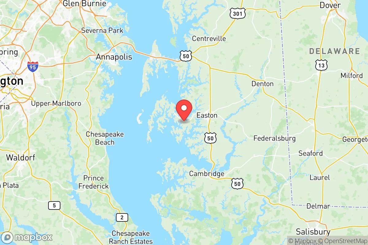
Talbot County, Maryland, offers a compelling mix of geographic isolation and strategic access that appeals to relocation-minded individuals and families prioritizing resilience and self-sufficiency. Situated on Maryland's Eastern Shore, the county is buffered by the Chesapeake Bay to the west and the Choptank River to the south, creating natural barriers that reduce the risks associated with urban sprawl and high-traffic corridors. While not immune to regional threats, Talbot County’s position — anchored by the historic town of Easton and the smaller communities of St. Michaels, Oxford, and Trappe — provides a defensible, resource-rich environment for those serious about disaster readiness and long-term stability.
Geographic position and natural advantages for long-term stability
Talbot County’s geography is its strongest asset for resilience. The county is a peninsula within a peninsula, bounded by the Chesapeake Bay on the west and the Choptank River on the south, with the Tred Avon River and Miles River cutting through its interior. This water-rich layout limits road access to a handful of routes — primarily U.S. Route 50 and Maryland Route 33 — which can be monitored or controlled in a crisis. The land is low-lying but fertile, with elevations rarely exceeding 50 feet, supporting agriculture and forestry that are central to the local economy. Easton, the county seat, sits roughly 15 miles inland from the Bay, offering a balance of accessibility and seclusion. The area’s temperate climate, with mild winters and moderate summers, reduces the frequency of extreme weather events compared to the Gulf Coast or the Great Plains, though it is not immune to nor’easters and occasional hurricanes. For a relocator, the key takeaway is that Talbot County’s natural layout provides a buffer against both man-made and natural disruptions, with multiple water sources and arable land within easy reach.
Risks, exposures, and proximity to fallout-relevant landmarks
No location is without risk, and Talbot County’s vulnerabilities stem primarily from its proximity to major population centers and critical infrastructure. The county lies about 70 miles east of Washington, D.C., and 90 miles south of Philadelphia, placing it within the fallout shadow of a nuclear event targeting the National Capital Region. The nearby Calvert Cliffs Nuclear Power Plant, located roughly 30 miles southwest across the Bay in Calvert County, is a specific concern — a major incident there could affect air and water quality across the Eastern Shore. Additionally, the Port of Baltimore, a major shipping hub for hazardous materials and petroleum products, sits about 60 miles northwest; a catastrophic release or attack on the port could contaminate the Chesapeake Bay and disrupt supply chains. On the positive side, Talbot County has no major military bases, refineries, or chemical plants within its borders, and the nearest active military installation — Dover Air Force Base in Delaware — is 50 miles northeast, a lower-priority target. The county’s primary risk is indirect: fallout from a strike on D.C. or Baltimore, or a secondary crisis like a pandemic or economic collapse that triggers urban unrest. For a relocator, the calculus is that Talbot County is far enough from primary targets to avoid direct blast effects but close enough to be affected by fallout patterns, especially with prevailing westerly winds. A robust sheltering plan and a stockpile of potassium iodide are prudent precautions.
Practical resilience for a relocator: food, water, energy, and defensibility
Talbot County scores well on practical resilience metrics, particularly for those willing to invest in self-sufficiency. The county’s agricultural base is strong: over 40% of the land is farmland, producing corn, soybeans, wheat, and livestock, with numerous farmers’ markets and CSAs in Easton and St. Michaels. The Chesapeake Bay and its tributaries provide abundant seafood — oysters, crabs, and fish — that can supplement food supplies indefinitely. Water access is excellent: the county sits atop the Columbia Aquifer, which yields clean groundwater at moderate depths (50-150 feet), and surface water from the Choptank River and Bay is plentiful, though it requires filtration or treatment. For energy, Talbot County is served by Delmarva Power, but grid reliability is average; winter storms and hurricanes can cause outages lasting days. Solar adoption is growing, with several local installers, and the county’s flat, open terrain is favorable for small-scale wind or solar setups. Defensibility is a mixed picture: the limited road access is a double-edged sword, making it easier to secure a property but also creating choke points if evacuation is necessary. The county’s population density is low — roughly 140 people per square mile — and the culture is rural and self-reliant, with a strong tradition of hunting, fishing, and gardening. Easton has a well-regarded hospital (University of Maryland Shore Medical Center) and a regional airport, but specialized medical care requires a trip to Annapolis or Baltimore. For a family, the public schools are solid, and the community is tight-knit, which fosters mutual aid networks. The main practical challenge is that the county’s affluence — median household income around $75,000 — means land prices are higher than in more remote parts of the Eastern Shore, so a relocator should budget accordingly for acreage and improvements.
Overall, Talbot County presents a strong strategic option for the resilience-minded relocator who values natural buffers, agricultural self-sufficiency, and a low-key, community-oriented lifestyle. Its proximity to high-value targets like Washington, D.C., and Baltimore introduces real but manageable risks, particularly from fallout and supply chain disruptions, which can be mitigated with preparation. The county’s water wealth, fertile soil, and defensible geography make it a viable long-term base for those serious about self-reliance, provided they are willing to invest in off-grid infrastructure and maintain a low profile. For a family or individual seeking a balance between access to civilization and genuine preparedness, Talbot County is a solid bet — not a fortress, but a well-positioned homestead in a region that rewards foresight.

* Values derived from national, state, county, city and local statistics and may differ in a specific area. Last updated: 2026-08-09T12:32:40.000Z
Narrative content on this page is AI-generated and may contain mistakes. Verify any details that matter before acting on them.
ReloMaps may earn a commission from affiliate links at no extra cost to you.

