
Photo: Wikipedia
Strategic Assessment of Cecil County
Meaningful friction. Expect exposure to either population pressure, blast zones, or natural disaster risk. Consider buying a retreat property.
What does the Strategic Assessment tell us?
Our Strategic Assessment grades tactical survivability of an area. Major population centers, military targets, fallout zones, natural disasters, and border exposure all drive risk — lower exposure means a more defensible position in a crisis.
This is heavily inspired by Joel Skousen's Strategic Relocation book. Highly recommended you checkout the book ($)What does this tell us?
Our Strategic Assessment grades tactical survivability of an area. Major population centers, military targets, fallout zones, natural disasters, and border exposure all drive risk — lower exposure means a more defensible position in a crisis.
This is heavily inspired by Joel Skousen's Strategic Relocation book. Highly recommended you checkout the book ($)Strategic Pillars

Key Distances
Strategic Assessment Analysis
Cecil County, Maryland, occupies a strategic position at the head of the Chesapeake Bay where the Susquehanna River meets the bay, offering a resilience profile that is genuinely mixed for the disaster-conscious relocator. The county’s location between the Philadelphia and Baltimore metropolitan areas provides economic opportunity, but that same corridor proximity introduces real exposure to man-made risks that a serious preparedness-minded individual must weigh. For a single person or family looking at the Mid-Atlantic, Cecil County is not a remote retreat, but it is not a dense urban target either; it is a transitional zone with specific advantages and specific vulnerabilities that require clear-eyed assessment.
Geographic position and natural advantages for long-term stability
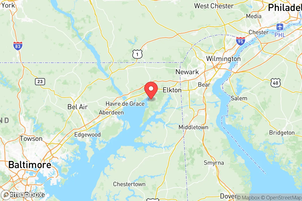
Cecil County’s defining geographic feature is its position at the confluence of the Susquehanna River and the Chesapeake Bay, with the county seat at Elkton anchoring the western edge and the port town of Perryville sitting at the river’s mouth. The county spans roughly 418 square miles, with a population around 105,000, giving it a moderate density that is neither crowded nor isolated. The topography is gently rolling Piedmont terrain, with the Fall Line running through the county — a geological boundary that historically limited navigation but also provides natural elevation changes and varied water resources. The county’s eastern edge borders Delaware and the Elk River, while the Chesapeake & Delaware Canal cuts across the northern portion, connecting the bay to the Delaware River — a critical piece of maritime infrastructure that is both an economic asset and a potential vulnerability.
For natural resilience, Cecil County benefits from a temperate climate with four distinct seasons, adequate annual rainfall averaging 45 inches, and a growing season of roughly 180 days that supports substantial small-scale agriculture. The county has productive farmland, particularly in the northern and eastern sections around Rising Sun and Colora, where soils support row crops and livestock. Water resources are abundant: the Susquehanna provides a massive freshwater source, and numerous creeks and ponds dot the landscape. The county’s position on the bay also moderates temperature extremes, reducing the severity of both summer heat and winter cold compared to inland locations. This combination of arable land, reliable rainfall, and accessible freshwater gives Cecil County a genuine agricultural resilience that many suburban counties lack.
Exposure to natural hazards and proximity to critical infrastructure targets
The most significant natural risk in Cecil County is flooding, driven by its extensive coastline along the Chesapeake Bay, the Elk River, and the Susquehanna. Hurricanes and nor’easters can produce storm surge that affects low-lying areas, particularly around Charlestown, Chesapeake City, and the bay-facing communities. The Susquehanna itself has a history of ice jams and spring flooding, with the river’s flow heavily managed by the Conowingo Dam just upstream in Maryland — a structure that, if compromised, would pose a catastrophic downstream threat to Perryville and Port Deposit. The county also sits in a moderate seismic zone; while large earthquakes are rare, the region has experienced minor tremors, and the proximity of the Fall Line means some fault activity is possible.
Man-made risks are more significant than natural ones for this area. Cecil County sits squarely between two major metropolitan areas, with the I-95 corridor running directly through it, and the county hosts the Perryville train station on Amtrak’s Northeast Corridor — one of the busiest rail lines in the country. The county is also home to the Bainbridge Naval Training Center site (now largely decommissioned but historically a major military installation), and it lies within roughly 50 miles of both the Aberdeen Proving Ground in Harford County to the south and the Port of Wilmington to the northeast. The Chesapeake & Delaware Canal is a chokepoint for maritime traffic, and the nearby refineries along the Delaware River — including facilities in Delaware City and Paulsboro, New Jersey — represent significant industrial targets. For a relocator concerned about fallout or secondary effects from a major incident, Cecil County’s position in the Northeast Corridor means it is not far from potential targets, though it is not a primary target itself.
Practical resilience for daily life: food, water, energy, and defensibility
For food security, Cecil County is genuinely strong. The county has over 1,000 farms, with significant production of corn, soybeans, and poultry, and it sits adjacent to the Eastern Shore’s agricultural heartland. Farmers markets operate in Elkton, North East, and Rising Sun, and the county’s agricultural extension service is active. A relocator with even modest land can produce a meaningful portion of their own food, and the local food system is robust enough that supply chain disruptions would be less severe here than in urban areas. Water is similarly favorable: the Susquehanna is a massive resource, and most of the county relies on groundwater wells outside the town limits, meaning individual water security is achievable with proper well maintenance and backup power.
Energy resilience is a weaker point. The county is served by the PJM grid, and power outages from storms are common, particularly in rural areas with overhead lines. The Conowingo Dam provides hydroelectric power, but it is a single point of failure for local generation. Natural gas infrastructure is present but not redundant, and the county has limited solar penetration compared to more progressive jurisdictions. A serious relocator should plan for extended outages with generator capacity and possibly off-grid solar, as grid reliability in this region is moderate at best. For defensibility, Cecil County offers a mixed picture: the terrain is not mountainous, but the many waterways, creeks, and the bay itself create natural chokepoints and defensible positions. The county’s rural northern sections, particularly around Colora and Liberty Grove, offer the kind of low-visibility, low-density living that supports a lower-profile existence, while the more populated Elkton and North East areas are more exposed.
The strategic picture for a preparedness-minded relocator
Overall, Cecil County is a reasonable but not ideal choice for the disaster-conscious individual or family. Its strengths are real: abundant water, productive farmland, a moderate climate, and a position that is removed from the densest urban cores while still offering access to employment and services. Its weaknesses are equally real: the I-95 corridor and Northeast Corridor rail line run through it, the canal and nearby refineries are potential targets, and the county’s energy infrastructure is not particularly robust. For a relocator who wants a balance of access and resilience, the northern and eastern parts of the county — away from the bay and the river, closer to the Delaware border — offer the best combination of agricultural self-sufficiency and reduced exposure. The county is not a survivalist retreat, but it is a defensible, livable middle ground for someone who wants to be prepared without abandoning the conveniences of the Mid-Atlantic. The key is to choose the specific location carefully, secure water and power independence, and understand that the county’s greatest vulnerability is its position in a corridor that connects two major metropolitan areas.

* Values derived from national, state, county, city and local statistics and may differ in a specific area. Last updated: 2026-10-19T07:47:58.000Z
Narrative content on this page is AI-generated and may contain mistakes. Verify any details that matter before acting on them.
ReloMaps may earn a commission from affiliate links at no extra cost to you.

