 Popular
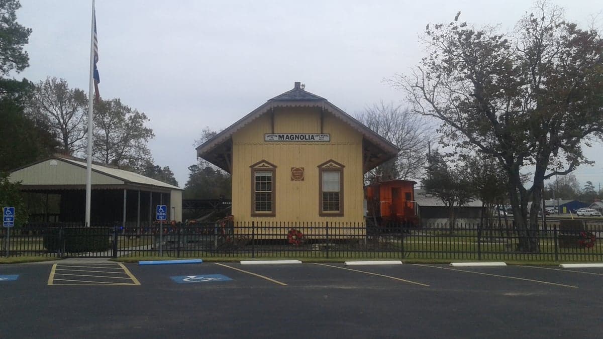
Photo: Wikipedia
Strategic Assessment of Magnolia, TX
Multiple tactical vulnerabilities. Population density, target proximity, or disaster risk are likely compounding. A retreat property and exit planning is required.
What does the Strategic Assessment tell us?
Our Strategic Assessment grades tactical survivability of an area. Major population centers, military targets, fallout zones, natural disasters, and border exposure all drive risk — lower exposure means a more defensible position in a crisis.
This is heavily inspired by Joel Skousen's Strategic Relocation book. Highly recommended you checkout the book ($)What does this tell us?
Our Strategic Assessment grades tactical survivability of an area. Major population centers, military targets, fallout zones, natural disasters, and border exposure all drive risk — lower exposure means a more defensible position in a crisis.
This is heavily inspired by Joel Skousen's Strategic Relocation book. Highly recommended you checkout the book ($)Strategic Pillars

Key Distances
Regional Safe Places
Below is our recommended "safe zones" in Texas and the surrounding area based on our strategic heuristics. For most people, it's unrealistic to live in a “safe zone” full-time due to work, family or other personal reasons. They tend to be more rural. However, many of these areas are perfect for second homes and retreat properties that double as a vacation home or even a short-term rental.

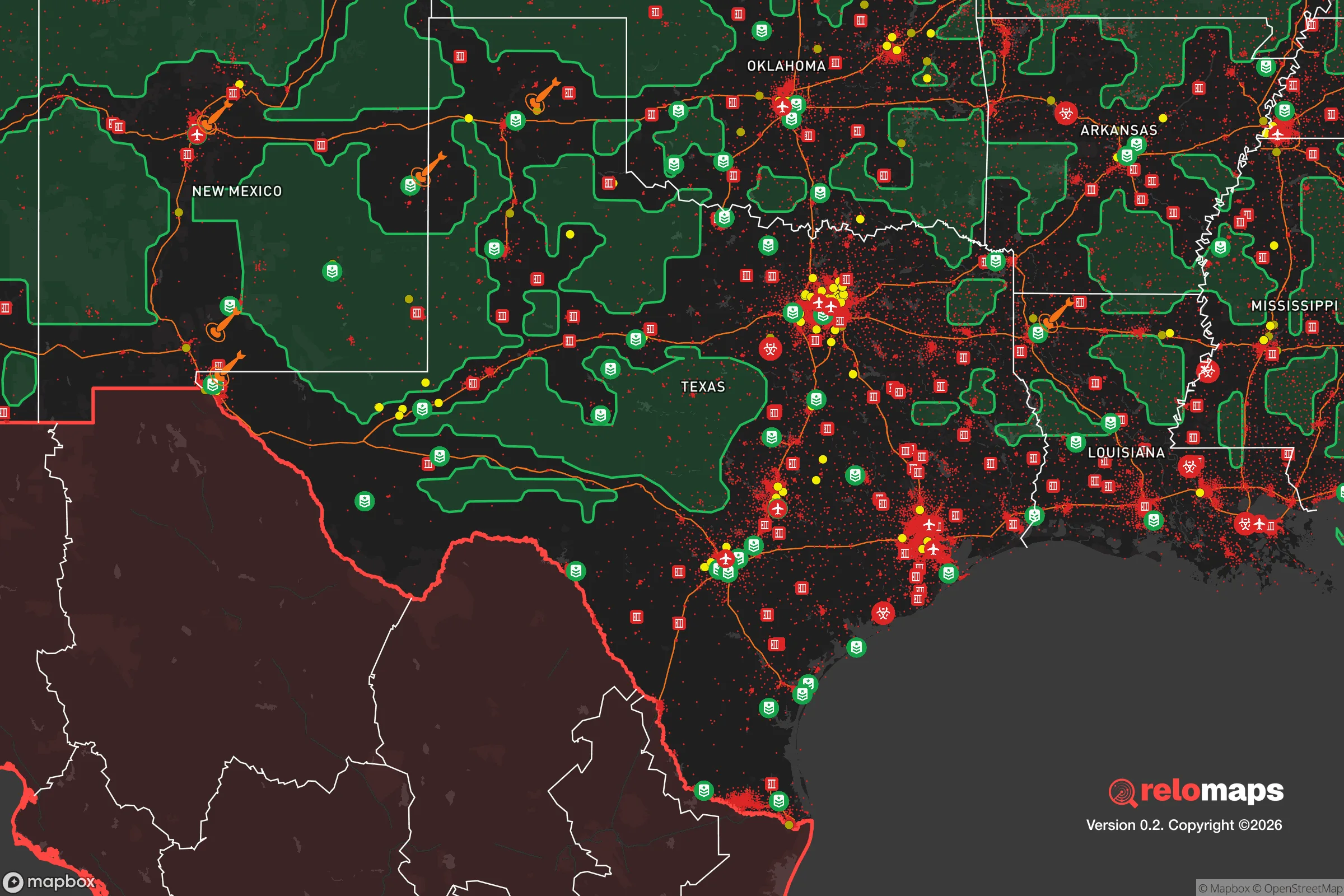


Important Note: For informational purposes only. This does not mean nothing bad ever happens in the green zones. Please use common sense. This is based on public data and modeled with AI. We tried to take a conservative approach but mistakes happen. We update this regularly as new information becomes available.
Solar Generator Recommendations
Backup power matters more here than in safer locations. We've picked three solar generators across budgets and capacity tiers — start with the budget unit if you only need a few essentials, or step up if you want to run a fridge and HVAC for days at a time.

Jackery Portable Power Station Explorer 300
Budget OptionPower on the Go: Weighing only 11 lbs, it's convenient to set up and store with book-sized foldable solar panels

BLUETTI Portable Power Station AC180
Designed for both indoor and outdoor scenarios, AC180 is highly capable as it has a robost capacity and continuous output power.

EF ECOFLOW DELTA Pro Ultra Power Station
Upgraded PickEcoFlow DELTA Pro Ultra is a whole-home energy system designed to grow with your family. Integrated with the Smart Home Panel 2, it scales to meet your evolving energy needs — keeping your home powered, intelligent, and secure through every stage of life.
We earn a commission, at no additional cost to you.
Strategic Assessment Analysis
Magnolia, Texas, occupies a strategic position roughly 40 miles northwest of Houston that offers a meaningful blend of rural buffer and practical access, making it a credible option for relocators prioritizing disaster readiness and self-sufficiency. The area sits on the western edge of the Piney Woods region, where the terrain transitions from coastal plains to slightly more elevated, forested land, providing natural advantages that many closer-in Houston suburbs lack. For a single individual or family thinking seriously about resilience, Magnolia presents a workable middle ground—close enough to urban infrastructure for supply runs and medical care, yet far enough to avoid the worst of a major metropolitan collapse scenario.
Geographic position and natural advantages for long-term stability
Magnolia’s location on the Sam Houston National Forest’s southern fringe gives it a distinct edge in terms of natural resources and defensible space. The area sits at roughly 200–250 feet above sea level, which is notably higher than much of Harris County and the immediate Houston metro, reducing flood risk from the region’s notorious storm surges and riverine flooding. The underlying geology is primarily sandy loam over clay, which drains reasonably well compared to the heavy clay soils closer to the coast, meaning that during heavy rain events, water tends to percolate rather than pool. The forest itself—over 163,000 acres of managed pine and hardwood—provides a substantial natural barrier to the east and north, offering both cover and a renewable source of timber, firewood, and game. The area’s watershed feeds into the San Jacinto River basin, but Magnolia itself sits on higher ground along the divide between the West Fork and the main stem, giving it a natural drainage advantage. For a relocator, this means that while no place in Southeast Texas is immune to hurricanes, Magnolia’s inland position and elevation make it one of the more survivable options within a two-hour drive of Houston.
Risk exposure: natural hazards and proximity to man-made vulnerabilities
No strategic assessment would be complete without acknowledging the risks. Magnolia’s primary natural threat is the same one that defines life in the Gulf South: hurricanes and their associated inland flooding. While the area is far enough from the coast to avoid the worst of storm surge, it still lies within the cone of uncertainty for major hurricanes like Harvey (2017) and Ike (2008), which dropped catastrophic rainfall across the region. The 2017 Tax Day flood and the 2016 Memorial Day flood both caused significant damage in parts of Montgomery County, though Magnolia fared better than areas closer to the San Jacinto River. Tornadoes are a secondary concern—Montgomery County averages about 3–5 tornadoes per year, mostly EF0–EF1, but the risk is real and should factor into any property selection. On the man-made side, Magnolia’s proximity to Houston is a double-edged sword. The city is a major petrochemical hub, with refineries and chemical plants along the Houston Ship Channel and in the Baytown/Deer Park corridor. A major industrial accident or terrorist event at one of these facilities could produce a toxic plume that, depending on wind direction, could reach Magnolia within a few hours. Additionally, the area lies roughly 60 miles from the San Jacinto River Waste Pits Superfund site and within 100 miles of the Strategic Petroleum Reserve’s Bryan Mound facility near Freeport, which, while not a direct fallout risk, represents a potential target in a conflict scenario. For a relocator concerned about societal collapse or nuclear war, Magnolia’s distance from major military installations (Fort Cavazos is about 120 miles west) and population centers is a net positive, but the petrochemical infrastructure in Houston remains a significant vulnerability.
Practical resilience for a relocator: food, water, energy, and defensibility
For someone serious about self-sufficiency, Magnolia offers a mix of opportunities and limitations. The area’s sandy loam soil is well-suited for gardening, particularly for crops like tomatoes, peppers, okra, and sweet potatoes, which thrive in the long, hot growing season (roughly March through October). The Sam Houston National Forest provides a reliable source of wild game—white-tailed deer, feral hogs, turkey, and small game—though hunting pressure is moderate and permits are required. Water is the more complex variable. The region’s groundwater comes from the Gulf Coast Aquifer, which is generally reliable but has experienced localized depletion and saltwater intrusion in some areas. Many rural properties in Magnolia rely on private wells, which can be a resilience asset if properly maintained and equipped with a hand pump or solar-powered backup. Surface water from the San Jacinto River and its tributaries is available but requires treatment due to agricultural runoff and upstream development. For energy, the area is served by Entergy Texas and the Electric Reliability Council of Texas (ERCOT) grid, which has a well-documented history of instability during extreme weather events. The February 2021 winter storm (Uri) left much of Montgomery County without power for days, and some rural areas went over a week without electricity. A relocator should plan for a robust backup power system—solar with battery storage or a propane/natural gas generator—and consider a wood-burning stove for heat, as natural gas service can also fail during grid outages. Defensibility is a mixed picture. Magnolia is not a gated community; it’s a spread-out exurban area with a mix of subdivisions, acreage properties, and small farms. The terrain is relatively flat with moderate tree cover, which offers some concealment but limited natural chokepoints. The nearest law enforcement is the Montgomery County Sheriff’s Office, which has a substation in Magnolia but is stretched thin across a large county. For a family, the best defensive strategy is to choose a property with good visibility, a reliable water source, and a defensible perimeter—ideally on a dead-end road or with a long driveway that provides early warning. The local culture is heavily oriented toward hunting and firearms ownership, which can be a social asset in a preparedness-minded community.
The overall strategic picture for Magnolia is one of cautious optimism for a relocator who is willing to invest in infrastructure and accept the trade-offs. The area’s inland position, elevation, and forest buffer provide genuine natural advantages over most Houston suburbs, while its proximity to the city’s medical, logistical, and economic resources offers a practical safety net for everyday life. The risks—hurricanes, grid instability, and proximity to petrochemical infrastructure—are real but manageable with proper planning. For a single individual or family looking to balance self-sufficiency with access to modern amenities, Magnolia represents a solid, if not exceptional, choice. It is not a remote bunker location, but it is a place where a prepared person can build a resilient life without feeling cut off from the world. The key is to go in with eyes open: invest in backup power, secure a reliable water source, and understand that the same proximity to Houston that makes daily life convenient also introduces vulnerabilities that require active mitigation. For the right relocator, Magnolia offers a workable foundation for long-term stability.

* Values derived from national, state, county, city and local statistics and may differ in a specific area. Last updated: 2026-07-30T02:01:00.000Z
Narrative content on this page is AI-generated and may contain mistakes. Verify any details that matter before acting on them.
ReloMaps may earn a commission from affiliate links at no extra cost to you.

