
Photo: Wikipedia
Strategic Assessment of Natchitoches County
Workable tactical position. Some exposure to population density or targets, but generally defensible in a crisis.
What does the Strategic Assessment tell us?
Our Strategic Assessment grades tactical survivability of an area. Major population centers, military targets, fallout zones, natural disasters, and border exposure all drive risk — lower exposure means a more defensible position in a crisis.
This is heavily inspired by Joel Skousen's Strategic Relocation book. Highly recommended you checkout the book ($)What does this tell us?
Our Strategic Assessment grades tactical survivability of an area. Major population centers, military targets, fallout zones, natural disasters, and border exposure all drive risk — lower exposure means a more defensible position in a crisis.
This is heavily inspired by Joel Skousen's Strategic Relocation book. Highly recommended you checkout the book ($)Strategic Pillars

Key Distances
Strategic Assessment Analysis
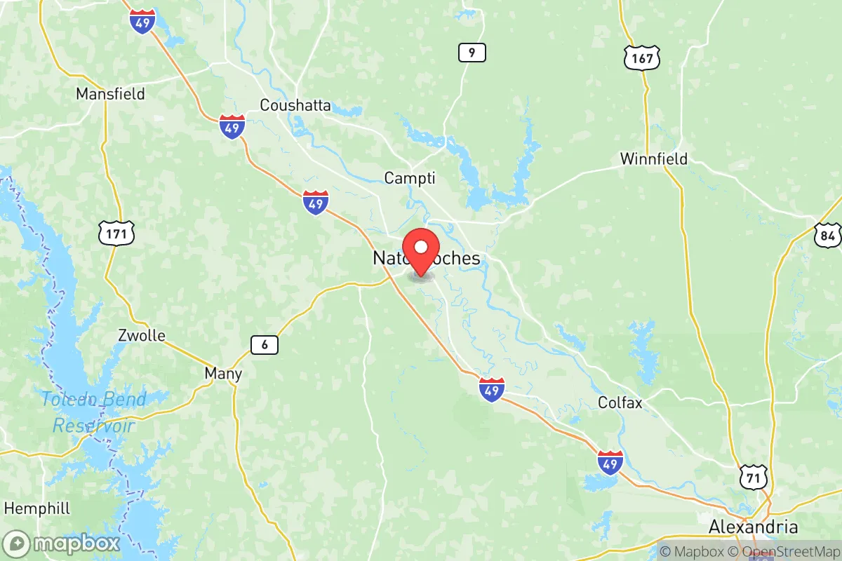
Natchitoches County, Louisiana, offers a compelling strategic profile for relocators prioritizing resilience and self-sufficiency, blending deep historical roots with a modern, low-key geographic position that buffers it from many of the risks concentrated in larger metropolitan corridors. Located in the north-central part of the state, the county is anchored by the city of Natchitoches, the oldest permanent settlement in the Louisiana Purchase territory, and its surrounding unincorporated areas like Campti, Clarence, and Goldonna. The area’s key advantage is its position roughly 60 miles south of Shreveport and 100 miles northwest of Alexandria, placing it within a comfortable day-trip radius of regional services while remaining distinctly removed from the high-density population centers and industrial complexes that present elevated risk profiles. For a reader weighing disaster readiness and long-term stability, Natchitoches County presents a balanced mix of natural buffers, manageable exposure, and practical infrastructure that supports a self-reliant lifestyle.
Geographic position and natural advantages for long-term stability
Natchitoches County sits in a transitional zone between the piney hills of north Louisiana and the flatter, more flood-prone areas of the central part of the state, offering a terrain that is gently rolling rather than mountainous or completely flat. The Red River runs through the county’s eastern edge, and the Cane River Lake—a historic, man-made oxbow—flows through the heart of Natchitoches city, providing a reliable freshwater source that is less susceptible to the severe drought conditions seen in the western U.S. The county’s elevation averages around 120 feet above sea level, which is modest but sufficient to avoid the catastrophic storm surge risks of coastal parishes like Cameron or Terrebonne. The Kisatchie National Forest, the only national forest in Louisiana, covers significant portions of the county’s western and southern reaches, offering a natural buffer of dense pine and hardwood stands that can serve as a resource for timber, game, and foraging. This forested landscape also provides a degree of visual and physical separation from major highways—Interstate 49 runs north-south through the county, but many rural properties are accessed via state roads like LA-1 and LA-6, which are less likely to become evacuation chokepoints. The climate is humid subtropical, with hot summers and mild winters, meaning the growing season is long (roughly 230 days), which is a practical advantage for anyone planning to establish a garden or small-scale farm. The area’s position also places it outside the direct path of most Gulf hurricanes, which tend to weaken as they move inland, though the county can still experience heavy rain and wind from remnants of storms like Hurricane Laura in 2020 or Hurricane Ida in 2021.
Risk exposure: natural hazards and proximity to fallout-relevant landmarks
While Natchitoches County avoids the highest-risk zones for hurricanes and storm surge, it is not immune to natural hazards. The primary natural risk is flooding, particularly along the Red River and its tributaries, such as Bayou Pierre and the Cane River. The 2016 Louisiana floods, which devastated parts of Baton Rouge and Lafayette, also caused significant inundation in low-lying areas of Natchitoches Parish, especially around the city of Natchitoches itself, where the Cane River overflowed its banks. Properties in the 100-year floodplain, particularly near the Red River in the eastern part of the county, carry a real insurance requirement and should be avoided by relocators seeking defensible high ground. Tornadoes are a secondary concern, with the county lying in the southern edge of “Dixie Alley,” where severe storms can spawn twisters—the 2020 Easter tornado outbreak produced an EF-2 that touched down near Campti, causing damage but no fatalities. On the man-made risk side, the county’s strategic position is a double-edged sword. It is roughly 90 miles from the Barksdale Air Force Base near Bossier City, which houses the 2nd Bomb Wing and B-52H Stratofortress bombers—a high-value military target in a conflict scenario. Additionally, the Port of Natchitoches, a small but active inland port on the Red River, handles agricultural goods and timber, but it is not a major industrial hub like the refineries in Lake Charles or the chemical plants along the Mississippi River. The nearest major petrochemical infrastructure is the ExxonMobil refinery in Baton Rouge, about 170 miles southeast, which is far enough to be outside a direct blast zone but close enough that a major incident could affect regional supply chains. For a relocator concerned about fallout from a nuclear event, the county’s distance from major cities like Dallas (250 miles west) and New Orleans (200 miles southeast) is a net positive, as prevailing winds in the region are generally from the south and southwest, meaning fallout from a coastal or Gulf-based event would likely be carried northward, away from Natchitoches. The county’s sparse population density—roughly 39,000 residents across 1,299 square miles—means that even a localized event would have limited human impact compared to urban centers.
Practical resilience for a relocator: food, water, energy, and defensibility
For someone serious about self-sufficiency, Natchitoches County offers a practical foundation. The area is part of Louisiana’s agricultural heartland, with major crops including soybeans, corn, cotton, and hay, as well as cattle ranching in the western parts of the parish. Local farmers’ markets, such as the Natchitoches Farmers Market on the riverbank, provide direct access to fresh produce, eggs, and meats, and the region’s strong hunting culture means deer, wild hog, and turkey are abundant in the Kisatchie National Forest and private timberlands. Water availability is a strong point: the county sits atop the Sparta Aquifer, a major groundwater source that supplies much of north Louisiana, and many rural properties rely on private wells, which are less vulnerable to municipal system failures. The Cane River Lake and Red River also offer surface water, though treatment would be necessary for drinking. Energy infrastructure is moderately resilient. The county is served by Cleco Power, which operates a mix of natural gas and coal plants, and the grid is tied into the larger MISO (Midcontinent Independent System Operator) network. However, power outages from storms are common—Cleco reported over 10,000 outages in Natchitoches Parish during Hurricane Laura in 2020—so solar panels with battery storage are a wise investment for anyone looking to maintain independence. Natural gas is widely available in the city of Natchitoches and some suburban areas, but rural properties often rely on propane tanks, which require proactive refueling. Defensibility is a mixed picture. The county’s low population density and large tracts of forested land make it easy to find a property with good visibility and limited neighbors, but the terrain is not mountainous, so there are few natural chokepoints or high-ground positions. The local law enforcement presence is modest—the Natchitoches Parish Sheriff’s Office has about 60 deputies for the entire county—so community-based security and neighborhood watch groups are more practical than relying on rapid police response. The presence of Northwestern State University in Natchitoches city adds a small but stable population of educated residents and a potential resource for medical or technical skills, though the university itself could become a target in a breakdown scenario. For a family, the area’s schools, including Natchitoches Central High School and the smaller Lakeview High School in Campti, are adequate but not exceptional, and the local healthcare system is anchored by Natchitoches Regional Medical Center, a 100-bed facility that can handle routine emergencies but would be overwhelmed in a major disaster.
The overall strategic picture for Natchitoches County is one of moderate resilience with clear trade-offs. It offers a genuine escape from the high-risk density of Gulf Coast cities and the industrial corridors of the Mississippi River, with abundant natural resources, a long growing season, and a low-key population that values self-reliance. The primary weaknesses are flood risk in low-lying areas, a modest healthcare system, and a location that, while not a primary target, is within a few hours’ drive of military and industrial assets that could attract attention in a broader conflict. For a relocator who is willing to invest in flood-proofing, off-grid energy, and community ties, Natchitoches County provides a defensible, affordable base that balances isolation with access to regional services. It is not a fortress, but it is a solid, practical choice for someone who values preparedness over convenience and is willing to put in the work to make a property truly self-sufficient.

* Values derived from national, state, county, city and local statistics and may differ in a specific area. Last updated: 2026-09-15T13:57:53.000Z
Narrative content on this page is AI-generated and may contain mistakes. Verify any details that matter before acting on them.
ReloMaps may earn a commission from affiliate links at no extra cost to you.

