Photo: Wikipedia
Strategic Assessment of Los Altos, CA
High tactical risk. This location is likely close to major population centers, strategic targets, or sits in a high-disaster corridor. A retreat property and careful exit planning is required.
What does the Strategic Assessment tell us?
Our Strategic Assessment grades tactical survivability of an area. Major population centers, military targets, fallout zones, natural disasters, and border exposure all drive risk — lower exposure means a more defensible position in a crisis.
This is heavily inspired by Joel Skousen's Strategic Relocation book. Highly recommended you checkout the book ($)What does this tell us?
Our Strategic Assessment grades tactical survivability of an area. Major population centers, military targets, fallout zones, natural disasters, and border exposure all drive risk — lower exposure means a more defensible position in a crisis.
This is heavily inspired by Joel Skousen's Strategic Relocation book. Highly recommended you checkout the book ($)Strategic Pillars

Key Distances
Regional Safe Places
Below is our recommended "safe zones" in California and the surrounding area based on our strategic heuristics. For most people, it's unrealistic to live in a “safe zone” full-time due to work, family or other personal reasons. They tend to be more rural. However, many of these areas are perfect for second homes and retreat properties that double as a vacation home or even a short-term rental.


Important Note: For informational purposes only. This does not mean nothing bad ever happens in the green zones. Please use common sense. This is based on public data and modeled with AI. We tried to take a conservative approach but mistakes happen. We update this regularly as new information becomes available.
Solar Generator Recommendations
Backup power matters more here than in safer locations. We've picked three solar generators across budgets and capacity tiers — start with the budget unit if you only need a few essentials, or step up if you want to run a fridge and HVAC for days at a time.

Jackery Portable Power Station Explorer 300
Budget OptionPower on the Go: Weighing only 11 lbs, it's convenient to set up and store with book-sized foldable solar panels

BLUETTI Portable Power Station AC180
Designed for both indoor and outdoor scenarios, AC180 is highly capable as it has a robost capacity and continuous output power.

EF ECOFLOW DELTA Pro Ultra Power Station
Upgraded PickEcoFlow DELTA Pro Ultra is a whole-home energy system designed to grow with your family. Integrated with the Smart Home Panel 2, it scales to meet your evolving energy needs — keeping your home powered, intelligent, and secure through every stage of life.
We earn a commission, at no additional cost to you.
Strategic Assessment Analysis
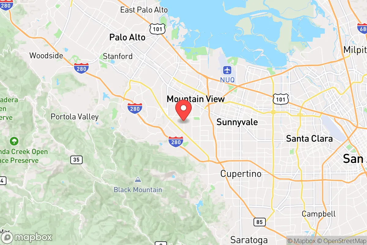
Los Altos sits in a precarious but potentially powerful position for those serious about strategic relocation. Its location on the western edge of the Santa Clara Valley, abutting the Santa Cruz Mountains, offers a rare combination of proximity to Silicon Valley’s resources and a buffer from the densest urban chaos. The city’s elevation, tree cover, and relative isolation from major freeway chokepoints give it a defensive edge that most Bay Area suburbs lack entirely. For the prepper or survivalist, Los Altos is not a bunker—it’s a forward operating base with good sightlines and a hard exit route.
Geographic position and natural advantages for long-term security
Los Altos sits at roughly 200–500 feet elevation, with the Santa Cruz Mountains rising immediately to the west. This terrain creates natural chokepoints: only a handful of roads—primarily Highway 280, Foothill Expressway, and Page Mill Road—connect the city to the broader Peninsula. In a grid-down or civil unrest scenario, these routes can be monitored or blocked with relative ease. The city’s residential core is a maze of winding, tree-lined streets with limited through-traffic, making it difficult for large groups to move through quickly. The nearby Rancho San Antonio Open Space Preserve and Monte Bello Ridge offer immediate backcountry access for hunting, foraging, or retreat. The area’s Mediterranean climate—dry summers, mild winters—means less risk of hypothermia or crop failure compared to colder regions. Water is the critical variable: Los Altos relies on the Hetch Hetchy system, which is a single-point-of-failure pipeline from Yosemite. However, the city sits atop the Santa Clara Valley Groundwater Basin, and many older homes have private wells. A prepper should verify well access before buying; properties on the western slopes often have independent water sources that could sustain a household indefinitely.
Risks, exposures, and proximity to fallout-relevant landmarks
The biggest liability is proximity to Silicon Valley’s high-value targets. Los Altos is roughly 10 miles from Apple’s Cupertino campus, 12 miles from Google’s Mountain View headquarters, and 15 miles from Stanford University and the SLAC National Accelerator Laboratory. In a major geopolitical conflict, these are Tier-1 targets for cyber, EMP, or kinetic strikes. The city also sits within 20 miles of the Port of Oakland and San Francisco International Airport—both potential evacuation or supply-chain chokepoints. Earthquake risk is real: the San Andreas Fault runs just 5 miles west, and the Hayward Fault is 15 miles east. A major quake would likely sever Highway 280 and 101, isolating Los Altos from both the coast and the East Bay. The city’s older housing stock—much of it built in the 1950s and 1960s—is not retrofitted to modern seismic codes. Wildfire is the most immediate seasonal threat. The 2020 CZU Lightning Complex fire came within 10 miles of Los Altos, and the city’s western edge is classified as a Very High Fire Hazard Severity Zone. Evacuation routes are limited, and during a fast-moving fire, the few exit roads would gridlock within minutes. For the survivalist, the lesson is clear: Los Altos is defensible only if you have a plan to stay and shelter, not to flee.
Practical resilience for a relocator: food, water, energy, and defensibility
Food security in Los Altos is mixed. The city itself has no significant agricultural land, but the surrounding Santa Clara Valley still has pockets of orchards and farms—particularly in nearby Sunnyvale and Cupertino. The Los Altos Farmers Market runs year-round, but in a crisis, local supply chains would collapse quickly. Serious preppers should plan for at least six months of stored food, plus seeds and tools for a home garden. Many lots are large enough for raised beds, and the mild climate allows for year-round growing. Water is the make-or-break factor. As noted, Hetch Hetchy is vulnerable to earthquake and sabotage. A well-equipped property with a hand pump or solar-powered pump is worth a premium. Rainwater catchment is legal in California, and Los Altos gets about 20 inches of rain annually—enough to supplement a household if storage is adequate. Energy resilience is strong: the area gets over 300 sunny days per year, making solar panels a no-brainer. Most homes have natural gas, which is piped from the east and could be disrupted in a quake. A backup propane tank or a whole-house generator is advisable. Defensibility is the city’s strongest suit. The low-density layout, with large lots and mature trees, means neighbors are far enough apart to avoid cascading fires or crowd threats. The local police force is well-funded and responsive, but in a prolonged SHTF scenario, they would be overwhelmed. A prepper should focus on perimeter security—motion lights, reinforced doors, and a clear line of sight from the house to the street. The Santa Cruz Mountains offer a fallback position for those with the gear and fitness to hike out.
The overall strategic picture for Los Altos is one of high potential but high risk. It is not a bug-out location—it is a stand-and-hold position for someone with resources, skills, and a plan. The city’s wealth and education levels mean that in a crisis, neighbors are more likely to cooperate than loot, but also that competition for scarce resources will be fierce. The proximity to Silicon Valley’s targets is a real liability, but the natural terrain and limited access points give a prepared individual a fighting chance. For the conservative relocator who values self-reliance, community cohesion, and a defensible perimeter, Los Altos is worth a hard look—but only if you are ready to dig in, not just ride out the storm.
* Values derived from national, state, county, city and local statistics and may differ in a specific area. Last updated: 2026-05-02T04:56:41.000Z
Narrative content on this page is AI-generated and may contain mistakes. Verify any details that matter before acting on them.
ReloMaps may earn a commission from affiliate links at no extra cost to you.