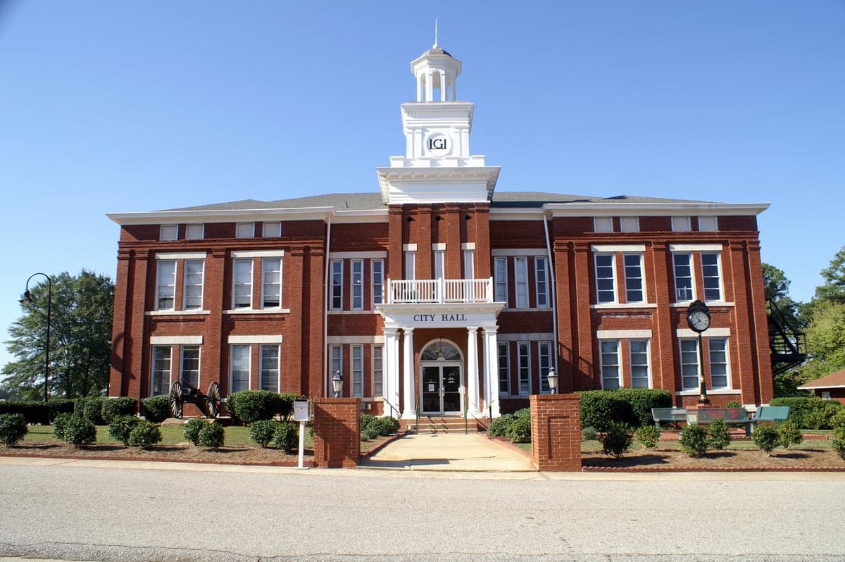
Photo: Wikipedia
Strategic Assessment of Locust Grove, GA
Meaningful friction. Expect exposure to either population pressure, blast zones, or natural disaster risk. Consider buying a retreat property.
What does the Strategic Assessment tell us?
Our Strategic Assessment grades tactical survivability of an area. Major population centers, military targets, fallout zones, natural disasters, and border exposure all drive risk — lower exposure means a more defensible position in a crisis.
This is heavily inspired by Joel Skousen's Strategic Relocation book. Highly recommended you checkout the book ($)What does this tell us?
Our Strategic Assessment grades tactical survivability of an area. Major population centers, military targets, fallout zones, natural disasters, and border exposure all drive risk — lower exposure means a more defensible position in a crisis.
This is heavily inspired by Joel Skousen's Strategic Relocation book. Highly recommended you checkout the book ($)Strategic Pillars

Key Distances
Regional Safe Places
Below is our recommended "safe zones" in Georgia and the surrounding area based on our strategic heuristics. For most people, it's unrealistic to live in a “safe zone” full-time due to work, family or other personal reasons. They tend to be more rural. However, many of these areas are perfect for second homes and retreat properties that double as a vacation home or even a short-term rental.
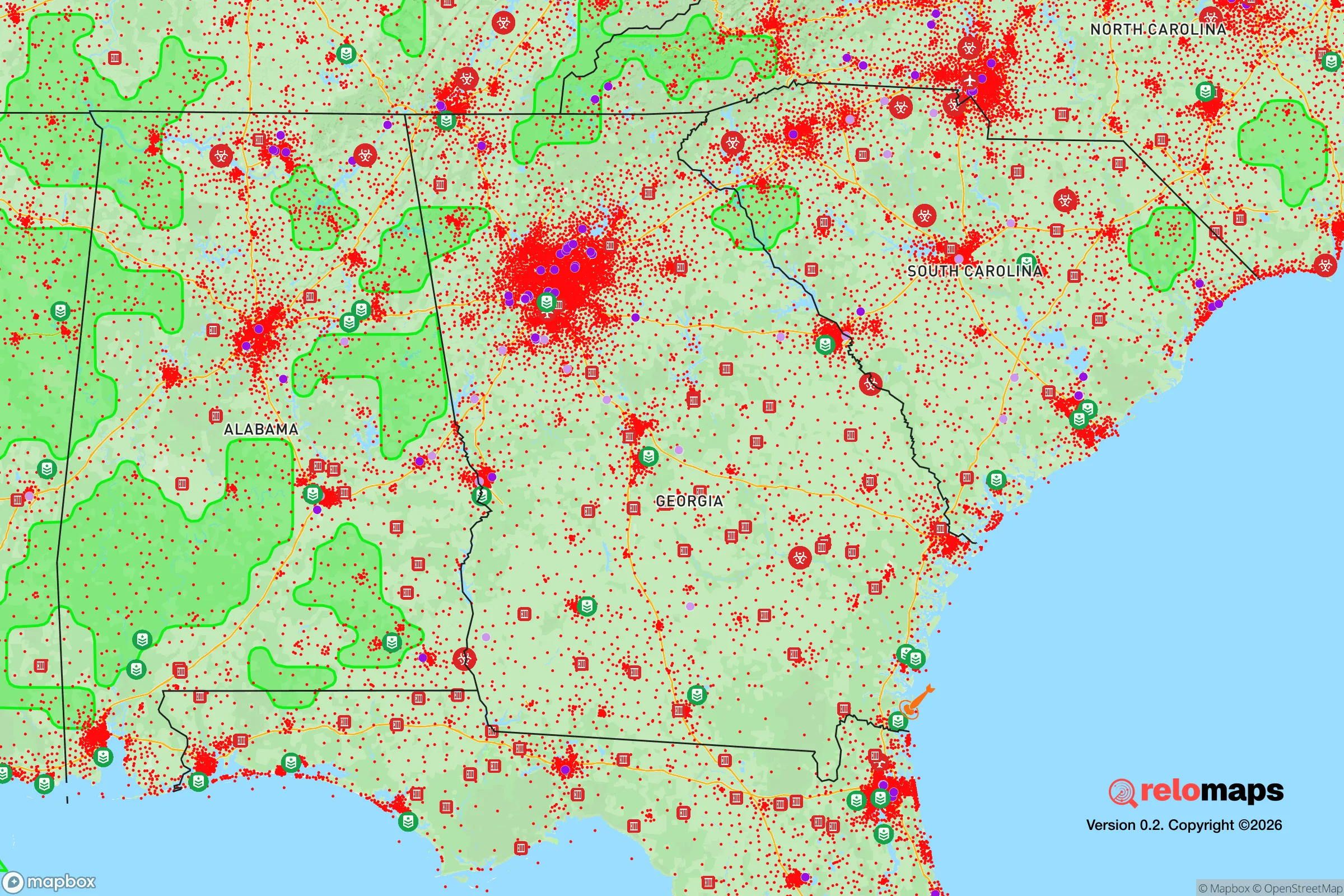
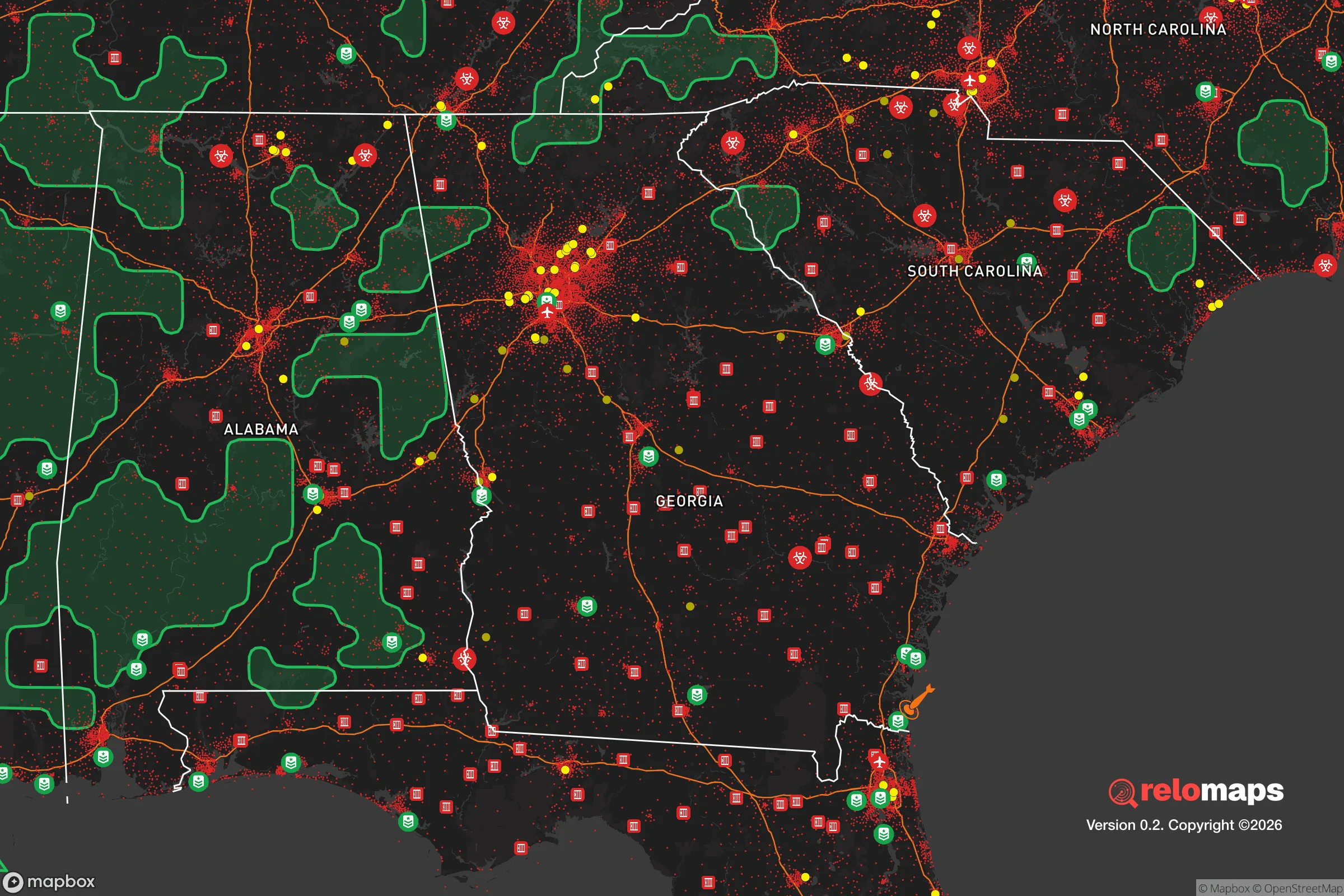


Important Note: For informational purposes only. This does not mean nothing bad ever happens in the green zones. Please use common sense. This is based on public data and modeled with AI. We tried to take a conservative approach but mistakes happen. We update this regularly as new information becomes available.
Solar Generator Recommendations
Backup power matters more here than in safer locations. We've picked three solar generators across budgets and capacity tiers — start with the budget unit if you only need a few essentials, or step up if you want to run a fridge and HVAC for days at a time.

Jackery Portable Power Station Explorer 300
Budget OptionPower on the Go: Weighing only 11 lbs, it's convenient to set up and store with book-sized foldable solar panels

BLUETTI Portable Power Station AC180
Designed for both indoor and outdoor scenarios, AC180 is highly capable as it has a robost capacity and continuous output power.

EF ECOFLOW DELTA Pro Ultra Power Station
Upgraded PickEcoFlow DELTA Pro Ultra is a whole-home energy system designed to grow with your family. Integrated with the Smart Home Panel 2, it scales to meet your evolving energy needs — keeping your home powered, intelligent, and secure through every stage of life.
We earn a commission, at no additional cost to you.
Strategic Assessment Analysis
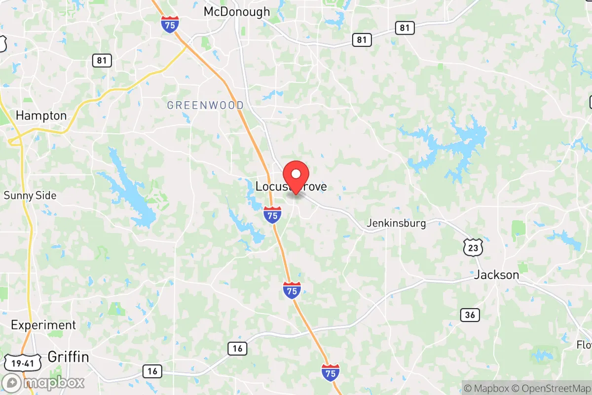
Locust Grove, Georgia, offers a strategic balance of rural accessibility and suburban infrastructure that appeals to relocation-minded readers prioritizing resilience and self-sufficiency. Situated roughly 35 miles southeast of downtown Atlanta along the I-75 corridor, this Henry County town sits far enough from major metropolitan centers to reduce exposure to urban cascading failures—grid collapse, civil unrest, or supply chain disruptions—while remaining close enough to leverage Atlanta’s medical and logistical resources in a non-crisis period. Its position in the Piedmont region, with rolling hills, clay soils, and a temperate climate, provides a moderate natural buffer against many of the extreme weather events that plague coastal or plains states, making it a credible candidate for those assessing long-term disaster readiness.
Geographic position and natural advantages for long-term stability
Locust Grove’s location in the upper Piedmont ecoregion delivers several inherent resilience advantages. The area sits at an elevation of roughly 850 feet above sea level, well above the flood-prone zones of Georgia’s coastal plain and far from the hurricane storm-surge risks of the Atlantic and Gulf coasts. The local topography—gently rolling hills with occasional steeper ridges—provides natural drainage and defensible sightlines without the extreme isolation or wildfire fuel loads found in mountainous regions. The climate is humid subtropical, with average annual rainfall of about 50 inches, which supports reliable well water recharge and year-round gardening. Winters are mild (average January lows around 30°F), reducing the risk of freeze-related infrastructure failures, while summers are hot and humid but manageable with passive cooling strategies. The area’s proximity to the Ocmulgee River basin, about 15 miles east, and the numerous small creeks and ponds in Henry County means surface water is accessible for those who secure legal access. For a relocator, the key natural advantage is the absence of catastrophic natural disaster threats: no hurricanes, no earthquakes, no tornado alleys (though occasional EF0-EF1 tornadoes occur), and no wildfire corridors. This baseline stability allows a household to focus on slow-onset risks—drought, heat waves, or regional economic shocks—rather than acute evacuation scenarios.
Risk exposure and proximity to fallout-relevant landmarks
While Locust Grove’s natural risk profile is favorable, its man-made risk exposure requires careful consideration. The most significant vulnerability is its position along the I-75 corridor, a major north-south freight and evacuation route. In a crisis—whether a pandemic, fuel shortage, or civil unrest—this highway can become a chokepoint or a vector for population movement. The town itself is roughly 10 miles from the Hartsfield-Jackson Atlanta International Airport, one of the world’s busiest, which in a national emergency could become a target for logistical disruption or a concentration point for displaced populations. Additionally, Locust Grove lies within 30 miles of several industrial facilities that could pose secondary risks: the Georgia Power Plant Scherer (a coal-fired plant in Juliette, about 25 miles northeast) and the Vogtle Electric Generating Plant (a nuclear facility near Waynesboro, about 90 miles southeast) are the most notable. While Vogtle is far enough to be outside any plausible fallout zone from a radiological incident, the plant’s presence on the Savannah River means that a worst-case scenario could affect water supplies downstream—though Locust Grove’s water comes from the Ocmulgee system, not the Savannah. More immediate is the proximity to Atlanta’s urban core: in a prolonged grid-down scenario, the risk of refugee flow along I-75 is real, and the town’s police force (about 30 sworn officers) would be quickly overwhelmed. For a relocator, the strategic takeaway is that Locust Grove is not a remote bug-out location—it is a semi-suburban community that would face pressure from the metro area in a crisis, but its distance (35 miles) and the presence of intervening towns (McDonough, Stockbridge) provide a buffer that more exurban locations lack.
Practical resilience for a relocator: food, water, energy, and defensibility
For a household serious about self-sufficiency, Locust Grove offers a mix of enabling factors and constraints. Water security is the strongest asset: Henry County sits atop the Floridan Aquifer system, one of the most productive in the Southeast, and many properties in the rural parts of the county can support private wells at depths of 100-300 feet. The county’s average well yield is 20-40 gallons per minute, sufficient for household use and small-scale irrigation. Rainwater harvesting is also viable given the 50-inch annual rainfall, though clay soils limit infiltration rates for greywater systems. For food production, the growing season runs from late March to early November (about 240 days), allowing for two crop cycles of warm-season vegetables. The local soil is primarily clay-loam, which requires amendment for intensive gardening but is workable with raised beds or no-till methods. Henry County has a strong agricultural heritage, and the Locust Grove Farmers Market (seasonal) and nearby farms (e.g., Southern Belle Farm) provide local food sources in normal times. For energy resilience, the area’s tree canopy is a double-edged sword: it provides passive cooling and biomass for heating, but also creates debris hazards during ice storms (which occur roughly once every 5-7 years). Solar potential is moderate—the region averages 4.5 peak sun hours per day—but net metering policies in Georgia are limited, so off-grid solar with battery storage is the more practical path for true independence. Natural gas is available in the town limits but not in rural areas, so propane or wood heat is the backup standard. Defensibility is moderate: the terrain offers some natural chokepoints (creek crossings, ridge lines), but the suburban layout with cul-de-sacs and open lots means a determined group could approach from multiple angles. The best defensive strategy here is obscurity and community—Locust Grove’s small-town character (population roughly 8,500) means that a well-integrated newcomer with local relationships would be far less visible than in a dense suburb.
The overall strategic picture for Locust Grove is one of calculated trade-offs. It is not a remote homestead—it is a working-class exurb with good bones for resilience but real exposure to Atlanta’s gravitational pull. For a relocator who wants to be within a day’s drive of major medical centers, who values a four-season growing climate without extreme weather, and who is willing to invest in well water and solar backup, Locust Grove offers a credible base. The key is to treat it as a semi-prepared suburban node, not a wilderness retreat: build community ties, store supplies for 30-60 days (the likely window before state or federal aid reaches a non-coastal Georgia town), and maintain a vehicle with good ground clearance for secondary roads if I-75 becomes impassable. The area’s resilience is average for the Southeast, but its location—close enough to resources, far enough from urban collapse—makes it a rational choice for the strategic-minded relocator who accepts that no location is perfect and plans accordingly.

* Values derived from national, state, county, city and local statistics and may differ in a specific area. Last updated: 2026-08-26T02:26:25.000Z
Narrative content on this page is AI-generated and may contain mistakes. Verify any details that matter before acting on them.
ReloMaps may earn a commission from affiliate links at no extra cost to you.

