
Photo: Wikipedia
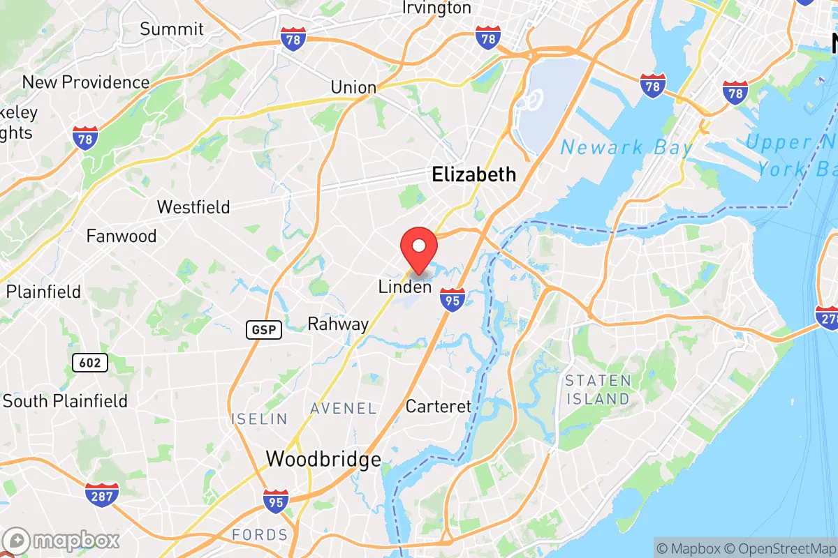
Strategic Assessment of Linden, NJ
High tactical risk. This location is likely close to major population centers, strategic targets, or sits in a high-disaster corridor. A retreat property and careful exit planning is required.
What does the Strategic Assessment tell us?
Our Strategic Assessment grades tactical survivability of an area. Major population centers, military targets, fallout zones, natural disasters, and border exposure all drive risk — lower exposure means a more defensible position in a crisis.
This is heavily inspired by Joel Skousen's Strategic Relocation book. Highly recommended you checkout the book ($)What does this tell us?
Our Strategic Assessment grades tactical survivability of an area. Major population centers, military targets, fallout zones, natural disasters, and border exposure all drive risk — lower exposure means a more defensible position in a crisis.
This is heavily inspired by Joel Skousen's Strategic Relocation book. Highly recommended you checkout the book ($)Strategic Pillars

Key Distances
Regional Safe Places
Below is our recommended "safe zones" in New Jersey and the surrounding area based on our strategic heuristics. For most people, it's unrealistic to live in a “safe zone” full-time due to work, family or other personal reasons. They tend to be more rural. However, many of these areas are perfect for second homes and retreat properties that double as a vacation home or even a short-term rental.


Important Note: For informational purposes only. This does not mean nothing bad ever happens in the green zones. Please use common sense. This is based on public data and modeled with AI. We tried to take a conservative approach but mistakes happen. We update this regularly as new information becomes available.
Solar Generator Recommendations
Backup power matters more here than in safer locations. We've picked three solar generators across budgets and capacity tiers — start with the budget unit if you only need a few essentials, or step up if you want to run a fridge and HVAC for days at a time.

Jackery Portable Power Station Explorer 300
Budget OptionPower on the Go: Weighing only 11 lbs, it's convenient to set up and store with book-sized foldable solar panels

BLUETTI Portable Power Station AC180
Designed for both indoor and outdoor scenarios, AC180 is highly capable as it has a robost capacity and continuous output power.

EF ECOFLOW DELTA Pro Ultra Power Station
Upgraded PickEcoFlow DELTA Pro Ultra is a whole-home energy system designed to grow with your family. Integrated with the Smart Home Panel 2, it scales to meet your evolving energy needs — keeping your home powered, intelligent, and secure through every stage of life.
We earn a commission, at no additional cost to you.
Strategic Assessment Analysis
Linden, New Jersey, sits in a precarious strategic position that demands a hard-eyed assessment from anyone serious about resilience. Its location within the New York metropolitan area offers undeniable economic access, but from a prepper’s perspective, that same proximity to a dense population center, major transportation hubs, and critical infrastructure creates a web of vulnerabilities that are difficult to mitigate. For a conservative-leaning individual or family weighing relocation, Linden’s advantages in day-to-day convenience are heavily outweighed by its exposure to cascading risks during any significant disruption—whether from civil unrest, a mass casualty event, or a natural disaster.
Geographic position and natural advantages: a double-edged location
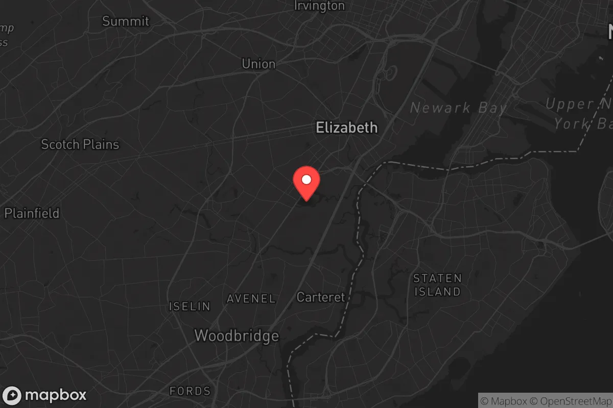
Linden occupies roughly 11 square miles in Union County, about 15 miles southwest of Manhattan, with direct access to the New Jersey Turnpike, Route 1/9, and the Goethals Bridge to Staten Island. Its position along the Arthur Kill waterway provides a natural boundary to the east, but this is not a defensible feature—it’s a shipping channel lined with industrial facilities. The area is flat, with no significant elevation changes, meaning no natural high ground for observation or retreat. The Rahway River runs through the city’s northern edge, offering a modest water source, but it’s heavily polluted from decades of industrial runoff and not viable for drinking without advanced filtration. The soil is mostly urban fill and clay, poor for sustained agriculture. In short, Linden has no natural choke points, no defensible terrain, and no reliable off-grid water supply. Its primary geographic “advantage” is simply being close to jobs and transit—a benefit that evaporates the moment the grid goes down or civil order fractures.
Risks, exposures, and proximity to fallout-relevant landmarks
This is where Linden’s strategic picture turns bleak. The city is ringed by high-value, high-risk targets. Directly to the east, across the Arthur Kill, sits the ExxonMobil Bayway Refinery—one of the largest oil refineries on the East Coast, processing over 230,000 barrels of crude per day. A major accident, terrorist strike, or wartime event at this facility would produce a toxic plume capable of blanketing Linden and surrounding communities in minutes. To the north, Newark Liberty International Airport handles roughly 40 million passengers annually; a mass casualty event there—whether from a crash, attack, or pandemic—would overwhelm local hospitals and strain emergency services for days. The Port Newark-Elizabeth Marine Terminal, the busiest container port on the Eastern seaboard, lies just west of the airport. A disruption at the port, whether from a cyberattack, labor strike, or military action, would choke supply chains and trigger panic buying that empties Linden’s grocery shelves within hours. Additionally, the Linden Generating Station, a natural gas-fired power plant, sits within city limits. While not nuclear, its failure during a grid collapse would leave the city without power and dependent on backup generators that are rarely tested under real stress. For a relocator, the concentration of these targets within a 5-mile radius makes Linden a high-probability zone for secondary effects during any major event.
Practical resilience for a relocator: food, water, energy, and defensibility
For a single individual or family looking to establish a resilient household, Linden presents serious practical hurdles. Food security is poor: the city has no significant community gardens or farmland, and the nearest reliable source of bulk food storage would require driving 20+ miles west into Hunterdon County. During a supply chain disruption, Linden’s residents would be competing with millions of others for limited resources at big-box stores like the Walmart on Route 1&9 or the ShopRite on Elizabeth Avenue—both of which would be stripped clean within hours. Water security is worse: the municipal supply comes from the Elizabethtown Water Company, drawing from the Raritan River and the Spruce Run Reservoir. A chemical spill, power outage, or deliberate contamination would cut off potable water to the entire city. Rainwater collection is possible but limited by roof space and the need for heavy filtration due to air pollution from the refinery and nearby highways. Energy independence is nearly impossible: Linden is fully grid-dependent, with no community solar co-ops or widespread residential battery storage. Natural gas for heating is piped in from the same infrastructure that serves the refinery, making it a single-point-of-failure risk. Defensibility is minimal: the city’s dense, grid-like street pattern offers no natural cover, and the high population density (roughly 42,000 people in 11 square miles) means that any civil unrest would quickly turn into a crowd hazard. There are no rural buffer zones, no nearby state forests for retreat, and the only escape routes—the Turnpike, Routes 1&9, and the Goethals Bridge—are notorious choke points that would gridlock within minutes of an evacuation order. For a prepper, Linden is a location you would plan to leave, not fortify.
The overall strategic picture for Linden is clear: it is a location optimized for economic convenience, not resilience. For a conservative-minded relocator who values self-sufficiency, community cohesion, and the ability to weather disruptions without relying on fragile urban systems, Linden offers few redeeming qualities. Its proximity to critical infrastructure—refineries, airports, ports, and power plants—makes it a high-risk zone for secondary effects during any major event. The lack of natural defensibility, poor water and food security, and dependence on a strained transportation network mean that a family’s survival plan would hinge almost entirely on pre-positioned supplies and a rapid evacuation route—both of which are difficult to maintain in a dense, expensive urban environment. If your priority is to be prepared for civic unrest, mass casualty events, or disasters, Linden is best viewed as a place to pass through, not a place to put down roots. Look instead to the rural townships of western New Jersey or eastern Pennsylvania, where lower population density, better water access, and more defensible terrain offer a foundation for genuine long-term resilience.
* Values derived from national, state, county, city and local statistics and may differ in a specific area. Last updated: 2026-05-03T09:16:39.000Z
Narrative content on this page is AI-generated and may contain mistakes. Verify any details that matter before acting on them.
ReloMaps may earn a commission from affiliate links at no extra cost to you.