
Photo: Wikipedia
Strategic Assessment of Levittown, PA
Meaningful friction. Expect exposure to either population pressure, blast zones, or natural disaster risk. Consider buying a retreat property.
What does the Strategic Assessment tell us?
Our Strategic Assessment grades tactical survivability of an area. Major population centers, military targets, fallout zones, natural disasters, and border exposure all drive risk — lower exposure means a more defensible position in a crisis.
This is heavily inspired by Joel Skousen's Strategic Relocation book. Highly recommended you checkout the book ($)What does this tell us?
Our Strategic Assessment grades tactical survivability of an area. Major population centers, military targets, fallout zones, natural disasters, and border exposure all drive risk — lower exposure means a more defensible position in a crisis.
This is heavily inspired by Joel Skousen's Strategic Relocation book. Highly recommended you checkout the book ($)Strategic Pillars

Key Distances
Regional Safe Places
Below is our recommended "safe zones" in Pennsylvania and the surrounding area based on our strategic heuristics. For most people, it's unrealistic to live in a “safe zone” full-time due to work, family or other personal reasons. They tend to be more rural. However, many of these areas are perfect for second homes and retreat properties that double as a vacation home or even a short-term rental.




Important Note: For informational purposes only. This does not mean nothing bad ever happens in the green zones. Please use common sense. This is based on public data and modeled with AI. We tried to take a conservative approach but mistakes happen. We update this regularly as new information becomes available.
Solar Generator Recommendations
Backup power matters more here than in safer locations. We've picked three solar generators across budgets and capacity tiers — start with the budget unit if you only need a few essentials, or step up if you want to run a fridge and HVAC for days at a time.

Jackery Portable Power Station Explorer 300
Budget OptionPower on the Go: Weighing only 11 lbs, it's convenient to set up and store with book-sized foldable solar panels

BLUETTI Portable Power Station AC180
Designed for both indoor and outdoor scenarios, AC180 is highly capable as it has a robost capacity and continuous output power.

EF ECOFLOW DELTA Pro Ultra Power Station
Upgraded PickEcoFlow DELTA Pro Ultra is a whole-home energy system designed to grow with your family. Integrated with the Smart Home Panel 2, it scales to meet your evolving energy needs — keeping your home powered, intelligent, and secure through every stage of life.
We earn a commission, at no additional cost to you.
Strategic Assessment Analysis
Levittown, Pennsylvania, presents a mixed strategic picture for the relocation-minded reader focused on resilience and self-sufficiency. Its primary advantage is its position within the densely populated Northeast Corridor, which offers robust infrastructure and economic stability, but this very proximity to major population centers and critical infrastructure introduces significant vulnerabilities. For a conservative-leaning individual or family weighing disaster readiness, Levittown’s location is a double-edged sword: it provides immediate access to resources and employment, yet sits within a high-risk zone for both natural and man-made disruptions.
Geographic position and natural advantages for long-term stability
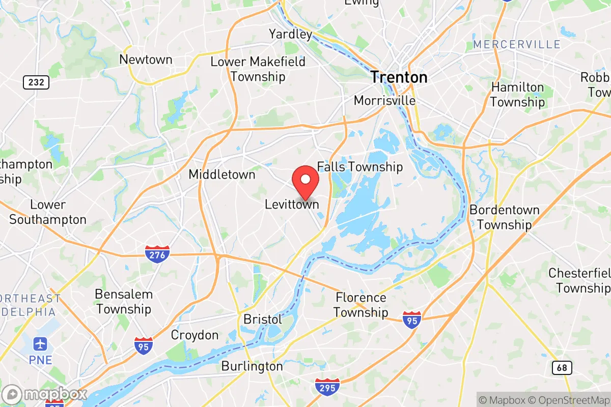
Levittown’s geography is defined by its location in Bucks County, roughly 20 miles northeast of Philadelphia and 60 miles south of New York City. This places it within the Delaware Valley, a region with a temperate climate, reliable rainfall, and access to the Delaware River, which serves as a major water source. The area’s natural advantages include relatively flat terrain that is not prone to landslides or seismic activity, and a climate that supports four distinct seasons without extreme temperature swings. The surrounding farmland in central and western Bucks County provides a buffer of open space, though Levittown itself is a densely developed suburban community. For a relocator, the key geographic strength is the region’s agricultural capacity: Pennsylvania is a leading producer of dairy, poultry, and grains, and within a 50-mile radius, there are numerous farms, farmers’ markets, and food-processing facilities. This proximity to food sources is a practical resilience asset, reducing dependence on long-distance supply chains. However, the area’s flat, low-lying sections near the Delaware River are flood-prone, particularly after heavy rains or snowmelt, which is a recurring natural risk that must be factored into any property selection.
Risks, exposures, and proximity to fallout-relevant landmarks
The most significant strategic drawback of Levittown is its location within a high-density target zone. The area lies within the Philadelphia metropolitan statistical area, which includes critical infrastructure such as the Philadelphia International Airport, the Port of Philadelphia, and major rail hubs. Additionally, Levittown is approximately 15 miles from the Trenton-Mercer Airport and 10 miles from the U.S. Army’s Joint Base McGuire-Dix-Lakehurst in New Jersey, a major military installation. These are all potential targets in a conflict scenario, and the fallout risks from a conventional or nuclear strike on Philadelphia or the military base would be substantial. The prevailing winds in the region are from the west and southwest, meaning that fallout from a Philadelphia event would likely drift northeast toward Levittown. Furthermore, the area is crisscrossed by major transportation corridors—Interstates 95, 295, and the Pennsylvania Turnpike—which are choke points for evacuation and supply routes. In a crisis, these highways would become congested or impassable. The presence of the Delaware River also presents a risk: it is a major shipping channel for hazardous materials, and an accident or sabotage at one of the chemical plants or refineries along its banks (such as the Philadelphia Energy Solutions refinery complex) could create a toxic plume. For a relocator prioritizing safety from man-made disasters, Levittown’s proximity to these landmarks is a clear negative.
Practical resilience for a relocator: food, water, energy, and defensibility
For a family or individual looking to establish a self-sufficient household, Levittown offers a mixed set of practical options. Water access is a relative strength: the area sits atop the Newark Basin aquifer, and many homes have private wells, though the majority rely on municipal water from the Delaware River. In a grid-down scenario, well owners with hand pumps or solar-powered pumps would have a significant advantage. However, the municipal water system is vulnerable to contamination and pressure loss. Food resilience is moderate: while local farms exist, Levittown itself is a bedroom community with limited agricultural land. Stockpiling and establishing a home garden are feasible, but the suburban lot sizes (typically 0.25 to 0.5 acres) constrain large-scale food production. Community gardens and local CSAs (community-supported agriculture) are available but may be overwhelmed in a crisis. Energy resilience is a challenge: the grid is reliable under normal conditions but is part of the PJM Interconnection, a massive regional grid that is a potential target. Solar panel installation is permitted in most of Levittown, but homeowners’ associations (HOAs) in some neighborhoods may restrict visible panels or battery systems. Natural gas is widely available for heating and cooking, which is a plus, but the pipeline network is also a vulnerability. Defensibility is low: Levittown is a dense, interconnected suburban development with a grid-like street pattern, making it difficult to secure a perimeter. The population density (roughly 3,500 people per square mile) means that in a prolonged emergency, competition for resources would be intense. The area’s strong sense of community and active neighborhood watch programs are social resilience assets, but they cannot compensate for the physical layout. For a relocator seeking a defensible property, a rural property in northern Bucks County or neighboring Montgomery County would be far more suitable.
Overall, Levittown’s strategic picture is one of trade-offs. It offers the stability of a well-established community with access to jobs, healthcare, and education, but its resilience against large-scale disasters—whether natural or man-made—is limited by its location and density. For a relocator who is serious about self-sufficiency and disaster readiness, Levittown is best viewed as a base of operations for the short to medium term, rather than a long-term retreat. The area’s strengths lie in its economic opportunities and social infrastructure, not in its ability to withstand a prolonged grid-down scenario or a direct man-made event. A prudent approach would be to use Levittown as a hub for work and education while maintaining a secondary property or plan for evacuation to a lower-density area in central or northern Pennsylvania. The key takeaway is that Levittown is a comfortable, functional community for normal times, but its strategic vulnerabilities require a relocator to have a clear, practiced contingency plan for when normal times end.

* Values derived from national, state, county, city and local statistics and may differ in a specific area. Last updated: 2026-08-11T09:15:02.000Z
Narrative content on this page is AI-generated and may contain mistakes. Verify any details that matter before acting on them.
ReloMaps may earn a commission from affiliate links at no extra cost to you.

