

Photo: Wikipedia
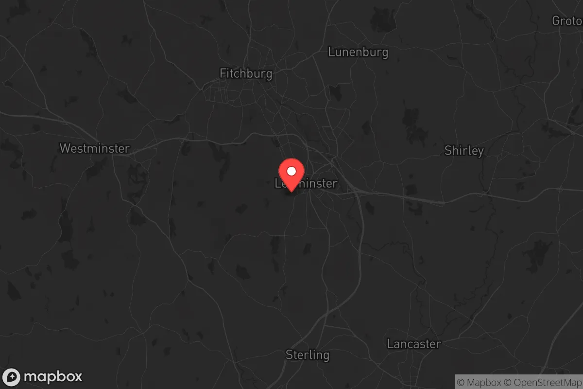
Strategic Assessment of Leominster, MA
Multiple tactical vulnerabilities. Population density, target proximity, or disaster risk are likely compounding. A retreat property and exit planning is required.
What does the Strategic Assessment tell us?
Our Strategic Assessment grades tactical survivability of an area. Major population centers, military targets, fallout zones, natural disasters, and border exposure all drive risk — lower exposure means a more defensible position in a crisis.
This is heavily inspired by Joel Skousen's Strategic Relocation book. Highly recommended you checkout the book ($)What does this tell us?
Our Strategic Assessment grades tactical survivability of an area. Major population centers, military targets, fallout zones, natural disasters, and border exposure all drive risk — lower exposure means a more defensible position in a crisis.
This is heavily inspired by Joel Skousen's Strategic Relocation book. Highly recommended you checkout the book ($)Strategic Pillars

Key Distances
Regional Safe Places
Below is our recommended "safe zones" in Massachusetts and the surrounding area based on our strategic heuristics. For most people, it's unrealistic to live in a “safe zone” full-time due to work, family or other personal reasons. They tend to be more rural. However, many of these areas are perfect for second homes and retreat properties that double as a vacation home or even a short-term rental.


Important Note: For informational purposes only. This does not mean nothing bad ever happens in the green zones. Please use common sense. This is based on public data and modeled with AI. We tried to take a conservative approach but mistakes happen. We update this regularly as new information becomes available.
Solar Generator Recommendations
Backup power matters more here than in safer locations. We've picked three solar generators across budgets and capacity tiers — start with the budget unit if you only need a few essentials, or step up if you want to run a fridge and HVAC for days at a time.

Jackery Portable Power Station Explorer 300
Budget OptionPower on the Go: Weighing only 11 lbs, it's convenient to set up and store with book-sized foldable solar panels

BLUETTI Portable Power Station AC180
Designed for both indoor and outdoor scenarios, AC180 is highly capable as it has a robost capacity and continuous output power.

EF ECOFLOW DELTA Pro Ultra Power Station
Upgraded PickEcoFlow DELTA Pro Ultra is a whole-home energy system designed to grow with your family. Integrated with the Smart Home Panel 2, it scales to meet your evolving energy needs — keeping your home powered, intelligent, and secure through every stage of life.
We earn a commission, at no additional cost to you.
Strategic Assessment Analysis
Leominster, Massachusetts, sits in a geographic sweet spot that offers a surprising degree of strategic resilience for those thinking about long-term preparedness. Located roughly 40 miles west of Boston and 20 miles north of Worcester, this city of about 43,000 people provides a buffer from the immediate blast radius of major urban targets while still offering access to critical supply chains and medical infrastructure. The city’s position along the Nashua River and its historic role as a manufacturing hub mean the bones of a self-sufficient community are still in place, even if the modern economy has shifted. For a relocator with a prepper mindset, Leominster represents a calculated trade-off: close enough to benefit from urban resources, far enough to avoid the worst of a collapse scenario.
Geographic position and natural advantages for long-term survival
Leominster’s location in north-central Massachusetts places it within the Nashua River Valley, a corridor that historically supported agriculture, industry, and transportation. The city is flanked by the Wachusett Reservoir to the south and the Fitchburg watershed to the north, giving the area a reliable freshwater supply that many suburban communities lack. The surrounding landscape is a mix of rolling hills, second-growth forests, and small farms, which provides natural cover and defensible terrain for those willing to bug in. The city itself sits at the intersection of Route 2 and Interstate 190, a major east-west artery that connects to the Massachusetts Turnpike (I-90) in about 20 minutes. This road network is a double-edged sword: it allows rapid evacuation or supply runs, but it also means Leominster is a natural chokepoint for any movement between Boston and the Berkshires. For a survivalist, the key advantage is the abundance of state forests and conservation land within a 10-mile radius, including the 4,000-acre Leominster State Forest and the 1,200-acre Dunn State Park. These areas offer hunting, foraging, and timber resources that could sustain a small group indefinitely, provided you know how to use them.
Risks, exposures, and proximity to fallout-relevant landmarks
The biggest strategic liability for Leominster is its proximity to Boston and Worcester, both of which are high-probability targets for civil unrest, terrorist attacks, or even a limited nuclear exchange. Leominster sits about 45 miles from Boston’s Logan Airport and 20 miles from Worcester Regional Airport, putting it within the fallout plume zone for a ground-level detonation at either location. The city is also directly downwind of the Seabrook Nuclear Power Plant in New Hampshire, about 50 miles to the northeast, which could become a radiological hazard in the event of a catastrophic failure or sabotage. On the ground, Leominster’s industrial past has left behind several EPA-listed Superfund sites, including the former plastics manufacturing areas along the Nashua River, which could complicate long-term water and soil safety after a disaster. The city’s population density—roughly 2,200 people per square mile—is moderate by Massachusetts standards, but the housing stock is dominated by older, tightly packed neighborhoods that would be difficult to defend in a grid-down scenario. The presence of Fitchburg State University and UMass Memorial HealthAlliance Hospital in nearby Leominster means the area will attract refugees from the coast, straining local resources within the first 72 hours of any major event.
Practical resilience for a relocator: food, water, energy, and defensibility
For someone serious about self-sufficiency, Leominster offers a mixed bag. The city’s water supply comes from the municipal system fed by the Spectacle Pond and the Nashua River, but private wells are common in the outlying areas—a critical advantage for those who can secure a property with a drilled well and a hand pump. The soil in the Nashua Valley is loamy and well-drained, suitable for vegetable gardens and small orchards, though the growing season is short (roughly 150 days) and the winters are harsh. Local food production is limited: there are a handful of community gardens and a few small farms selling at the Leominster Farmers Market, but the city is not a breadbasket. For protein, the state forests offer deer, turkey, and small game, but hunting pressure is high, and you’ll need to know the regulations or be willing to operate off-grid. Energy resilience is a bright spot: Massachusetts has aggressive solar incentives, and many homes in the area have rooftop panels or access to community solar programs. Wood heat is also viable, with plenty of firewood available from state forests (with a permit) and local tree services. Defensibility is the weak link. Leominster’s layout—a classic New England mill city with a dense downtown core and sprawling suburban subdivisions—makes it hard to secure a perimeter. The best bet is to target the rural edges of town, particularly the areas near the Leominster State Forest or along the Ashburnham line, where lots are larger and neighbors are fewer. Avoid the floodplains along the Nashua River, which are prone to spring flooding and would be a liability in a prolonged wet period.
The overall strategic picture for Leominster is one of cautious viability for a prepared relocator. It is not a hardened redoubt like the rural mountain towns of western Massachusetts or northern New Hampshire, but it offers a realistic compromise for someone who needs to stay within commuting distance of a job or family obligations while still building a resilient lifestyle. The city’s history of manufacturing and its current mix of light industry, healthcare, and education provide a economic buffer that could help you stockpile supplies and invest in property improvements without drawing suspicion. The key is to treat Leominster as a base of operations, not a final fortress. Have a bug-out plan for the hills to the west, maintain a low profile in the community, and invest in water storage and off-grid power before the next crisis hits. If you can handle the cold winters and the occasional liberal politics of the state, this city gives you a fighting chance to ride out the storm—provided you don’t get caught in the exodus from Boston when the lights go out.
* Values derived from national, state, county, city and local statistics and may differ in a specific area. Last updated: 2026-05-01T02:53:02.000Z
Narrative content on this page is AI-generated and may contain mistakes. Verify any details that matter before acting on them.
ReloMaps may earn a commission from affiliate links at no extra cost to you.