

Photo: Wikipedia
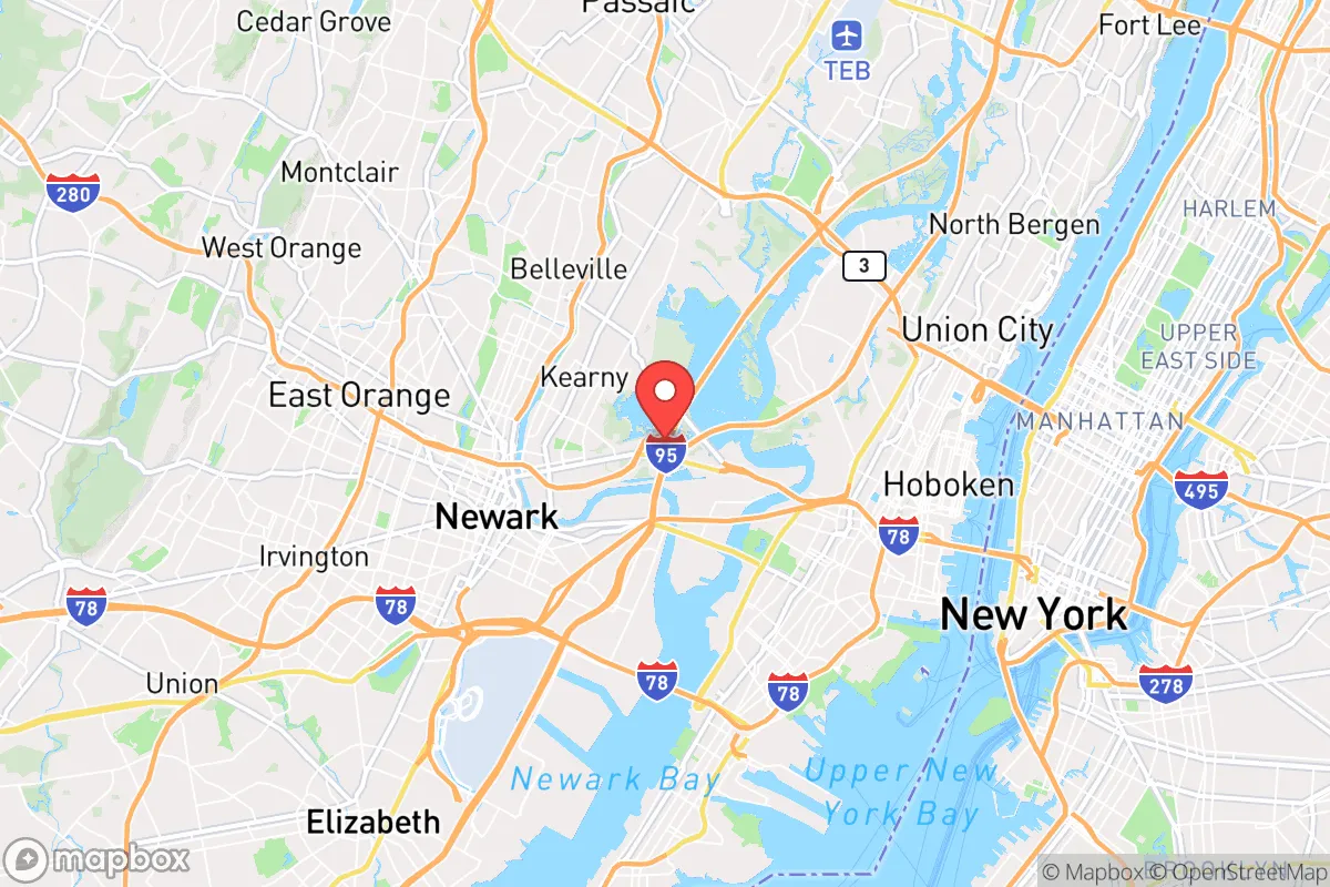
Strategic Assessment of Kearny, NJ
High tactical risk. This location is likely close to major population centers, strategic targets, or sits in a high-disaster corridor. A retreat property and careful exit planning is required.
What does the Strategic Assessment tell us?
Our Strategic Assessment grades tactical survivability of an area. Major population centers, military targets, fallout zones, natural disasters, and border exposure all drive risk — lower exposure means a more defensible position in a crisis.
This is heavily inspired by Joel Skousen's Strategic Relocation book. Highly recommended you checkout the book ($)What does this tell us?
Our Strategic Assessment grades tactical survivability of an area. Major population centers, military targets, fallout zones, natural disasters, and border exposure all drive risk — lower exposure means a more defensible position in a crisis.
This is heavily inspired by Joel Skousen's Strategic Relocation book. Highly recommended you checkout the book ($)Strategic Pillars

Key Distances
Regional Safe Places
Below is our recommended "safe zones" in New Jersey and the surrounding area based on our strategic heuristics. For most people, it's unrealistic to live in a “safe zone” full-time due to work, family or other personal reasons. They tend to be more rural. However, many of these areas are perfect for second homes and retreat properties that double as a vacation home or even a short-term rental.


Important Note: For informational purposes only. This does not mean nothing bad ever happens in the green zones. Please use common sense. This is based on public data and modeled with AI. We tried to take a conservative approach but mistakes happen. We update this regularly as new information becomes available.
Solar Generator Recommendations
Backup power matters more here than in safer locations. We've picked three solar generators across budgets and capacity tiers — start with the budget unit if you only need a few essentials, or step up if you want to run a fridge and HVAC for days at a time.

Jackery Portable Power Station Explorer 300
Budget OptionPower on the Go: Weighing only 11 lbs, it's convenient to set up and store with book-sized foldable solar panels

BLUETTI Portable Power Station AC180
Designed for both indoor and outdoor scenarios, AC180 is highly capable as it has a robost capacity and continuous output power.

EF ECOFLOW DELTA Pro Ultra Power Station
Upgraded PickEcoFlow DELTA Pro Ultra is a whole-home energy system designed to grow with your family. Integrated with the Smart Home Panel 2, it scales to meet your evolving energy needs — keeping your home powered, intelligent, and secure through every stage of life.
We earn a commission, at no additional cost to you.
Strategic Assessment Analysis
Kearny, New Jersey, sits in a precarious strategic position that demands serious consideration for anyone prioritizing long-term resilience and family security. While its location within the New York metropolitan area offers immediate economic advantages, the same geography that makes it accessible also places it in the crosshairs of multiple threat vectors—from civil unrest cascading out of nearby urban centers to the fallout risks associated with critical infrastructure. For the conservative-minded relocator assessing this town through a prepper lens, the calculus is sobering: Kearny provides a decent base for short-term economic stability, but its long-term survivability in a major crisis is deeply compromised by its proximity to high-value targets and dense population centers.
Geographic position and natural advantages for long-term security
Kearny occupies a roughly 10-square-mile area in Hudson County, bordered by the Passaic and Hackensack Rivers, with the Kearny Point peninsula jutting into Newark Bay. This riverine geography provides a natural moat effect—access to the town is limited to a handful of bridges and roadways, which could be controlled or blocked in a crisis. The town sits on relatively high ground compared to surrounding floodplains, with elevations reaching 100 feet in some residential areas, offering some protection against storm surge from the nearby Atlantic coast. The Hackensack Meadowlands to the east provide a buffer of undeveloped marshland that slows any approach from that direction. However, these same waterways create chokepoints that could trap residents if evacuation becomes necessary. The town's position roughly 8 miles west of Manhattan means it lies directly in the shadow of the region's primary economic and political target, making it a likely secondary zone for any event targeting New York City. For a relocator seeking true strategic depth, Kearny's natural advantages are modest at best—the rivers offer some defensibility, but the surrounding urbanization overwhelms any geographic benefit.
Risks, exposures, and proximity to fallout-relevant landmarks
The most significant risk factor for Kearny is its location within the blast and fallout radius of multiple high-value targets. Newark Liberty International Airport lies just 3 miles south, a prime target for any aerial or ground-based attack. The Port Newark-Elizabeth Marine Terminal, one of the busiest container ports in the nation, is less than 4 miles away and represents a critical logistics node that would be a priority for disruption. The Pulaski Skyway and New Jersey Turnpike, both major arteries running through or near Kearny, would become instant chokepoints and targets during any civil unrest or infrastructure attack. Additionally, the town sits within 10 miles of the region's major rail tunnels and bridges, including the Portal Bridge and North River Tunnels, which are critical to the Northeast Corridor rail line. In a mass casualty event or large-scale disaster, Kearny would likely experience cascading failures: power grid instability from attacks on nearby substations, water supply contamination from industrial releases in the heavily industrialized Newark Bay area, and mass migration of displaced populations from Newark, Jersey City, and New York City. The town's own industrial base—including chemical storage facilities along the Passaic River—presents a secondary hazard, as any accident or sabotage could release toxic materials into the air or water. For a survivalist, the concentration of so many high-value targets within a 10-mile radius makes Kearny a high-risk location for any scenario involving strategic strikes or coordinated attacks.
Practical resilience for a relocator: food, water, energy, and defensibility
When assessing Kearny's practical resilience, the picture is mixed but leans negative. The town's water supply comes from the Passaic Valley Water Commission, drawing from the Passaic River—a waterway heavily impacted by industrial pollution and upstream runoff. In a crisis, this supply would be vulnerable to contamination from chemical plants, sewage overflows, or deliberate sabotage. Residents would need robust filtration systems or stored water reserves to maintain safe drinking supplies. Food security is poor: Kearny has limited agricultural land, and the surrounding region is densely developed. The town's few supermarkets and bodegas would be stripped within hours of any major disruption, and resupply would be impossible if roads are blocked. Local energy infrastructure is equally fragile—the town relies on the regional grid, which has shown vulnerability during storms and heat waves. Solar panels with battery storage would be a wise investment, but many homes in Kearny's older housing stock lack the roof orientation or structural capacity for effective solar installation. Defensibility is the one area where Kearny offers some advantage: the river boundaries and limited road access create natural perimeter control points. A coordinated neighborhood watch or community defense group could potentially secure the town's bridges and main arterials. However, the sheer population density—over 40,000 residents in a small area—means that any extended crisis would lead to resource competition and internal conflict. The town's housing stock, primarily older single-family homes and multi-unit buildings, offers limited space for long-term storage of supplies or for gardening. For a relocator with a family, Kearny demands a high level of preparation: at least 90 days of stored food and water, a reliable off-grid power source, and a clear evacuation plan to more defensible rural areas in western New Jersey or Pennsylvania.
The overall strategic picture for Kearny is one of calculated risk with limited upside for the serious prepper. Its location provides access to jobs and services in a stable environment, but that same proximity to New York City and Newark makes it a high-probability zone for any major crisis involving civil unrest, infrastructure attack, or mass casualty events. The town's natural defenses are modest, its resource base is fragile, and its population density creates internal vulnerabilities that are hard to mitigate. For a conservative relocator who values community and economic opportunity above pure survival, Kearny might work as a temporary base while building resources for a more secure retreat location. But for anyone serious about long-term family security in an unstable world, the smart play is to look further west—toward the rural counties of Sussex or Warren, where distance from targets, access to land, and lower population density offer a genuinely defensible position. Kearny is a place to pass through, not a place to dig in.
* Values derived from national, state, county, city and local statistics and may differ in a specific area. Last updated: 2026-04-25T03:07:34.000Z
Narrative content on this page is AI-generated and may contain mistakes. Verify any details that matter before acting on them.
ReloMaps may earn a commission from affiliate links at no extra cost to you.