Photo: Wikipedia
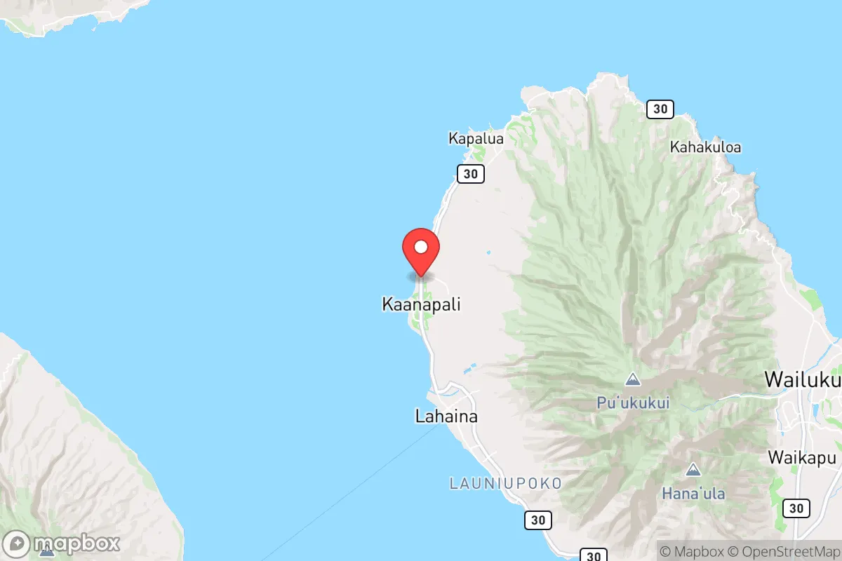
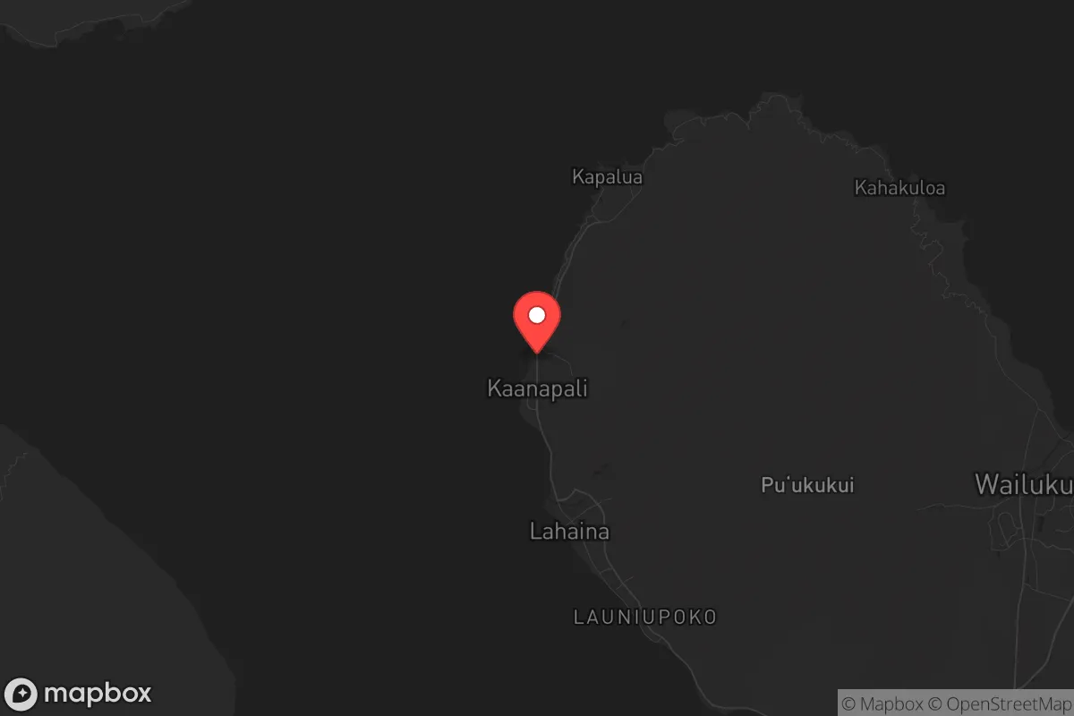
Strategic Assessment of Kaanapali, HI
Strong survivability profile. Good buffer from population centers, with manageable environmental and tactical risks.
What does the Strategic Assessment tell us?
Our Strategic Assessment grades tactical survivability of an area. Major population centers, military targets, fallout zones, natural disasters, and border exposure all drive risk — lower exposure means a more defensible position in a crisis.
This is heavily inspired by Joel Skousen's Strategic Relocation book. Highly recommended you checkout the book ($)What does this tell us?
Our Strategic Assessment grades tactical survivability of an area. Major population centers, military targets, fallout zones, natural disasters, and border exposure all drive risk — lower exposure means a more defensible position in a crisis.
This is heavily inspired by Joel Skousen's Strategic Relocation book. Highly recommended you checkout the book ($)Strategic Pillars

Key Distances
Regional Safe Places
Below is our recommended "safe zones" in Hawaii and the surrounding area based on our strategic heuristics. For most people, it's unrealistic to live in a “safe zone” full-time due to work, family or other personal reasons. They tend to be more rural. However, many of these areas are perfect for second homes and retreat properties that double as a vacation home or even a short-term rental.


Important Note: For informational purposes only. This does not mean nothing bad ever happens in the green zones. Please use common sense. This is based on public data and modeled with AI. We tried to take a conservative approach but mistakes happen. We update this regularly as new information becomes available.
Solar Generator Recommendations
Backup power matters more here than in safer locations. We've picked three solar generators across budgets and capacity tiers — start with the budget unit if you only need a few essentials, or step up if you want to run a fridge and HVAC for days at a time.

Jackery Portable Power Station Explorer 300
Budget OptionPower on the Go: Weighing only 11 lbs, it's convenient to set up and store with book-sized foldable solar panels

BLUETTI Portable Power Station AC180
Designed for both indoor and outdoor scenarios, AC180 is highly capable as it has a robost capacity and continuous output power.

EF ECOFLOW DELTA Pro Ultra Power Station
Upgraded PickEcoFlow DELTA Pro Ultra is a whole-home energy system designed to grow with your family. Integrated with the Smart Home Panel 2, it scales to meet your evolving energy needs — keeping your home powered, intelligent, and secure through every stage of life.
We earn a commission, at no additional cost to you.
Strategic Assessment Analysis
Kaanapali, on Maui’s west coast, presents a complex strategic picture for those prioritizing long-term resilience and self-sufficiency. Its primary advantage is geographic isolation—over 2,300 miles from the continental US—which inherently buffers against mainland cascading failures, supply chain disruptions, and large-scale civil unrest. However, this same isolation creates a critical dependency on sea and air resupply, making it a high-risk location if those lifelines are severed. For a conservative-leaning prepper, Kaanapali offers a beautiful but fragile environment where preparedness must account for both natural and man-made threats, with limited escape routes.
Geographic position and natural advantages for long-term security
Kaanapali sits on Maui’s leeward coast, shielded by the West Maui Mountains, which provide a natural barrier from prevailing trade winds and storm surges. This location offers a relatively stable microclimate with lower rainfall than the island’s wetter eastern side, reducing risks of landslides and flash flooding that plague other parts of Maui. The area’s proximity to the ocean provides a reliable food source—fishing—and access to desalination if freshwater systems fail. The surrounding topography, including the steep slopes of Puʻu Kukui and the rugged coastline, limits easy overland access from the island’s interior, offering a degree of natural defensibility. For a relocator, this means fewer points of entry for potential threats, but also limited egress if evacuation becomes necessary. The nearest major population center, Kahului (about 30 miles east), is the island’s primary port and airport, making it a likely focal point for any large-scale response or, conversely, a target for disruption.
Risks, exposures, and proximity to fallout-relevant landmarks
The most significant strategic vulnerability for Kaanapali is its dependence on Kahului’s infrastructure. The harbor and airport there handle nearly all incoming fuel, food, and medical supplies. A major earthquake, tsunami, or coordinated attack on these facilities would cripple the entire island within days. Kaanapali itself is within a tsunami inundation zone—the 1960 Hilo tsunami caused damage here, and a modern event could wipe out low-lying resorts and residential areas. Additionally, the area’s popularity as a tourist destination means it’s a high-profile target for civil unrest or mass casualty events. During a societal breakdown, the thousands of stranded tourists would compete for limited resources, turning Kaanapali into a pressure cooker. The nearby Lahaina area, just south, was devastated by the 2023 wildfires, highlighting the risk of dry-season fires driven by trade winds—a threat that could cut off the only road out of West Maui (Honoapiʻilani Highway). For a prepper, the concentration of luxury hotels and transient populations makes Kaanapali a liability rather than an asset in a crisis, as it lacks the agricultural self-sufficiency of upcountry Maui.
Practical resilience for a relocator: food, water, energy, and defensibility
Freshwater in Kaanapali comes from the Iao aquifer and West Maui streams, but the distribution system is vulnerable to earthquake damage and saltwater intrusion. A well-maintained rainwater catchment system with UV filtration is essential—most homes lack this, so retrofitting is a priority. Food security is weak: the area’s soil is rocky and dry, limiting large-scale gardening. Local farmers markets in Napili and Honokowai offer some produce, but the island imports about 85% of its food. A prepper should plan for at least a six-month supply of non-perishables, plus fishing gear for nearshore species like mahi-mahi and ono. Energy is another weak point—Maui Electric relies on imported oil and solar, with battery storage still limited. A solar-plus-battery system is viable given the abundant sun, but grid failures during storms or cyberattacks are common. Defensibility is mixed: the resort corridor is open and exposed, but the residential neighborhoods above Kaanapali (e.g., Kahana Ridge) offer better vantage points and limited access roads. Community cohesion is low due to transient populations, so building a network of like-minded neighbors is critical. The nearest hospital, Maui Memorial Medical Center in Kahului, is 30 miles away and could be overwhelmed in a mass casualty event—medical self-sufficiency is non-negotiable.
Overall, Kaanapali is a high-risk, high-reward location for a strategic relocator. Its isolation provides a buffer from mainland chaos, but that same isolation becomes a trap if supply lines are cut. The area’s dependence on tourism and imported goods makes it fragile, and the 2023 Lahaina fire is a stark reminder that natural disasters can strike without warning. For a conservative prepper, the best approach is to treat Kaanapali as a temporary retreat rather than a permanent fortress—use it for its climate and ocean access, but maintain a secondary location on the mainland with more self-sufficiency. If you’re willing to invest in off-grid systems and build a tight-knit community, it can work, but don’t underestimate the logistical nightmare of being stranded on an island when the world goes sideways. The strategic picture is clear: Kaanapali offers a beautiful life, but only if you’re prepared to live it without the safety net of modern infrastructure.
* Values derived from national, state, county, city and local statistics and may differ in a specific area. Last updated: 2026-04-24T00:09:19.000Z
Narrative content on this page is AI-generated and may contain mistakes. Verify any details that matter before acting on them.
ReloMaps may earn a commission from affiliate links at no extra cost to you.