Photo: Wikipedia
Strategic Assessment of Jeffersontown, KY
Multiple tactical vulnerabilities. Population density, target proximity, or disaster risk are likely compounding. A retreat property and exit planning is required.
What does the Strategic Assessment tell us?
Our Strategic Assessment grades tactical survivability of an area. Major population centers, military targets, fallout zones, natural disasters, and border exposure all drive risk — lower exposure means a more defensible position in a crisis.
This is heavily inspired by Joel Skousen's Strategic Relocation book. Highly recommended you checkout the book ($)What does this tell us?
Our Strategic Assessment grades tactical survivability of an area. Major population centers, military targets, fallout zones, natural disasters, and border exposure all drive risk — lower exposure means a more defensible position in a crisis.
This is heavily inspired by Joel Skousen's Strategic Relocation book. Highly recommended you checkout the book ($)Strategic Pillars

Key Distances
Regional Safe Places
Below is our recommended "safe zones" in Kentucky and the surrounding area based on our strategic heuristics. For most people, it's unrealistic to live in a “safe zone” full-time due to work, family or other personal reasons. They tend to be more rural. However, many of these areas are perfect for second homes and retreat properties that double as a vacation home or even a short-term rental.


Important Note: For informational purposes only. This does not mean nothing bad ever happens in the green zones. Please use common sense. This is based on public data and modeled with AI. We tried to take a conservative approach but mistakes happen. We update this regularly as new information becomes available.
Solar Generator Recommendations
Backup power matters more here than in safer locations. We've picked three solar generators across budgets and capacity tiers — start with the budget unit if you only need a few essentials, or step up if you want to run a fridge and HVAC for days at a time.

Jackery Portable Power Station Explorer 300
Budget OptionPower on the Go: Weighing only 11 lbs, it's convenient to set up and store with book-sized foldable solar panels

BLUETTI Portable Power Station AC180
Designed for both indoor and outdoor scenarios, AC180 is highly capable as it has a robost capacity and continuous output power.

EF ECOFLOW DELTA Pro Ultra Power Station
Upgraded PickEcoFlow DELTA Pro Ultra is a whole-home energy system designed to grow with your family. Integrated with the Smart Home Panel 2, it scales to meet your evolving energy needs — keeping your home powered, intelligent, and secure through every stage of life.
We earn a commission, at no additional cost to you.
Strategic Assessment Analysis
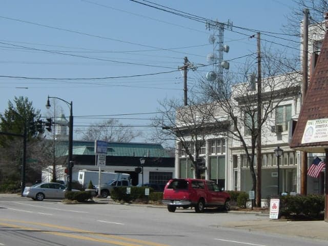
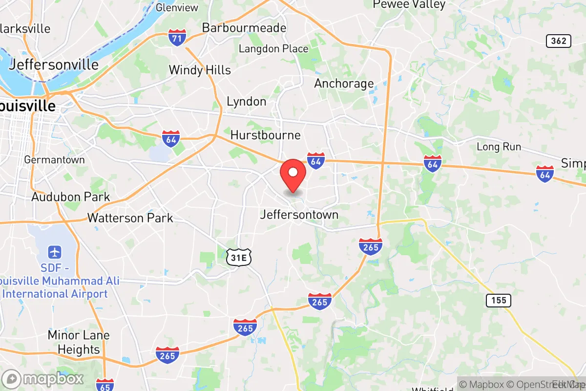
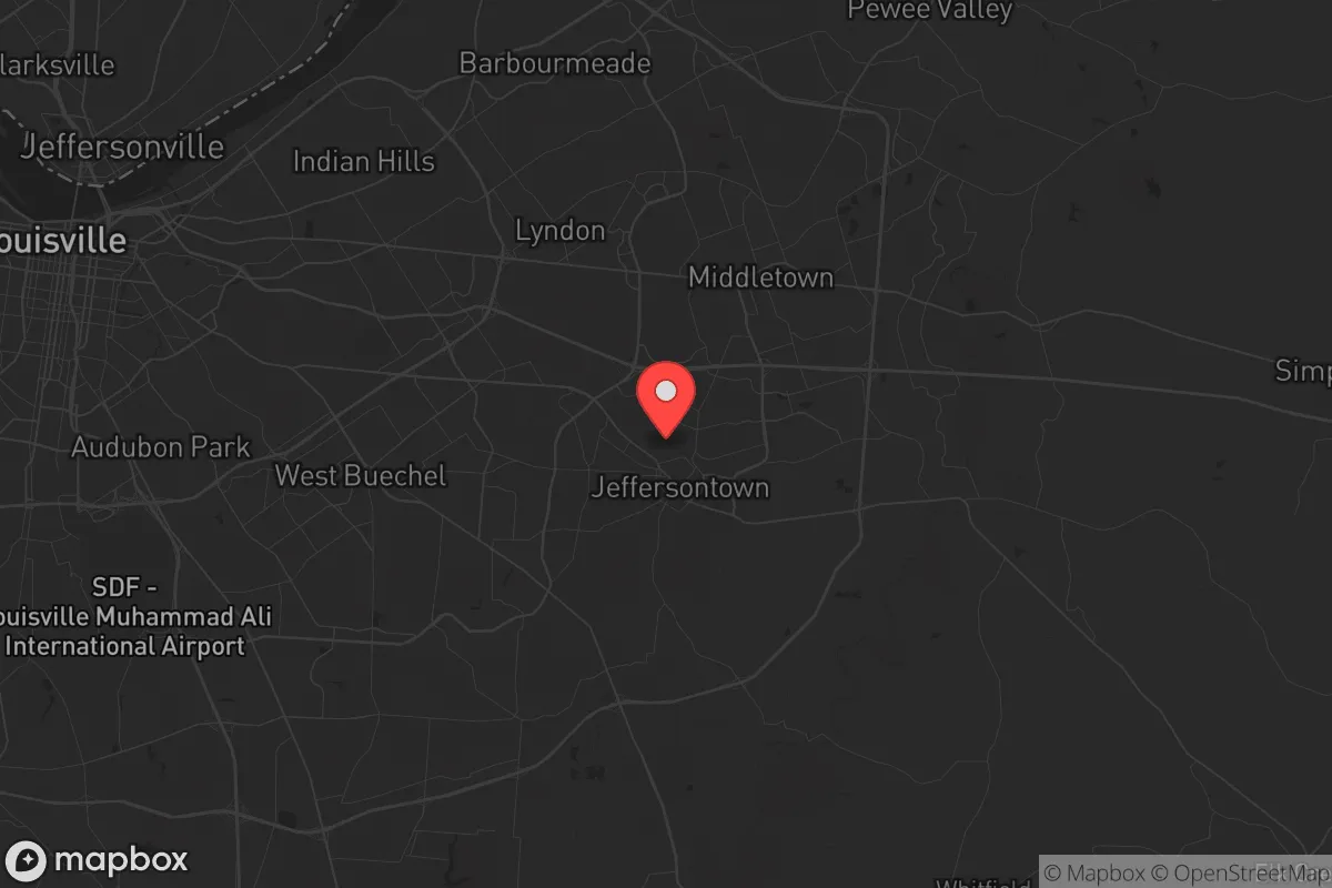
Jeffersontown, Kentucky, offers a surprisingly resilient strategic position for those prioritizing preparedness and self-sufficiency, largely due to its location within the greater Louisville metro area while maintaining a distinct, semi-rural character. The city sits on the eastern edge of Jefferson County, roughly 15 miles from downtown Louisville, placing it close enough to access regional resources but far enough to avoid the immediate chaos of a major urban collapse. Its proximity to I-64 and I-265 provides critical egress routes into the more sparsely populated regions of Shelby and Henry counties, while the surrounding farmland and wooded areas offer natural buffers against the worst fallout of a metropolitan crisis.
Geographic position and natural advantages for long-term survival
Jeffersontown’s geography is its primary strategic asset. The area sits on the eastern edge of the Bluegrass region, characterized by rolling hills, limestone bedrock, and abundant groundwater. The nearby Floyd’s Fork Creek and the larger Salt River drainage provide reliable water sources, though treatment would be necessary. The soil is fertile, supporting small-scale agriculture—a critical factor for food security if supply chains falter. The city’s elevation, averaging around 700 feet, offers modest defensive advantages over the lower-lying Ohio River floodplain to the north. Jeffersontown is not in a flood zone, unlike parts of Louisville, reducing the risk of natural disasters compounding man-made ones. The surrounding hardwood forests provide cover, fuel, and building materials, while the limestone geology offers potential for root cellars or underground shelters. The area’s relatively low population density (about 27,000 residents) compared to Louisville’s 620,000 means less competition for resources in a crisis, though the suburban sprawl still presents challenges.
Risks, exposures, and proximity to fallout-relevant landmarks
The primary vulnerability is proximity to Louisville, a major transportation and industrial hub. Jeffersontown lies within 20 miles of the Louisville International Airport (SDF), a major UPS cargo hub and potential target for disruption. The city is also near the Rubbertown industrial corridor along the Ohio River, which houses chemical plants and refineries—a significant hazard zone for toxic releases or targeted attacks. Interstate 65, a major north-south artery, runs just west of Jeffersontown, making it a likely chokepoint for evacuation or supply routes during unrest. The city itself is not a high-value target, but its proximity to these landmarks means fallout from a Louisville-centric event—whether a terrorist attack, civil unrest, or infrastructure failure—would directly impact Jeffersontown. Residents should plan for the possibility of being cut off from Louisville’s hospitals and emergency services within hours of a major incident. The nearby Fort Knox military base, about 30 miles southwest, is a mixed blessing: it provides a potential security buffer but also a target for adversaries.
Practical resilience for a relocator: food, water, energy, and defensibility
For a relocator serious about preparedness, Jeffersontown offers a workable but not ideal baseline. Water is the most critical concern. The city draws from the Louisville Water Company, which treats Ohio River water—a centralized system vulnerable to contamination or sabotage. Private wells are uncommon within city limits, so a relocator should plan for rainwater catchment, cisterns, or a drilled well on a larger property. The nearby Floyd’s Fork Creek is a backup, but it’s subject to agricultural runoff and requires filtration. Food security is more promising: the surrounding farmland supports corn, soybeans, and livestock, and the city’s farmers’ market (seasonal) indicates local production. Jeffersontown has several community gardens and a strong local food co-op network, which could be leveraged for barter or mutual aid. Energy resilience is moderate. The grid is reliable but tied to the regional system; solar panels are viable given Kentucky’s average 4.5 peak sun hours per day, but zoning in suburban neighborhoods may restrict installations. Natural gas is widely available for heating, but a propane backup or wood stove is advisable. Defensibility is the weakest point. The city’s layout—a mix of suburban subdivisions, strip malls, and industrial parks—offers limited natural chokepoints. Homes on the eastern edge, near the Jefferson County line, provide better defensibility due to larger lots, tree cover, and proximity to rural escape routes. The local police force is small (about 40 officers), so self-reliance is paramount. The city’s relatively low crime rate (violent crime at 1.5 per 1,000 residents in 2023) suggests a stable community, but that could shift rapidly in a crisis.
Overall, Jeffersontown presents a mixed strategic picture for the survivalist-minded relocator. Its strengths lie in its semi-rural buffer, access to water and farmland, and proximity to multiple escape corridors into less populated counties. Its weaknesses are the unavoidable proximity to Louisville’s vulnerabilities—industrial hazards, transportation chokepoints, and population density that could turn into a liability during unrest. For a single individual or family willing to invest in off-grid water, food storage, and a defensible property on the eastern fringe, Jeffersontown offers a viable base of operations that balances access to urban resources with a reasonable retreat option. The key is to treat it as a staging ground, not a final redoubt—a place to build skills, stockpile supplies, and maintain situational awareness while keeping one eye on the exit routes eastward. In a world where the next crisis is a matter of when, not if, Jeffersontown is a solid B+ choice: not perfect, but far better than being trapped in the urban core.
* Values derived from national, state, county, city and local statistics and may differ in a specific area. Last updated: 2026-04-21T09:09:28.000Z
Narrative content on this page is AI-generated and may contain mistakes. Verify any details that matter before acting on them.
ReloMaps may earn a commission from affiliate links at no extra cost to you.