
Photo: Wikipedia
Strategic Assessment of Jamestown, NY
Meaningful friction. Expect exposure to either population pressure, blast zones, or natural disaster risk. Consider buying a retreat property.
What does the Strategic Assessment tell us?
Our Strategic Assessment grades tactical survivability of an area. Major population centers, military targets, fallout zones, natural disasters, and border exposure all drive risk — lower exposure means a more defensible position in a crisis.
This is heavily inspired by Joel Skousen's Strategic Relocation book. Highly recommended you checkout the book ($)What does this tell us?
Our Strategic Assessment grades tactical survivability of an area. Major population centers, military targets, fallout zones, natural disasters, and border exposure all drive risk — lower exposure means a more defensible position in a crisis.
This is heavily inspired by Joel Skousen's Strategic Relocation book. Highly recommended you checkout the book ($)Strategic Pillars

Key Distances
Regional Safe Places
Below is our recommended "safe zones" in New York and the surrounding area based on our strategic heuristics. For most people, it's unrealistic to live in a “safe zone” full-time due to work, family or other personal reasons. They tend to be more rural. However, many of these areas are perfect for second homes and retreat properties that double as a vacation home or even a short-term rental.


Important Note: For informational purposes only. This does not mean nothing bad ever happens in the green zones. Please use common sense. This is based on public data and modeled with AI. We tried to take a conservative approach but mistakes happen. We update this regularly as new information becomes available.
Solar Generator Recommendations
Backup power matters more here than in safer locations. We've picked three solar generators across budgets and capacity tiers — start with the budget unit if you only need a few essentials, or step up if you want to run a fridge and HVAC for days at a time.

Jackery Portable Power Station Explorer 300
Budget OptionPower on the Go: Weighing only 11 lbs, it's convenient to set up and store with book-sized foldable solar panels

BLUETTI Portable Power Station AC180
Designed for both indoor and outdoor scenarios, AC180 is highly capable as it has a robost capacity and continuous output power.

EF ECOFLOW DELTA Pro Ultra Power Station
Upgraded PickEcoFlow DELTA Pro Ultra is a whole-home energy system designed to grow with your family. Integrated with the Smart Home Panel 2, it scales to meet your evolving energy needs — keeping your home powered, intelligent, and secure through every stage of life.
We earn a commission, at no additional cost to you.
Strategic Assessment Analysis
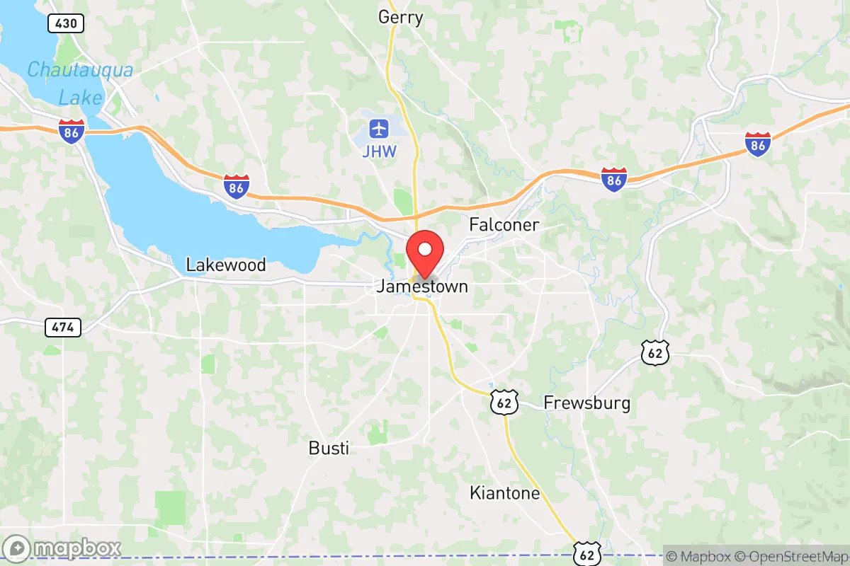
Jamestown, New York, sits in a geographic pocket that offers a blend of industrial-era infrastructure and relative isolation from the most volatile corridors of the Northeast, making it a candidate for those prioritizing resilience over convenience. Its location in Chautauqua County, roughly 70 miles southwest of Buffalo and 50 miles east of Erie, Pennsylvania, places it outside the immediate blast radius of major metropolitan targets while still providing access to the Great Lakes region’s logistical networks. For a relocator with a survivalist or prepper mindset, the area’s history of economic decline has paradoxically created affordable housing, underutilized industrial space, and a population that values self-reliance—traits that align with a conservative, prepare-for-the-worst worldview. The key question is whether Jamestown’s advantages outweigh its proximity to risks like Lake Erie’s industrial shoreline and the potential for fallout from larger cities.
Geographic position and natural advantages for long-term survival
Jamestown’s position in the Allegheny Plateau gives it a mix of rolling hills, dense woodlands, and access to the Chadakoin River, which flows into the Conewango Creek and eventually the Allegheny River. This water network is a strategic asset: it provides a potential escape route southward toward less populated areas of Pennsylvania and West Virginia, and it supports off-grid water collection and small-scale hydropower if the grid fails. The surrounding Chautauqua County is heavily forested—over 60% tree cover—offering ample cover for retreat-style living and raw materials for shelter and fuel. The area’s elevation, averaging 1,300 feet, reduces flood risk compared to low-lying lakefront communities, and the local soil is suitable for small-scale agriculture, though the growing season is short (roughly 140 days). For a relocator, the natural advantages are real but modest: you’re not in a temperate paradise, but you’re also not in a floodplain or a wildfire corridor. The nearby Chautauqua Lake (about 10 miles north) provides a secondary water source and fishing, though its recreational development means more eyes on your activities during normal times.
Risks, exposures, and proximity to fallout-relevant landmarks
The most significant risk for Jamestown is its proximity to Lake Erie’s industrial corridor, which includes the Buffalo-Niagara Falls metro area (population 1.1 million) and the Erie, Pennsylvania, metro (270,000). In a major conflict or terrorist event, these cities are plausible targets due to the Niagara Power Project, the Peace Bridge border crossing, and the Great Lakes shipping infrastructure. Fallout from a ground burst at Buffalo would likely drift east-northeast with prevailing winds, putting Jamestown in a secondary risk zone—not ground zero, but within the 50-100 mile radius where radioactive particles could settle within hours. The Chautauqua County Airport (KJHW) is a small general aviation field, not a military target, but the nearby Westfield-Barcelona Airport and the presence of natural gas pipelines in the region add minor risk. More immediate for a prepper: the area’s reliance on a single major highway (I-86) for east-west travel creates a chokepoint. If that route is compromised by civil unrest or a disaster, Jamestown becomes effectively isolated from Buffalo and Erie, which could be a double-edged sword—cut off from supply lines but also from the chaos of fleeing populations. The local nuclear power plant, the now-decommissioned West Valley Demonstration Project (about 30 miles northeast), is a legacy waste site, not an active reactor, but its stored radioactive material is a long-term contamination concern if the site is breached by a natural disaster or attack.
Practical resilience for a relocator: food, water, energy, and defensibility
For a single individual or family looking to hunker down, Jamestown offers a mixed bag. Water is the strongest asset: the Chadakoin River runs through the city, and the municipal water system draws from Chautauqua Lake, but a prepper should plan for well water or rainwater catchment on the outskirts. The local water table is high enough for shallow wells in most rural parcels within 15 miles of town. Food production is feasible but labor-intensive: the soil is acidic and rocky, requiring raised beds or heavy amendment, but the area has a strong tradition of hunting (deer, turkey, small game) and fishing (walleye, perch in the lake). The Amish and Mennonite communities in nearby Clymer and Sherman are a resource for seed stock, livestock, and off-grid skills—if you can build rapport. Energy resilience is a weak point: the grid is aging, and winter storms frequently cause multi-day outages. Solar is viable but limited by cloud cover (the region averages only 160 sunny days per year), so a generator with stored fuel or a wood-burning stove is essential. Defensibility is moderate: the city itself has a dense urban core with narrow streets and older brick buildings that could be fortified, but the real value is in the surrounding rural townships (e.g., Busti, Ellery, Harmony) where properties with acreage and natural barriers (creeks, ridges) are still affordable—under $150,000 for a fixer-upper on 10 acres as of 2025. The local population skews older and conservative, which reduces the likelihood of civil unrest originating within the community, but it also means fewer young, able-bodied neighbors for mutual aid.
The overall strategic picture for Jamestown is one of calculated trade-offs. It is not a fortress, nor is it a dead zone. For a relocator who values low cost of living, water access, and distance from primary targets, it offers a viable base of operations—provided you accept the short growing season, the risk of lake-effect snow (over 200 inches annually in some years), and the reality that you are still within a day’s drive of Buffalo, Cleveland, and Pittsburgh. The conservative-leaning culture of Chautauqua County—where gun ownership is common, local government is small, and community ties are strong—aligns with a prepper’s desire for minimal interference and maximum self-determination. But do not mistake isolation for safety: a major event at the Niagara power complex or a dirty bomb at the West Valley site would put Jamestown in the fallout plume. The smart play is to treat Jamestown as a staging area—a place to build skills, store supplies, and establish a network—while maintaining a secondary retreat deeper into the Allegheny National Forest or the Pennsylvania Wilds, about 50 miles south. If you’re looking for a low-profile, affordable, and defensible spot to ride out the coming instability, Jamestown earns a solid B-minus: not perfect, but far better than the suburbs of a major city.
* Values derived from national, state, county, city and local statistics and may differ in a specific area. Last updated: 2026-05-01T05:40:29.000Z
Narrative content on this page is AI-generated and may contain mistakes. Verify any details that matter before acting on them.
ReloMaps may earn a commission from affiliate links at no extra cost to you.